
Obviously we don't have anything for Trinidad 1933, which peaked as a Cat 2 in Caribbean and Gulf. As for those in the satellite era:
Bret 2017 at its peak:

Ana 1979 at its peak:
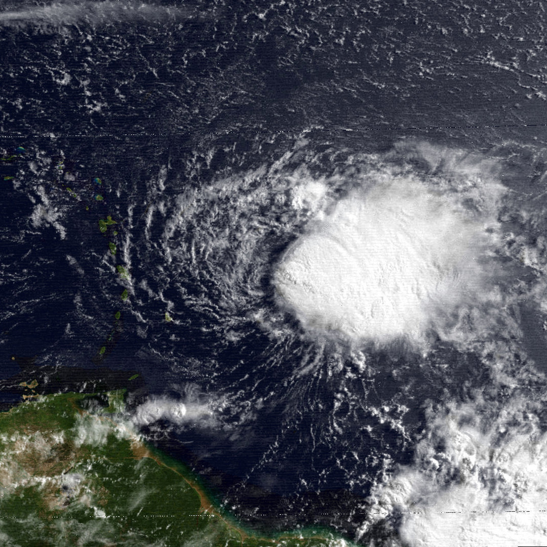
TD3 2023 right now:
Moderator: S2k Moderators


wxman57 wrote:12Z GFS is finally coming around. Weakening TS enters the Caribbean then weakens to a depression or remnant low south of PR in about 5 days. Someone asked about Barbados - you won't see much out of it. A little rain and little wind south of the track. Wind will be about 20 mph less on the south side of the storm.


ThomasW wrote:Hypercane_Kyle wrote:ThomasW wrote:Three likely ends up in the islands as a minimal tropical storm. NHC forecast is overblown, imo. GFS downtrended significantly at 12z and shear only looks to rise with a 21 mph forward motion. EL NINO.
Fast trades and shear in June are not exactly uncommon.
Not to mention you have two developing systems in the MDR, which is the exact opposite of what one would expect in June.ThomasW wrote:My friend - I am just remindoing everyone that this is an El Nino. It isn't directly affecting Three as the atmosphere isn't coupled - yet
I'd recommend checking out the seasonal indicators thread on this. Right now Atlantic temperatures are the warmest ever recorded. That, combined with anomalously low SAL, is why we are seeing this insane surge of activity. This is not normal for June, no matter how you look at it.
I do understand the +AMO is incredibly strong as of now. But El nIno will win over warm surface temperatures in the Atlantic. You don't have to believe me, just wait until September rolls around and the Atlantic is SAL/shear stricken
tiger_deF wrote:The geographic proximity of 3L and 93L is fascinating to me. Can they both become named systems without interrupting the ventilation of one another?


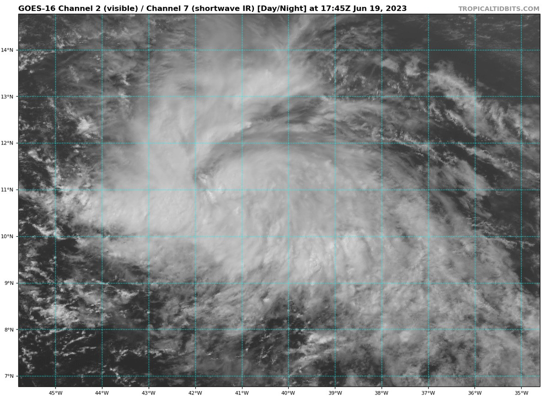
Hypercane_Kyle wrote:Bret 2017's record falls to... Bret 2023!

kevin wrote:At what point in Bret's lifetime could we expect any recon to be performed? Surely at least when it approaches the islands right if it's still a potent storm at that stage.
kevin wrote:At what point in Bret's lifetime could we expect any recon to be performed? Surely at least when it approaches the islands right if it's still a potent storm at that stage.

Hypercane_Kyle wrote:Bret 2017's record falls to... Bret 2023!


GeauxTigers wrote:wxman57 wrote:12Z GFS is finally coming around. Weakening TS enters the Caribbean then weakens to a depression or remnant low south of PR in about 5 days. Someone asked about Barbados - you won't see much out of it. A little rain and little wind south of the track. Wind will be about 20 mph less on the south side of the storm.
I’m flying to St John Wednesday. What can i expect out of this? Thank u!
wxman57 wrote:ThomasW wrote:wxman57 wrote:12Z GFS is finally coming around. Weakening TS enters the Caribbean then weakens to a depression or remnant low south of PR in about 5 days. Someone asked about Barbados - you won't see much out of it. A little rain and little wind south of the track. Wind will be about 20 mph less on the south side of the storm.
Agreed. I respect the folks at the NHC but I'm not sure what they're doing here.
NHC folks are demonstrating an abundance of caution. They don't want anyone in the islands to ignore this potential storm.
Users browsing this forum: No registered users and 57 guests


