
Source: https://www.star.nesdis.noaa.gov/GOES/floater.php?stormid=AL032023#homePageLink
Moderator: S2k Moderators


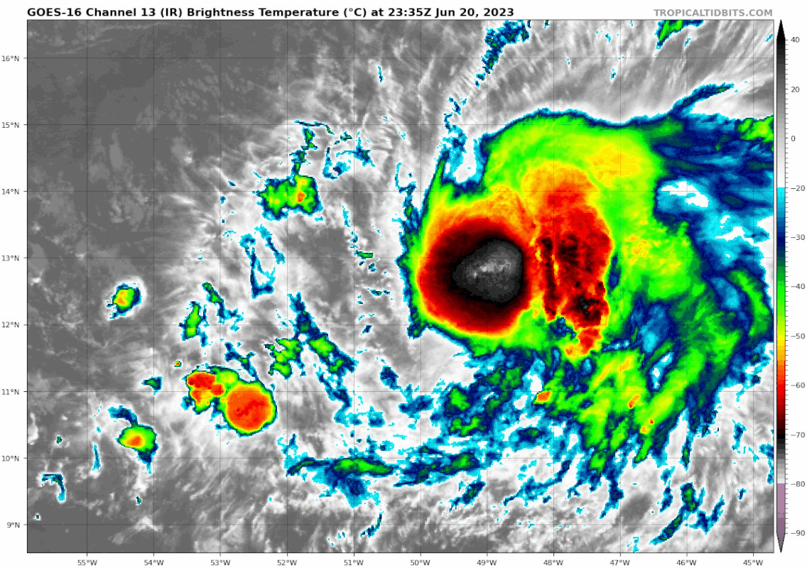

Teban54 wrote:An angry Atlantic shrimp.
Based on my amateur eyeballing of the shortwave IR imagery, it seems that the LLC might also be tucked in under the convection now, instead of at the edge.
https://i.postimg.cc/mgSMZr5F/goes16-ir-03-L-202306202335.gif

cheezyWXguy wrote:Teban54 wrote:An angry Atlantic shrimp.
Based on my amateur eyeballing of the shortwave IR imagery, it seems that the LLC might also be tucked in under the convection now, instead of at the edge.
https://i.postimg.cc/mgSMZr5F/goes16-ir-03-L-202306202335.gif
Agreed, based on shortwave ir “nighttime vis” it looks to me like the center is directly under the latest deep convective burst. Curious to see if this will continue through the night, unlike last night


Nuno wrote:Now the NHC forecast seems too conservative for strength. No longer exposed, improved outflow, less shear. Definitely strengthening at the moment.

cycloneye wrote:TXNT28 KNES 211218
TCSNTL
A. 03L (BRET)
B. 21/1130Z
C. 12.9N
D. 51.9W
E. THREE/GOES-E
F. T3.5/3.5
G. IR/EIR/VIS
H. REMARKS...8/10 BANDING YIELDS A DT OF 3.5. THE MET IS 3.5 BASED ON
A 24 HR DEVELOPING TREND. THE PT IS ALSO 3.5. THE FT IS BASED ON THE DT.
I. ADDL POSITIONS
NIL
...GATLING

Users browsing this forum: No registered users and 73 guests


