captainbarbossa19 wrote:Monsoonjr99 wrote:Definitely getting to that point in the season where captainbarbossa's timeline becomes relevant
I almost forgot to post it this year! Thank you for reminding me!
Captain Barbossa's Tropical Cyclone Timeline:1. June 1st: Everyone is excited about the upcoming season. Many are anticipating upcoming action later in the month, but most know that the real action will most likely start in August.
2. July 1st: One or two TCs manage to form in June. Many complain about how weak and disorganized the cyclones are.
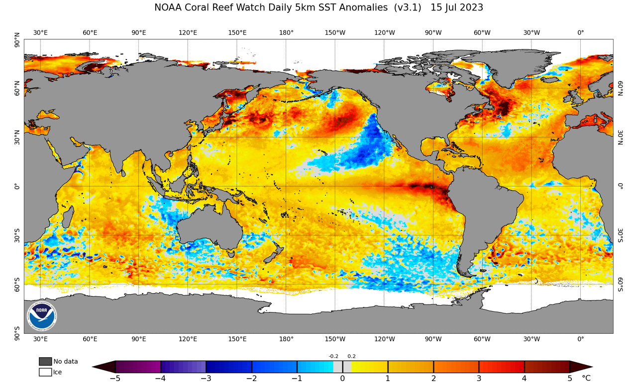
3. July 15th: Lots of SAL is present in the Atlantic basin. However, most people are not surprised by this, as they were expecting it.
4. August 1st: Atlantic is still slow. Dry, stable air is present in the tropics. However, models are beginning to suggest things will be changing within a few weeks.
5. August 15th: Models show nothing in the near-future. Many are becoming skeptical about the season amounting to anything significant.
6. August 23rd: There are multiple invests in the Atlantic and conditions are rapidly beginning to change. The models begin to show cyclogenesis. Many quickly change their minds about a quieter season.
7. August 24th: Some experts continue to doubt signs of the Atlantic awakening. These experts issue outlooks that support original ideas of a quieter season.
8. August 31st: There is now at least one active TC. There is a potential that at least one TC could become a hurricane. Many people appear shocked by the increased activity.
9. September 30th: Several TCs have already formed and dissipated. A few who suggested that the season would be quiet now state that they always knew the Atlantic would spring to life.
10. November 30th: The last storm probably has dissipated by this point. Many look back at the season and state that they are surprised with the outcome.