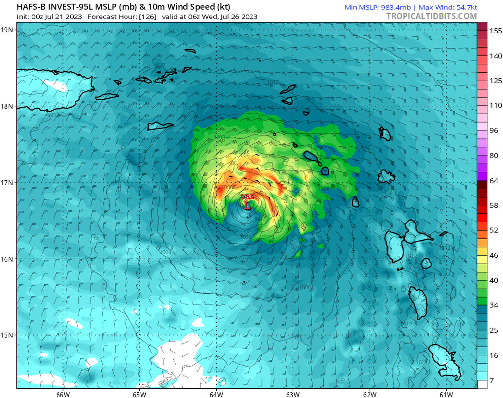
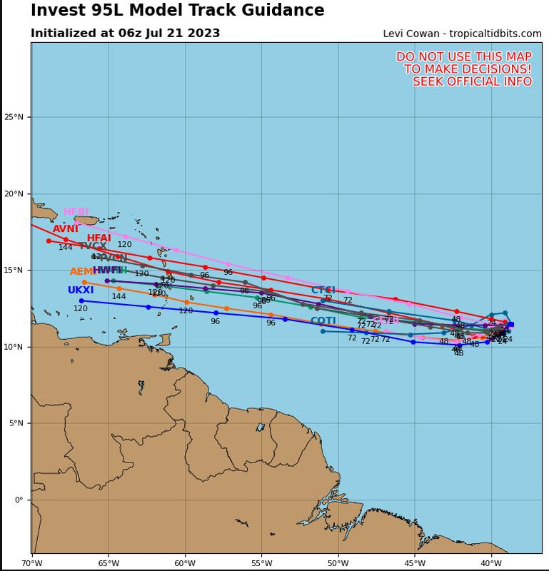
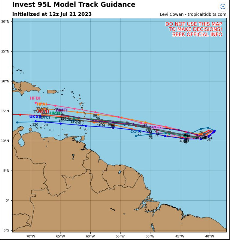
HAFS-B is stronger overall, with a strong TS approaching the Lesser Antilles and ending the run almost as a hurricane:
Both HWRF and HMON are even stronger than HAFS-B, with a Cat 1 before the islands.
Moderator: S2k Moderators


Blown Away wrote:[url]https://i.postimg.cc/4Nk7sRhR/c3ea8cde-8077-4f7c-b562-117ac004684c.gif [/url]
06z GFS... Some models continue showing this SW dip over next 2-3 days. IMO this SW dip is a critical move that will heavily influence development down the road. The SW dip will likely keep 95L weaker into the Caribbean and S of the big islands, if this dip doesn't happen I think the northern route possibly into better UL conditions may happen?


abajan wrote:Blown Away wrote:[url]https://i.postimg.cc/4Nk7sRhR/c3ea8cde-8077-4f7c-b562-117ac004684c.gif [/url]
06z GFS... Some models continue showing this SW dip over next 2-3 days. IMO this SW dip is a critical move that will heavily influence development down the road. The SW dip will likely keep 95L weaker into the Caribbean and S of the big islands, if this dip doesn't happen I think the northern route possibly into better UL conditions may happen?
That's a pretty pronounced dip. The Euro, and CMC (to a lesser extent), shows it too. Can't recall when last I've seen models show anything like that in the MDR east of the Antilles.


Hypercane_Kyle wrote:Small system, I think it's possible the global models may not be resolving it very well. .....


BobHarlem wrote:12z Icon is showing that dip too for tomorrow afternoon and Sunday.
Ivanhater wrote:Curious to see if the 12z guidance latches on to the recent convective trend, at least in the short term.


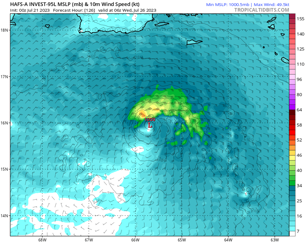
cycloneye wrote:HAFS-A at 989 mbs south of PR.
https://i.imgur.com/eb7QIKX.png
HAFS-B at 973 mbs south of Mona Channel.
https://i.imgur.com/IbdoN0v.png
Users browsing this forum: No registered users and 24 guests