2023 Indicators (SST, SAL, MSLP, Wind shear, Steering, Instability) and Day 16+ Models

This is the general tropical discussion area. Anyone can take their shot at predicting a storms path.

Moderator: S2k Moderators

Forum rules

The posts in this forum are NOT official forecasts and should not be used as such. They are just the opinion of the poster and may or may not be backed by sound meteorological data. They are NOT endorsed by any professional institution or STORM2K. For official information, please refer to products from the National Hurricane Center and National Weather Service.

Help Support Storm2K
Message
Author
WeatherBoy2000
Category 1
Category 1
Posts: 347
Joined: Mon Apr 10, 2023 9:29 am

Re: 2023 Indicators (SST, SAL, MSLP, Wind shear, Steering, Instability) and Day 16+ Models

#1061 Postby WeatherBoy2000 » Wed Aug 02, 2023 9:58 am

Category5Kaiju wrote:
Teban54 wrote:
CyclonicFury wrote:While I do think 2023 will be unusually favorable and active for a Nino year (and shear has been somewhat lower than many significant Ninos, and we've been above average thus far including 2 June MDR systems), I think some of the most bullish forecasts are almost certainly going to bust too high. The UKMET ACE forecast of 215 would be the eighth-highest on record. To get an ACE total that high, the Atlantic would need to produce several long-tracked major hurricanes. Even in a -ENSO year, I think these forecasts would be very difficult to achieve; 2010 is an example of such. 2010 had the warmest MDR on record before this year, and ended up with ~165 ACE despite a strong La Nina in place which didn't even crack the top 10.

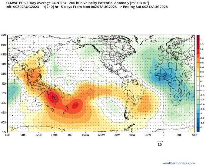
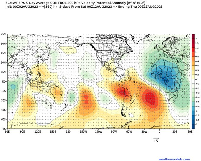
The first half of August in the Atlantic does not appear as if it will be all that active; I wouldn't be shocked if Klotzbach's first 2 week forecast calls for below average activity considering the lack of coherent signals at the moment. 2004, the most active Nino season on record in ACE, saw significant activity during the first half of August, including Hurricanes Alex and Charley (both majors). 1969, another Nino year, started to get going in early-mid August as well. I think at the moment, the Atlantic is still at least a couple weeks away from the "lid coming off" in terms of significant activity.

In recent years, a few Twitter mets have repeatedly talked about the Atlantic being quieter during the August 1-20 period since 2010, especially in terms of quality. In contrast, several seasons before 2010 had notable activity in early and mid August like you mentioned. Even 2009 (El Nino, below average Atlantic) had Bill, the strongest storm of the season, becoming a Cat 4 on August 19.

They seem to think it's due to issues with mid-level dry air that has "plagued" the basin during this specific period in recent years. I'm not sure if it's conservative bias again, or if it's an actual change in pattern and seasonal indicators.


For the most part, seasons typically do not see major hurricanes before August 20. In that sense, I there might be a bit of a conservative bias. However, the seasons that did (1980, 1983, 1996, 2000, 2004, and 2005 as examples) mainly happened before 2010. So...I could see why this viewpoint gained traction. Now it's totally possible that somewhere down the line, there will be a season that does see a major before the August 20 time (yes, I'm not completely ruling out 2023 until we're near August 20 :lol: ), but it indeed is an interesting thing to think about regarding how we've gone so long without a season like that. I mean, imagine the wx community craze if an Allen-like storm happens (Category 5 long-tracker in very early August) in the future.


In another post, I pointed out that since 2010, no year had a major hurricane develop prior to August 20th. In the 1995-2009 timeframe it was quite common. I think there is a legit argument to be made that since 2010 it has been even more difficult to get a more front loaded season, they've been more peak to back loaded since then. The main concern is that a strong el nino might not allow for a more backloaded season to occur. However, since 2010, +enso seasons have been able to perform in the late season:

2012: numerous storms, the most notable and strongest being Sandy.

2014: October was the season's most active month with Gonzalo being the season's strongest storm

2015 the super el nino year: 2 out of the season's 4 hurricanes developed in the October-November timeframe, including Joaquin, the season's strongest storm.

2018: Micheal, Nadine, and Oscar, with Micheal being the season's strongest storm.

2019: A lot of junk I'm too lazy to list.

The full on +enso shutdown was something that occurred more in the 2000s (2002, 2004, and 2006), it doesn't mean it won't happen this year but along with the lack of frontloaded seasons it just hasn't been the trend recently.
2 likes   

User avatar
SFLcane
S2K Supporter
S2K Supporter
Posts: 10163
Age: 47
Joined: Sat Jun 05, 2010 1:44 pm
Location: Lake Worth Florida

Re: 2023 Indicators (SST, SAL, MSLP, Wind shear, Steering, Instability) and Day 16+ Models

#1062 Postby SFLcane » Wed Aug 02, 2023 10:29 am

Betting we get mutiple storms soon. Velocity-wise this is about as favorable as it gets for the Atlantic.

Image

Image
2 likes   

Ianswfl
Category 1
Category 1
Posts: 482
Joined: Thu Mar 23, 2023 11:11 pm

Re: 2023 Indicators (SST, SAL, MSLP, Wind shear, Steering, Instability) and Day 16+ Models

#1063 Postby Ianswfl » Wed Aug 02, 2023 1:00 pm

WeatherBoy2000 wrote:
Category5Kaiju wrote:
Teban54 wrote:In recent years, a few Twitter mets have repeatedly talked about the Atlantic being quieter during the August 1-20 period since 2010, especially in terms of quality. In contrast, several seasons before 2010 had notable activity in early and mid August like you mentioned. Even 2009 (El Nino, below average Atlantic) had Bill, the strongest storm of the season, becoming a Cat 4 on August 19.

They seem to think it's due to issues with mid-level dry air that has "plagued" the basin during this specific period in recent years. I'm not sure if it's conservative bias again, or if it's an actual change in pattern and seasonal indicators.


For the most part, seasons typically do not see major hurricanes before August 20. In that sense, I there might be a bit of a conservative bias. However, the seasons that did (1980, 1983, 1996, 2000, 2004, and 2005 as examples) mainly happened before 2010. So...I could see why this viewpoint gained traction. Now it's totally possible that somewhere down the line, there will be a season that does see a major before the August 20 time (yes, I'm not completely ruling out 2023 until we're near August 20 :lol: ), but it indeed is an interesting thing to think about regarding how we've gone so long without a season like that. I mean, imagine the wx community craze if an Allen-like storm happens (Category 5 long-tracker in very early August) in the future.


In another post, I pointed out that since 2010, no year had a major hurricane develop prior to August 20th. In the 1995-2009 timeframe it was quite common. I think there is a legit argument to be made that since 2010 it has been even more difficult to get a more front loaded season, they've been more peak to back loaded since then. The main concern is that a strong el nino might not allow for a more backloaded season to occur. However, since 2010, +enso seasons have been able to perform in the late season:

2012: numerous storms, the most notable and strongest being Sandy.

2014: October was the season's most active month with Gonzalo being the season's strongest storm

2015 the super el nino year: 2 out of the season's 4 hurricanes developed in the October-November timeframe, including Joaquin, the season's strongest storm.

2018: Micheal, Nadine, and Oscar, with Micheal being the season's strongest storm.

2019: A lot of junk I'm too lazy to list.

The full on +enso shutdown was something that occurred more in the 2000s (2002, 2004, and 2006), it doesn't mean it won't happen this year but along with the lack of frontloaded seasons it just hasn't been the trend recently.


I've pointed that out too! How it seems to be later in the season now we get storms, the more powerful storms. It also seems the SST stay warm later now too versus early season. the 1990s, 2005 etc seemed to have hurricanes earlier in the season. Now it's mostly more junk systems pre season or early season.
0 likes   


User avatar
SFLcane
S2K Supporter
S2K Supporter
Posts: 10163
Age: 47
Joined: Sat Jun 05, 2010 1:44 pm
Location: Lake Worth Florida

Re: 2023 Indicators (SST, SAL, MSLP, Wind shear, Steering, Instability) and Day 16+ Models

#1065 Postby SFLcane » Wed Aug 02, 2023 7:59 pm

Image
0 likes   

LarryWx
S2K Supporter
S2K Supporter
Posts: 6308
Joined: Sun Sep 07, 2003 2:04 pm
Location: GA

Re: 2023 Indicators (SST, SAL, MSLP, Wind shear, Steering, Instability) and Day 16+ Models

#1066 Postby LarryWx » Thu Aug 03, 2023 1:54 am

Ianswfl wrote:
WeatherBoy2000 wrote:
Category5Kaiju wrote:
For the most part, seasons typically do not see major hurricanes before August 20. In that sense, I there might be a bit of a conservative bias. However, the seasons that did (1980, 1983, 1996, 2000, 2004, and 2005 as examples) mainly happened before 2010. So...I could see why this viewpoint gained traction. Now it's totally possible that somewhere down the line, there will be a season that does see a major before the August 20 time (yes, I'm not completely ruling out 2023 until we're near August 20 :lol: ), but it indeed is an interesting thing to think about regarding how we've gone so long without a season like that. I mean, imagine the wx community craze if an Allen-like storm happens (Category 5 long-tracker in very early August) in the future.


In another post, I pointed out that since 2010, no year had a major hurricane develop prior to August 20th. In the 1995-2009 timeframe it was quite common. I think there is a legit argument to be made that since 2010 it has been even more difficult to get a more front loaded season, they've been more peak to back loaded since then. The main concern is that a strong el nino might not allow for a more backloaded season to occur. However, since 2010, +enso seasons have been able to perform in the late season:

2012: numerous storms, the most notable and strongest being Sandy.

2014: October was the season's most active month with Gonzalo being the season's strongest storm

2015 the super el nino year: 2 out of the season's 4 hurricanes developed in the October-November timeframe, including Joaquin, the season's strongest storm.

2018: Micheal, Nadine, and Oscar, with Micheal being the season's strongest storm.

2019: A lot of junk I'm too lazy to list.

The full on +enso shutdown was something that occurred more in the 2000s (2002, 2004, and 2006), it doesn't mean it won't happen this year but along with the lack of frontloaded seasons it just hasn't been the trend recently.


I've pointed that out too! How it seems to be later in the season now we get storms, the more powerful storms. It also seems the SST stay warm later now too versus early season. the 1990s, 2005 etc seemed to have hurricanes earlier in the season. Now it's mostly more junk systems pre season or early season.


If there were a year for when the frequency of a very strong late season picked up, I'd think that 1995 would be the year:

-1995: Opal strongest storm of season Oct 4th (916 mb/130 knots)
-1998: Mitch strongest storm of season Oct 26th (905 mb/155 knots)
-1999: Lenny one of strongest of season Nov 17th (933 mb/135 knots)
-2000: Keith strongest of season Oct 1st (939 mb/120 knots)
-2001: two strongest of season Iris Oct 8th (948 mb/125 knots) and Michelle Nov 3rd (933 mb/120 knots)
-2002: Lili strongest of season (938 mb/125 knots) Oct 2nd
-2005: Wilma lowest SLP in Atlantic on record Oct 19th (882 mb/160 knots)

So, 7 of 11 years (64%) during 1995-2005 had a very strong late season. Since then, these had fairly comparable very strong late seasons: 2008 (Paloma), 2011 (Ophelia), 2012 (Sandy), 2014 (Gonzalo), 2015 (Joaquin), 2016 (Matthew, Nicole), 2018 (Michael), 2020 (Eta, Iota), and 2021 (Sam). So, for 2006-22, 9 of 17 (53%) had comparable late seasons although 9 of 14 (64%) of 2008-21 were comparable.

During 1960-1994 in stark contrast, only 20% at most of those years had comparable late seasons. From 1995 on, the late season picked way up.
3 likes   
Personal Forecast Disclaimer:
The posts in this forum are NOT official forecasts and should not be used as such. They are just the opinion of the poster and may or may not be backed by sound meteorological data. They are NOT endorsed by any professional institution or storm2k.org. For official information, please refer to the NHC and NWS products.

Ianswfl
Category 1
Category 1
Posts: 482
Joined: Thu Mar 23, 2023 11:11 pm

Re: 2023 Indicators (SST, SAL, MSLP, Wind shear, Steering, Instability) and Day 16+ Models

#1067 Postby Ianswfl » Thu Aug 03, 2023 9:37 am

LarryWx wrote:
Ianswfl wrote:
WeatherBoy2000 wrote:
In another post, I pointed out that since 2010, no year had a major hurricane develop prior to August 20th. In the 1995-2009 timeframe it was quite common. I think there is a legit argument to be made that since 2010 it has been even more difficult to get a more front loaded season, they've been more peak to back loaded since then. The main concern is that a strong el nino might not allow for a more backloaded season to occur. However, since 2010, +enso seasons have been able to perform in the late season:

2012: numerous storms, the most notable and strongest being Sandy.

2014: October was the season's most active month with Gonzalo being the season's strongest storm

2015 the super el nino year: 2 out of the season's 4 hurricanes developed in the October-November timeframe, including Joaquin, the season's strongest storm.

2018: Micheal, Nadine, and Oscar, with Micheal being the season's strongest storm.

2019: A lot of junk I'm too lazy to list.

The full on +enso shutdown was something that occurred more in the 2000s (2002, 2004, and 2006), it doesn't mean it won't happen this year but along with the lack of frontloaded seasons it just hasn't been the trend recently.


I've pointed that out too! How it seems to be later in the season now we get storms, the more powerful storms. It also seems the SST stay warm later now too versus early season. the 1990s, 2005 etc seemed to have hurricanes earlier in the season. Now it's mostly more junk systems pre season or early season.


If there were a year for when the frequency of a very strong late season picked up, I'd think that 1995 would be the year:

-1995: Opal strongest storm of season Oct 4th (916 mb/130 knots)
-1998: Mitch strongest storm of season Oct 26th (905 mb/155 knots)
-1999: Lenny one of strongest of season Nov 17th (933 mb/135 knots)
-2000: Keith strongest of season Oct 1st (939 mb/120 knots)
-2001: two strongest of season Iris Oct 8th (948 mb/125 knots) and Michelle Nov 3rd (933 mb/120 knots)
-2002: Lili strongest of season (938 mb/125 knots) Oct 2nd
-2005: Wilma lowest SLP in Atlantic on record Oct 19th (882 mb/160 knots)

So, 7 of 11 years (64%) during 1995-2005 had a very strong late season. Since then, these had fairly comparable very strong late seasons: 2008 (Paloma), 2011 (Ophelia), 2012 (Sandy), 2014 (Gonzalo), 2015 (Joaquin), 2016 (Matthew, Nicole), 2018 (Michael), 2020 (Eta, Iota), and 2021 (Sam). So, for 2006-22, 9 of 17 (53%) had comparable late seasons although 9 of 14 (64%) of 2008-21 were comparable.

During 1960-1994 in stark contrast, only 20% at most of those years had comparable late seasons. From 1995 on, the late season picked way up.


Why does it seem since the early 2000s the mdr seems more dusty and dry? Even 2005 struggled with dry air and a lot of the waves developed a bit further west. Up until the early 2000s i dont remember it as hard for eastern atl waves. What's causing more dust? The Sahara desert must be growing.
0 likes   

WeatherBoy2000
Category 1
Category 1
Posts: 347
Joined: Mon Apr 10, 2023 9:29 am

Re: 2023 Indicators (SST, SAL, MSLP, Wind shear, Steering, Instability) and Day 16+ Models

#1068 Postby WeatherBoy2000 » Thu Aug 03, 2023 10:00 am

Ianswfl wrote:
LarryWx wrote:
Ianswfl wrote:
I've pointed that out too! How it seems to be later in the season now we get storms, the more powerful storms. It also seems the SST stay warm later now too versus early season. the 1990s, 2005 etc seemed to have hurricanes earlier in the season. Now it's mostly more junk systems pre season or early season.


If there were a year for when the frequency of a very strong late season picked up, I'd think that 1995 would be the year:

-1995: Opal strongest storm of season Oct 4th (916 mb/130 knots)
-1998: Mitch strongest storm of season Oct 26th (905 mb/155 knots)
-1999: Lenny one of strongest of season Nov 17th (933 mb/135 knots)
-2000: Keith strongest of season Oct 1st (939 mb/120 knots)
-2001: two strongest of season Iris Oct 8th (948 mb/125 knots) and Michelle Nov 3rd (933 mb/120 knots)
-2002: Lili strongest of season (938 mb/125 knots) Oct 2nd
-2005: Wilma lowest SLP in Atlantic on record Oct 19th (882 mb/160 knots)

So, 7 of 11 years (64%) during 1995-2005 had a very strong late season. Since then, these had fairly comparable very strong late seasons: 2008 (Paloma), 2011 (Ophelia), 2012 (Sandy), 2014 (Gonzalo), 2015 (Joaquin), 2016 (Matthew, Nicole), 2018 (Michael), 2020 (Eta, Iota), and 2021 (Sam). So, for 2006-22, 9 of 17 (53%) had comparable late seasons although 9 of 14 (64%) of 2008-21 were comparable.

During 1960-1994 in stark contrast, only 20% at most of those years had comparable late seasons. From 1995 on, the late season picked way up.


Why does it seem since the early 2000s the mdr seems more dusty and dry? Even 2005 struggled with dry air and a lot of the waves developed a bit further west. Up until the early 2000s i dont remember it as hard for eastern atl waves. What's causing more dust? The Sahara desert must be growing.


I don't think things have ever been that easy for the mdr. The Cape Verde season is pretty short, the peak is only about August 20th-September 20th or so. The "unfavorability" we're seeing now is nothing compared to the -amo era. Just look at the 1970s, pretty much the whole decade was devoid of any long tracking mdr major hurricanes. Except for 2022, every year since 2017 has at least one powerful CV storm.
6 likes   

User avatar
CyclonicFury
Category 5
Category 5
Posts: 2025
Age: 26
Joined: Sun Jul 02, 2017 12:32 pm
Location: NC
Contact:

Re: 2023 Indicators (SST, SAL, MSLP, Wind shear, Steering, Instability) and Day 16+ Models

#1069 Postby CyclonicFury » Thu Aug 03, 2023 3:31 pm

There's been a lot of talk from about how unusally dry the MDR has been in the mid-levels, which doesn't really seem to be the case looking at the actual data. In fact the mid-levels have been more moist in the MDR than recent years even if slightly below average compared to long term climo. The Caribbean has been anomalously dry at the mid-levels though.

Image
Image
Image

So based on this I'd argue the reason why 95L and 96L were unable to develop was more climo related than a sign the MDR is unusually hostile this year.
7 likes   
NCSU B.S. in Meteorology Class of 2021. Tropical weather blogger at http://www.cyclonicfury.com. My forecasts and thoughts are NOT official, for official forecasts please consult the National Hurricane Center.

User avatar
Woofde
Category 1
Category 1
Posts: 480
Joined: Tue Jul 06, 2021 11:33 am

Re: 2023 Indicators (SST, SAL, MSLP, Wind shear, Steering, Instability) and Day 16+ Models

#1070 Postby Woofde » Thu Aug 03, 2023 7:02 pm

We are now above all previous seasons for sea surface temperatures. There is still typically another 2 weeks or so of warming from this time. As the dry air subsides there will be plenty of fuel out there for any storms to tap into.Image
2 likes   

User avatar
SFLcane
S2K Supporter
S2K Supporter
Posts: 10163
Age: 47
Joined: Sat Jun 05, 2010 1:44 pm
Location: Lake Worth Florida

Re: 2023 Indicators (SST, SAL, MSLP, Wind shear, Steering, Instability) and Day 16+ Models

#1071 Postby SFLcane » Fri Aug 04, 2023 8:41 am

If Phil, UKMET, U of AZ, ECMWF are all right my friends there is going to be some trouble looming very soon. About as classic setup as it gets.

Image
2 likes   

User avatar
Cpv17
Category 5
Category 5
Posts: 4979
Joined: Wed Dec 07, 2016 2:24 pm
Location: Wharton/El Campo, TX

Re: 2023 Indicators (SST, SAL, MSLP, Wind shear, Steering, Instability) and Day 16+ Models

#1072 Postby Cpv17 » Fri Aug 04, 2023 9:28 am

SFLcane wrote:If Phil, UKMET, U of AZ, ECMWF are all right my friends there is going to be some trouble looming very soon. About as classic setup as it gets.

https://i.postimg.cc/dt6tK1hk/gefs1.png


Yep. That should put SFL and the Gulf coast on alert.
0 likes   

User avatar
ScottNAtlanta
Category 5
Category 5
Posts: 2367
Joined: Sat May 25, 2013 3:11 pm
Location: Atlanta, GA

Re: 2023 Indicators (SST, SAL, MSLP, Wind shear, Steering, Instability) and Day 16+ Models

#1073 Postby ScottNAtlanta » Fri Aug 04, 2023 9:45 am

Most of the dynamic MJO models are flirting with getting into the favorable phases 7, 8, 1, and 2 from the 8th through the end of the month depending on which model. That could be foreshadowing a flip of the switch in mid August.
0 likes   
The posts in this forum are NOT official forecast and should not be used as such. They are just the opinion of the poster and may or may not be backed by sound meteorological data. They are NOT endorsed by any professional institution or storm2k.org. For official information, please refer to the NHC and NWS products.

LarryWx
S2K Supporter
S2K Supporter
Posts: 6308
Joined: Sun Sep 07, 2003 2:04 pm
Location: GA

Re: 2023 Indicators (SST, SAL, MSLP, Wind shear, Steering, Instability) and Day 16+ Models

#1074 Postby LarryWx » Fri Aug 04, 2023 9:48 am

SFLcane wrote:If Phil, UKMET, U of AZ, ECMWF are all right my friends there is going to be some trouble looming very soon. About as classic setup as it gets.

https://i.postimg.cc/dt6tK1hk/gefs1.png


That midmonth timeframe you showed is the most dangerous time this month to the SE US per the CFS (I know it is an inferior model) of the last few days. The CMC/GEPS agrees with this midmonth threat to the SE US. Also, the last few ICON and JMA runs support the same idea.
0 likes   
Personal Forecast Disclaimer:
The posts in this forum are NOT official forecasts and should not be used as such. They are just the opinion of the poster and may or may not be backed by sound meteorological data. They are NOT endorsed by any professional institution or storm2k.org. For official information, please refer to the NHC and NWS products.

hurricane2025
Tropical Storm
Tropical Storm
Posts: 209
Joined: Thu Apr 08, 2021 10:36 am

Re: 2023 Indicators (SST, SAL, MSLP, Wind shear, Steering, Instability) and Day 16+ Models

#1075 Postby hurricane2025 » Fri Aug 04, 2023 9:54 am

if the ridge is that strong your looking at Mexico to Miss
0 likes   

User avatar
Cpv17
Category 5
Category 5
Posts: 4979
Joined: Wed Dec 07, 2016 2:24 pm
Location: Wharton/El Campo, TX

Re: 2023 Indicators (SST, SAL, MSLP, Wind shear, Steering, Instability) and Day 16+ Models

#1076 Postby Cpv17 » Fri Aug 04, 2023 9:57 am

hurricane2025 wrote:if the ridge is that strong your looking at Mexico to Miss


Yeah and SFL.
0 likes   

hurricane2025
Tropical Storm
Tropical Storm
Posts: 209
Joined: Thu Apr 08, 2021 10:36 am

Re: 2023 Indicators (SST, SAL, MSLP, Wind shear, Steering, Instability) and Day 16+ Models

#1077 Postby hurricane2025 » Fri Aug 04, 2023 10:04 am

yep like andrew, rita type track
1 likes   

User avatar
Jr0d
S2K Supporter
S2K Supporter
Posts: 1409
Joined: Tue Aug 27, 2019 10:52 am
Location: Cayo Hueso

Re: 2023 Indicators (SST, SAL, MSLP, Wind shear, Steering, Instability) and Day 16+ Models

#1078 Postby Jr0d » Fri Aug 04, 2023 10:41 am

hurricane2025 wrote:yep like andrew, rita type track

Lets hope not.

I am not liking what the CMC is putting out. The GFS starts to deepen the same wave over Cuba/Fl Keys then shows a weak storm heading towards Texas. Time frame late next weekend, early next week.
0 likes   

Ianswfl
Category 1
Category 1
Posts: 482
Joined: Thu Mar 23, 2023 11:11 pm

Re: 2023 Indicators (SST, SAL, MSLP, Wind shear, Steering, Instability) and Day 16+ Models

#1079 Postby Ianswfl » Fri Aug 04, 2023 10:56 am

Jr0d wrote:
hurricane2025 wrote:yep like andrew, rita type track

Lets hope not.

I am not liking what the CMC is putting out. The GFS starts to deepen the same wave over Cuba/Fl Keys then shows a weak storm heading towards Texas. Time frame late next weekend, early next week.


Maybe it will pop like the labor day storm over those hot waters!
0 likes   

User avatar
Jr0d
S2K Supporter
S2K Supporter
Posts: 1409
Joined: Tue Aug 27, 2019 10:52 am
Location: Cayo Hueso

Re: 2023 Indicators (SST, SAL, MSLP, Wind shear, Steering, Instability) and Day 16+ Models

#1080 Postby Jr0d » Fri Aug 04, 2023 11:07 am

Ianswfl wrote:
Jr0d wrote:
hurricane2025 wrote:yep like andrew, rita type track

Lets hope not.

I am not liking what the CMC is putting out. The GFS starts to deepen the same wave over Cuba/Fl Keys then shows a weak storm heading towards Texas. Time frame late next weekend, early next week.


Maybe it will pop like the labor day storm over those hot waters!


This is my biggest fear. A tropical wave approaching the Bahamas becomes a depression over the Bahamas then rapidly strengthens while doing the WSW dive of death(look at Andrew and the 1935 Labor Day Storm). These bathtub waters can allow for explosive strengthening. Lets say a storm goes from a depression to major hurricane in less than 48 hours and targets the Florida Keys. There will not be enough time to evacuate.

While location bias is a factor for me, I do not have a good feeling about this one. I hope the CMC is way off and we will not be having a hurricane party next weekend or anytime this year. I am still recovering financially from being flooded by Ian.

Look at these 90° water temps in Key West. This is open water unlike the shallow waters of Florida Bay that hit 100° a few weeks ago. The available heat energy in this area is off the scale!

https://www.ndbc.noaa.gov/show_plot.php ... _label=EDT
0 likes   


Return to “Talkin' Tropics”

Who is online

Users browsing this forum: scotto and 52 guests