#1018 Postby SouthFLTropics » Tue Aug 15, 2023 1:14 pm
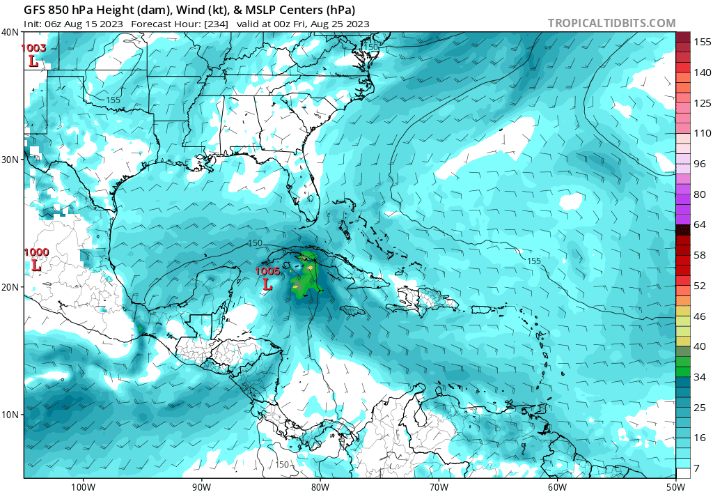
There's nothing scientific at all when it comes to what I'm about to say and I have no facts at all to back it up. However, in my experience, mother nature always makes up for herself one way or another. In other words, if I were in Texas right now, I'd be concerned about a strike from a TS or Hurricane sometime soon. As dry as it has been there, the rain will come at some point, and you may not be able to turn the faucet off when it does. Mother nature will erase the current drought in a flash.
3 likes
Fourth Generation Florida Native
Personal Storm History: David 79, Andrew 92, Erin 95, Floyd 99, Irene 99, Frances 04, Jeanne 04, Wilma 05, Matthew 16, Irma 17, Ian 22, Nicole 22, Milton 24


