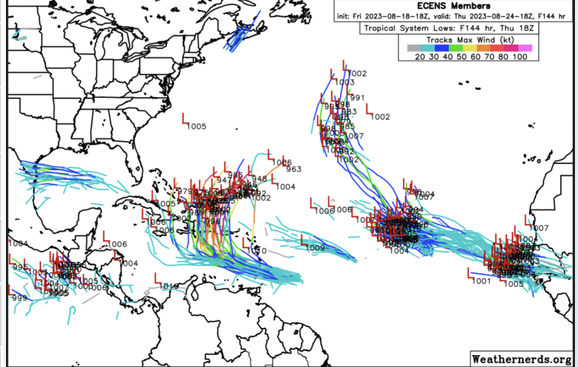
18z ECENS… If correct some strong members over DR/PR…
Moderator: S2k Moderators


wxman57 wrote:I 100% believe the 384 hr panel of the 18Z GFS. Has to be right THIS time!


wxman57 wrote:I 100% believe the 384 hr panel of the 18Z GFS. Has to be right THIS time!


Blown Away wrote:[url]https://i.postimg.cc/Mp8nDbn5/61-D3-C25-C-74-B1-47-DB-80-C2-6-DCC160-C6-CA9.jpg [/url]
18z ECENS… If correct some strong members over DR/PR…

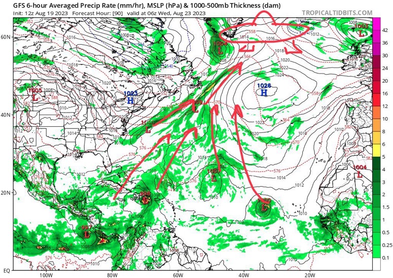
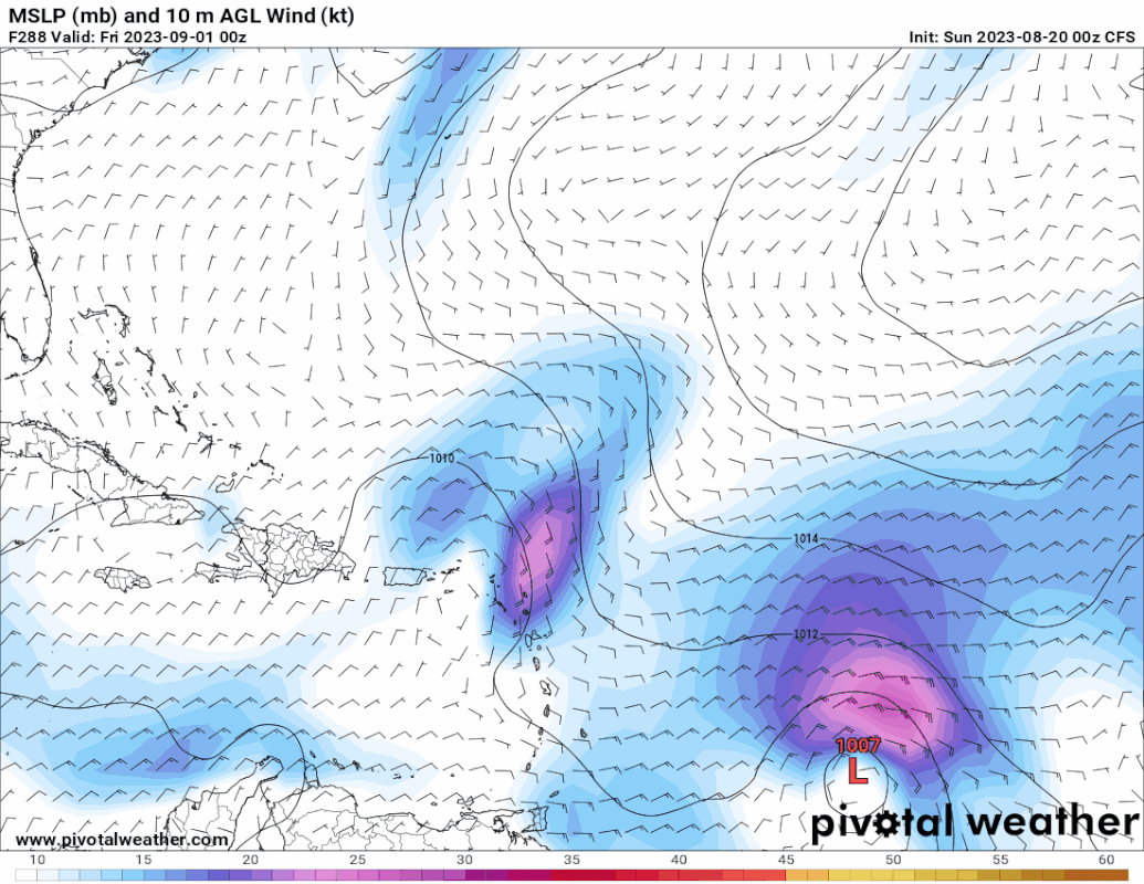
aspen wrote:The models seem to like the next two waves, one that’ll emerge tomorrow and a second that’ll emerge midweek. But it’s kind of a mess on the models; there are like half a different disturbances with various shots of development over the next 7-10 days, some of which could compete with each other, and some that are favored by different models. Perhaps we get a few NS out of this mess, or the bell ringing results in the picture becoming a little clearer.

GCANE wrote:That EPAC disturbance crossing the IoT into the GoM looks interesting.
Wampadawg wrote:GCANE wrote:That EPAC disturbance crossing the IoT into the GoM looks interesting.
A little hope for the parched Gulf coast just something to hang on to Death Ridge 2023 is a beast!

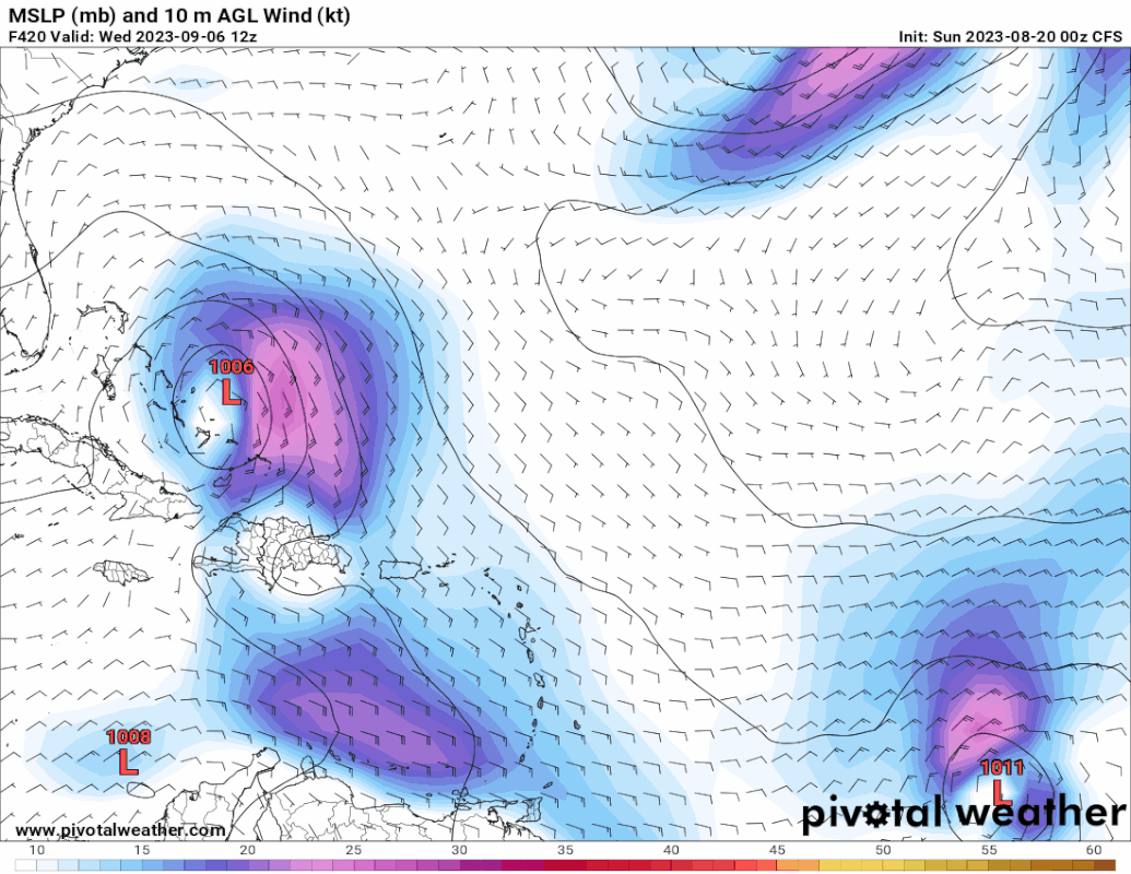
SouthFLTropics wrote:00z GFS with a possible Labor Day weekend spoiler inbound towards the Bahamas.
Sent from my iPhone using Tapatalk
otowntiger wrote:SouthFLTropics wrote:00z GFS with a possible Labor Day weekend spoiler inbound towards the Bahamas.
Sent from my iPhone using Tapatalk
Not sure what you’re seeing but gfs looks pretty clear to me at the time. I only see the extreme edges of a system pretty far out in the central Atlantic on the last screen and it doesn’t look threatening.
IcyTundra wrote:otowntiger wrote:SouthFLTropics wrote:00z GFS with a possible Labor Day weekend spoiler inbound towards the Bahamas.
Sent from my iPhone using Tapatalk
Not sure what you’re seeing but gfs looks pretty clear to me at the time. I only see the extreme edges of a system pretty far out in the central Atlantic on the last screen and it doesn’t look threatening.
He was talking about the 0Z GFS from late last night. It was showing a hurricane in the Bahamas on Labor Day weekend but it is no longer showing it on the 12Z run.
 ??
?? 
Its been active in se fla, yesterday was a bust but over achieving since midniteSFLcane wrote:Tc outbreak incoming.. these waves in particular are interesting
Users browsing this forum: No registered users and 181 guests