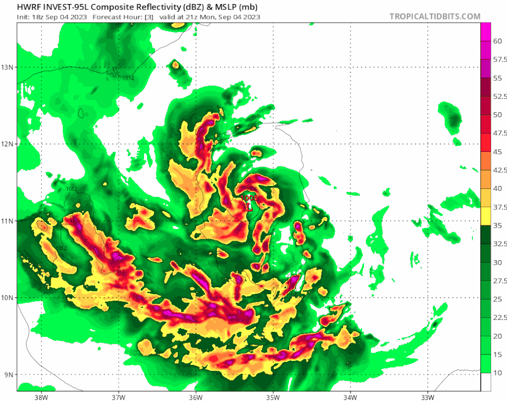
ATL: LEE - Models

Moderator: S2k Moderators

Message
Author
User avatar
Spacecoast
Category 2
Category 2
Posts: 758
Joined: Thu Aug 31, 2017 2:03 pm

Re: ATL: INVEST 95L - Models

#241 Postby Spacecoast » Mon Sep 04, 2023 4:36 pm

zzzh wrote:
NotSparta wrote:That ECMWF/EPS suite this cycle is about the strongest I can remember for anything in the Atlantic, particularly an invest. This definitely has the potential to be quite impressive, hopefully the troughing is strong enough to keep it away from land

Part of the reason why EPS is so strong is that it got upgraded this June. I doubt the old EPS would be this crazy :D

Agreed.
Empirically, it does seem like the upgrade has improved (it's reputation) in two areas:
    Genesis- so far this year, the Euro has done very well forecasting genesis. Outperforming the GFS, without generating false positives.
    Intensity- Noticeably higher intensities, than last year's model. Probably still better to use Hurricane models for near term intensity.
The GFS, on the other hand seems to still have genesis issues, (perhaps some degradation) with false negatives, and false positives.

Just my observation / recollection, as I have not been tracking verification / performance data.
4 likes   

User avatar
Hurricane2022
Category 5
Category 5
Posts: 1497
Joined: Tue Aug 23, 2022 11:38 pm
Location: Araçatuba, Brazil

Re: ATL: INVEST 95L - Models

#242 Postby Hurricane2022 » Mon Sep 04, 2023 5:24 pm

 https://twitter.com/WxTca/status/1698787263730323530


I honestly wouldn't be surprised if Bruce Lee becomes a powerful sub-900 mb hurricane :lol:
3 likes   
Sorry for the bad English sometimes...!
For reliable and detailed information for any meteorological phenomenon, please consult the National Hurricane Center, Joint Typhoon Warning Center , or your local Meteo Center.

--------

Una cvm Christo, pro Christo, et in Christo. Sit nomen Domini benedictvm.

User avatar
aspen
Category 5
Category 5
Posts: 8812
Joined: Sat Oct 12, 2019 7:10 pm
Location: Connecticut, USA

Re: ATL: INVEST 95L - Models

#243 Postby aspen » Mon Sep 04, 2023 5:48 pm

Man the GFS sure hates New England/Atlantic Canada. 18z goes into MA/ME.
0 likes   
Irene '11 Sandy '12 Hermine '16 5/15/2018 Derecho Fay '20 Isaias '20 Elsa '21 Henri '21 Ida '21

I am only a meteorology enthusiast who knows a decent amount about tropical cyclones. Look to the professional mets, the NHC, or your local weather office for the best information.

User avatar
Woofde
Category 1
Category 1
Posts: 475
Joined: Tue Jul 06, 2021 11:33 am

Re: RE: Re: ATL: INVEST 95L - Models

#244 Postby Woofde » Mon Sep 04, 2023 5:51 pm

aspen wrote:Man the GFS sure hates New England/Atlantic Canada. 18z goes into MA/ME.
If that run actually came to fruition, it would probably put a couple feet of water in my house. We've seen a lot of model runs like that over the years, especially at this range. Climatology says it rarely happens, though always possible. Most people here forget that we are indeed in the risk area for Hurricanes.
0 likes   

User avatar
HurricaneBelle
S2K Supporter
S2K Supporter
Posts: 1169
Joined: Sun Aug 27, 2006 6:12 pm
Location: Clearwater, FL

Re: ATL: INVEST 95L - Models

#245 Postby HurricaneBelle » Mon Sep 04, 2023 6:30 pm

TheDreamTraveler wrote:Thought this was interesting in the third image he posted. Of the 6 storms that formed since 2000 where 95L is forecast to form that eventually became major hurricanes 4 of them struck the US and 2 didn't


Six is a small sample size of anything
3 likes   

User avatar
Spacecoast
Category 2
Category 2
Posts: 758
Joined: Thu Aug 31, 2017 2:03 pm

Re: ATL: INVEST 95L - Models

#246 Postby Spacecoast » Mon Sep 04, 2023 7:01 pm

18z GEFS: Ensemble mean crosses just NE of 20N,60W in 5 days.
Image
1 likes   

SconnieCane
Category 4
Category 4
Posts: 997
Joined: Thu Aug 02, 2018 5:29 pm
Location: Madison, WI

Re: ATL: INVEST 95L - Models

#247 Postby SconnieCane » Mon Sep 04, 2023 7:13 pm

Buzzsaw blade in 90 hours if the 18Z HWRF verifies. :eek:
0 likes   

User avatar
aspen
Category 5
Category 5
Posts: 8812
Joined: Sat Oct 12, 2019 7:10 pm
Location: Connecticut, USA

Re: ATL: INVEST 95L - Models

#248 Postby aspen » Mon Sep 04, 2023 7:13 pm

HAFS-A and B finish off with Cat 5 Hurricane Lee: 145 kt/927 mbar for A and 140 kt/920 mbar for B.
1 likes   
Irene '11 Sandy '12 Hermine '16 5/15/2018 Derecho Fay '20 Isaias '20 Elsa '21 Henri '21 Ida '21

I am only a meteorology enthusiast who knows a decent amount about tropical cyclones. Look to the professional mets, the NHC, or your local weather office for the best information.

User avatar
AubreyStorm
Category 1
Category 1
Posts: 337
Age: 44
Joined: Fri Jun 16, 2017 6:21 pm
Location: Texas, USA

Re: ATL: INVEST 95L - Models

#249 Postby AubreyStorm » Mon Sep 04, 2023 7:30 pm

aspen wrote:HAFS-A and B finish off with Cat 5 Hurricane Lee: 145 kt/927 mbar for A and 140 kt/920 mbar for B.


Where I see that run?
0 likes   
The posts are NOT an official forecast. Please REFER to the NHC and NWS for official forecasts and products.

TomballEd
Category 2
Category 2
Posts: 585
Age: 61
Joined: Wed Aug 16, 2023 4:52 pm
Location: Spring/Klein area, not Tomball

Re: ATL: INVEST 95L - Models

#250 Postby TomballEd » Mon Sep 04, 2023 7:46 pm

Euro ensembles are now run at the same resolution as the op, 9 km, IIRC. The 'control' EPS will be retired soon. per the ECMWF
0 likes   

User avatar
Hurricane2022
Category 5
Category 5
Posts: 1497
Joined: Tue Aug 23, 2022 11:38 pm
Location: Araçatuba, Brazil

Re: ATL: INVEST 95L - Models

#251 Postby Hurricane2022 » Mon Sep 04, 2023 7:46 pm

AubreyStorm wrote:
aspen wrote:HAFS-A and B finish off with Cat 5 Hurricane Lee: 145 kt/927 mbar for A and 140 kt/920 mbar for B.


Where I see that run?

https://www.tropicaltidbits.com/analysis/models/
:D :D
1 likes   
Sorry for the bad English sometimes...!
For reliable and detailed information for any meteorological phenomenon, please consult the National Hurricane Center, Joint Typhoon Warning Center , or your local Meteo Center.

--------

Una cvm Christo, pro Christo, et in Christo. Sit nomen Domini benedictvm.

User avatar
Blown Away
S2K Supporter
S2K Supporter
Posts: 10140
Joined: Wed May 26, 2004 6:17 am

Re: ATL: INVEST 95L - Models

#252 Postby Blown Away » Mon Sep 04, 2023 7:52 pm

Image

18z HWRF a bit S of 12z…
1 likes   
Hurricane Eye Experience: David 79, Irene 99, Frances 04, Jeanne 04, Wilma 05... EYE COMING MY WAY IN 2024…
Hurricane Brush Experience: Andrew 92, Erin 95, Floyd 99, Matthew 16, Irma 17, Ian 22, Nicole 22…

verruckt
Tropical Low
Tropical Low
Posts: 26
Joined: Thu Oct 06, 2016 12:58 am

Re: ATL: INVEST 95L - Models

#253 Postby verruckt » Mon Sep 04, 2023 8:06 pm

Blown Away wrote:[url]https://i.postimg.cc/5NjM6RGj/hwrf-ref-95-L-fh3-126.gif [/url]

18z HWRF a bit S of 12z…


The crazy part of that, with a little rough math would mean:
-An eye ~60 miles in diameter
-Overall storm ~330 miles in diameter.
0 likes   

zzzh
Category 3
Category 3
Posts: 833
Joined: Thu Sep 02, 2021 1:13 pm

Re: ATL: INVEST 95L - Models

#254 Postby zzzh » Mon Sep 04, 2023 8:36 pm

Image
HAFS-A :lol:
2 likes   

User avatar
Hypercane_Kyle
Category 5
Category 5
Posts: 3344
Joined: Sat Mar 07, 2015 7:58 pm
Location: Cape Canaveral, FL

Re: ATL: INVEST 95L - Models

#255 Postby Hypercane_Kyle » Mon Sep 04, 2023 8:40 pm

Water temps are 30C just north of the Lesser Antilles. Combined that with a favorable upper-level environment and it would not surprise me if 95L ends up being similar to Irma in terms of intensity. Euro is showing exactly that. Fortunately it's looking likely it'll be a miss of the islands.
0 likes   
My posts are my own personal opinion, defer to the National Hurricane Center (NHC) and other NOAA products for decision making during hurricane season.

User avatar
Category5Kaiju
Category 5
Category 5
Posts: 4051
Joined: Thu Dec 24, 2020 12:45 pm
Location: Seattle

Re: ATL: INVEST 95L - Models

#256 Postby Category5Kaiju » Mon Sep 04, 2023 8:41 pm


A wannabe Patricia? In the open MDR? Woof :)
2 likes   
Unless explicitly stated, all info in my posts is based on my own opinions and observations. Tropical storms and hurricanes can be extremely dangerous. Do not think you can beat Mother Nature. Refer to an accredited weather research agency or meteorologist if you need to make serious decisions regarding an approaching storm.

User avatar
Ptarmigan
Category 5
Category 5
Posts: 5313
Joined: Wed Aug 16, 2006 9:06 pm

Re: ATL: INVEST 95L - Models

#257 Postby Ptarmigan » Mon Sep 04, 2023 8:52 pm

Hurricane2022 wrote:https://twitter.com/WxTca/status/1698787263730323530?t=25FdgKNn0pe26GWmTT8jmQ&s=19
I honestly wouldn't be surprised if Bruce Lee becomes a powerful sub-900 mb hurricane :lol:


If it panned out, Lee would be one of the strongest hurricanes in the past several years.
1 likes   

User avatar
blp
Category 5
Category 5
Posts: 2840
Age: 46
Joined: Thu Sep 09, 2004 7:51 pm
Location: Miami, FL
Contact:

Re: ATL: INVEST 95L - Models

#258 Postby blp » Mon Sep 04, 2023 9:02 pm

I don't think we will get sub 900 if it's over open waters heading OTS. You won't have almost any recon Only if Dvorak estimates come back at an 8 which is highly unlikely in that part of the Atlantic. Maybe the Western Caribbean which has much higher TCHP.
0 likes   
The following post is NOT an official forecast and should not be used as such. It is just the opinion of the poster and may or may not be backed by sound meteorological data. It is NOT endorsed by any professional institution including storm2k.org For Official Information please refer to the NHC and NWS products.

User avatar
Teban54
Category 5
Category 5
Posts: 3168
Joined: Sat May 19, 2018 1:19 pm

Re: ATL: INVEST 95L - Models

#259 Postby Teban54 » Mon Sep 04, 2023 9:16 pm

blp wrote:I don't think we will get sub 900 if it's over open waters heading OTS. You won't have almost any recon Only if Dvorak estimates come back at an 8 which is highly unlikely in that part of the Atlantic. Maybe the Western Caribbean which has much higher TCHP.

If it turns out to be a New England threat - which GFS is showing and which is certainly still on the table - then I expect there to be recon.

Franklin also had recon at its peak even though it was clearly heading OTS.
2 likes   

User avatar
Meteorcane
Category 2
Category 2
Posts: 559
Joined: Thu Jul 21, 2011 6:49 am
Location: North Platte Nebraska

Re: ATL: INVEST 95L - Models

#260 Postby Meteorcane » Mon Sep 04, 2023 9:28 pm

Teban54 wrote:
blp wrote:I don't think we will get sub 900 if it's over open waters heading OTS. You won't have almost any recon Only if Dvorak estimates come back at an 8 which is highly unlikely in that part of the Atlantic. Maybe the Western Caribbean which has much higher TCHP.

If it turns out to be a New England threat - which GFS is showing and which is certainly still on the table - then I expect there to be recon.

Franklin also had recon at its peak even though it was clearly heading OTS.


Yeah with a possible Bermuda threat there will be some recon too. Should also be some of the environmental sampling missions later in the period too.
0 likes   


Return to “2023”

Who is online

Users browsing this forum: No registered users and 4 guests