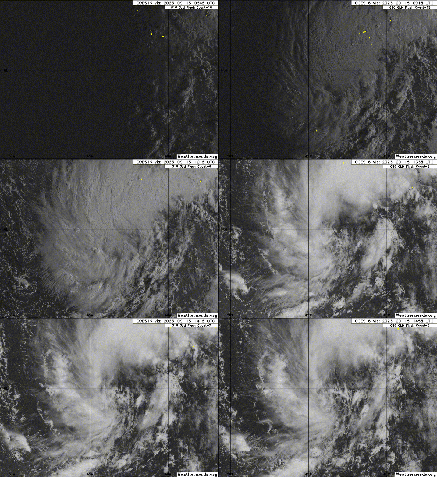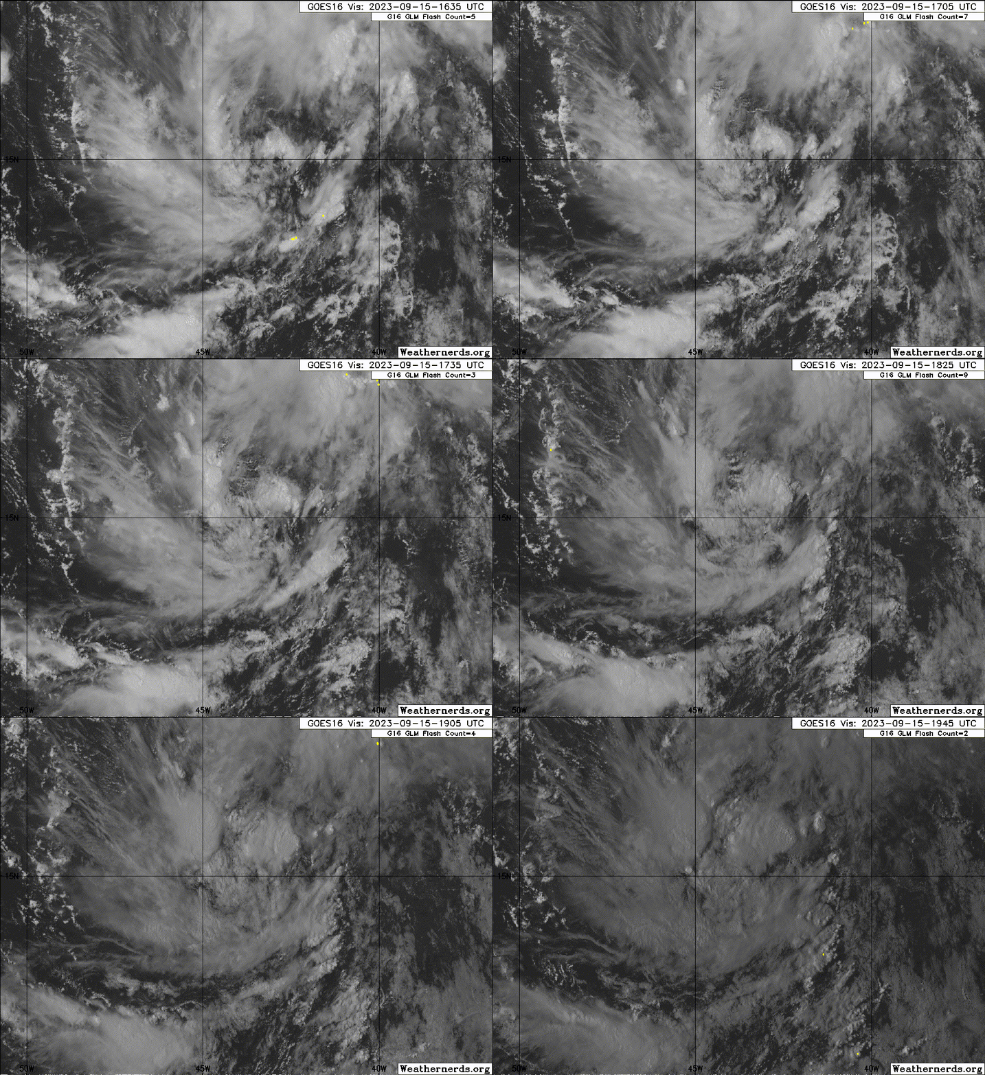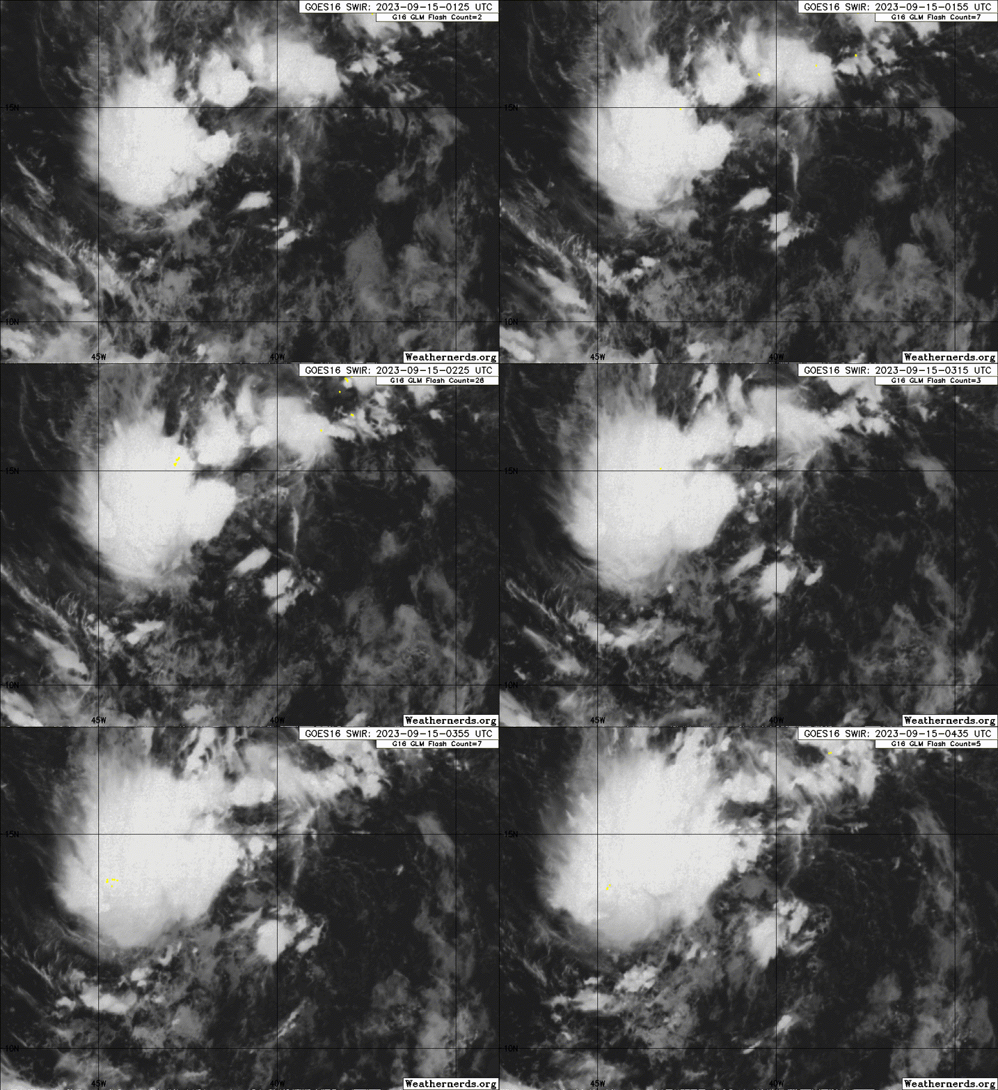
ATL: NIGEL - Post-Tropical - Discussion
Moderator: S2k Moderators
-
Sciencerocks
- Category 5

- Posts: 10181
- Age: 40
- Joined: Thu Jul 06, 2017 1:51 am
- weeniepatrol
- Category 5

- Posts: 1341
- Joined: Sat Aug 22, 2020 5:30 pm
- Location: WA State
Re: ATL: INVEST 97L - Discussion
Excerpt from 8 a.m. TWO:
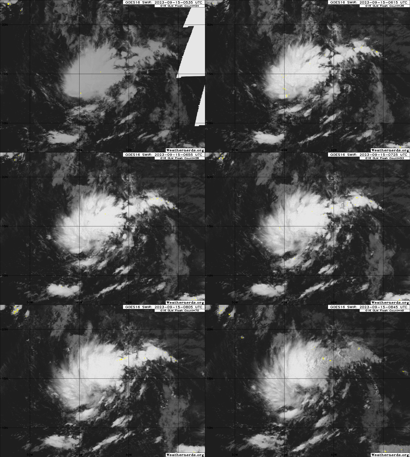
Central Tropical Atlantic (AL97):
Showers and thunderstorms have become better organized in
association with a broad low pressure area located about midway
between the Cabo Verde Islands and the Lesser Antilles.
Environmental conditions remain conducive for additional
development, and this system is expected to become a tropical
depression within the next day or so while it moves
west-northwestward to northwestward at 10 to 15 mph across the
central tropical Atlantic.
* Formation chance through 48 hours...high...90 percent.
* Formation chance through 7 days...high...90 percent.

0 likes
- wxman57
- Moderator-Pro Met

- Posts: 23172
- Age: 68
- Joined: Sat Jun 21, 2003 8:06 pm
- Location: Houston, TX (southwest)
Re: ATL: INVEST 97L - Discussion
Looks like this one will recurve east of Bermuda and stay away from Nova Scotia and Newfoundland.
0 likes
-
MEANINGLESS_NUMBERS
- Category 2

- Posts: 503
- Joined: Mon Nov 02, 2020 1:43 pm
Re: ATL: INVEST 97L - Discussion
wxman57 wrote:Looks like this one will recurve east of Bermuda and stay away from Nova Scotia and Newfoundland.
Hopefully, but models still sweep it over Bermuda. The GFS is still close and had a direct hit in the last 4-5 runs. The most recent Euro has us in the wind field. For 7 days out that is as close enough to worry about.
1 likes
Emily '87, Felix '95, Gert '99, Fabian '03, Humberto '19, Paulette '20, Teddy '20, Fiona '22, Lee '23, Ernesto '24, Humberto/Imelda '25
Re: ATL: FIFTEEN - Tropical Depression - Discussion
AL, 15, 2023091512, , BEST, 0, 140N, 435W, 30, 1007, TD, 34, NEQ, 0, 0, 0, 0, 1011, 260, 70, 0, 0, L, 0, , 0, 0, FIFTEEN, M, 0, , 0, 0, 0, 0, genesis-num, 031, TRANSITIONED, alA72023 to al152023,
2 likes
Re: ATL: INVEST 97L - Discussion
Special Message from NHC Issued 15 Sep 2023 14:16 UTC
NHC will initiate advisories on Tropical Depression Fifteen, located over the central tropical Atlantic Ocean, at 1100 AM AST (1500 UTC).
NHC will initiate advisories on Tropical Depression Fifteen, located over the central tropical Atlantic Ocean, at 1100 AM AST (1500 UTC).
4 likes
Re: ATL: FIFTEEN - Tropical Depression - Discussion
Tropical Depression Fifteen Advisory Number 1
NWS National Hurricane Center Miami FL AL152023
Issued by the NWS Weather Prediction Center College Park MD
1100 AM AST Fri Sep 15 2023
...NEW TROPICAL DEPRESSION FORMS IN THE CENTRAL ATLANTIC...
...EXPECTED TO BECOME A HURRICANE WELL NORTHEAST OF THE LESSER
ANTILLES...
SUMMARY OF 1100 AM AST...1500 UTC...INFORMATION
-----------------------------------------------
LOCATION...14.4N 43.8W
ABOUT 1170 MI...1880 KM E OF THE LESSER ANTILLES
MAXIMUM SUSTAINED WINDS...35 MPH...55 KM/H
PRESENT MOVEMENT...NW OR 320 DEGREES AT 12 MPH...19 KM/H
MINIMUM CENTRAL PRESSURE...1007 MB...29.74 INCHES
0 likes
- Iceresistance
- Category 5

- Posts: 9579
- Age: 22
- Joined: Sat Oct 10, 2020 9:45 am
- Location: Tecumseh, OK/Norman, OK
Re: ATL: FIFTEEN - Tropical Depression - Discussion
EXTENDED OUTLOOK. NOTE...ERRORS FOR TRACK HAVE AVERAGED NEAR 125 NM
ON DAY 4 AND 175 NM ON DAY 5...AND FOR INTENSITY NEAR 15 KT EACH DAY
OUTLOOK VALID 19/1200Z 26.0N 56.8W
MAX WIND 105 KT...GUSTS 130 KT.
OUTLOOK VALID 20/1200Z 29.0N 60.0W
MAX WIND 100 KT...GUSTS 120 KT.
ON DAY 4 AND 175 NM ON DAY 5...AND FOR INTENSITY NEAR 15 KT EACH DAY
OUTLOOK VALID 19/1200Z 26.0N 56.8W
MAX WIND 105 KT...GUSTS 130 KT.
OUTLOOK VALID 20/1200Z 29.0N 60.0W
MAX WIND 100 KT...GUSTS 120 KT.
7 likes
Bill 2015 & Beta 2020
Winter 2020-2021
All observations are in Tecumseh, OK unless otherwise noted.
Winter posts are focused mainly for Oklahoma & Texas.
Take any of my forecasts with a grain of salt, refer to the NWS, SPC, and NHC for official information
Never say Never with weather! Because ANYTHING is possible!
Winter 2020-2021

All observations are in Tecumseh, OK unless otherwise noted.
Winter posts are focused mainly for Oklahoma & Texas.
Take any of my forecasts with a grain of salt, refer to the NWS, SPC, and NHC for official information
Never say Never with weather! Because ANYTHING is possible!
- weeniepatrol
- Category 5

- Posts: 1341
- Joined: Sat Aug 22, 2020 5:30 pm
- Location: WA State
Re: ATL: FIFTEEN - Tropical Depression - Discussion
2023 strong El Niño rages on
120mph peak and “could be conservative”
The depression is forecast to gradually intensify over the next
couple of days as moderate northeasterly shear and the initial broad
cyclone structure could provide a check on the intensification
rate. By early next week, this system is forecast to move over
near record warm sea-surface temperatures for the region in light
shear conditions. It probably sounds like a broken record at this
point in the season, but rapid intensification is a significant
possibility, and the official forecast could be conservative below.
The intensity forecast is near or above the intensity consensus,
only leveling off at 120 hours due to gradual SST cooling and the
possibility of eyewall replacement cycles, as suggested by the HAFS
model suite.
120mph peak and “could be conservative”
7 likes
- wxman57
- Moderator-Pro Met

- Posts: 23172
- Age: 68
- Joined: Sat Jun 21, 2003 8:06 pm
- Location: Houston, TX (southwest)
Re: ATL: INVEST 97L - Discussion
MEANINGLESS_NUMBERS wrote:wxman57 wrote:Looks like this one will recurve east of Bermuda and stay away from Nova Scotia and Newfoundland.
Hopefully, but models still sweep it over Bermuda. The GFS is still close and had a direct hit in the last 4-5 runs. The most recent Euro has us in the wind field. For 7 days out that is as close enough to worry about.
Bermuda definitely needs to keep an eye on Nigel. The storms seem to have an affinity for Bermuda this season.
3 likes
Re: ATL: FIFTEEN - Tropical Depression - Discussion
weeniepatrol wrote:2023 strong El Niño rages onThe depression is forecast to gradually intensify over the next
couple of days as moderate northeasterly shear and the initial broad
cyclone structure could provide a check on the intensification
rate. By early next week, this system is forecast to move over
near record warm sea-surface temperatures for the region in light
shear conditions. It probably sounds like a broken record at this
point in the season, but rapid intensification is a significant
possibility, and the official forecast could be conservative below.
The intensity forecast is near or above the intensity consensus,
only leveling off at 120 hours due to gradual SST cooling and the
possibility of eyewall replacement cycles, as suggested by the HAFS
model suite.
120mph peak and “could be conservative”
1 likes
-
Sciencerocks
- Category 5

- Posts: 10181
- Age: 40
- Joined: Thu Jul 06, 2017 1:51 am
- ElectricStorm
- Category 5

- Posts: 5140
- Age: 25
- Joined: Tue Aug 13, 2019 11:23 pm
- Location: Norman, OK
Re: ATL: FIFTEEN - Tropical Depression - Discussion
Wow another super aggressive initial forecast 
Hopefully Bermuda is ready
Hopefully Bermuda is ready
1 likes
B.S Meteorology, University of Oklahoma '25
Please refer to the NHC, NWS, or SPC for official information.
Please refer to the NHC, NWS, or SPC for official information.
-
MEANINGLESS_NUMBERS
- Category 2

- Posts: 503
- Joined: Mon Nov 02, 2020 1:43 pm
Re: ATL: FIFTEEN - Tropical Depression - Discussion
ElectricStorm wrote:Wow another super aggressive initial forecast
Hopefully Bermuda is ready
Rum supplies dangerously low after Franklin, Idalia, and Lee. Restocking as we speak!
3 likes
Emily '87, Felix '95, Gert '99, Fabian '03, Humberto '19, Paulette '20, Teddy '20, Fiona '22, Lee '23, Ernesto '24, Humberto/Imelda '25
- Hurricane2022
- Category 5

- Posts: 2016
- Joined: Tue Aug 23, 2022 11:38 pm
- Location: Araçatuba, Brazil
Re: ATL: FIFTEEN - Tropical Depression - Discussion
0 likes
Sorry for the bad English sometimes...!
For reliable and detailed information for any meteorological phenomenon, please consult the National Hurricane Center, Joint Typhoon Warning Center , or your local Meteo Center.
--------
ECCE OMNIA NOVA FACIAM (Ap 21,5).
For reliable and detailed information for any meteorological phenomenon, please consult the National Hurricane Center, Joint Typhoon Warning Center , or your local Meteo Center.
--------
ECCE OMNIA NOVA FACIAM (Ap 21,5).
-
floridasun
- Tropical Storm

- Posts: 245
- Joined: Tue Sep 14, 2021 3:59 pm
Re: ATL: FIFTEEN - Tropical Depression - Discussion
Too me look like moving west not nw as nhc saying
0 likes
- Hurricaneman
- Category 5

- Posts: 7404
- Age: 45
- Joined: Tue Aug 31, 2004 3:24 pm
- Location: central florida
Re: ATL: FIFTEEN - Tropical Depression - Discussion
floridasun wrote:Too me look like moving west not nw as nhc saying
Right now if you follow the center it’s going NW to NNW
0 likes
-
Sciencerocks
- Category 5

- Posts: 10181
- Age: 40
- Joined: Thu Jul 06, 2017 1:51 am
Re: ATL: FIFTEEN - Tropical Depression - Discussion
The intensity guidance is somewhat lower this cycle, but the NHC forecast remains generally the same as before. This is near the upper-end of the latest guidance envelope.
The peak forecast has been slightly lowered to 100 kt from 105.
0 likes
TC naming lists: retirements and intensity
Most aggressive Advisory #1's in North Atlantic (cr. kevin for starting the list)
Most aggressive Advisory #1's in North Atlantic (cr. kevin for starting the list)
Who is online
Users browsing this forum: No registered users and 34 guests


