ATL: NIGEL - Post-Tropical - Discussion
Moderator: S2k Moderators
-
WalterWhite

- Category 1

- Posts: 342
- Joined: Fri Mar 17, 2023 5:53 pm
Re: ATL: FIFTEEN - Tropical Depression - Discussion
I still think this will become a major hurricane. SSTs are still very warm in 15L's projected path.
1 likes

Re: ATL: FIFTEEN - Tropical Depression - Discussion
ElectricStorm wrote:12z hurricane models are generally showing a pretty broad core, which would likely prevent this from becoming too strong. Of the four models, only the HWRF has it becoming a major. Not surprised the NHC bumped the peak down slightly, although this becoming a major is still very possible (maybe even likely)
18z runs are about to start, we'll see if they're similar to the 12z runs
The HAFS models showing a large core is pretty telling, as unlike the HWRF, they don’t have a big core bias. I think we’ll see something similar to Larry ‘21: a low-end major with a giant eye.
2 likes
Irene '11 Sandy '12 Hermine '16 5/15/2018 Derecho Fay '20 Isaias '20 Elsa '21 Henri '21 Ida '21
I am only a meteorology enthusiast who knows a decent amount about tropical cyclones. Look to the professional mets, the NHC, or your local weather office for the best information.
I am only a meteorology enthusiast who knows a decent amount about tropical cyclones. Look to the professional mets, the NHC, or your local weather office for the best information.
-
cycloneye

- Admin

- Posts: 149276
- Age: 69
- Joined: Thu Oct 10, 2002 10:54 am
- Location: San Juan, Puerto Rico
ATL: FIFTEEN - Recon
THe squadron has been very busy this season and looks like it will continue that way with this Tropical Cyclone.
POSSIBLY BEGIN FIXES ON TROPICAL
DEPRESSION FIFTEEN AT 18/1730Z.
DEPRESSION FIFTEEN AT 18/1730Z.
0 likes
Visit the Caribbean-Central America Weather Thread where you can find at first post web cams,radars
and observations from Caribbean basin members Click Here
and observations from Caribbean basin members Click Here
-
Sciencerocks
- Category 5

- Posts: 10181
- Age: 40
- Joined: Thu Jul 06, 2017 1:51 am
Re: ATL: FIFTEEN - Tropical Depression - Discussion
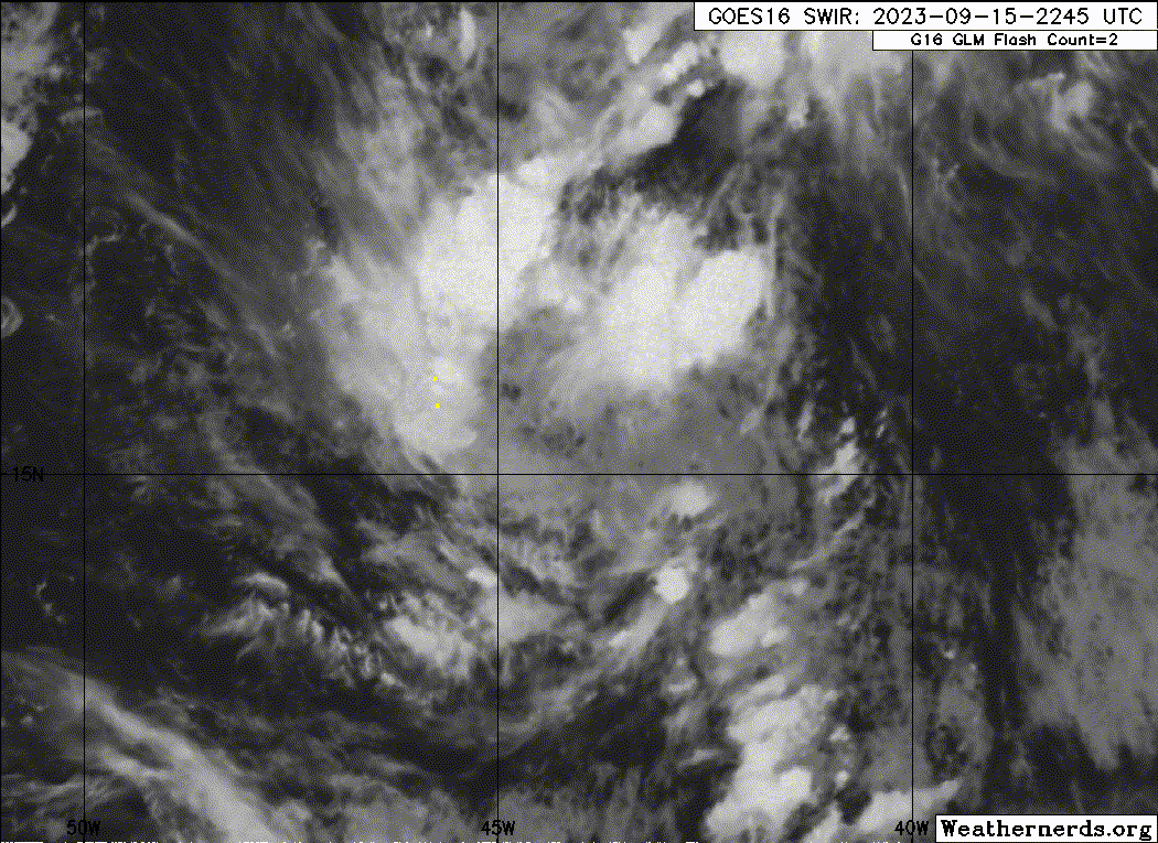
ASCAT shows a broad structure. Needs to tighten up.
0 likes


Re: ATL: FIFTEEN - Tropical Depression - Discussion
Best Track:
Central pressure has dropped a millibar and the CoC has moved NNW from its previous estimated position:
Source: https://ftp.nhc.noaa.gov/atcf/btk/bal152023.dat
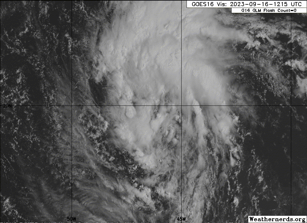
AL, 15, 2023091612, , BEST, 0, 191N, 458W, 30, 1006, TD
Central pressure has dropped a millibar and the CoC has moved NNW from its previous estimated position:
AL, 15, 2023091606, , BEST, 0, 172N, 450W, 30, 1007, TD
Source: https://ftp.nhc.noaa.gov/atcf/btk/bal152023.dat
0 likes

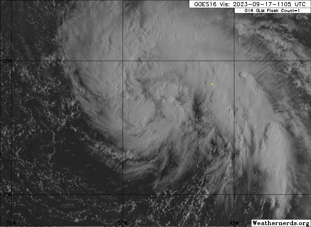
Re: ATL: FIFTEEN - Tropical Depression - Discussion
TD 15 is stretched out into a oval with most of the convection been at the northern end. As the convection builds it should coalesce at the northern end which seems to of started to happen.
Source - https://col.st/qU7me

Source - https://col.st/qU7me
2 likes
-
cycloneye
- Admin
- Posts: 149276
- Age: 69
- Joined: Thu Oct 10, 2002 10:54 am
- Location: San Juan, Puerto Rico
Re: ATL: FIFTEEN - Recon
cycloneye wrote:THe squadron has been very busy this season and looks like it will continue that way with this Tropical Cyclone.POSSIBLY BEGIN FIXES ON TROPICAL
DEPRESSION FIFTEEN AT 18/1730Z.
There will be no recon for this system as it will move well east of Bermuda. The above from Fridays TCPOD has been canceled.
0 likes
Visit the Caribbean-Central America Weather Thread where you can find at first post web cams,radars
and observations from Caribbean basin members Click Here
and observations from Caribbean basin members Click Here
-
Sciencerocks
- Category 5
- Posts: 10181
- Age: 40
- Joined: Thu Jul 06, 2017 1:51 am
-
Sciencerocks
- Category 5
- Posts: 10181
- Age: 40
- Joined: Thu Jul 06, 2017 1:51 am

Re: ATL: FIFTEEN - Tropical Depression - Discussion
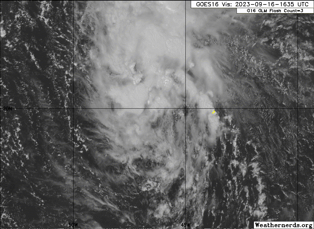
AL, 15, 2023091700, , BEST, 0, 215N, 476W, 35, 1005, TS
1 likes
-
Hurricane2022

- Category 5
- Posts: 2016
- Joined: Tue Aug 23, 2022 11:38 pm
- Location: Araçatuba, Brazil
Re: ATL: FIFTEEN - Tropical Depression - Discussion
Landy wrote:AL, 15, 2023091700, , BEST, 0, 215N, 476W, 35, 1005, TS
After 6 years Nigel finally is a TS!!!
2 likes
Sorry for the bad English sometimes...!
For reliable and detailed information for any meteorological phenomenon, please consult the National Hurricane Center, Joint Typhoon Warning Center , or your local Meteo Center.
--------
ECCE OMNIA NOVA FACIAM (Ap 21,5).
For reliable and detailed information for any meteorological phenomenon, please consult the National Hurricane Center, Joint Typhoon Warning Center , or your local Meteo Center.
--------
ECCE OMNIA NOVA FACIAM (Ap 21,5).
-
Sciencerocks
- Category 5
- Posts: 10181
- Age: 40
- Joined: Thu Jul 06, 2017 1:51 am

-
cycloneye
- Admin
- Posts: 149276
- Age: 69
- Joined: Thu Oct 10, 2002 10:54 am
- Location: San Juan, Puerto Rico
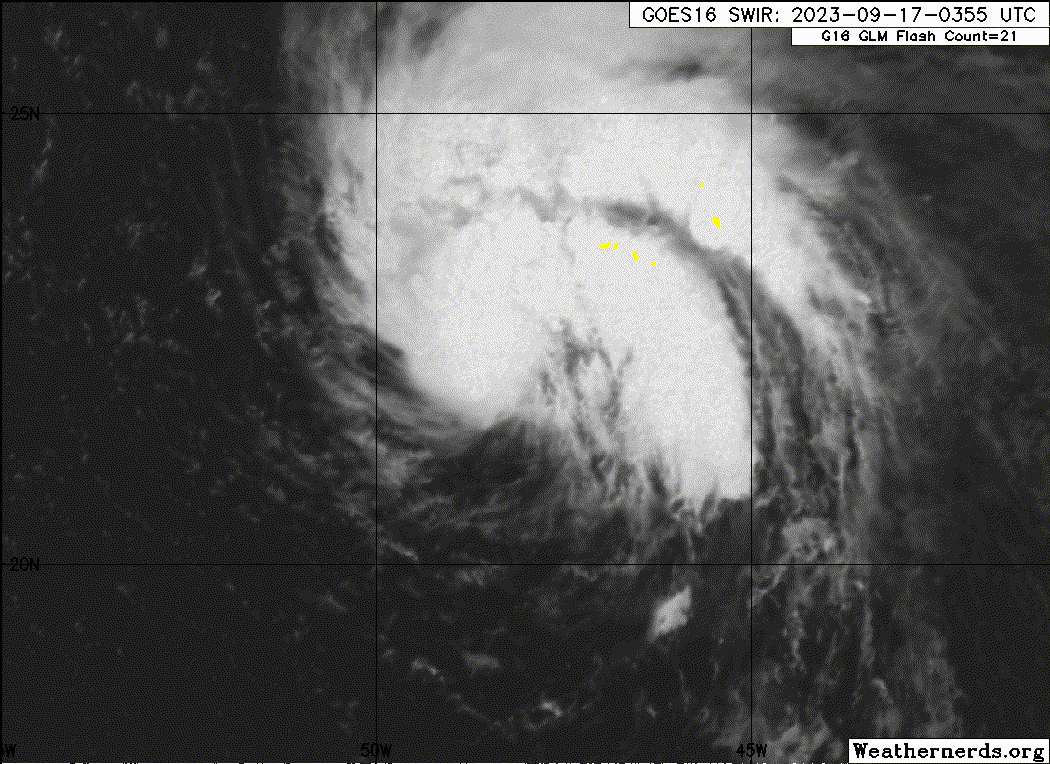
Re: ATL: NIGEL - Tropical Storm - Discussion
...TROPICAL STORM NIGEL FORMS IN THE CENTRAL ATLANTIC...
...EXPECTED TO BECOME A HURRICANE ON MONDAY.
...EXPECTED TO BECOME A HURRICANE ON MONDAY.
0 likes
Visit the Caribbean-Central America Weather Thread where you can find at first post web cams,radars
and observations from Caribbean basin members Click Here
and observations from Caribbean basin members Click Here
-
Hurricane2022
- Category 5
- Posts: 2016
- Joined: Tue Aug 23, 2022 11:38 pm
- Location: Araçatuba, Brazil
Re: ATL: NIGEL - Tropical Storm - Discussion
000
WTNT35 KNHC 170240
TCPAT5
BULLETIN
Tropical Storm Nigel Advisory Number 7
NWS National Hurricane Center Miami FL AL152023
1100 PM AST Sat Sep 16 2023
...TROPICAL STORM NIGEL FORMS IN THE CENTRAL ATLANTIC...
...EXPECTED TO BECOME A HURRICANE ON MONDAY...
SUMMARY OF 1100 PM AST...0300 UTC...INFORMATION
-----------------------------------------------
LOCATION...22.0N 48.0W
ABOUT 980 MI...1580 KM ENE OF THE LESSER ANTILLES
MAXIMUM SUSTAINED WINDS...40 MPH...65 KM/H
PRESENT MOVEMENT...NW OR 325 DEGREES AT 16 MPH...26 KM/H
MINIMUM CENTRAL PRESSURE...1005 MB...29.68 INCHES
WATCHES AND WARNINGS
--------------------
There are no coastal watches or warnings in effect.
DISCUSSION AND OUTLOOK
----------------------
The satellite presentation of the cyclone has improved this evening
as there has been an increase in convective banding over the
northern portion of the circulation. The center appears to be
located near the southern portion of the convective mass. Dvorak
Data T-numbers from both SAB and TAFB were T2.5 (35 kt) at 0000 UTC
and objective satellite estimates from UW/CIMSS are in the 35 to 40
kt range. Based on these data, the initial intensity has been
raised to 35 kt. Nigel becomes the 10th named storm to form in
the Atlantic basin since August 20th.
Nigel is moving northwestward at about 14 kt. A mid-level ridge
to the northeast of the cyclone should steer the storm
northwestward during the next few days. After that time, Nigel is
expected to turn northward around the western side of the ridge. By
the middle of next week, the global model guidance indicates that
the storm should turn northeast ahead of a broad mid-latitude
trough over the western Atlantic. There is fairly good agreement
in the global model guidance on the overall scenario, but there are
some timing or forward speed difference later in the period. The
NHC forecast track is near the HFIP corrected consensus which is
close to a blend of the latest GFS and ECMWF models.
Environmental conditions are expected to be conducive for steady
intensification during the next few days, with low vertical wind
shear and warm sea surface temperatures along the forecast track.
A period of rapid intensification is is certainly possible within
the next two to three days. Although the SHIP RI probabilities are
not very high at the moment, DTOPS gives a 50 percent chance of a 65
kt increase in intensity during the next 72 hours. The NHC forecast
is close to that, showing a 60 kt increase in strength during the
time. After 72 hours, increasing southwesterly shear is likely to
cause gradual weakening. The NHC wind speed forecast is closest to
the HFIP corrected consensus.
FORECAST POSITIONS AND MAX WINDS
INIT 17/0300Z 22.0N 48.0W 35 KT 40 MPH
12H 17/1200Z 23.6N 49.2W 45 KT 50 MPH
24H 18/0000Z 25.3N 50.6W 55 KT 65 MPH
36H 18/1200Z 26.7N 52.2W 65 KT 75 MPH
48H 19/0000Z 27.8N 54.0W 75 KT 85 MPH
60H 19/1200Z 29.4N 55.7W 85 KT 100 MPH
72H 20/0000Z 31.3N 56.7W 95 KT 110 MPH
96H 21/0000Z 36.0N 55.6W 85 KT 100 MPH
120H 22/0000Z 41.9N 47.3W 80 KT 90 MPH
$$
Forecaster Brown
0 likes
Sorry for the bad English sometimes...!
For reliable and detailed information for any meteorological phenomenon, please consult the National Hurricane Center, Joint Typhoon Warning Center , or your local Meteo Center.
--------
ECCE OMNIA NOVA FACIAM (Ap 21,5).
For reliable and detailed information for any meteorological phenomenon, please consult the National Hurricane Center, Joint Typhoon Warning Center , or your local Meteo Center.
--------
ECCE OMNIA NOVA FACIAM (Ap 21,5).
-
galaxy401

- Category 5
- Posts: 2446
- Age: 30
- Joined: Sat Aug 25, 2012 9:04 pm
- Location: Casa Grande, Arizona
Re: ATL: NIGEL - Tropical Storm - Discussion
Wrapping up quicker now. Up to 45 kts on Best Track. Won't be surprised to see another major out of this.
0 likes
Got my eyes on moving right into Hurricane Alley: Florida.
-
Sciencerocks
- Category 5
- Posts: 10181
- Age: 40
- Joined: Thu Jul 06, 2017 1:51 am
-
cycloneye
- Admin
- Posts: 149276
- Age: 69
- Joined: Thu Oct 10, 2002 10:54 am
- Location: San Juan, Puerto Rico
Re: ATL: NIGEL - Tropical Storm - Discussion
Going up fast.
AL, 15, 2023091712, , BEST, 0, 235N, 488W, 50, 997, TS
0 likes
Visit the Caribbean-Central America Weather Thread where you can find at first post web cams,radars
and observations from Caribbean basin members Click Here
and observations from Caribbean basin members Click Here

Re: ATL: NIGEL - Tropical Storm - Discussion
Go Nigel go!
0 likes
Igor 2010, Sandy 2012, Fay 2014, Gonzalo 2014, Joaquin 2015, Nicole 2016, Humberto 2019, Imelda 2025
I am only a tropical weather enthusiast. My predictions are not official and may or may not be backed by sound meteorological data. For official information, please refer to the NHC and NWS products.
I am only a tropical weather enthusiast. My predictions are not official and may or may not be backed by sound meteorological data. For official information, please refer to the NHC and NWS products.
-
Sciencerocks
- Category 5
- Posts: 10181
- Age: 40
- Joined: Thu Jul 06, 2017 1:51 am
Who is online
Users browsing this forum: No registered users and 100 guests