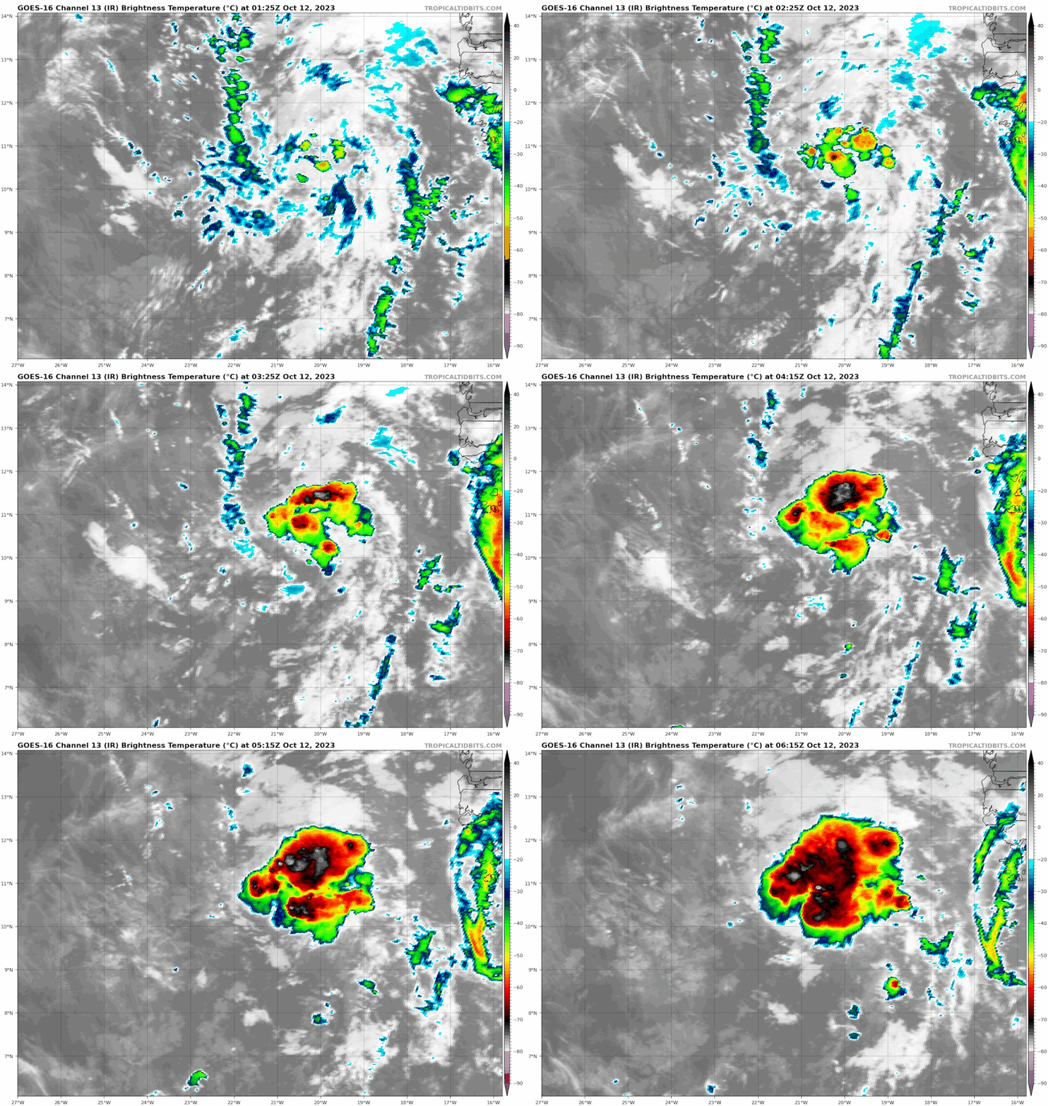
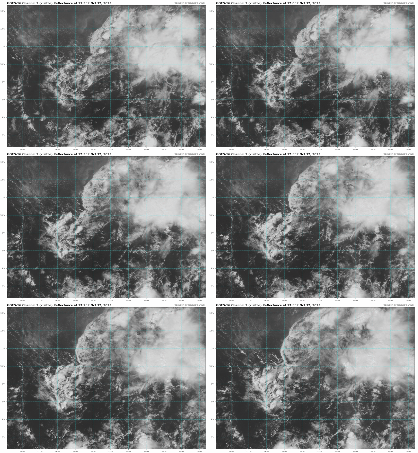
https://ftp.nhc.noaa.gov/atcf/btk/bal942023.dat
ATL: TAMMY - Post-Tropical - Discussion
Moderator: S2k Moderators
ATL: TAMMY - Post-Tropical - Discussion
AL, 94, 2023101112, , BEST, 0, 105N, 205W, 20, 1011, DB, 34, NEQ, 0, 0, 0, 0, 1013, 120, 100, 0, 0, L, 0, , 0, 0, INVEST, S, 0, , 0, 0, 0, 0, genesis-num, 040, SPAWNINVEST, al752023 to al942023,
AL, 94, 2023101112, , BEST, 0, 89N, 193W, 30, 1011, LO, 34, NEQ, 0, 0, 0, 0, 1013, 120, 90, 0, 0, L, 0, , 0, 0, INVEST, S, 0, , 0, 0, 0, 0, genesis-num, 040, SPAWNINVEST, al752023 to al942023,
https://ftp.nhc.noaa.gov/atcf/btk/bal942023.dat
Last edited by Subtrop on Wed Oct 11, 2023 7:47 am, edited 1 time in total.
0 likes
- AnnularCane
- S2K Supporter

- Posts: 2964
- Joined: Thu Jun 08, 2006 9:18 am
- Location: Wytheville, VA
Re: ATL: INVEST 94L - Discussion
Well. That was fast. 
1 likes
"But it never rained rain. It never snowed snow. And it never blew just wind. It rained things like soup and juice. It snowed mashed potatoes and green peas. And sometimes the wind blew in storms of hamburgers." -- Judi Barrett, Cloudy with a Chance of Meatballs
- cycloneye
- Admin

- Posts: 149703
- Age: 69
- Joined: Thu Oct 10, 2002 10:54 am
- Location: San Juan, Puerto Rico
Re: ATL: INVEST 94L - Discussion

0 likes
Visit the Caribbean-Central America Weather Thread where you can find at first post web cams,radars
and observations from Caribbean basin members Click Here
and observations from Caribbean basin members Click Here
Re: ATL: INVEST 94L - Discussion
Is the latitude of 94L unusually low, at this point in the season?
0 likes
Re: ATL: INVEST 94L - Discussion
This might be a Caribbean problem down the line, like the precursor waves of Gamma, Delta, Zeta, Eta, Iota, Julia, and Lisa.
1 likes
Irene '11 Sandy '12 Hermine '16 5/15/2018 Derecho Fay '20 Isaias '20 Elsa '21 Henri '21 Ida '21
I am only a meteorology enthusiast who knows a decent amount about tropical cyclones. Look to the professional mets, the NHC, or your local weather office for the best information.
I am only a meteorology enthusiast who knows a decent amount about tropical cyclones. Look to the professional mets, the NHC, or your local weather office for the best information.
- cycloneye
- Admin

- Posts: 149703
- Age: 69
- Joined: Thu Oct 10, 2002 10:54 am
- Location: San Juan, Puerto Rico
Re: ATL: INVEST 94L - Discussion
Eastern Tropical Atlantic (AL94):
A broad area of low pressure located several hundred miles to the
south-southeast of the Cabo Verde Islands is producing a large area
of showers and thunderstorms. This activity has changed little in
organization this afternoon, but environmental conditions appear
conducive for some slow development over the next few days. This
system should move generally westward across the eastern and central
tropical Atlantic through early next week.
* Formation chance through 48 hours...low...20 percent.
* Formation chance through 7 days...low...30 percent.
0 likes
Visit the Caribbean-Central America Weather Thread where you can find at first post web cams,radars
and observations from Caribbean basin members Click Here
and observations from Caribbean basin members Click Here
- ElectricStorm
- Category 5

- Posts: 5154
- Age: 25
- Joined: Tue Aug 13, 2019 11:23 pm
- Location: Norman, OK
Re: ATL: INVEST 94L - Discussion
Probably won't do much in the near term but I agree it could be something to watch down the road
1 likes
B.S Meteorology, University of Oklahoma '25
Please refer to the NHC, NWS, or SPC for official information.
Please refer to the NHC, NWS, or SPC for official information.
Re: ATL: INVEST 94L - Discussion
8PM Tropical Weather Outlook excerpt:
Eastern Tropical Atlantic (AL94):
A broad area of low pressure located several hundred miles to the
south-southeast of the Cabo Verde Islands is producing a large area
of disorganized showers and thunderstorms. Environmental conditions
appear conducive for some slow development over the next few days.
This system should move generally westward across the eastern and
central tropical Atlantic through early next week.
* Formation chance through 48 hours...low...20 percent.
* Formation chance through 7 days...low...30 percent.
1 likes
- Hurrilurker
- Category 2

- Posts: 738
- Joined: Mon Jun 09, 2003 3:32 pm
- Location: San Francisco, CA
Re: ATL: INVEST 94L - Discussion
Is the shear low enough for anything to make it all the way across right now? Plus everything seems to do a strong right hook just before getting to the islands anyway this year.
0 likes
Re: ATL: INVEST 94L - Discussion
DMAX being DMAX:


1 likes
TC naming lists: retirements and intensity
Most aggressive Advisory #1's in North Atlantic (cr. kevin for starting the list)
Most aggressive Advisory #1's in North Atlantic (cr. kevin for starting the list)
- cycloneye
- Admin

- Posts: 149703
- Age: 69
- Joined: Thu Oct 10, 2002 10:54 am
- Location: San Juan, Puerto Rico
Re: ATL: INVEST 94L - Discussion
https://twitter.com/AndyHazelton/status/1712233162539975024
https://twitter.com/pppapin/status/1712339571302707598
https://twitter.com/pppapin/status/1712339571302707598
0 likes
Visit the Caribbean-Central America Weather Thread where you can find at first post web cams,radars
and observations from Caribbean basin members Click Here
and observations from Caribbean basin members Click Here
- cycloneye
- Admin

- Posts: 149703
- Age: 69
- Joined: Thu Oct 10, 2002 10:54 am
- Location: San Juan, Puerto Rico
Re: ATL: INVEST 94L - Discussion
Tropical Weather Outlook
NWS National Hurricane Center Miami FL
800 AM EDT Thu Oct 12 2023
For the North Atlantic...Caribbean Sea and the Gulf of Mexico:
Active Systems:
The National Hurricane Center is issuing advisories on Tropical
Depression Sean, located over the central tropical Atlantic.
1. Eastern Tropical Atlantic (AL94):
A broad area of low pressure located several hundred miles to the
south of the Cabo Verde Islands continues to produce some
disorganized showers and thunderstorms. Environmental conditions
could support some slow development of this system over the next
several days while it moves generally westward across the eastern
and central tropical Atlantic.
* Formation chance through 48 hours...low...20 percent.
* Formation chance through 7 days...low...30 percent.
Forecaster Papin
0 likes
Visit the Caribbean-Central America Weather Thread where you can find at first post web cams,radars
and observations from Caribbean basin members Click Here
and observations from Caribbean basin members Click Here
- cycloneye
- Admin

- Posts: 149703
- Age: 69
- Joined: Thu Oct 10, 2002 10:54 am
- Location: San Juan, Puerto Rico
Re: ATL: INVEST 94L - Discussion
0 likes
Visit the Caribbean-Central America Weather Thread where you can find at first post web cams,radars
and observations from Caribbean basin members Click Here
and observations from Caribbean basin members Click Here
- Blown Away
- S2K Supporter

- Posts: 10253
- Joined: Wed May 26, 2004 6:17 am
Re: ATL: INVEST 94L - Discussion
The 8am position "X" was repositioned farther south which likely carries this energy farther W since it's in no hurry to develop, also per the EURO.
1 likes
Hurricane Eye Experience: David 79, Irene 99, Frances 04, Jeanne 04, Wilma 05… Hurricane Brush Experience: Andrew 92, Erin 95, Floyd 99, Matthew 16, Irma 17, Ian 22, Nicole 22…
- cycloneye
- Admin

- Posts: 149703
- Age: 69
- Joined: Thu Oct 10, 2002 10:54 am
- Location: San Juan, Puerto Rico
Re: ATL: INVEST 94L - Discussion
AL, 94, 2023101212, , BEST, 0, 94N, 228W, 25, 1010, LO

1 likes
Visit the Caribbean-Central America Weather Thread where you can find at first post web cams,radars
and observations from Caribbean basin members Click Here
and observations from Caribbean basin members Click Here
- Blown Away
- S2K Supporter

- Posts: 10253
- Joined: Wed May 26, 2004 6:17 am
Re: ATL: INVEST 94L - Discussion
cycloneye wrote:AL, 94, 2023101212, , BEST, 0, 94N, 228W, 25, 1010, LO
https://i.imgur.com/unpecxk.png

Estimated position seems about right.
0 likes
Hurricane Eye Experience: David 79, Irene 99, Frances 04, Jeanne 04, Wilma 05… Hurricane Brush Experience: Andrew 92, Erin 95, Floyd 99, Matthew 16, Irma 17, Ian 22, Nicole 22…
- wxman57
- Moderator-Pro Met

- Posts: 23175
- Age: 68
- Joined: Sat Jun 21, 2003 8:06 pm
- Location: Houston, TX (southwest)
Re: ATL: INVEST 94L - Discussion
I don't expect much from this feature. It should pass Barbados around next Friday as a tropical wave. MDR is not a favorable environment, but neither is the Caribbean. Wind shear is predicted to increase if it reaches the western Caribbean. Lots and lots of strong shear across the Gulf and Florida. Significant development seems unlikely.
3 likes
- cycloneye
- Admin

- Posts: 149703
- Age: 69
- Joined: Thu Oct 10, 2002 10:54 am
- Location: San Juan, Puerto Rico
Re: ATL: INVEST 94L - Discussion
Eastern Tropical Atlantic (AL94):
Shower and thunderstorm activity is limited and disorganized this
afternoon in association with a broad area of low pressure located
several hundred miles to the south of the Cabo Verde Islands. While
environmental conditions are currently only marginally favorable for
slow development over the next couple of days, they are forecast to
become more favorable by early next week. A tropical depression
could form by the middle of next week as this system moves generally
westward across the eastern and central tropical Atlantic.
* Formation chance through 48 hours...low...10 percent.
* Formation chance through 7 days...medium...40 percent.
1 likes
Visit the Caribbean-Central America Weather Thread where you can find at first post web cams,radars
and observations from Caribbean basin members Click Here
and observations from Caribbean basin members Click Here
Re: ATL: INVEST 94L - Discussion
So the orange wave that no one is chatting about?
0 likes
Harvey,Hanna,Beta,Texas Winter storm2021,Nicholas,Beryl
- AnnularCane
- S2K Supporter

- Posts: 2964
- Joined: Thu Jun 08, 2006 9:18 am
- Location: Wytheville, VA
Re: ATL: INVEST 94L - Discussion
Wampadawg wrote:So the orange wave that no one is chatting about?
A lot of talk in the models thread.
0 likes
"But it never rained rain. It never snowed snow. And it never blew just wind. It rained things like soup and juice. It snowed mashed potatoes and green peas. And sometimes the wind blew in storms of hamburgers." -- Judi Barrett, Cloudy with a Chance of Meatballs
Who is online
Users browsing this forum: No registered users and 55 guests


