Texas Spring 2024
Moderator: S2k Moderators
Forum rules

The posts in this forum are NOT official forecast and should not be used as such. They are just the opinion of the poster and may or may not be backed by sound meteorological data. They are NOT endorsed by any professional institution or STORM2K.
-
rwfromkansas
- Category 5

- Posts: 3024
- Joined: Sat Aug 27, 2005 12:47 am
- Location: North Fort Worth
Re: Texas Spring 2024
Some more coming in further northwest. Not severe, but looks like it on radar. Again I’m out of town in Lubbock missing the action but will be back later for any future events but still eyeing the radar.
1 likes


Re: Texas Spring 2024
MCS season, should see a few more north to south running events the coming days. Especially with ensembles forecasting troughing in the east and ridge in the west, NW flow with these.
2 likes
The above post and any post by Ntxw is NOT an official forecast and should not be used as such. It is just the opinion of the poster and may or may not be backed by sound meteorological data. It is NOT endorsed by any professional institution including Storm2k. For official information, please refer to NWS products.
Help support Storm2K!


Re: Texas Spring 2024
Powerful storm. No power in North Dallas. The intensity seemed slightly less than June 2019 storm but duration was much longer. Hope not a multi day outage for peeps but might be.
0 likes
-
WeatherNewbie
- Tropical Storm

- Posts: 235
- Joined: Mon Mar 22, 2010 3:42 pm
- Location: Richardson, Texas
Re: Texas Spring 2024
lots of tree branches down all along the commute from richardson to uptown.
1 likes
The above post is NOT an official forecast and should not be used as such. It is just the opinion of the poster and may or may not be backed by sound meteorological data. It is NOT endorsed by any professional institution including storm2k.org. For official information, please refer to NWS products.
-
jasons2k

- Storm2k Executive

- Posts: 8290
- Age: 52
- Joined: Wed Jul 06, 2005 12:32 pm
- Location: The Woodlands, TX
Texas Spring 2024
From Jeff:
All of southeast Texas has been upgraded into an “enhanced” or level 3 out of 5 risk for this afternoon.
Large complex of thunderstorms over north Texas is moving toward the southeast and either this complex itself or new thunderstorms that will form along its leading outflow boundaries are likely to impact SE TX starting as early as noon and lasting into the early evening hours. While there is still some uncertainty and how exactly this will evolve this afternoon, confidence is increasing that strong to severe thunderstorms will move into the region.
Main threats will be damaging winds of 60-80mph and large hail although an isolated tornado cannot be ruled out. The air mass over SE TX is very unstable and will support vigorous thunderstorm development through the afternoon hours.
High winds may down trees and tree limbs, fences, and move loose outdoor objects. Power outages will be possible.
Tonight:
A second complex of thunderstorms will likely develop over portions of central Texas and move into SE TX late tonight into early Wednesday. It is unclear how this complex will evolve as much of its evolution and severe threat will be determine with the incoming weather this afternoon. Should thunderstorms this afternoon become widespread the air mass will become “worked over” and tonight’s activity may weaken as it moves into the area. This seems to be recent indications in the high resolution guidance. Again not a lot confidence in this part of the forecast.
Heavy Rainfall:
Thunderstorms will produce rainfall amounts of 1-3 inches with higher isolated totals of 3-5 inches where any cell mergers or slowing of lines occurs. High hourly rainfall rates may lead to rapid short term flash flooding. Widespread flooding and flash flooding is not expected.
Jeff Lindner
Director Hydrologic Operations Division/Meteorologist
Harris County Flood Control District
9900 Northwest Freeway | Houston, Texas 77092
346-286-4000 (main) | 346-286-4165 (direct) | 281-924-2091 (cell)
jeff.lindner@hcfcd.org (mailto:jeff.lindner@hcfcd.org)
| Twitter: @jefflindner1
1 likes
-
rwfromkansas
- Category 5
- Posts: 3024
- Joined: Sat Aug 27, 2005 12:47 am
- Location: North Fort Worth
Re: Texas Spring 2024
Looks like SPC is moving tonight's complex further south based on that info. The 12z 3k NAM did lose the N TX complex tonight. But, not HRRR.
Last edited by rwfromkansas on Tue May 28, 2024 9:46 am, edited 2 times in total.
1 likes
-
cheezyWXguy

- Category 5
- Posts: 6281
- Joined: Mon Feb 13, 2006 12:29 am
- Location: Dallas, TX
Re: Texas Spring 2024
funster wrote:Powerful storm. No power in North Dallas. The intensity seemed slightly less than June 2019 storm but duration was much longer. Hope not a multi day outage for peeps but might be.
Here in Dallas proper, judging by the damage, this one was a bit worse. Seeing a lot more branches and some entire trees down. I think this one was more widespread too, I don’t recall 600,000+ without power after the 2019 MCS
0 likes
Re: Texas Spring 2024
cheezyWXguy wrote:funster wrote:Powerful storm. No power in North Dallas. The intensity seemed slightly less than June 2019 storm but duration was much longer. Hope not a multi day outage for peeps but might be.
Here in Dallas proper, judging by the damage, this one was a bit worse. Seeing a lot more branches and some entire trees down. I think this one was more widespread too, I don’t recall 600,000+ without power after the 2019 MCS
What's impressive about today's event vs June 2019 is the latter happened during peak heating after a day with plentiful morning sunshine (when the temp/dewpoint spread was much wider, thus in theory would have enhanced the downdraft strength), whereas today's event happened at diurnal minimum.
Also, I'm pretty certain the coverage of severe wind in June 2019 was more widespread throghout the Metroplex in June 2019, even if the peak rainfall/wind intensity was somewhat less impressive. Today's event was mostly concentrated in the NE half of DFW (granted, still a ton of people impacted).
0 likes
Re: Texas Spring 2024
If recall June 2019 was down bursts/microburst from collapsing thunderstorm complex. Locally some winds then were higher in some locales. Today's was your more standard MCS with a strong leading storm that may (if confirmed) have dropped a lower end qlcs style spin up tornado anywhere from Denton/Collin County border to NE Dallas county and east/se. Everywhere else 60-80mph winds would do some tree damage.
0 likes
The above post and any post by Ntxw is NOT an official forecast and should not be used as such. It is just the opinion of the poster and may or may not be backed by sound meteorological data. It is NOT endorsed by any professional institution including Storm2k. For official information, please refer to NWS products.
Help support Storm2K!
Help support Storm2K!
Re: Texas Spring 2024
Still going strong here. This is one of the more impressive MCS systems. Powerful, widespread, and long-lasting. My daughter's school ended up delayed due to the weather and then cancelling due to no power. Crazy
0 likes
-
bubba hotep

- S2K Supporter

- Posts: 6013
- Joined: Wed Dec 28, 2016 1:00 am
- Location: Collin County Texas
Re: Texas Spring 2024
rwfromkansas wrote:Looks like SPC is moving tonight's complex further south based on that info. The 12z 3k NAM did lose the N TX complex tonight. But, not HRRR.
The one thing you can bank on is that the 12z models will be wrong. How will they be wrong? Who knows lol
0 likes
Winter time post are almost exclusively focused on the DFW area.
Re: Texas Spring 2024
Outflow boundary's made it all the way down to Austin and is pushing westward towards San Angelo.
In fact, it has prompted a Hgh Wind Warning for the San Angelo area.
Meanwhile, wake winds are picking back up here.
In fact, it has prompted a Hgh Wind Warning for the San Angelo area.
Meanwhile, wake winds are picking back up here.
1 likes
Re: Texas Spring 2024
snownado wrote:Outflow boundary's made it all the way down to Austin and is pushing westward towards San Angelo.
In fact, it has prompted a Hgh Wind Warning for the San Angelo area.
Meanwhile, wake winds are picking back up here.
Getting widespread post-storm gusts of 40-50 MPH (wind advisory criteria).
0 likes
Re: Texas Spring 2024
cstrunk wrote:For all of our pocketbook's sake, I hope the metro areas continue avoiding costly severe weather as much as possible... Texas could use a break from those kind of episodes...
^^^Cottage cheese at this point. Unfortunately, now 2 for 2...
1 likes
-
bubba hotep
- S2K Supporter
- Posts: 6013
- Joined: Wed Dec 28, 2016 1:00 am
- Location: Collin County Texas
Re: Texas Spring 2024
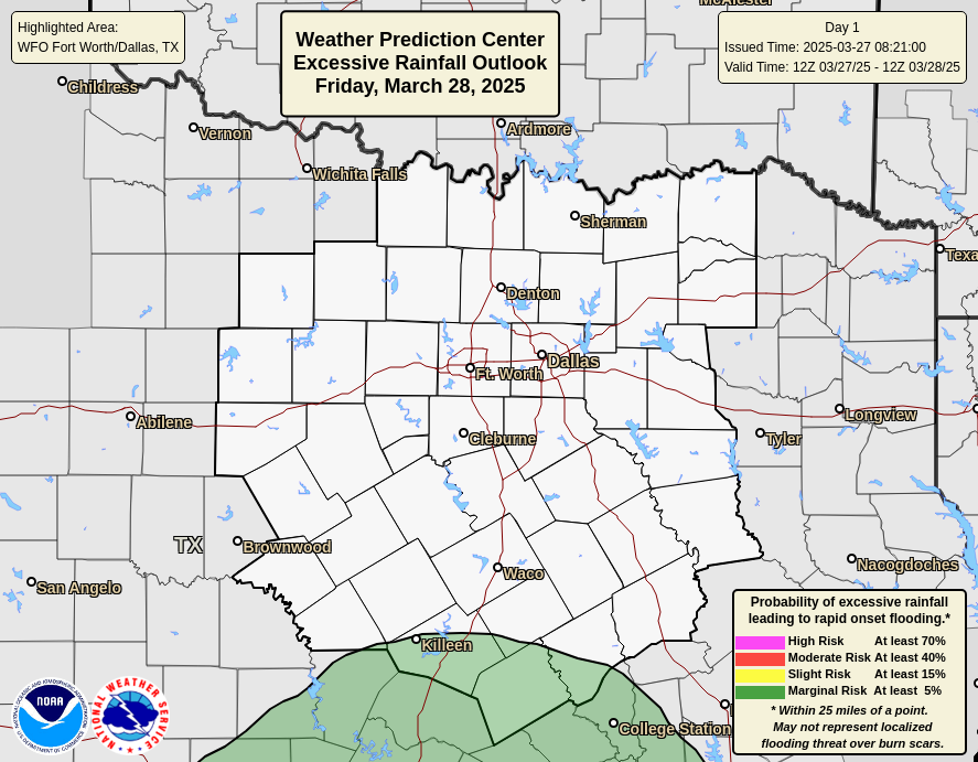
Updated WPC Day 1
1 likes
Winter time post are almost exclusively focused on the DFW area.

Re: Texas Spring 2024
0.42 inches IMBY now the sun is out. Wonder how that will play for storms later today.
0 likes
Re: Texas Spring 2024
The storms this morning produced a swath of 3-5" across DFW.
There's still technically a few more days left in Met. Spring. So with today's rainfall (1.91" at DFW) 2024 is going end up top 10 wettest Spring after all.
Crazy thing is, I'm not aware of any other year on record that had both a top 10 warmest Spring *AND* top 10 wettest Spring...
Last edited by snownado on Wed May 29, 2024 6:44 am, edited 1 time in total.
0 likes
-
WeatherNewbie
- Tropical Storm
- Posts: 235
- Joined: Mon Mar 22, 2010 3:42 pm
- Location: Richardson, Texas
Re: Texas Spring 2024
when should we start to have a feel on round 2 this evening? lots of nervous family and coworkers.
0 likes
The above post is NOT an official forecast and should not be used as such. It is just the opinion of the poster and may or may not be backed by sound meteorological data. It is NOT endorsed by any professional institution including storm2k.org. For official information, please refer to NWS products.
Re: Texas Spring 2024
WeatherNewbie wrote:when should we start to have a feel on round 2 this evening? lots of nervous family and coworkers.
The models are not good with these events until a cluster of storms actually form. I would expect the same thing early tomorrow morning similar to this morning. Not sure we will get the same high winds as widespread but expect another round.
0 likes
The above post and any post by Ntxw is NOT an official forecast and should not be used as such. It is just the opinion of the poster and may or may not be backed by sound meteorological data. It is NOT endorsed by any professional institution including Storm2k. For official information, please refer to NWS products.
Help support Storm2K!
Help support Storm2K!
Re: Texas Spring 2024
Houston area getting the storms now from this morning.
0 likes
The above post and any post by Ntxw is NOT an official forecast and should not be used as such. It is just the opinion of the poster and may or may not be backed by sound meteorological data. It is NOT endorsed by any professional institution including Storm2k. For official information, please refer to NWS products.
Help support Storm2K!
Help support Storm2K!
Return to “USA & Caribbean Weather”
Who is online
Users browsing this forum: Gotwood, rwfromkansas, SnowyOwl31, Stratton23 and 106 guests