
Euro 0Z

Moderator: S2k Moderators


Near or at record heights, i was comparing to the euro, very suttle difference but clearly the they have the same idea.NDG wrote:jlauderdal wrote:Gfs is interested, weaker ridge but that will be sorted out later.NDG wrote:Will be interesting to see if the 12z Euro continues its solution of development near Bahamas and track west towards the FL/SE US. But it looks to have a hybrid subtropical look to it with it being so close to the ULL tracking west, possibly acquiring full tropical characteristics before coming inland, *if this comes to fruition.
Definitely has my attention.
https://media.giphy.com/media/v1.Y2lkPTc5MGI3NjExcjFkZmt6a2ZrdWc5b3hjZXhuNjBvMnF3dW44ZWt6cXp1cXlpeWhzYSZlcD12MV9pbnRlcm5hbF9naWZfYnlfaWQmY3Q9Zw/Scsd4rAu5tU3XyI9M0/giphy.gif
Actually thats a very strong ridge over the NE US thus a track west towards FL/SE US as it shows.
BobHarlem wrote:Origin is interesting from basically extreme southern remnants the big stream of moisture from this past week reorganizing while the majority shoots away.
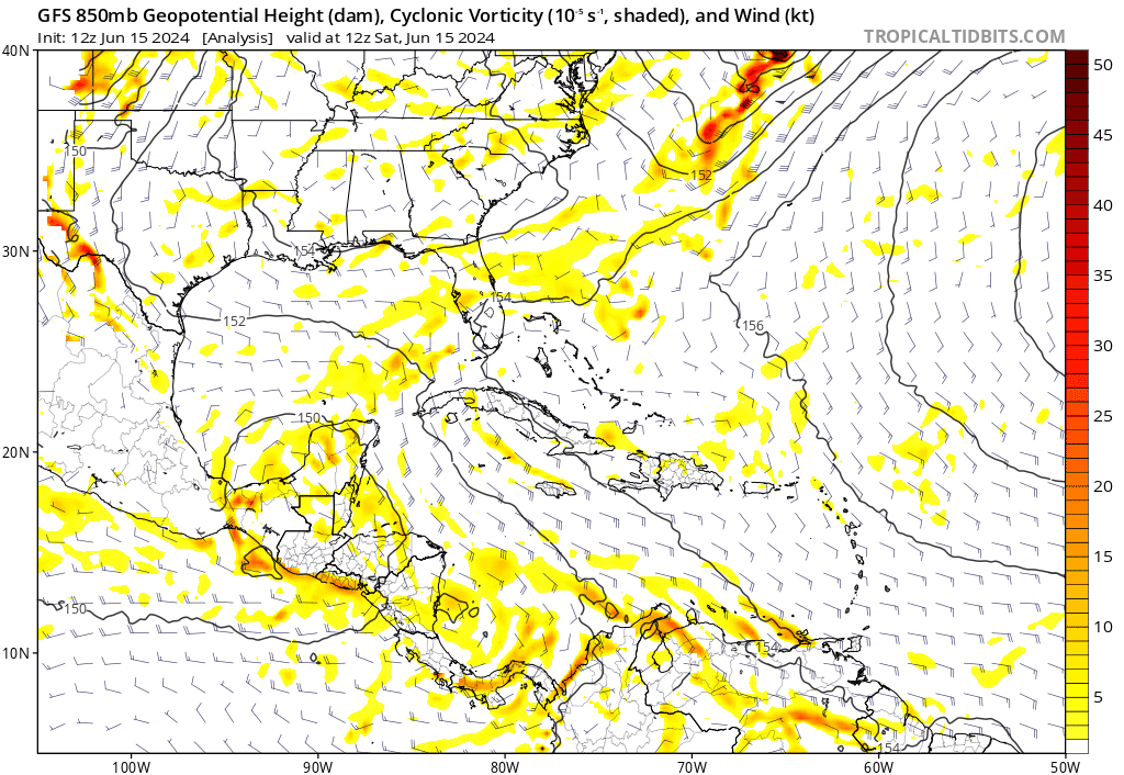
12zgfs
https://i.postimg.cc/N0v0z1QG/gfs-z850-vort-watl-fh0-138.gif
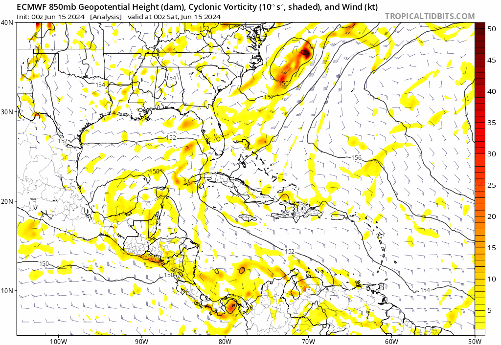
0z euro
https://i.postimg.cc/prcTG4L3/ecmwf-z850-vort-watl-fh0-138.gif


skyline385 wrote:
That would be quite a track for the first or second storm of the season if it verifies.

Hurricane2022 wrote:skyline385 wrote:
That would be quite a track for the first or second storm of the season if it verifies.
*getting 1992 vibes*

Hurricane2022 wrote:skyline385 wrote:
That would be quite a track for the first or second storm of the season if it verifies.
*getting 1992 vibes*


skyline385 wrote:Hurricane2022 wrote:skyline385 wrote:
That would be quite a track for the first or second storm of the season if it verifies.
*getting 1992 vibes*
Andrew was in August and that was on par for August climo, a standard track for SE FL impact including passing through the Hebert box. Mid-June hit on SE FL into NOLA from a cut-off low doing a loop is just something else.
toad strangler wrote:skyline385 wrote:Hurricane2022 wrote:*getting 1992 vibes*
Andrew was in August and that was on par for August climo, a standard track for SE FL impact including passing through the Hebert box. Mid-June hit on SE FL into NOLA from a cut-off low doing a loop is just something else.
That track in mid June by itself would be anomalous for sure when citing standard basin climatology. A depression or weak TS taking this anomalous track wouldn’t be so surprising. As long as nothing more comes of it.


LarryWx wrote:toad strangler wrote:skyline385 wrote:
Andrew was in August and that was on par for August climo, a standard track for SE FL impact including passing through the Hebert box. Mid-June hit on SE FL into NOLA from a cut-off low doing a loop is just something else.
That track in mid June by itself would be anomalous for sure when citing standard basin climatology. A depression or weak TS taking this anomalous track wouldn’t be so surprising. As long as nothing more comes of it.
agreed:
History of TC landfalls from the E or SE to SE US May-June:
- 1873 minimal TS GA/FL border 6/2
- 1909 low end TS Ft. Lauderdale 6/28
- 1972 minimal STS Alpha Brunswick 5/27
- 1984 TD 1 St. Augustine 6/13
- 2012 high end TS Beryl Jacksonville 5/28
- 2016 TD Bonnie Isle of Palms, SC 5/29
- 2020 50 mph TS Bertha Isle of Palms, SC 5/27

Users browsing this forum: Google Adsense [Bot] and 342 guests


