#112 Postby cycloneye » Mon Jun 17, 2024 6:42 am
Southwestern Gulf of Mexico:
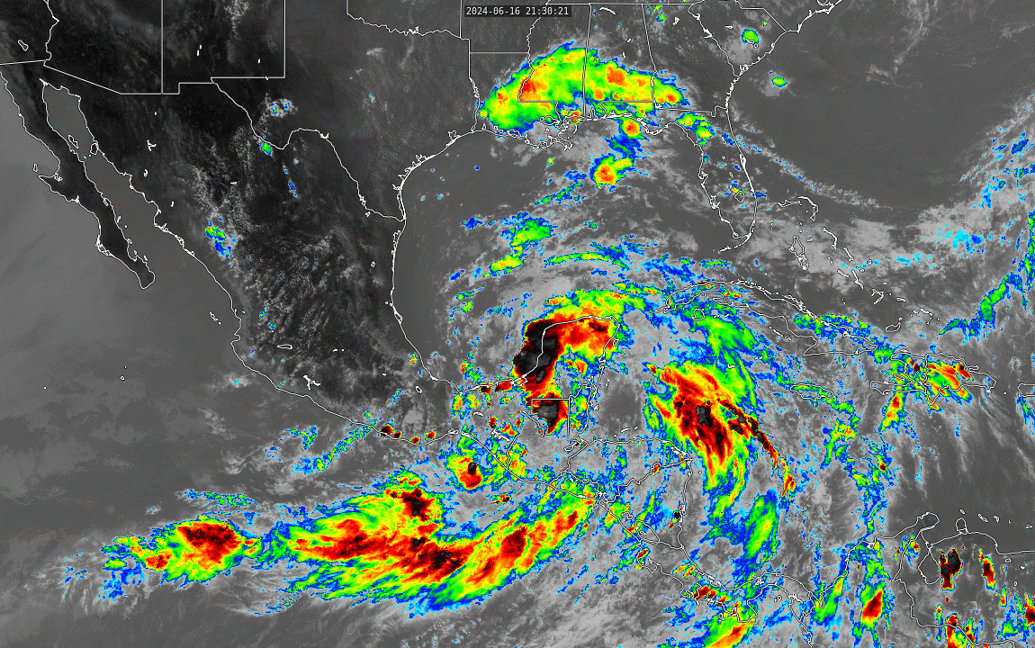
Satellite imagery and surface observations indicate that a broad
area of low pressure is forming over the Bay of Campeche.
Environmental conditions appear conducive for additional gradual
development, and a tropical depression or tropical storm is likely
to form by midweek while it moves slowly westward or
west-northwestward toward the western Gulf coast.
Regardless of development, several days of heavy rainfall are
expected across portions of southern Mexico and Central America, and
these rains are likely to cause life-threatening flooding and flash
flooding. Locally heavy rainfall is also expected to spread over
portions of the northwestern coast of the Gulf of Mexico by the
middle of the week. In addition, gale warnings have been issued for
portions of the Gulf of Mexico, and more information on those
warnings is available in High Seas Forecasts issued by the National
Weather Service. Interests along the western and northwestern Gulf
coasts should monitor the progress of this system. An Air Force
Reserve Hurricane Hunter aircraft is scheduled to investigate the
system later today.
* Formation chance through 48 hours...high...70 percent.
* Formation chance through 7 days...high...70 percent.
0 likes
Visit the Caribbean-Central America Weather Thread where you can find at first post web cams,radars
and observations from Caribbean basin members
Click Here