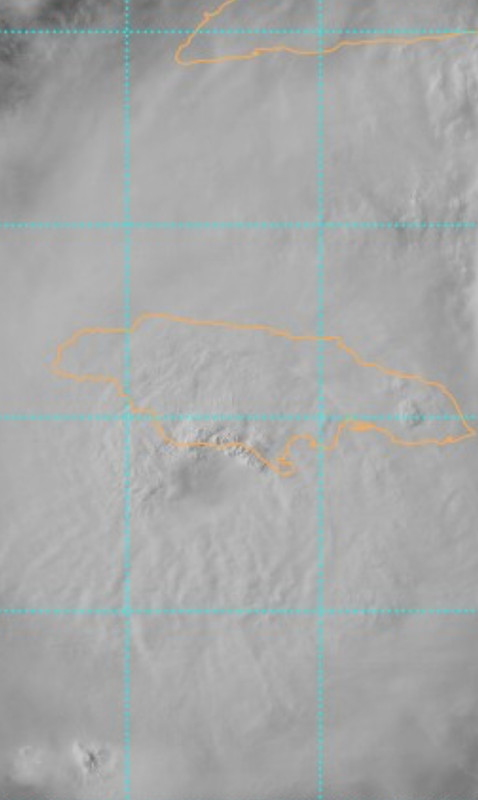
ATL: BERYL - Post-Tropical - Discussion

Moderator: S2k Moderators

Message
Author
Javlin
Category 5
Category 5
Posts: 1616
Age: 64
Joined: Fri Jul 09, 2004 7:58 pm
Location: ms gulf coast

Re: ATL: BERYL - Hurricane - Discussion

#2161 Postby Javlin » Wed Jul 03, 2024 4:20 pm

Aric Dunn wrote:
Javlin wrote:
Aric Dunn wrote:IF you all are curious.. what the models missed ( and all those who only look at models). the tutt that was across the western carrib and extending up across florida..... ended up in the last 12 hours mostly cutting off and begin retrograding. this changed the shear axis and looks to be opening up a outflow channel. always use your eyeballs. models are a guide only... not be hugged

https://weather.cod.edu/satrad/?parms=c ... =undefined

will it last ? maybe. the tutt/low should continue westward keeping Beryl in a pretty decent environment.

Thanks Aric she been giving that TUTT tongue a lashing looks to of won and yes eyeballs it's called Fluid Dynamics. :wink:


yeah there was little doubt Beryl wouldnt be able to plow through the tutt. of course there would some draw back and interactions but it would win out. what I didnt see coming was part of the tutt cutting on.

figured it would take some time to recover.

but here we are.

I imagined earlier like late last night in a post about the height of the system having an effect on is battle with the wind shear more or less both being in the same ballfield lets say?
0 likes   

3090
Category 2
Category 2
Posts: 548
Age: 65
Joined: Fri Aug 19, 2011 4:01 pm

Re: ATL: BERYL - Hurricane - Discussion

#2162 Postby 3090 » Wed Jul 03, 2024 4:22 pm

GCANE wrote:Also, there is the ULL forming off the Gulf-Coast of FL.
My thought is this will Fujiwhara with Beryl and give Beryl a shift in track, i.e. a stronger north component.

This is interesting!!
1 likes   

Aric Dunn
Category 5
Category 5
Posts: 21238
Age: 42
Joined: Sun Sep 19, 2004 9:58 pm
Location: Ready for the Chase.
Contact:

Re: ATL: BERYL - Hurricane - Discussion

#2163 Postby Aric Dunn » Wed Jul 03, 2024 4:24 pm

GCANE wrote:
Aric Dunn wrote:
Javlin wrote:Thanks Aric she been giving that TUTT tongue a lashing looks to of won and yes eyeballs it's called Fluid Dynamics. :wink:


yeah there was little doubt Beryl wouldnt be able to plow through the tutt. of course there would some draw back and interactions but it would win out. what I didnt see coming was part of the tutt cutting on.

figured it would take some time to recover.

but here we are.


The TUTT never had any strong 355K PVS signature. It was a dud from the start


yeppers.. I like to say it had no back up..
Last edited by Aric Dunn on Wed Jul 03, 2024 4:28 pm, edited 1 time in total.
3 likes   
Note: If I make a post that is brief. Please refer back to previous posts for the analysis or reasoning. I do not re-write/qoute what my initial post said each time.
If there is nothing before... then just ask :)

Space & Atmospheric Physicist, Embry-Riddle Aeronautical University,
I believe the sky is falling...

Javlin
Category 5
Category 5
Posts: 1616
Age: 64
Joined: Fri Jul 09, 2004 7:58 pm
Location: ms gulf coast

Re: ATL: BERYL - Hurricane - Discussion

#2164 Postby Javlin » Wed Jul 03, 2024 4:24 pm

GCANE wrote:
Aric Dunn wrote:
Javlin wrote:Thanks Aric she been giving that TUTT tongue a lashing looks to of won and yes eyeballs it's called Fluid Dynamics. :wink:


yeah there was little doubt Beryl wouldnt be able to plow through the tutt. of course there would some draw back and interactions but it would win out. what I didnt see coming was part of the tutt cutting on.

figured it would take some time to recover.

but here we are.


The TUTT never had any strong 355K PVS signature. It was a dud from the start


So not having a strong signature lead to an over estimation of said wind field/shear?Some of the stuff you look at is over my head such as the PVS. :wink:
1 likes   

User avatar
ColdFusion
S2K Supporter
S2K Supporter
Posts: 443
Joined: Wed Feb 13, 2008 3:46 pm
Location: Addison, TX

Re: ATL: BERYL - Hurricane - Discussion

#2165 Postby ColdFusion » Wed Jul 03, 2024 4:25 pm

Blinhart wrote:I don't think a single model showed her doing what she is doing right now, so I think we are all screwed in figuring out where she will be in 72 hours let alone 120 hours from now.


Hm, I think the NHC track/cone has been doing remarkably well, no?
0 likes   

Sunnydays
Tropical Low
Tropical Low
Posts: 41
Joined: Mon May 22, 2023 7:30 am

Re: ATL: BERYL - Hurricane - Discussion

#2166 Postby Sunnydays » Wed Jul 03, 2024 4:27 pm

Didn't the synoptic aircraft fly yesterday and get readings and measurements? Isn't that what those missions are for? To try and add correct info into the models so they can come to more accurate conclusions?
1 likes   

User avatar
GCANE
S2K Supporter
S2K Supporter
Posts: 11453
Joined: Mon Oct 22, 2007 8:03 am

Re: ATL: BERYL - Hurricane - Discussion

#2167 Postby GCANE » Wed Jul 03, 2024 4:28 pm

Beryl is now entering an inexhaustible supply of high OHC water.
The west Carib current has the deepest high-OHC water of the whole Atlantic and feeds the GoM Loop Current.
It's the main reasons TC's max out in the west Carib.
6 likes   

3090
Category 2
Category 2
Posts: 548
Age: 65
Joined: Fri Aug 19, 2011 4:01 pm

Re: ATL: BERYL - Hurricane - Discussion

#2168 Postby 3090 » Wed Jul 03, 2024 4:29 pm

GCANE wrote:Also, there is the ULL forming off the Gulf-Coast of FL.
My thought is this will Fujiwhara with Beryl and give Beryl a shift in track, i.e. a stronger north component.

And it appears the ULL is moving at a very fast pace. Depending on timing the ULL will definitely tend to draw Beryl to it wherever the ULL goes.
2 likes   

tolakram
Admin
Admin
Posts: 19990
Age: 61
Joined: Sun Aug 27, 2006 8:23 pm
Location: Florence, KY (name is Mark)

Re: ATL: BERYL - Hurricane - Discussion

#2169 Postby tolakram » Wed Jul 03, 2024 4:29 pm

Sunnydays wrote:Didn't the synoptic aircraft fly yesterday and get readings and measurements? Isn't that what those missions are for? To try and add correct info into the models so they can come to more accurate conclusions?


Have they been inaccurate? Let's see what happens. Latest HWRF run with the new data shows marked weakening beginning soon after Jamaica. It will either happen, or it won't. :)
5 likes   
M a r k
- - - - -
Join us in chat: Storm2K Chatroom Invite. Android and IOS apps also available.

The posts in this forum are NOT official forecasts and should not be used as such. Posts are NOT endorsed by any professional institution or STORM2K.org. For official information and forecasts, please refer to NHC and NWS products.

ChrisH-UK
Category 2
Category 2
Posts: 611
Joined: Sat May 29, 2021 8:22 am

Re: ATL: BERYL - Hurricane - Discussion

#2170 Postby ChrisH-UK » Wed Jul 03, 2024 4:30 pm

Kazmit wrote:Anyone have a link to the Cuban radar? I have suspicion that the eyewall will come ashore in Treasure Beach next.


The Cuban weather service radars are here - http://www.insmet.cu/asp/genesis.asp?TB ... B1=RADARES
Mexican weather radars are here - https://smn.conagua.gob.mx/es/observand ... radares-v3
3 likes   

User avatar
Blown Away
S2K Supporter
S2K Supporter
Posts: 10140
Joined: Wed May 26, 2004 6:17 am

Re: ATL: BERYL - Hurricane - Discussion

#2171 Postby Blown Away » Wed Jul 03, 2024 4:31 pm

Image

S coast of Jamaica probably just catching eyewall and maybe very brief calm eye conditions…
0 likes   
Hurricane Eye Experience: David 79, Irene 99, Frances 04, Jeanne 04, Wilma 05... EYE COMING MY WAY IN 2024…
Hurricane Brush Experience: Andrew 92, Erin 95, Floyd 99, Matthew 16, Irma 17, Ian 22, Nicole 22…

tolakram
Admin
Admin
Posts: 19990
Age: 61
Joined: Sun Aug 27, 2006 8:23 pm
Location: Florence, KY (name is Mark)

Re: ATL: BERYL - Hurricane - Discussion

#2172 Postby tolakram » Wed Jul 03, 2024 4:32 pm

We might get a landfall, hard to tell.

Image
5 likes   
M a r k
- - - - -
Join us in chat: Storm2K Chatroom Invite. Android and IOS apps also available.

The posts in this forum are NOT official forecasts and should not be used as such. Posts are NOT endorsed by any professional institution or STORM2K.org. For official information and forecasts, please refer to NHC and NWS products.

User avatar
WaveBreaking
Category 2
Category 2
Posts: 563
Joined: Sun Jun 30, 2024 11:33 am
Location: US

Re: ATL: BERYL - Hurricane - Discussion

#2173 Postby WaveBreaking » Wed Jul 03, 2024 4:32 pm

North eyewall currently firing stronger convection over Jamaica's southern coast. Might worsen flooding problems there.

Image
6 likes   
I am NOT a professional meteorologist, so take all of my posts with a grain of salt. My opinions are mine and mine alone.

User avatar
GCANE
S2K Supporter
S2K Supporter
Posts: 11453
Joined: Mon Oct 22, 2007 8:03 am

Re: ATL: BERYL - Hurricane - Discussion

#2174 Postby GCANE » Wed Jul 03, 2024 4:36 pm

LL Convergence on the coast is firing off some massive tower.
Land interaction may actually benefit Beryl.
4 likes   

User avatar
Teban54
Category 5
Category 5
Posts: 3168
Joined: Sat May 19, 2018 1:19 pm

Re: ATL: BERYL - Hurricane - Discussion

#2175 Postby Teban54 » Wed Jul 03, 2024 4:40 pm

4 likes   

User avatar
GCANE
S2K Supporter
S2K Supporter
Posts: 11453
Joined: Mon Oct 22, 2007 8:03 am

Re: ATL: BERYL - Hurricane - Discussion

#2176 Postby GCANE » Wed Jul 03, 2024 4:43 pm

That ridge that is supposed to push Beryl into the Yucatan doesn't look like much of a ridge especially when there is convection firing in it.
1 likes   

UTSARoadrunner4
Tropical Storm
Tropical Storm
Posts: 244
Age: 28
Joined: Wed Aug 26, 2020 11:19 pm

Re: ATL: BERYL - Hurricane - Discussion

#2177 Postby UTSARoadrunner4 » Wed Jul 03, 2024 4:47 pm

Aric Dunn wrote:Now we wait to see if the little bit of land interaction causes any major problems....

As of right now it looks like it’s helping, not hurting.
4 likes   

User avatar
Nimbus
Category 5
Category 5
Posts: 5274
Joined: Mon Jul 19, 2004 10:54 am

Re: ATL: BERYL - Hurricane - Discussion

#2178 Postby Nimbus » Wed Jul 03, 2024 4:53 pm

GCANE wrote:That ridge that is supposed to push Beryl into the Yucatan doesn't look like much of a ridge especially when there is convection firing in it.


Currently watching the trough split that Levi has been advertising for the last couple days.
All the 12Z models forecast weakening from southerly shear, maybe its just Siesta time?
1 likes   

CrazyC83
Professional-Met
Professional-Met
Posts: 34001
Joined: Tue Mar 07, 2006 11:57 pm
Location: Deep South, for the first time!

Re: ATL: BERYL - Hurricane - Discussion

#2179 Postby CrazyC83 » Wed Jul 03, 2024 4:53 pm

If the shear is much less than believed, is there a chance that Beryl could re-intensify before the Yucatan?
1 likes   

Bimms
Tropical Low
Tropical Low
Posts: 39
Joined: Thu Jul 30, 2020 11:24 am

Re: ATL: BERYL - Hurricane - Discussion

#2180 Postby Bimms » Wed Jul 03, 2024 4:53 pm

GCANE wrote:That ridge that is supposed to push Beryl into the Yucatan doesn't look like much of a ridge especially when there is convection firing in it.


It's going to skirt the tip of the Yucatan, at least this what I've been thinking and saying for a while now.
4 likes   


Return to “2024”

Who is online

Users browsing this forum: Google Adsense [Bot] and 30 guests