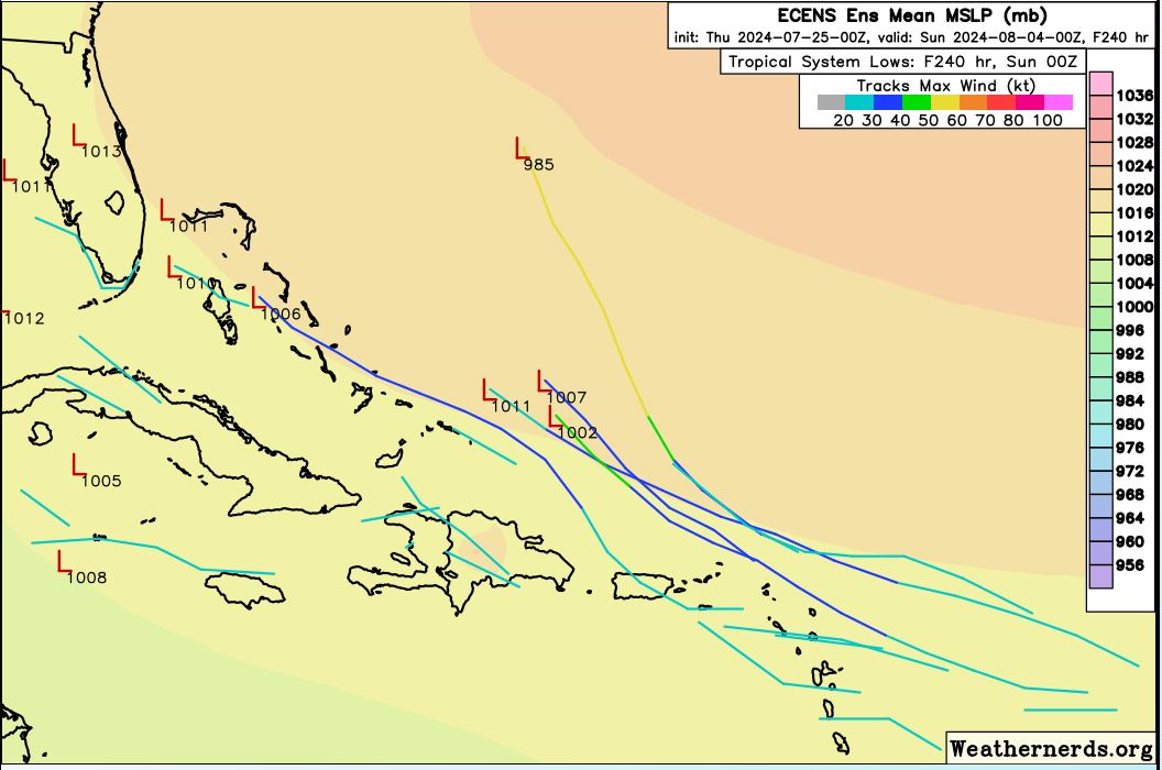
2024 Global Model Runs Discussion (Out thru day 16)

This is the general tropical discussion area. Anyone can take their shot at predicting a storms path.

Moderator: S2k Moderators

Forum rules

The posts in this forum are NOT official forecasts and should not be used as such. They are just the opinion of the poster and may or may not be backed by sound meteorological data. They are NOT endorsed by any professional institution or STORM2K. For official information, please refer to products from the National Hurricane Center and National Weather Service.

Help Support Storm2K
Message
Author
User avatar
Nimbus
Category 5
Category 5
Posts: 5300
Joined: Mon Jul 19, 2004 10:54 am

Re: 2024 Global Model Runs Discussion (Out thru day 16)

#561 Postby Nimbus » Thu Jul 25, 2024 5:51 am

REDHurricane wrote:
zzzh wrote:Euro and EPS basically drops development this run.


Eh I'm not so sure about that, to me it looks like half of the EPS members still keep the system forming north of the Greater Antilles while the other half show a weaker, more southerly system holding off on development until it hits the western Caribbean and interacting with a CAG-type setup possibly? In my experience it's pretty typical for the models to take a few days to calibrate once a potential TC comes off of Africa, so we should have a much better idea about the forecast in another day or two.

https://i.ibb.co/Dkj3j6p/Screen-Shot-2024-07-25-at-3-27-31-AM.png


They are just spreading the probability out with this run split.
Weaker / stronger storm possibilities.
2 likes   

jlauderdal
S2K Supporter
S2K Supporter
Posts: 7183
Joined: Wed May 19, 2004 5:46 am
Location: NE Fort Lauderdale
Contact:

Re: 2024 Global Model Runs Discussion (Out thru day 16)

#562 Postby jlauderdal » Thu Jul 25, 2024 6:22 am

REDHurricane wrote:
zzzh wrote:Euro and EPS basically drops development this run.


Eh I'm not so sure about that, to me it looks like half of the EPS members still keep the system forming north of the Greater Antilles while the other half show a weaker, more southerly system holding off on development until it hits the western Caribbean and interacting with a CAG-type setup possibly? In my experience it's pretty typical for the models to take a few days to calibrate once a potential TC comes off of Africa, so we should have a much better idea about the forecast in another day or two.

https://i.ibb.co/Dkj3j6p/Screen-Shot-2024-07-25-at-3-27-31-AM.png

Typical stronger north, weaker south. If this one doesn't go, August 8th and beyond looks very favorable. The stars need to line up for hurricane development.
0 likes   

User avatar
toad strangler
S2K Supporter
S2K Supporter
Posts: 4543
Joined: Sun Jul 28, 2013 3:09 pm
Location: Earth
Contact:

Re: 2024 Global Model Runs Discussion (Out thru day 16)

#563 Postby toad strangler » Thu Jul 25, 2024 7:04 am

jlauderdal wrote:
REDHurricane wrote:
zzzh wrote:Euro and EPS basically drops development this run.


Eh I'm not so sure about that, to me it looks like half of the EPS members still keep the system forming north of the Greater Antilles while the other half show a weaker, more southerly system holding off on development until it hits the western Caribbean and interacting with a CAG-type setup possibly? In my experience it's pretty typical for the models to take a few days to calibrate once a potential TC comes off of Africa, so we should have a much better idea about the forecast in another day or two.

https://i.ibb.co/Dkj3j6p/Screen-Shot-2024-07-25-at-3-27-31-AM.png

Typical stronger north, weaker south. If this one doesn't go, August 8th and beyond looks very favorable. The stars need to line up for hurricane development.


The 00z Euro still sends a weak signal all the way across the basin. If there was ever a year when you have to watch these little bundles of energy with two eyes, this is it. Earlier than the usual "bell ringing" day of 8/20 that legendary Dr. William Gray coined. Plus we have all seen models drop a signal only to bring it back with a vengeance. Either way time is short on the doldrums I do believe.
2 likes   

User avatar
AnnularCane
S2K Supporter
S2K Supporter
Posts: 2862
Joined: Thu Jun 08, 2006 9:18 am
Location: Wytheville, VA

Re: 2024 Global Model Runs Discussion (Out thru day 16)

#564 Postby AnnularCane » Thu Jul 25, 2024 7:42 am

Not to detract, but is that another set of runs heading for the islands?
0 likes   
"But it never rained rain. It never snowed snow. And it never blew just wind. It rained things like soup and juice. It snowed mashed potatoes and green peas. And sometimes the wind blew in storms of hamburgers." -- Judi Barrett, Cloudy with a Chance of Meatballs

User avatar
Ubuntwo
Category 5
Category 5
Posts: 1406
Age: 31
Joined: Thu Oct 05, 2017 10:41 pm

Re: 2024 Global Model Runs Discussion (Out thru day 16)

#565 Postby Ubuntwo » Thu Jul 25, 2024 8:06 am

otowntiger wrote:
zzzh wrote:Euro and EPS basically drops development this run.

8-) :sun:

Said run came out after your post last night :wink:
4 likes   
Kendall -> SLO -> PBC

Memorable Storms: Katrina (for its Florida landfall...) Wilma Matthew Irma

User avatar
Ubuntwo
Category 5
Category 5
Posts: 1406
Age: 31
Joined: Thu Oct 05, 2017 10:41 pm

Re: 2024 Global Model Runs Discussion (Out thru day 16)

#566 Postby Ubuntwo » Thu Jul 25, 2024 8:14 am

0z Euro brings the wave offshore 1-2 degrees further north, rendering the northern lobe more exposed to drier air. This thins out the wave’s moist pocket, delaying amplification. As a consequence of the lower amplitude, the wave gains less latitude -> a track into the Caribbean. By the last frame we see the wave enter a low-shear environment with a localized moist pocket, so I would expect formation in the Gulf. That said, there is lingering dry air in its broader environment, so this doesn’t look like an RI setup just yet. And yeah… 10 days out.
4 likes   
Kendall -> SLO -> PBC

Memorable Storms: Katrina (for its Florida landfall...) Wilma Matthew Irma

User avatar
Blown Away
S2K Supporter
S2K Supporter
Posts: 10145
Joined: Wed May 26, 2004 6:17 am

Re: 2024 Global Model Runs Discussion (Out thru day 16)

#567 Postby Blown Away » Thu Jul 25, 2024 9:30 am

Image
00z ECENS
0 likes   
Hurricane Eye Experience: David 79, Irene 99, Frances 04, Jeanne 04, Wilma 05... EYE COMING MY WAY IN 2024…
Hurricane Brush Experience: Andrew 92, Erin 95, Floyd 99, Matthew 16, Irma 17, Ian 22, Nicole 22…

User avatar
Steve
S2K Supporter
S2K Supporter
Posts: 9621
Joined: Sat Apr 05, 2003 11:41 pm
Location: Not a state-caster

Re: 2024 Global Model Runs Discussion (Out thru day 16)

#568 Postby Steve » Thu Jul 25, 2024 12:48 pm

12z ICON, CMC and GFS still have that hit on New England from the south Monday night. GFS and CMC target Maine whereas ICON is more Rhode Island/Massachusetts. Both show a weak system (more defined earlier) coming up. Looks like a weak TS or TD most likely though it does show up in both the 500mb and surface pressure plots.
1 likes   

User avatar
cycloneye
Admin
Admin
Posts: 145317
Age: 68
Joined: Thu Oct 10, 2002 10:54 am
Location: San Juan, Puerto Rico

Re: 2024 Global Model Runs Discussion (Out thru day 16)

#569 Postby cycloneye » Thu Jul 25, 2024 1:06 pm

12z Euro is back with some development, this time it moves it to Florida Penninsula as TD / weak TS.

Image
1 likes   
Visit the Caribbean-Central America Weather Thread where you can find at first post web cams,radars
and observations from Caribbean basin members Click Here

IcyTundra
Category 5
Category 5
Posts: 1205
Joined: Mon Jun 07, 2021 9:32 pm
Location: Dickinson, Texas

Re: 2024 Global Model Runs Discussion (Out thru day 16)

#570 Postby IcyTundra » Thu Jul 25, 2024 1:16 pm

12Z Euro with a TS just off the coast of Florida.
Image
1 likes   

User avatar
SouthFLTropics
Category 5
Category 5
Posts: 4236
Age: 50
Joined: Thu Aug 14, 2003 8:04 am
Location: Port St. Lucie, Florida

Re: 2024 Global Model Runs Discussion (Out thru day 16)

#571 Postby SouthFLTropics » Thu Jul 25, 2024 1:18 pm

If we can take that TS here on the east Florida coast and call it our storm for the year, I’ll gladly accept that.


Sent from my iPhone using Tapatalk
1 likes   
Fourth Generation Florida Native

Personal Storm History: David 79, Andrew 92, Erin 95, Floyd 99, Irene 99, Frances 04, Jeanne 04, Wilma 05, Matthew 16, Irma 17, Ian 22, Nicole 22, Milton 24

floridasun
Tropical Storm
Tropical Storm
Posts: 201
Joined: Tue Sep 14, 2021 3:59 pm

Re: 2024 Global Model Runs Discussion (Out thru day 16)

#572 Postby floridasun » Thu Jul 25, 2024 2:37 pm

we need become invest to see what nhc runs show euro having issue this area
1 likes   

User avatar
Ubuntwo
Category 5
Category 5
Posts: 1406
Age: 31
Joined: Thu Oct 05, 2017 10:41 pm

Re: 2024 Global Model Runs Discussion (Out thru day 16)

#573 Postby Ubuntwo » Thu Jul 25, 2024 4:14 pm

Because it has yet to be posted, today's 12z EPS. 35% develop the wave rolling off Africa now and another 15% develop a later wave in the MDR.
Image
6 likes   
Kendall -> SLO -> PBC

Memorable Storms: Katrina (for its Florida landfall...) Wilma Matthew Irma

LarryWx
S2K Supporter
S2K Supporter
Posts: 6305
Joined: Sun Sep 07, 2003 2:04 pm
Location: GA

Re: 2024 Global Model Runs Discussion (Out thru day 16)

#574 Postby LarryWx » Fri Jul 26, 2024 1:06 am

The 0Z Euro has a TD moving NW in the N Gulf at 240.
1 likes   
Personal Forecast Disclaimer:
The posts in this forum are NOT official forecasts and should not be used as such. They are just the opinion of the poster and may or may not be backed by sound meteorological data. They are NOT endorsed by any professional institution or storm2k.org. For official information, please refer to the NHC and NWS products.

LarryWx
S2K Supporter
S2K Supporter
Posts: 6305
Joined: Sun Sep 07, 2003 2:04 pm
Location: GA

Re: 2024 Global Model Runs Discussion (Out thru day 16)

#575 Postby LarryWx » Fri Jul 26, 2024 1:44 am

The 0Z EPS is the most active in quite a long time with many members with a landfall of a TC from S TX through the rest of the Gulf coast and the E coast anywhere from Aug 3 to Aug 7.
3 likes   
Personal Forecast Disclaimer:
The posts in this forum are NOT official forecasts and should not be used as such. They are just the opinion of the poster and may or may not be backed by sound meteorological data. They are NOT endorsed by any professional institution or storm2k.org. For official information, please refer to the NHC and NWS products.

zzzh
Category 3
Category 3
Posts: 834
Joined: Thu Sep 02, 2021 1:13 pm

Re: 2024 Global Model Runs Discussion (Out thru day 16)

#576 Postby zzzh » Fri Jul 26, 2024 2:49 am

Notice that this EC run has a monsoon trough breakdown, different from all previous runs. Typically these monsoon trough interactions are hard to forecast.
0 likes   

User avatar
kevin
Category 5
Category 5
Posts: 2586
Age: 26
Joined: Wed Aug 28, 2019 4:35 am

Re: 2024 Global Model Runs Discussion (Out thru day 16)

#577 Postby kevin » Fri Jul 26, 2024 3:12 am

00z Euro ensemble is looking scary, but still pretty much nothing on the GEFS. Interesting model days ahead.

Image
2 likes   

Keldeo1997
Category 2
Category 2
Posts: 637
Joined: Fri Oct 11, 2019 11:35 pm

Re: 2024 Global Model Runs Discussion (Out thru day 16)

#578 Postby Keldeo1997 » Fri Jul 26, 2024 3:22 am

The GFS will come around. Its spamming Majors in the East Pac even though that isn't realistic. GFS has a East Pac Bias for some reason.
2 likes   

zzzh
Category 3
Category 3
Posts: 834
Joined: Thu Sep 02, 2021 1:13 pm

Re: 2024 Global Model Runs Discussion (Out thru day 16)

#579 Postby zzzh » Fri Jul 26, 2024 4:40 am

Keep an eye on the western end of the monsoon trough near 45w. If it spins up faster than EC is depicting then it will likely not going to be affected/swallowed by the subsequent big wave.
0 likes   

Frank P
S2K Supporter
S2K Supporter
Posts: 2776
Joined: Fri Aug 29, 2003 10:52 am
Location: Biloxi Beach, Ms
Contact:

Re: 2024 Global Model Runs Discussion (Out thru day 16)

#580 Postby Frank P » Fri Jul 26, 2024 5:11 am

0z EURO run moving NW at end of the run

Image
0 likes   


Return to “Talkin' Tropics”

Who is online

Users browsing this forum: gib, Stormybajan and 33 guests