#585 Postby Blown Away » Fri Jul 26, 2024 6:26 am
jlauderdal wrote:LarryWx wrote:The 0Z EPS is the most active in quite a long time with many members with a landfall of a TC from S TX through the rest of the Gulf coast and the E coast anywhere from Aug 3 to Aug 7.
This an all interests from Brownsville to the Cape Fear(NF)need to watch

. Interesting its ahead of the favorable setup around Aug 10th. What we are seeing is the high setup for august as predicted a few weeks ago. This a very dangerous pattern for the United States with the expansive high driving systems well past 60W and its the systems that develop beyond 60 which are historically the most damaging. No more lectures about preparations, you know what to do.
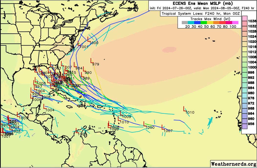
Very active 00z ECENS...
0 likes
Hurricane Eye Experience: David 79, Irene 99, Frances 04, Jeanne 04, Wilma 05… Hurricane Brush Experience: Andrew 92, Erin 95, Floyd 99, Matthew 16, Irma 17, Ian 22, Nicole 22…