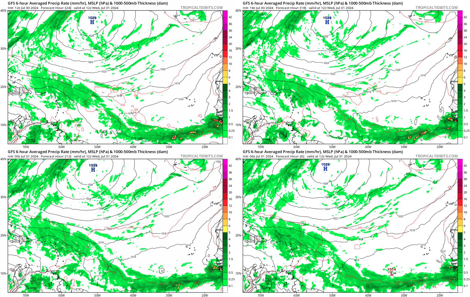
Possible development in the Western Atlantic / GOM (Is Invest 97L)

This is the general tropical discussion area. Anyone can take their shot at predicting a storms path.

Moderator: S2k Moderators

Forum rules

The posts in this forum are NOT official forecasts and should not be used as such. They are just the opinion of the poster and may or may not be backed by sound meteorological data. They are NOT endorsed by any professional institution or STORM2K. For official information, please refer to products from the National Hurricane Center and National Weather Service.

Help Support Storm2K
Message
Author
User avatar
SFLcane
S2K Supporter
S2K Supporter
Posts: 10163
Age: 47
Joined: Sat Jun 05, 2010 1:44 pm
Location: Lake Worth Florida

Re: Possible development in the Western Atlantic (0/60)

#381 Postby SFLcane » Wed Jul 31, 2024 9:00 am

:double:

Image
1 likes   

User avatar
boca
Category 5
Category 5
Posts: 6367
Age: 60
Joined: Mon Dec 15, 2003 8:49 am
Location: Boca Raton,FL

Re: Possible development in the Western Atlantic (0/60)

#382 Postby boca » Wed Jul 31, 2024 9:21 am


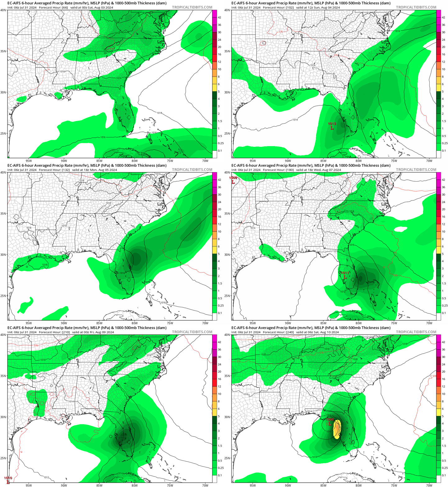
Which model is that are they new or changed their name to something else.
0 likes   

jlauderdal
S2K Supporter
S2K Supporter
Posts: 7182
Joined: Wed May 19, 2004 5:46 am
Location: NE Fort Lauderdale
Contact:

Re: Possible development in the Western Atlantic (0/60)

#383 Postby jlauderdal » Wed Jul 31, 2024 9:22 am

boca wrote:


Which model is that are they new or changed their name to something else.

Euro AI model, and it's been all over the place; discount it for now.
1 likes   

User avatar
SFLcane
S2K Supporter
S2K Supporter
Posts: 10163
Age: 47
Joined: Sat Jun 05, 2010 1:44 pm
Location: Lake Worth Florida

Re: Possible development in the Western Atlantic (0/60)

#384 Postby SFLcane » Wed Jul 31, 2024 9:24 am

jlauderdal wrote:
boca wrote:


Which model is that are they new or changed their name to something else.

Euro AI model, and it's been all over the place; discount it for now.


Cant discount anything right now we dont even have a coherent disturbance yet. Gfs surely not alone with the gom idea. Just saying
2 likes   

User avatar
boca
Category 5
Category 5
Posts: 6367
Age: 60
Joined: Mon Dec 15, 2003 8:49 am
Location: Boca Raton,FL

Re: Possible development in the Western Atlantic (0/60)

#385 Postby boca » Wed Jul 31, 2024 9:29 am

SFLcane wrote:
jlauderdal wrote:
boca wrote:
Which model is that are they new or changed their name to something else.

Euro AI model, and it's been all over the place; discount it for now.


Cant discount anything right now we dont even have a coherent disturbance yet. Gfs surely not alone with the gom idea. Just saying


Thank you for the info.
0 likes   

jlauderdal
S2K Supporter
S2K Supporter
Posts: 7182
Joined: Wed May 19, 2004 5:46 am
Location: NE Fort Lauderdale
Contact:

Re: Possible development in the Western Atlantic (0/60)

#386 Postby jlauderdal » Wed Jul 31, 2024 9:36 am

SFLcane wrote:
jlauderdal wrote:
boca wrote:
Which model is that are they new or changed their name to something else.

Euro AI model, and it's been all over the place; discount it for now.


Cant discount anything right now we dont even have a coherent disturbance yet. Gfs surely not alone with the gom idea. Just saying

The GOM idea isn't the issue; how it gets to the gulf is and its inconsistency. Discount doesn't mean toss it, and there are runs of models that get tossed completely. If that run of the Euro-AI is remotely close to reality with its track east and across florida, I will eat 10 pounds of crow.
2 likes   

User avatar
NDG
S2K Supporter
S2K Supporter
Posts: 15446
Joined: Sun Jul 09, 2006 10:14 pm
Location: Orlando, FL

Re: Possible development in the Western Atlantic (0/60)

#387 Postby NDG » Wed Jul 31, 2024 9:38 am

I wouldn't throw out the GFS solutions out the window with the Euro ensembles trending west little by little, even more in the short term.
ICON and CMC have always been too inconsistent for me to put too much stock into them.

Image
1 likes   

BIFF_THE_UNRULY
Tropical Storm
Tropical Storm
Posts: 143
Joined: Fri Jun 28, 2024 2:12 pm

Re: Possible development in the Western Atlantic (0/60)

#388 Postby BIFF_THE_UNRULY » Wed Jul 31, 2024 9:40 am

ill say it again. i dont like the hook. i can just see that shift west a few hundred miles as the week goes on
1 likes   

BobHarlem
Category 5
Category 5
Posts: 2105
Joined: Thu Oct 20, 2005 6:11 pm

Re: Possible development in the Western Atlantic (0/60)

#389 Postby BobHarlem » Wed Jul 31, 2024 9:41 am

It'll be odd if it coming from such a dry origin it winds up being a large flooding Tropical storm for Florida or the Southeast (I.e. Fay or Ian type of flooding in Florida). The AI Euro is like the AI image generator that randomly sticks in third arms and the like, but the idea of a stall or just massive rain I think is legitimate.
1 likes   

User avatar
NDG
S2K Supporter
S2K Supporter
Posts: 15446
Joined: Sun Jul 09, 2006 10:14 pm
Location: Orlando, FL

Re: Possible development in the Western Atlantic (0/60)

#390 Postby NDG » Wed Jul 31, 2024 9:49 am

BobHarlem wrote:It'll be odd if it coming from such a dry origin it winds up being a large flooding Tropical storm for Florida or the Southeast (I.e. Fay or Ian type of flooding in Florida). The AI Euro is like the AI image generator that randomly sticks in third arms and the like, but the idea of a stall or just massive rain I think is legitimate.


Ever since it was in western Africa it always had a very rich low level moisture but as soon as it started getting away from the H70 SAL last night it started to bloom like a flower, will continue to do so the more west it gets.
1 likes   

jlauderdal
S2K Supporter
S2K Supporter
Posts: 7182
Joined: Wed May 19, 2004 5:46 am
Location: NE Fort Lauderdale
Contact:

Re: Possible development in the Western Atlantic (0/60)

#391 Postby jlauderdal » Wed Jul 31, 2024 10:02 am

BIFF_THE_UNRULY wrote:ill say it again. i dont like the hook. i can just see that shift west a few hundred miles as the week goes on

No doubt, we stared down Floyd back in the day as it was coming into the bahamas and was supposed to hook, it did but we are all boarded up in sofla just in case. Sofla was shut down for 2 days, and we had less than an inch of rain and plenty of sun; that was a big win and my first time looking down the barrel of a major hurricane.
0 likes   

User avatar
AnnularCane
S2K Supporter
S2K Supporter
Posts: 2862
Joined: Thu Jun 08, 2006 9:18 am
Location: Wytheville, VA

Re: Possible development in the Western Atlantic (0/60)

#392 Postby AnnularCane » Wed Jul 31, 2024 10:06 am

I wish they'd make it an invest so it can have a floater. I keep going into Tropical Tidbits forgetting that there's no floater yet and have to settle for one of the wider views instead.
2 likes   
"But it never rained rain. It never snowed snow. And it never blew just wind. It rained things like soup and juice. It snowed mashed potatoes and green peas. And sometimes the wind blew in storms of hamburgers." -- Judi Barrett, Cloudy with a Chance of Meatballs

User avatar
Blown Away
S2K Supporter
S2K Supporter
Posts: 10145
Joined: Wed May 26, 2004 6:17 am

Re: Possible development in the Western Atlantic (0/60)

#393 Postby Blown Away » Wed Jul 31, 2024 10:10 am

Image
Convection really building...
3 likes   
Hurricane Eye Experience: David 79, Irene 99, Frances 04, Jeanne 04, Wilma 05... EYE COMING MY WAY IN 2024…
Hurricane Brush Experience: Andrew 92, Erin 95, Floyd 99, Matthew 16, Irma 17, Ian 22, Nicole 22…


User avatar
SFLcane
S2K Supporter
S2K Supporter
Posts: 10163
Age: 47
Joined: Sat Jun 05, 2010 1:44 pm
Location: Lake Worth Florida

Re: Possible development in the Western Atlantic (0/60)

#395 Postby SFLcane » Wed Jul 31, 2024 10:19 am

Image
2 likes   

BobHarlem
Category 5
Category 5
Posts: 2105
Joined: Thu Oct 20, 2005 6:11 pm

Re: Possible development in the Western Atlantic (0/60)

#396 Postby BobHarlem » Wed Jul 31, 2024 10:20 am

Juicing up quite well today, click image for latest:
Image
Last edited by BobHarlem on Wed Jul 31, 2024 10:21 am, edited 1 time in total.
2 likes   

User avatar
toad strangler
S2K Supporter
S2K Supporter
Posts: 4543
Joined: Sun Jul 28, 2013 3:09 pm
Location: Earth
Contact:

Re: Possible development in the Western Atlantic (0/60)

#397 Postby toad strangler » Wed Jul 31, 2024 10:21 am


This got juicy really quick.
1 likes   

User avatar
Blown Away
S2K Supporter
S2K Supporter
Posts: 10145
Joined: Wed May 26, 2004 6:17 am

Re: Possible development in the Western Atlantic (0/60)

#398 Postby Blown Away » Wed Jul 31, 2024 10:24 am

Image
Just an observation, the GFS has been showing initial deeper convection over the past few runs... Maybe seeing better conditions and maybe they can lock in better??
0 likes   
Hurricane Eye Experience: David 79, Irene 99, Frances 04, Jeanne 04, Wilma 05... EYE COMING MY WAY IN 2024…
Hurricane Brush Experience: Andrew 92, Erin 95, Floyd 99, Matthew 16, Irma 17, Ian 22, Nicole 22…

User avatar
chaser1
S2K Supporter
S2K Supporter
Posts: 5464
Age: 64
Joined: Sat Oct 15, 2005 5:59 pm
Location: Longwood, Fl

Re: Possible development in the Western Atlantic (0/60)

#399 Postby chaser1 » Wed Jul 31, 2024 10:24 am

DunedinDave wrote:So is it me or does anyone else get Elena vibes when they see the GFS?

Btw, you want a good ole GFS vs Euro battle, this is it because they’re on opposite sides of the spectrum here.


Bingo! Same thoughts too. Not suggesting the exact same occurs but a similar evolution seems less unlikely.

So here too is something to consider. Jump onto Tropical Tidbits, click Models, then Euro (6Z run) for the forecast time of 0Z Aug 3rd. Now go to the bottom of the page and click on the "Previous Run" arrow a few times. Now click on the "Next Run" arrow to the current (6Z) model output. The reason that the recent runs of Operational EURO is less enthusiastic about organization and genesis in the S. Bahamas and off S. Florida is that you'll notice with each model run, the 500 mb vorticity has become progressively weaker and more NE/SW stretched out. Do the same with the ICON and you'll see the same thing.

Furthermore, NDG made a nice observation regarding the clear forecast distinction between the GFS and the EURO 6Z 500 mb heights for 0Z Aug 3rd. The GFS distinctly indicating a further west extension of the W. Atlantic mid-level ridge then what the EURO seemed to indicate. Possible reason being that the wave itself has yet to develop any vertical structure and is doing nothing (yet) to assist in breaking down the strong ridge to it's north. So why begin to lean more toward a GFS solution GOM solution?? Well, take a look at last night's EURO 0Z 500 mb Geopotential Height forecast for 3Z on Aug 3rd (not the 500mb vorticity output). Now, click on the "Prior Run" button at the bottom of screen. Interestingly the EURO depicts greater 594 height bridging over N. Florida then what its prior runs depicted.

Hipshot, "how will we know which one verifies?" Great question but that likely will be answered at the point and time when we finally do have a (persistent) CDO develop. Right now, there are some intense CB's popping NNE of E. Puerto Rico but it's getting pretty sheared. I think we'll have to wait at least 24 more hours to see some evidence of a more congruent concentration of convection and mid-level organization. If NHC indicates later today that this system has been classified, than it still begs the question "where?". Hey, perhaps this disturbance unexpectedly starts to become better organized today, NHC classifies it an invest and the EURO still proves plausible... but I doubt it. Days ago I projected my thoughts that this would not develop North of the Greater Antilles firstly due to its sprawling size and dry air. At that point I though it seemed inevitable for the disturbance to drag across the Greater Antilles. I didn't buy much into this developing into a GOM hurricane though and I still have my doubts. Now I wait for the EURO 12Z run to further lean toward a GOM solution (weak, strong or otherwise) or perhaps further west development in the Florida Straits or just south of Cuba.
3 likes   
Andy D

(For official information, please refer to the NHC and NWS products.)

User avatar
tropicwatch
Category 5
Category 5
Posts: 3383
Age: 61
Joined: Sat Jun 02, 2007 10:01 am
Location: Panama City Florida
Contact:

Re: Possible development in the Western Atlantic (0/60)

#400 Postby tropicwatch » Wed Jul 31, 2024 10:25 am

Looking a lot better this morning with the buildup of convection. Finally might get an invest tag this afternoon.
0 likes   
Tropicwatch


Agnes 72', Eloise 75, Elena 85', Kate 85', Charley 86', Florence 88', Beryl 94', Dean 95', Erin 95', Opal 95', Earl 98', Georges 98', Ivan 2004', Arlene 2005', Dennis 2005', Ida 2009' Debby 2012' Irma 2017' Michael 2018'


Return to “Talkin' Tropics”

Who is online

Users browsing this forum: No registered users and 19 guests