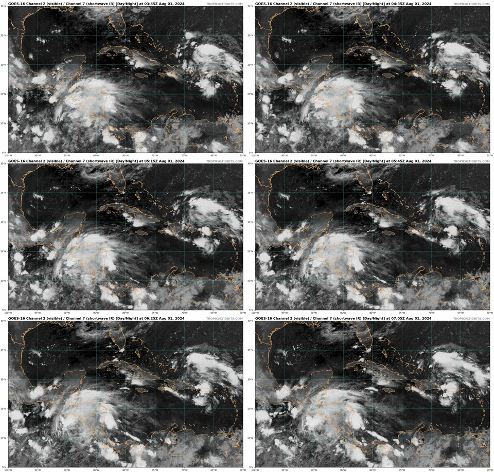
Possible development in the Western Atlantic / GOM (Is Invest 97L)

This is the general tropical discussion area. Anyone can take their shot at predicting a storms path.

Moderator: S2k Moderators

Forum rules

The posts in this forum are NOT official forecasts and should not be used as such. They are just the opinion of the poster and may or may not be backed by sound meteorological data. They are NOT endorsed by any professional institution or STORM2K. For official information, please refer to products from the National Hurricane Center and National Weather Service.

Help Support Storm2K
Message
Author
AxaltaRacing24
Category 5
Category 5
Posts: 1753
Age: 24
Joined: Wed Jul 27, 2016 11:14 am
Location: Jupiter, FL

Re: Possible development in the Western Atlantic / GOM (0/60)

#601 Postby AxaltaRacing24 » Thu Aug 01, 2024 1:05 am

ConvergenceZone wrote:Wow I'm shocked that this isn't an invest yet, being that it's only a few days away from "POTENTIAL" landfall.

Honestly, it is Thursday, and this storm could hit something as soon as Monday.
0 likes   

User avatar
ElectricStorm
Category 5
Category 5
Posts: 5017
Age: 24
Joined: Tue Aug 13, 2019 11:23 pm
Location: Skiatook, OK / Norman, OK

Re: Possible development in the Western Atlantic / GOM (0/60)

#602 Postby ElectricStorm » Thu Aug 01, 2024 1:28 am

0z Euro also stalls in the Gulf but keeps it very weak. I think if this does end up stalling in the gulf, it would probably be stronger than what the Euro has.
0 likes   
I am in no way a professional. Take what I say with a grain of salt as I could be totally wrong. Please refer to the NHC, NWS, or SPC for official information.

Boomer Sooner!

LarryWx
Category 5
Category 5
Posts: 6246
Joined: Sun Sep 07, 2003 2:04 pm
Location: GA

Re: Possible development in the Western Atlantic / GOM (0/60)

#603 Postby LarryWx » Thu Aug 01, 2024 1:52 am

0Z EPS: another further W shift with almost all in Gulf; most of these landfall NE Gulf but some go to NW Gulf
0 likes   
Personal Forecast Disclaimer:
The posts in this forum are NOT official forecasts and should not be used as such. They are just the opinion of the poster and may or may not be backed by sound meteorological data. They are NOT endorsed by any professional institution or storm2k.org. For official information, please refer to the NHC and NWS products.

User avatar
REDHurricane
Category 1
Category 1
Posts: 394
Age: 27
Joined: Sun Jul 03, 2022 2:36 pm
Location: Northeast Pacific Ocean

Re: Possible development in the Western Atlantic / GOM (0/60)

#604 Postby REDHurricane » Thu Aug 01, 2024 2:27 am

Yeah this is exactly why I was rooting for the Euro's forecast even though it initially showed the stronger solution compared to the other models -- any system that enters the Gulf right now is a bad situation waiting to happen. Agreed with everyone else that this should already be an invest and (hopefully) will be one at the next update, if you look really close at the last few frames of the IR satellite loop you can see energy bursting counterclockwise out of the convective blob over Puerto Rico that smells to me a bit like the beginnings of tropical cyclogenesis

Image
2 likes   

User avatar
N2FSU
S2K Supporter
S2K Supporter
Posts: 1062
Joined: Thu Sep 04, 2003 2:04 pm
Location: Tallahassee, FL

Re: Possible development in the Western Atlantic / GOM (0/60)

#605 Postby N2FSU » Thu Aug 01, 2024 2:49 am

Watching from Tallahassee and not liking ANY of what I’m seeing. :eek:
2 likes   

User avatar
Hurricane2022
Category 5
Category 5
Posts: 1496
Joined: Tue Aug 23, 2022 11:38 pm
Location: Araçatuba, Brazil

Re: Possible development in the Western Atlantic / GOM (10/60)

#606 Postby Hurricane2022 » Thu Aug 01, 2024 4:46 am

The models have been causing a astronomically big suspense in this system for a while now. This is annoying and tedious for me, even though I'm thousands of kilometers away from this system. I think people in the Eastern Gulf, especially the anxious people in that region, must be on the verge of a heart attack. :lol:
:raincloud:
0 likes   
Sorry for the bad English sometimes...!
For reliable and detailed information for any meteorological phenomenon, please consult the National Hurricane Center, Joint Typhoon Warning Center , or your local Meteo Center.

--------

Una cvm Christo, pro Christo, et in Christo. Sit nomen Domini benedictvm.

User avatar
Blown Away
S2K Supporter
S2K Supporter
Posts: 10140
Joined: Wed May 26, 2004 6:17 am

Re: Possible development in the Western Atlantic / GOM (0/60)

#607 Postby Blown Away » Thu Aug 01, 2024 4:55 am

N2FSU wrote:Watching from Tallahassee and not liking ANY of what I’m seeing. :eek:


Clearly if this AOI lifts off the GA islands earlier than W Cuba it will likely strengthen and go N like 06z GFS is showing… Does appear this AOI is a smidge farther N and skirts N coast of PR, Hispaniola, and Cuba, might be the difference…
1 likes   
Hurricane Eye Experience: David 79, Irene 99, Frances 04, Jeanne 04, Wilma 05... EYE COMING MY WAY IN 2024…
Hurricane Brush Experience: Andrew 92, Erin 95, Floyd 99, Matthew 16, Irma 17, Ian 22, Nicole 22…

DunedinDave
Tropical Storm
Tropical Storm
Posts: 217
Joined: Fri Aug 25, 2023 10:31 am

Re: Possible development in the Western Atlantic / GOM (10/60)

#608 Postby DunedinDave » Thu Aug 01, 2024 5:07 am

That’s a major change from GFS at 06z. Much further east and faster and weaker z No stall out. Almost identical to ICON model with landfall in big bend.
0 likes   

User avatar
chris_fit
Category 5
Category 5
Posts: 3222
Age: 42
Joined: Wed Sep 10, 2003 11:58 pm
Location: Tampa Bay Area, FL

Re: Possible development in the Western Atlantic / GOM (10/60)

#609 Postby chris_fit » Thu Aug 01, 2024 5:10 am

06Z GFS stronger and slight E Shift. SW/W Coast of FL at play. Here's the last 4 GFS run trend. Ugly for Tampa area.

Image
0 likes   

User avatar
chris_fit
Category 5
Category 5
Posts: 3222
Age: 42
Joined: Wed Sep 10, 2003 11:58 pm
Location: Tampa Bay Area, FL

Re: Possible development in the Western Atlantic / GOM (10/60)

#610 Postby chris_fit » Thu Aug 01, 2024 5:12 am

DunedinDave wrote:That’s a major change from GFS at 06z. Much further east and faster and weaker z No stall out. Almost identical to ICON model with landfall in big bend.


Still stalls, just later in the forecast period.... Maybe coming back for round 2?

Image
1 likes   

User avatar
Nimbus
Category 5
Category 5
Posts: 5274
Joined: Mon Jul 19, 2004 10:54 am

Re: Possible development in the Western Atlantic / GOM (0/60)

#611 Postby Nimbus » Thu Aug 01, 2024 5:19 am

Blown Away wrote:
N2FSU wrote:Watching from Tallahassee and not liking ANY of what I’m seeing. :eek:


Clearly if this AOI lifts off the GA islands earlier than W Cuba it will likely strengthen and go N like 06z GFS is showing… Does appear this AOI is a smidge farther N and skirts N coast of PR, Hispaniola, and Cuba, might be the difference…


UKMET initializes the closed low just off the north shore of Cuba in the same location as GFS.
00Z GFS has a Harvey scenario with surface pressures dropping into the 950's before flooding NOLA and most of the north gulf coast. Tallahassee has a lot of pine forest that would be destroyed. Rain estimates in feet that soften the ground and the shallow pine roots are then anchored in mud. Even tropical storm force winds will decimate a forest.

06Z GFS decimates the north caostal Florida forests with a tropical storm winds guess that would be easier on the roofs though.

It would be tempting to call an invest now with two models in agreement but...
Last edited by Nimbus on Thu Aug 01, 2024 5:40 am, edited 1 time in total.
0 likes   

User avatar
chris_fit
Category 5
Category 5
Posts: 3222
Age: 42
Joined: Wed Sep 10, 2003 11:58 pm
Location: Tampa Bay Area, FL

Re: Possible development in the Western Atlantic / GOM (10/60)

#612 Postby chris_fit » Thu Aug 01, 2024 5:20 am

Sure does come back for round 2. Looks like a Cat 2/3 into Jax? Wow, almost unheard of!

Image
1 likes   

Frank P
S2K Supporter
S2K Supporter
Posts: 2772
Joined: Fri Aug 29, 2003 10:52 am
Location: Biloxi Beach, Ms
Contact:

Re: Possible development in the Western Atlantic / GOM (10/60)

#613 Postby Frank P » Thu Aug 01, 2024 5:41 am

Looks like some broad rotation is showing up on the IR loops just above Haita moving west...

Image
image url
0 likes   

User avatar
toad strangler
S2K Supporter
S2K Supporter
Posts: 4543
Joined: Sun Jul 28, 2013 3:09 pm
Location: Earth
Contact:

Re: Possible development in the Western Atlantic (0/60)

#614 Postby toad strangler » Thu Aug 01, 2024 5:41 am

toad strangler wrote:
ronjon wrote:
Nimbus wrote:06Z GFS I'll give you a hint "oranges"


Major hurricane along Gulf Coast impacting Florida panhandle that drifts just offshore and slowly moves west toward NO. Yikes! But 7 to 10 days out so fantasy at this point.


There have been several models doing a long term stall in various places. The Euro was one in earlier runs in SC. Wild model output the past few days. I guess that should be expected when there is no coherent system to hone in on. I expect more of it :D


IRT the 6z GFS .... :uarrow: 8-)
0 likes   

USTropics
Category 5
Category 5
Posts: 2635
Joined: Sun Aug 12, 2007 3:45 am
Location: Florida State University

Re: Possible development in the Western Atlantic / GOM (10/60)

#615 Postby USTropics » Thu Aug 01, 2024 5:46 am

Blown Away wrote:
N2FSU wrote:Watching from Tallahassee and not liking ANY of what I’m seeing. :eek:


Clearly if this AOI lifts off the GA islands earlier than W Cuba it will likely strengthen and go N like 06z GFS is showing… Does appear this AOI is a smidge farther N and skirts N coast of PR, Hispaniola, and Cuba, might be the difference…


This is the key point, where the mid-level vorticity ends up consolidating in the next 24-48 hours is critical to long term track implications. The 06z run of the GFS model had the mid-level circulation riding the northern coast of Cuba in 48 hours (green circle), and combine this with a deeper trough (dashed blue) over the southeastern United States that erodes the nose of the ridge (pink) to the east of Florida, this allows the system to feel the effects/flow of the trough (blue arrow) and move to the northeast:
Image

Compare this exact time frame to the 00z GFS run, and the mid-level circulation is riding the southern coast of Cuba and the trough is not quite as amplified (the ridge extends further west over Florida). The system remains embedded in the low-level flow for a longer period of time and moves more west before turning north. The trough lifts out before the system can fully turn northeast, and steering currents collapse thereafter:
Image

Both are very realistic scenarios, we'll have to see how the evolution transpires today with the vorticity. These CIMSS vorticity products below will be excellent tools (given land interaction and topography, follow the mid and upper-level vorticity for now). One thing I've already noticed over the last ~8 hours is building upper-level vorticity to the south of Puerto Rico; the longer this persists it could tug on the mid-level circulation:

Upper-level vorticity (500mb)
Image
https://tropic.ssec.wisc.edu/real-time/windmain.php?&basin=atlantic&sat=wg8&prod=vor2&zoom=&time=

Mid-level vorticity (700mb)
Image
https://tropic.ssec.wisc.edu/real-time/windmain.php?&basin=atlantic&sat=wg8&prod=vor3&zoom=&time=
Last edited by USTropics on Thu Aug 01, 2024 5:47 am, edited 1 time in total.
6 likes   

User avatar
N2FSU
S2K Supporter
S2K Supporter
Posts: 1062
Joined: Thu Sep 04, 2003 2:04 pm
Location: Tallahassee, FL

Re: Possible development in the Western Atlantic / GOM (10/60)

#616 Postby N2FSU » Thu Aug 01, 2024 5:46 am

I thought the 0z GFS was crazy.
6z says hold my beer!

Image


Sent from my iPhone using Tapatalk
6 likes   

BobHarlem
Category 5
Category 5
Posts: 2034
Joined: Thu Oct 20, 2005 6:11 pm

Re: Possible development in the Western Atlantic / GOM (10/60)

#617 Postby BobHarlem » Thu Aug 01, 2024 6:07 am

Rain estimates from the 6z GFS:

Image
1 likes   

User avatar
LCfromFL
Category 1
Category 1
Posts: 257
Joined: Wed Aug 11, 2004 11:17 pm
Location: NE FL

Re: Possible development in the Western Atlantic / GOM (10/60)

#618 Postby LCfromFL » Thu Aug 01, 2024 6:10 am

chris_fit wrote:Sure does come back for round 2. Looks like a Cat 2/3 into Jax? Wow, almost unheard of!

https://i.imgur.com/eKgDGsH.gif


:eek: Yikes! This would be devastating for us here in NE FL. My home flooded with TS Fay in 2008 and Hurricane Irma in 2017.
0 likes   

BobHarlem
Category 5
Category 5
Posts: 2034
Joined: Thu Oct 20, 2005 6:11 pm

Re: Possible development in the Western Atlantic / GOM (10/60)

#619 Postby BobHarlem » Thu Aug 01, 2024 6:11 am

Watches and Warnings are going to be fun since wouldn't it make sense to start calling them later tomorrow? I don't envy the NHC at all on this forecast and the likely PTC (and fully general) confusion from it.

I'm sure they'd like to call an invest on it ASAP, but getting that tagged in the wrong spot won't help much, especially with a potential col blocker pattern coming up here.
Last edited by BobHarlem on Thu Aug 01, 2024 6:25 am, edited 2 times in total.
1 likes   

User avatar
LCfromFL
Category 1
Category 1
Posts: 257
Joined: Wed Aug 11, 2004 11:17 pm
Location: NE FL

Re: Possible development in the Western Atlantic / GOM (10/60)

#620 Postby LCfromFL » Thu Aug 01, 2024 6:13 am

BobHarlem wrote:Rain estimates from the 6z GFS:

https://i.imgur.com/cVn8ohk.png


:eek: Egads! If this pans out, we'll have Thomas Creek (which is nearly 1/4 mile away from us) inside our home (again). When we flood, it's a s-l-o-w rise of water due to ditches draining back to the Creek - so we should have time to move everything upstairs...but that is such a PIA and not how I want to spend my weekend.
1 likes   


Return to “Talkin' Tropics”

Who is online

Users browsing this forum: Google Adsense [Bot], zzzh and 106 guests