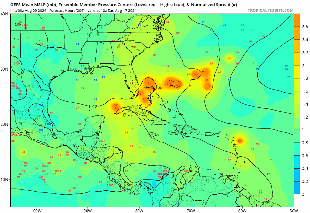
2024 Global Model Runs Discussion (Out thru day 16)

This is the general tropical discussion area. Anyone can take their shot at predicting a storms path.

Moderator: S2k Moderators

Forum rules

The posts in this forum are NOT official forecasts and should not be used as such. They are just the opinion of the poster and may or may not be backed by sound meteorological data. They are NOT endorsed by any professional institution or STORM2K. For official information, please refer to products from the National Hurricane Center and National Weather Service.

Help Support Storm2K
Message
Author
User avatar
aspen
Category 5
Category 5
Posts: 8818
Joined: Sat Oct 12, 2019 7:10 pm
Location: Connecticut, USA

Re: 2024 Global Model Runs Discussion (Out thru day 16)

#741 Postby aspen » Thu Aug 08, 2024 2:36 pm

Teban54 wrote:
aspen wrote:There have been a lot of cases of MDR systems with a modeled “sibling” right behind it that either doesn’t form (Elsa ‘21, Beryl ‘24) or falls far below model expectations (Bret and Cindy ‘23).

I think Cindy 2023 actually outperformed the models. Most runs initially didn't even have it form at all until just a few days before it actually did, while they had a much longer lead time for Bret.

Now, if you're talking about how Cindy's formation limited Bret from reaching its ceiling, that may be more plausible. But Bret also had to deal with June climo (as with all other systems you mentioned) in an El Nino year, which is very different from what we have now.

I thought some models made Cindy a C1. I guess I was mistaken. Maybe I’m getting the Bret/Cindy combo confused with something else.

I do clearly remember that a lot were turning Bret into a strong hurricane, and it was yet another consecutive June/July MDR storm that fell below aggressive model estimates thanks to climo, after Gonzalo ‘20, Elsa’21, and Bonnie ‘22. Beryl was the only one this decade that actually met — and exceeded — those trigger-happy models showing RI into a major in the western MDR. Everything else was fairly normal intensity for that time of year.
0 likes   
Irene '11 Sandy '12 Hermine '16 5/15/2018 Derecho Fay '20 Isaias '20 Elsa '21 Henri '21 Ida '21

I am only a meteorology enthusiast who knows a decent amount about tropical cyclones. Look to the professional mets, the NHC, or your local weather office for the best information.

Stratton23
Category 5
Category 5
Posts: 2519
Joined: Fri Jul 21, 2023 10:59 pm
Location: Katy, Tx

Re: 2024 Global Model Runs Discussion (Out thru day 16)

#742 Postby Stratton23 » Fri Aug 09, 2024 12:53 am

Little bit of a weak signal starting to show in ensembles for the western gulf in the 19-21st time frame, very weak bur a few members starting to sniff out something, noaa does have a development zone in that area for the 14-21st , so the time frame on the ensembles does check out
1 likes   

BobHarlem
Category 5
Category 5
Posts: 2106
Joined: Thu Oct 20, 2005 6:11 pm

Re: 2024 Global Model Runs Discussion (Out thru day 16)

#743 Postby BobHarlem » Fri Aug 09, 2024 12:52 pm

12z icon ends with a 4 system conga line in the Atlantic
Image
4 likes   

User avatar
cajungal
Category 5
Category 5
Posts: 2330
Age: 49
Joined: Sun Mar 14, 2004 9:34 pm
Location: Schriever, Louisiana (60 miles southwest of New Orleans)

Re: 2024 Global Model Runs Discussion (Out thru day 16)

#744 Postby cajungal » Fri Aug 09, 2024 1:25 pm

Wonder how long the trough will stick around. Trough protecting the gulf plus a heat ridge over us in Louisiana
0 likes   

BIFF_THE_UNRULY
Tropical Storm
Tropical Storm
Posts: 143
Joined: Fri Jun 28, 2024 2:12 pm

Re: 2024 Global Model Runs Discussion (Out thru day 16)

#745 Postby BIFF_THE_UNRULY » Fri Aug 09, 2024 3:01 pm

cajungal wrote:Wonder how long the trough will stick around. Trough protecting the gulf plus a heat ridge over us in Louisiana


Thought i heard something about lifting in the next 10-14 days. May not be around for the tail end of this conga line. Cant be sure tho
1 likes   

Stratton23
Category 5
Category 5
Posts: 2519
Joined: Fri Jul 21, 2023 10:59 pm
Location: Katy, Tx

Re: 2024 Global Model Runs Discussion (Out thru day 16)

#746 Postby Stratton23 » Fri Aug 09, 2024 5:54 pm

The upper air pattern will change as it always does, so while the gulf may be protected right now, that probably will not last for much longer, once that MJO moves in, its game on for the entire atlantic basin
3 likes   

User avatar
SFLcane
S2K Supporter
S2K Supporter
Posts: 10163
Age: 47
Joined: Sat Jun 05, 2010 1:44 pm
Location: Lake Worth Florida

Re: 2024 Global Model Runs Discussion (Out thru day 16)

#747 Postby SFLcane » Fri Aug 09, 2024 8:52 pm

:eek:

Image
6 likes   

User avatar
AubreyStorm
Category 1
Category 1
Posts: 337
Age: 44
Joined: Fri Jun 16, 2017 6:21 pm
Location: Texas, USA

Re: 2024 Global Model Runs Discussion (Out thru day 16)

#748 Postby AubreyStorm » Fri Aug 09, 2024 10:17 pm

0 likes   
The posts are NOT an official forecast. Please REFER to the NHC and NWS for official forecasts and products.

Stratton23
Category 5
Category 5
Posts: 2519
Joined: Fri Jul 21, 2023 10:59 pm
Location: Katy, Tx

Re: 2024 Global Model Runs Discussion (Out thru day 16)

#749 Postby Stratton23 » Sat Aug 10, 2024 12:40 am

MJO heading into very favorable phases 2-3 for the atlantic, ensembles are completely lost and are not handeling this MJO passage well at all, i am not buying them showing sinking air staying predominantly over the atlantic, they are completely off, and i am extremely suspicious of the lack of any activity on ensembles beyond this wave
3 likes   

User avatar
chaser1
S2K Supporter
S2K Supporter
Posts: 5464
Age: 64
Joined: Sat Oct 15, 2005 5:59 pm
Location: Longwood, Fl

Re: 2024 Global Model Runs Discussion (Out thru day 16)

#750 Postby chaser1 » Sat Aug 10, 2024 1:41 am

Stratton23 wrote:MJO heading into very favorable phases 2-3 for the atlantic, ensembles are completely lost and are not handeling this MJO passage well at all, i am not buying them showing sinking air staying predominantly over the atlantic, they are completely off, and i am extremely suspicious of the lack of any activity on ensembles beyond this wave


Especially following recent long range globals suddenly lining up the wave train. And now "the switch" mysteriously gets turned off? I just don't think I buy that
1 likes   
Andy D

(For official information, please refer to the NHC and NWS products.)

zzzh
Category 3
Category 3
Posts: 834
Joined: Thu Sep 02, 2021 1:13 pm

Re: 2024 Global Model Runs Discussion (Out thru day 16)

#751 Postby zzzh » Sat Aug 10, 2024 4:00 am

EPS shows nothing after 98L. Kinda surprised given the very favorable MJO and the fact that EPS is fairly good at detecting MDR storms in medium-long range.
2 likes   

rockice
Tropical Low
Tropical Low
Posts: 10
Joined: Sat Aug 12, 2023 8:09 am

Re: 2024 Global Model Runs Discussion (Out thru day 16)

#752 Postby rockice » Sat Aug 10, 2024 11:08 am

cajungal wrote:Wonder how long the trough will stick around. Trough protecting the gulf plus a heat ridge over us in Louisiana

Long range ensembles the trough come day next 5days ,imo Louisiana not get hit this years.
0 likes   

Stratton23
Category 5
Category 5
Posts: 2519
Joined: Fri Jul 21, 2023 10:59 pm
Location: Katy, Tx

Re: 2024 Global Model Runs Discussion (Out thru day 16)

#753 Postby Stratton23 » Sat Aug 10, 2024 11:08 am

zzzh makes zero sense to me at all, MJO is going into phases 2-3 in the atlantic once its moves in and thats about as favorable as it gets for the basin, Im definitely suspicious of the lack of activity and i highly suspect we are going to have more areas of interest across the atlantic basin to watch sftwr this wave, might have to go against ensembles for this one since they are not seeing this progression of the MJO well at all
0 likes   

User avatar
cajungal
Category 5
Category 5
Posts: 2330
Age: 49
Joined: Sun Mar 14, 2004 9:34 pm
Location: Schriever, Louisiana (60 miles southwest of New Orleans)

Re: 2024 Global Model Runs Discussion (Out thru day 16)

#754 Postby cajungal » Sat Aug 10, 2024 11:12 am

rockice wrote:
cajungal wrote:Wonder how long the trough will stick around. Trough protecting the gulf plus a heat ridge over us in Louisiana

Long range ensembles the trough come day next 5days ,imo Louisiana not get hit this years.


Definitely not complaining. We need a long break
1 likes   

User avatar
Teban54
Category 5
Category 5
Posts: 3204
Joined: Sat May 19, 2018 1:19 pm

Re: 2024 Global Model Runs Discussion (Out thru day 16)

#755 Postby Teban54 » Sat Aug 10, 2024 12:06 pm

chaser1 wrote:
Stratton23 wrote:MJO heading into very favorable phases 2-3 for the atlantic, ensembles are completely lost and are not handeling this MJO passage well at all, i am not buying them showing sinking air staying predominantly over the atlantic, they are completely off, and i am extremely suspicious of the lack of any activity on ensembles beyond this wave


Especially following recent long range globals suddenly lining up the wave train. And now "the switch" mysteriously gets turned off? I just don't think I buy that

I saved the following loop a few days ago right after 98L started showing up on the operational GFS. The model that often had the reputation of spinning up phantom storms and overintensifying them... Yet, it showed nothing from 318 hrs to 168 hrs.

This is why trusting negative signals on 200+ hr model runs verbatim is a bad idea.

Image
4 likes   

WeatherBoy2000
Category 1
Category 1
Posts: 346
Joined: Mon Apr 10, 2023 9:29 am

Re: 2024 Global Model Runs Discussion (Out thru day 16)

#756 Postby WeatherBoy2000 » Sat Aug 10, 2024 12:46 pm

Teban54 wrote:
chaser1 wrote:
Stratton23 wrote:MJO heading into very favorable phases 2-3 for the atlantic, ensembles are completely lost and are not handeling this MJO passage well at all, i am not buying them showing sinking air staying predominantly over the atlantic, they are completely off, and i am extremely suspicious of the lack of any activity on ensembles beyond this wave


Especially following recent long range globals suddenly lining up the wave train. And now "the switch" mysteriously gets turned off? I just don't think I buy that

I saved the following loop a few days ago right after 98L started showing up on the operational GFS. The model that often had the reputation of spinning up phantom storms and overintensifying them... Yet, it showed nothing from 318 hrs to 168 hrs.

This is why trusting negative signals on 200+ hr model runs verbatim is a bad idea.

https://i.postimg.cc/9fZRLLrS/gfs-z850-vort-atl-fh150-trend.gif


I think we could at the very least throw out the long range gfs lol:

 https://x.com/DerekOrtt/status/1822322552129118647

1 likes   

zzzh
Category 3
Category 3
Posts: 834
Joined: Thu Sep 02, 2021 1:13 pm

Re: 2024 Global Model Runs Discussion (Out thru day 16)

#757 Postby zzzh » Sat Aug 10, 2024 12:57 pm

GFS really is trash for genesis in recent years. It can only spin up random vorticity in west Caribbean/reverse monsoon troughs in WPAC, but not any other storms in the Atlantic. It also has a severe bias toward strong pacific MJO in medium long range:
Image
Image
Strong eq upper westerlies getting completely replaced by strong easterlies is truely wild.
4 likes   

User avatar
cheezyWXguy
Category 5
Category 5
Posts: 6108
Joined: Mon Feb 13, 2006 12:29 am
Location: Dallas, TX

Re: 2024 Global Model Runs Discussion (Out thru day 16)

#758 Postby cheezyWXguy » Sat Aug 10, 2024 1:09 pm

I swear the gfs does this every year. Overemphasis on epac development, a tendency toward depicting El Niño conditions regardless of background state/mjo, and then storms magically appear in the short range.
5 likes   

User avatar
chaser1
S2K Supporter
S2K Supporter
Posts: 5464
Age: 64
Joined: Sat Oct 15, 2005 5:59 pm
Location: Longwood, Fl

Re: 2024 Global Model Runs Discussion (Out thru day 16)

#759 Postby chaser1 » Sat Aug 10, 2024 1:32 pm

Two things. That GFS long range wind shear map that Derek Ortt displayed is a little misleading too. Notwithstanding the point regarding the GFS suddenly implying unfavorable upper level winds, when you step back and look at the Northern Hemisphere - especially the N. Pacific, it's clearly evident that the origan of these Westerlies are certainly NOT from the Pacific. Seems as if the GFS long range is over amplifying sharp upper level conditions that originate from Canada (perhaps a result of the blocking pattern that Webb referenced earlier). I don't know whether those GFS upper-level conditions will verify but the EURO and GFS do seem similar at about 240 hours (I believe that GFS graphic from Derek was more like 320 hr.s).

The other thing is that I seriously wonder if the GFS inherently "undervalues" W. Atlantic mid and upper-level heights for some reason? There have been numerous events over the years where I recall an westward moving Atlantic system seemingly continued moving further west then anticipated, only to be explained by NHC as "extended ridging in the lower levels". One would think this should only apply to more shallow systems but that was not the case. I wonder if part of the issue has more to do with data collection between 60W - 80W?
0 likes   
Andy D

(For official information, please refer to the NHC and NWS products.)

zzzh
Category 3
Category 3
Posts: 834
Joined: Thu Sep 02, 2021 1:13 pm

Re: 2024 Global Model Runs Discussion (Out thru day 16)

#760 Postby zzzh » Sat Aug 10, 2024 2:29 pm

chaser1 wrote:Two things. That GFS long range wind shear map that Derek Ortt displayed is a little misleading too. Notwithstanding the point regarding the GFS suddenly implying unfavorable upper level winds, when you step back and look at the Northern Hemisphere - especially the N. Pacific, it's clearly evident that the origan of these Westerlies are certainly NOT from the Pacific. Seems as if the GFS long range is over amplifying sharp upper level conditions that originate from Canada (perhaps a result of the blocking pattern that Webb referenced earlier). I don't know whether those GFS upper-level conditions will verify but the EURO and GFS do seem similar at about 240 hours (I believe that GFS graphic from Derek was more like 320 hr.s).

The other thing is that I seriously wonder if the GFS inherently "undervalues" W. Atlantic mid and upper-level heights for some reason? There have been numerous events over the years where I recall an westward moving Atlantic system seemingly continued moving further west then anticipated, only to be explained by NHC as "extended ridging in the lower levels". One would think this should only apply to more shallow systems but that was not the case. I wonder if part of the issue has more to do with data collection between 60W - 80W?

Image
Those westerlies are 0% from the wavebreaking caused by Canada ridging, it is 100% tropical forcing shown in the U200 anomaly map, see the eq westerlies surge due to phantom Pacific MJO.
I do agree that using a single shear map from 300h+ is somewhat misleading, but GFS does have the issue.
GFS has a systematic bias in weak ridging, not just in the Atlantic, as opposed to the strong ridge bias EC has.
1 likes   


Return to “Talkin' Tropics”

Who is online

Users browsing this forum: Kingarabian and 46 guests