
ATL: ERNESTO - Models
Moderator: S2k Moderators
-
TomballEd
- Category 5

- Posts: 1322
- Age: 62
- Joined: Wed Aug 16, 2023 4:52 pm
- Location: Spring/Klein area, not Tomball
ATL: INVEST 98L - Discussion
It isn't completely out to see if it hits land. GFS has a Cat 1 or Cat 2 hitting Puerto Rico and Hispaniola, A hurricane of any strength crossing Hispaniola will cause major flooding in both nations. Haiti, especially, with mountains stripped of trees and a government that isn't in full control, could suffer badly.
3 likes
-
crownweather

- S2K Supporter

- Posts: 602
- Age: 51
- Joined: Sat Aug 12, 2006 9:21 am
- Location: Sturbridge, Massachusetts
- Contact:
Re: ATL: INVEST 98L - Models
48 hour 18Z GFS model track a bit further south than the 12Z forecast. Wonder if this will be a continuing theme.
Sent from my iPhone using Tapatalk
Sent from my iPhone using Tapatalk
0 likes
Rob Lightbown
Crown Weather Services
https://crownweather.com
Crown Weather Services
https://crownweather.com

Re: ATL: INVEST 98L - Models
18z GFS is odd. Based on the 850mb vorticity plot, it looks like the tough connects with 98L while it’s still south of 30N. It also gets pivoted into a rare Maine landfall. East coast impacts are still not off the table.
0 likes
Irene '11 Sandy '12 Hermine '16 5/15/2018 Derecho Fay '20 Isaias '20 Elsa '21 Henri '21 Ida '21
I am only a meteorology enthusiast who knows a decent amount about tropical cyclones. Look to the professional mets, the NHC, or your local weather office for the best information.
I am only a meteorology enthusiast who knows a decent amount about tropical cyclones. Look to the professional mets, the NHC, or your local weather office for the best information.

Re: ATL: INVEST 98L - Models
aspen wrote:18z GFS is odd. Based on the 850mb vorticity plot, it looks like the tough connects with 98L while it’s still south of 30N. It also gets pivoted into a rare Maine landfall. East coast impacts are still not off the table.
A track like this also has potential to create major surge issues in Massachusetts Bay, even without a direct landfall.
0 likes
TC naming lists: retirements and intensity
Most aggressive Advisory #1's in North Atlantic (cr. kevin for starting the list)
Most aggressive Advisory #1's in North Atlantic (cr. kevin for starting the list)
-
Tekken_Guy
- Tropical Storm

- Posts: 150
- Joined: Fri Sep 01, 2017 8:08 pm
Re: ATL: INVEST 98L - Models
aspen wrote:18z GFS is odd. Based on the 850mb vorticity plot, it looks like the tough connects with 98L while it’s still south of 30N. It also gets pivoted into a rare Maine landfall. East coast impacts are still not off the table.
As of right now New England and Atlantic Canada seem the most at risk for an East Coast hit. NYC area and south look safer for now if it recurves before Cuba.
0 likes
-
cheezyWXguy

- Category 5
- Posts: 6282
- Joined: Mon Feb 13, 2006 12:29 am
- Location: Dallas, TX
Re: ATL: INVEST 98L - Models
From what I can tell it looks like the 18z gefs has a little fewer escapees. Very large spread from the gulf to ots continues though
0 likes
-
Tekken_Guy
- Tropical Storm
- Posts: 150
- Joined: Fri Sep 01, 2017 8:08 pm
Re: ATL: INVEST 98L - Models
cheezyWXguy wrote:From what I can tell it looks like the 18z gefs has a little fewer escapees. Very large spread from the gulf to ots continues though
How does NY/NJ fare?
0 likes
-
floridasun
- Tropical Storm
- Posts: 245
- Joined: Tue Sep 14, 2021 3:59 pm
-
Spacecoast

- Category 2

- Posts: 773
- Joined: Thu Aug 31, 2017 2:03 pm

-
floridasun
- Tropical Storm
- Posts: 245
- Joined: Tue Sep 14, 2021 3:59 pm
Re: ATL: INVEST 98L - Models
Spacecoast wrote:floridasun wrote:when new gfs,geps come out?
18z GEFS:
https://i.ibb.co/T1d744J/gfs-ememb-lowlocs-watl-fh54-246.gif
ok ty look like more west on this run for this one
0 likes
-
floridasun
- Tropical Storm
- Posts: 245
- Joined: Tue Sep 14, 2021 3:59 pm
Re: ATL: INVEST 98L - Models
Spacecoast wrote:floridasun wrote:when new gfs,geps come out?
18z GEFS:
https://i.ibb.co/T1d744J/gfs-ememb-lowlocs-watl-fh54-246.gif
only one out now
0 likes
-
Blown Away

- S2K Supporter
- Posts: 10253
- Joined: Wed May 26, 2004 6:17 am
Re: ATL: INVEST 98L - Models
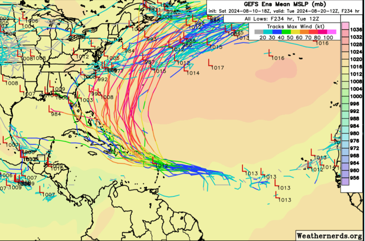
18z GEFS have likely recurve, but each run has more going over GA, Bahamas, and westward.
0 likes
Hurricane Eye Experience: David 79, Irene 99, Frances 04, Jeanne 04, Wilma 05… Hurricane Brush Experience: Andrew 92, Erin 95, Floyd 99, Matthew 16, Irma 17, Ian 22, Nicole 22…
-
Category5Kaiju

- Category 5
- Posts: 4347
- Joined: Thu Dec 24, 2020 12:45 pm
- Location: Seattle during the summer, Phoenix during the winter
Re: ATL: INVEST 98L - Models
Blown Away wrote:[url]https://i.postimg.cc/767zTXQK/IMG-8159.jpg [/url]
18z GEFS have likely recurve, but each run has more going over GA, Bahamas, and westward.
It's been trending that way for sure. Iirc, there were more members that just outright missed the islands even several days ago. Gotta see if the GEFS strike gold this time or not
0 likes
Unless explicitly stated, all information in my posts is based on my own opinions and observations. Tropical storms and hurricanes can be extremely dangerous. Refer to an accredited weather research agency or meteorologist if you need to make serious decisions regarding an approaching storm.

Re: ATL: INVEST 98L - Models
The Ensemble Member Pressure Center map in my amateur opinion is one of the better maps to look out, especially this early and before we have a named system.
Obviously there is uncertainty with when and if the storm will turn north from a future trough. One scenario I have not seen mention yet is a path over Hispaniola where the mountains significantly weaken the storm, making it shallower and less susceptible to the trough's influence.
It is concerning to see a few Ensembles taking it much further west. Obviously any significant storm impacting Haiti is going to cause a great deal of suffering, usually more so with heavy rains, flooding and landslides that high winds so hopefully that scenario does not pan out.
Ideally this misses the Lesser Antilles to north and becomes the first real surf maker of the season for the East Coast.
0 likes
-
gatorcane

- S2K Supporter
- Posts: 23708
- Age: 48
- Joined: Sun Mar 13, 2005 3:54 pm
- Location: Boca Raton, FL
Re: ATL: INVEST 98L - Models
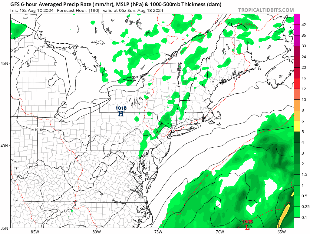
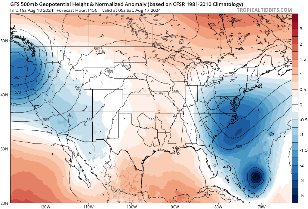
The 18Z GFS has lows in the mid 50s as far south as western areas of North Carolina with widespread 50s across West Virgina, Pennsylvania and the Northeast next weekend, reminiscent of early fall. That is quite a trough for this time of year and if it is really this strong would be able to turn the cyclone north quite easily well offshore the US.
500MB map, with the anomalously strong eastern CONUS trough:
500MB map, with the anomalously strong eastern CONUS trough:
2 likes
Re: ATL: INVEST 98L - Models
gatorcane wrote:The 18Z GFS has lows in the mid 50s as far south as western areas of North Carolina with widespread 50s across West Virgina, Pennsylvania and the Northeast next weekend, reminiscent of early fall. That is quite a trough for this time of year and if it is really this strong would be able to turn the cyclone north quite easily well offshore the US.
500MB map, with the anomalously strong eastern CONUS trough:
https://i.postimg.cc/nrV9XZ81/gfs-z500a-Norm-us-27.png
Maybe it paves the way for a weakness to linger and send this wave train into the NATL
0 likes
Andrew (1992), Irene (1999), Frances (2004), Katrina (2005), Wilma (2005), Fay (2008), Irma (2017), Eta (2020), Ian (2022)
-
cycloneye

- Admin

- Posts: 149725
- Age: 69
- Joined: Thu Oct 10, 2002 10:54 am
- Location: San Juan, Puerto Rico
Re: ATL: INVEST 98L - Models


0 likes
Visit the Caribbean-Central America Weather Thread where you can find at first post web cams,radars
and observations from Caribbean basin members Click Here
and observations from Caribbean basin members Click Here
-
Blown Away
- S2K Supporter
- Posts: 10253
- Joined: Wed May 26, 2004 6:17 am
Re: ATL: INVEST 98L - Models
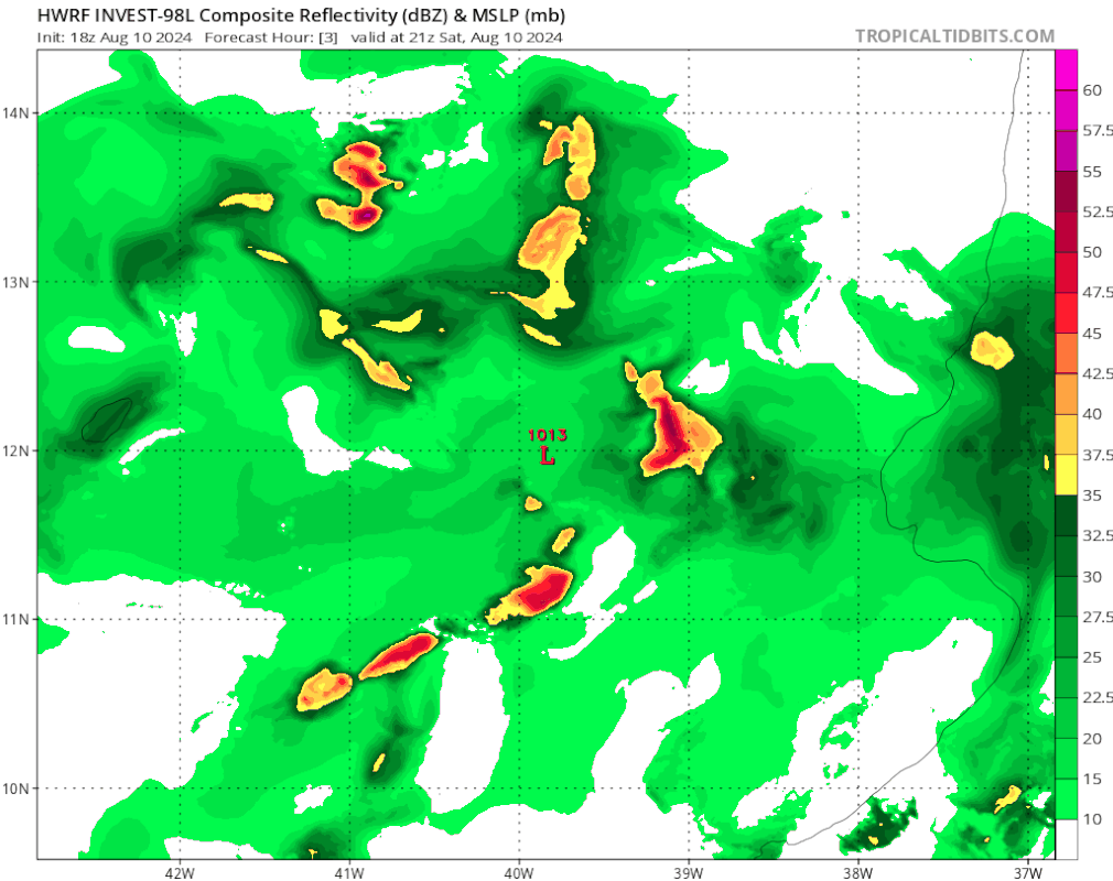
18z HWRF goes WNW through the GA’s and finishes in the SE Bahamas as a solid Cat 1.
0 likes
Hurricane Eye Experience: David 79, Irene 99, Frances 04, Jeanne 04, Wilma 05… Hurricane Brush Experience: Andrew 92, Erin 95, Floyd 99, Matthew 16, Irma 17, Ian 22, Nicole 22…
-
floridasun
- Tropical Storm
- Posts: 245
- Joined: Tue Sep 14, 2021 3:59 pm
Re: ATL: INVEST 98L - Models
dont show pass 126 hours dont know ifn keep going into bahamas or go north out to sea or move north west toward Carolina?Blown Away wrote:[url]https://i.postimg.cc/6585YzXc/hwrf-ref-98-L-fh3-126.gif [/url]
18z HWRF goes WNW through the GA’s and finishes in the SE Bahamas as a solid Cat 1.
0 likes
Re: ATL: INVEST 98L - Models
0Z ICON: quite a bit closer to US E coast vs 12Z run going N along 70W
0 likes
Personal Forecast Disclaimer:
The posts in this forum are NOT official forecasts and should not be used as such. They are just the opinion of the poster and may or may not be backed by sound meteorological data. They are NOT endorsed by any professional institution or storm2k.org. For official information, please refer to the NHC and NWS products.
The posts in this forum are NOT official forecasts and should not be used as such. They are just the opinion of the poster and may or may not be backed by sound meteorological data. They are NOT endorsed by any professional institution or storm2k.org. For official information, please refer to the NHC and NWS products.
Who is online
Users browsing this forum: No registered users and 44 guests