Hypercane_Kyle wrote:The times we've seen the "big" TC outbreaks, I've never seen the models accurately predict them 10 days out.
When was the last time a major, high-profile storm in recent times was correctly predicted that far out? Was it Ian?
Moderator: S2k Moderators


Hypercane_Kyle wrote:The times we've seen the "big" TC outbreaks, I've never seen the models accurately predict them 10 days out.

Category5Kaiju wrote:Hypercane_Kyle wrote:The times we've seen the "big" TC outbreaks, I've never seen the models accurately predict them 10 days out.
When was the last time a major, high-profile storm in recent times was correctly predicted that far out? Was it Ian?


TomballEd wrote:Starting out past 300 hours, both the GFS ensembles and Euro ensembles have some very weak members (1010 mb, +/- a couple of mb). They are close to Africa, the ensembles sometimes show very weak systems that are part of the ITCZ/MT that stay just off Africa, Or maybe they are seeing a wave. But for the next 10 days, after Ernesto leaves, I don't think there will be any activity. The 4 week Euro loner range ensemble probabilities beyond 2 weeks show a small area of very low chances (<10%) in a small area in the Gulf and a larger area from ECUSA to the mid-Atlantic to N of the Greater Antilles. An area of 10-15% are well offshore ECUSA. The pattern suggests a persistent trough in Midwest or East Coast.
I think well above normal ACE is still very possible, maybe not to CSU forecast levels, I suspect 2024 has fewer than 20 NS but I still think conditions are too good for the season to still be above normal. Just not as above normal as the Spring forecasts predicted.
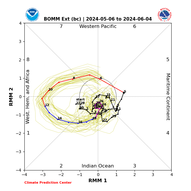
Steve wrote:Most of the globals' MJO has the index rounding the circle toward 5-6-7 which is part of the reason why they're not anticipating much in the mid-term. Looks like Phase 4 in the early 20's of August. However, the bias corrected Australian (BOMM) cuts from 5 back across the circle to almost 2 by the end of the first week of September. If this is right, expect a burst around then. I still think it will look differently than what it does as of 8/12 which should update in a few hours.
https://www.cpc.ncep.noaa.gov/products/precip/CWlink/MJO/CLIVAR/BOMM_BC.png
jlauderdal wrote:Steve wrote:Most of the globals' MJO has the index rounding the circle toward 5-6-7 which is part of the reason why they're not anticipating much in the mid-term. Looks like Phase 4 in the early 20's of August. However, the bias corrected Australian (BOMM) cuts from 5 back across the circle to almost 2 by the end of the first week of September. If this is right, expect a burst around then. I still think it will look differently than what it does as of 8/12 which should update in a few hours.
https://www.cpc.ncep.noaa.gov/products/precip/CWlink/MJO/CLIVAR/BOMM_BC.png
13 weeks gets us into the first week of September, CSU calling for 23 NS and we have had 5. 18 storms in 13 weeks, not buying it, my 19 NS might be high but we will see. The math is the math. I would take my 19 down to 17 if I had a redo, less storms but same ACE.
jlauderdal wrote:Steve wrote:Most of the globals' MJO has the index rounding the circle toward 5-6-7 which is part of the reason why they're not anticipating much in the mid-term. Looks like Phase 4 in the early 20's of August. However, the bias corrected Australian (BOMM) cuts from 5 back across the circle to almost 2 by the end of the first week of September. If this is right, expect a burst around then. I still think it will look differently than what it does as of 8/12 which should update in a few hours.
https://www.cpc.ncep.noaa.gov/products/precip/CWlink/MJO/CLIVAR/BOMM_BC.png
13 weeks gets us into the first week of September, CSU calling for 23 NS and we have had 5. 18 storms in 13 weeks, not buying it, my 19 NS might be high but we will see. The math is the math

Steve wrote:jlauderdal wrote:Steve wrote:Most of the globals' MJO has the index rounding the circle toward 5-6-7 which is part of the reason why they're not anticipating much in the mid-term. Looks like Phase 4 in the early 20's of August. However, the bias corrected Australian (BOMM) cuts from 5 back across the circle to almost 2 by the end of the first week of September. If this is right, expect a burst around then. I still think it will look differently than what it does as of 8/12 which should update in a few hours.
https://www.cpc.ncep.noaa.gov/products/precip/CWlink/MJO/CLIVAR/BOMM_BC.png
13 weeks gets us into the first week of September, CSU calling for 23 NS and we have had 5. 18 storms in 13 weeks, not buying it, my 19 NS might be high but we will see. The math is the math
Gonna take some simultaneous systems to get there. I'm not sure where we are as far as named storm days or hurricane days so far, but CSU called for 120 named storm days and 50 hurricane days. I'm assuming we're roughly 15-20 into NS and probably 5 or 6 into H days. If that assumption is close, there are 108 days until November 30th though we know that most of November won't feature activity (might be one or two ocean systems or in the Caribbean due to the La Nina). We would have 100 named storm days to go which is about a constant system between now and the end of the season adjusted by however many simultaneous storms there are to offset the days without any named storms.
I don't have an opinion one way or the other on this. There are times when bursts bring on 2, 3 or even 4 systems. But there are usually only a couple of these a season that even features those. So it's all a big ? to me until we hit 4-5 weeks from now and see what we are dealing with numbers wise.
SFLcane wrote:TomballEd wrote:Starting out past 300 hours, both the GFS ensembles and Euro ensembles have some very weak members (1010 mb, +/- a couple of mb). They are close to Africa, the ensembles sometimes show very weak systems that are part of the ITCZ/MT that stay just off Africa, Or maybe they are seeing a wave. But for the next 10 days, after Ernesto leaves, I don't think there will be any activity. The 4 week Euro loner range ensemble probabilities beyond 2 weeks show a small area of very low chances (<10%) in a small area in the Gulf and a larger area from ECUSA to the mid-Atlantic to N of the Greater Antilles. An area of 10-15% are well offshore ECUSA. The pattern suggests a persistent trough in Midwest or East Coast.
I think well above normal ACE is still very possible, maybe not to CSU forecast levels, I suspect 2024 has fewer than 20 NS but I still think conditions are too good for the season to still be above normal. Just not as above normal as the Spring forecasts predicted.
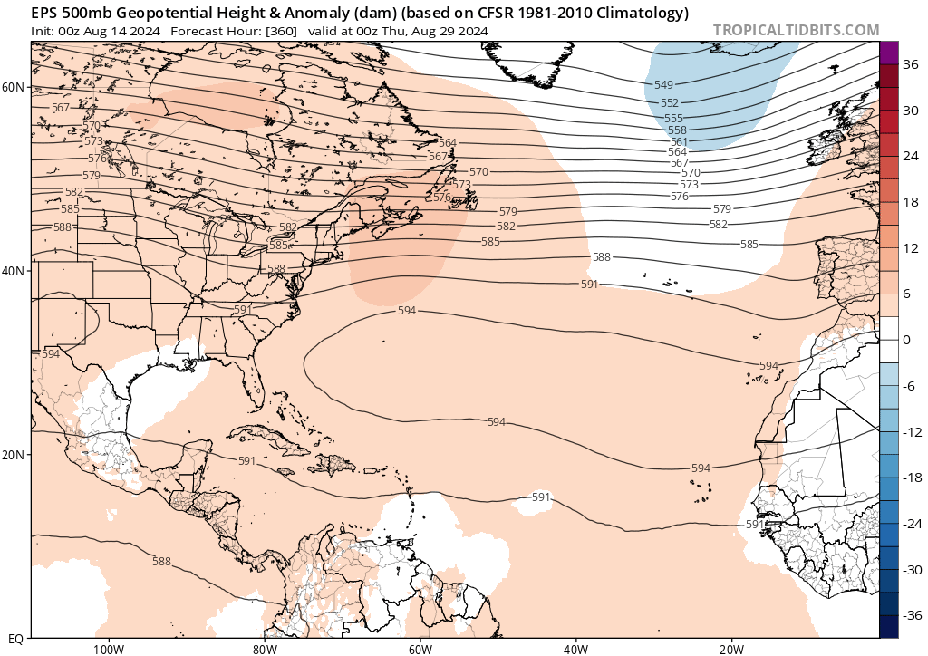
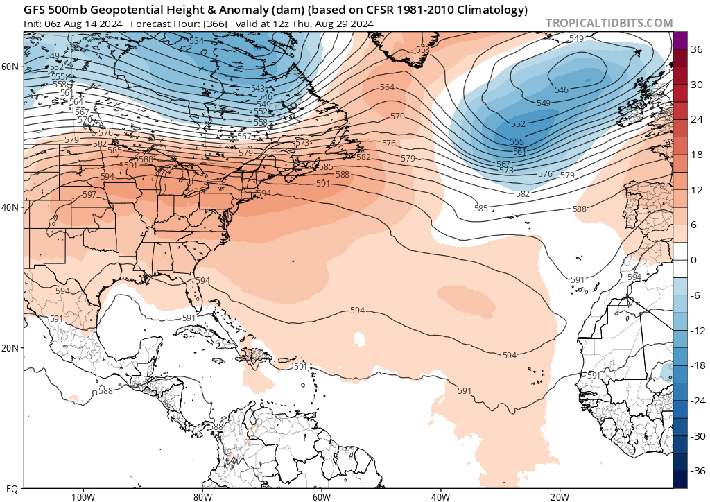
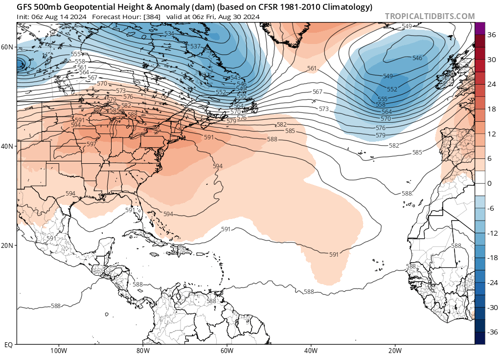
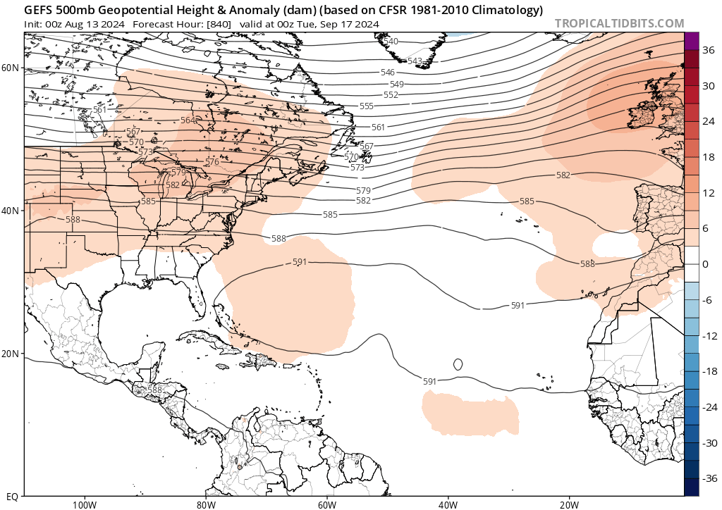
Actually models suggest quite the expansive ridge "+NAO" building across the tropical atlantic as we get deeper into Aug to start sept.
https://i.postimg.cc/sfhhNcgV/ssss.png
https://i.postimg.cc/5N5Fx2zT/nnnn.png


jlauderdal wrote:Steve wrote:Most of the globals' MJO has the index rounding the circle toward 5-6-7 which is part of the reason why they're not anticipating much in the mid-term. Looks like Phase 4 in the early 20's of August. However, the bias corrected Australian (BOMM) cuts from 5 back across the circle to almost 2 by the end of the first week of September. If this is right, expect a burst around then. I still think it will look differently than what it does as of 8/12 which should update in a few hours.
https://www.cpc.ncep.noaa.gov/products/precip/CWlink/MJO/CLIVAR/BOMM_BC.png
13 weeks gets us into the first week of September, CSU calling for 23 NS and we have had 5. 18 storms in 13 weeks, not buying it, my 19 NS might be high but we will see. The math is the math


SFLcane wrote:zzzh wrote:https://i.imgur.com/TSUwZZU.png
Just like that
https://i.postimg.cc/763kWVmW/nnn.png
Users browsing this forum: No registered users and 70 guests