wxman57 wrote:Stormlover70 wrote:Is that including the west coast of Florida? Seems like with the current pattern we are safe.
The Florida peninsula should be safe by Thanksgiving.
Agreed.
Moderator: S2k Moderators


wxman57 wrote:Stormlover70 wrote:Is that including the west coast of Florida? Seems like with the current pattern we are safe.
The Florida peninsula should be safe by Thanksgiving.


wxman57 wrote:Looking for an ensemble member somewhere to indicate development? Ha!

DorkyMcDorkface wrote:wxman57 wrote:Looking for an ensemble member somewhere to indicate development? Ha!
Sorry but I don't recall anyone in this thread doing that? The maps are being posted because there are genuine signals containing numerous ensemble members showing storms in contrast to the operational guidance. No one is selectively cherry picking stray members and claiming there will be a storm based off that alone.


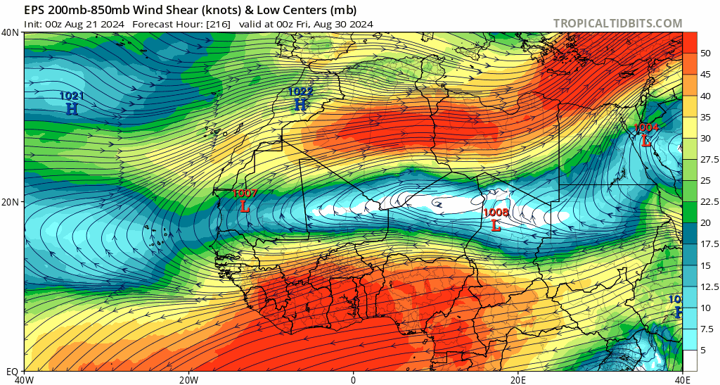
skyline385 wrote:Regardless of what happens and we all know activity will resume in early September if not end August, it is certainly extremely unusual to see deterministic models this quiet post Aug. 20 in a record warm +AMO during a transitioning Nino year and if anyone is claiming that it was expected, that argument is certainly not in good faith because anyone who has been tracking the NATL for few years would know, the switch flip always happens around this time in NATL climo.
I still fully expect activity to resume in a couple of weeks and the hyperactivity threshold is still extremely easy to beat (we only need ~105ACE more, the average activity post Aug 20 in 1991-2020 climo is ~110 ACE) but this little lull is going to make it difficult for those near record breaking 220+ ACE numbers. We could still potentially get there if September peaks as it does and we get an extended CV season in October but its going to be difficult imo.
Teban54 wrote:skyline385 wrote:Regardless of what happens and we all know activity will resume in early September if not end August, it is certainly extremely unusual to see deterministic models this quiet post Aug. 20 in a record warm +AMO during a transitioning Nino year and if anyone is claiming that it was expected, that argument is certainly not in good faith because anyone who has been tracking the NATL for few years would know, the switch flip always happens around this time in NATL climo.
I still fully expect activity to resume in a couple of weeks and the hyperactivity threshold is still extremely easy to beat (we only need ~105ACE more, the average activity post Aug 20 in 1991-2020 climo is ~110 ACE) but this little lull is going to make it difficult for those near record breaking 220+ ACE numbers. We could still potentially get there if September peaks as it does and we get an extended CV season in October but its going to be difficult imo.
While I don't think anyone was expecting what we're seeing... Here's some food for thought.
In earlier years, global models (especially GFS and, for a while, CMC) were notorious for spinning up phantom storms that didn't materialize or vastly underperformed in reality. It was not uncommon during late August: it happened in 2017 when models made Harvey and PTC 10 MDR majors, it happened in 2022 when they showed numerous MDR storms before Danielle and Earl that poofed one by one, and I'm sure there were other years.
(In fact, phantoms can still happen even later, well into peak season. 2021 had one such episode that resulted in people season cancelling while Larry was still a Cat 3.)
My point is: Suppose we take it as a given that no other storms form in August (which is not a guarantee). Would it fundamentally change things if operational global models were showing storms that end up being phantoms, compared to the status quo of not showing anything at all?
Personally, I feel the answer should theoretically be no -- what models are showing 10 days in advance has no effect on the conditions that actually materialize 10 days later. Yet, I can't help but feel that the discussion here would be very different if the phantom storms appeared, even if we end up being fooled.
skyline385 wrote:Teban54 wrote:skyline385 wrote:Regardless of what happens and we all know activity will resume in early September if not end August, it is certainly extremely unusual to see deterministic models this quiet post Aug. 20 in a record warm +AMO during a transitioning Nino year and if anyone is claiming that it was expected, that argument is certainly not in good faith because anyone who has been tracking the NATL for few years would know, the switch flip always happens around this time in NATL climo.
I still fully expect activity to resume in a couple of weeks and the hyperactivity threshold is still extremely easy to beat (we only need ~105ACE more, the average activity post Aug 20 in 1991-2020 climo is ~110 ACE) but this little lull is going to make it difficult for those near record breaking 220+ ACE numbers. We could still potentially get there if September peaks as it does and we get an extended CV season in October but its going to be difficult imo.
While I don't think anyone was expecting what we're seeing... Here's some food for thought.
In earlier years, global models (especially GFS and, for a while, CMC) were notorious for spinning up phantom storms that didn't materialize or vastly underperformed in reality. It was not uncommon during late August: it happened in 2017 when models made Harvey and PTC 10 MDR majors, it happened in 2022 when they showed numerous MDR storms before Danielle and Earl that poofed one by one, and I'm sure there were other years.
(In fact, phantoms can still happen even later, well into peak season. 2021 had one such episode that resulted in people season cancelling while Larry was still a Cat 3.)
My point is: Suppose we take it as a given that no other storms form in August (which is not a guarantee). Would it fundamentally change things if operational global models were showing storms that end up being phantoms, compared to the status quo of not showing anything at all?
Personally, I feel the answer should theoretically be no -- what models are showing 10 days in advance has no effect on the conditions that actually materialize 10 days later. Yet, I can't help but feel that the discussion here would be very different if the phantom storms appeared, even if we end up being fooled.
I agree with the sentiment in your post but here's the thing about it. Models would show phantom majors around Aug 20th because the conditions they saw were very favorable in the 10 days ahead as soon as the switch flipped. They are in the end numerical models without a mind of their own or any kind of reference to past seasons, they run off what they see every single run so the question then is, why aren't they seeing the favorable conditions yet this year and what is causing the delay? The current theory seems to be the high latitude waves combined with a heavy SAL season and a MJO stuck in phases 2/3 producing heavy easterly shear but all of this should be starting to decrease soon. The delay however will affect the activity of the season though as the NATL is using up peak season time. Like I said earlier, hyperactive season is still easy to beat but the more peak season time the NATL wastes, the less likely it is for those 220+ ACE numbers to verify. This of course does not say anything about the impact the season will have which has already been pretty significant.
wxman57 wrote:I found a comparison between this time in 2023 vs. now using the NHC 7-day outlook graphic so I made my own. Quite a difference. After August 19 in 2023, there were 3 storms that formed in late August, 6 in September and 2 in October. That's 11 named storms after August 19th. This year, nothing. Unlikely we'll see any additional storms in August and early September is looking dead, too. We could reach the peak of the season (Sept 10) with only 5-6 named storms. I love it! Days off this time of year are a luxury.
I read Klotzbach's season update but I think something is being missed. Warm water - check. Low wind shear - maybe. As for a favorable environment - nope. Caribbean and Tropical Atlantic are dominated by dry, sinking air. It doesn't matter how warm the water is. If the atmosphere isn't favorable then hurricanes struggle to develop. I'm thinking my revised numbers of 18/8/4 may be too high. I'm just hoping for the current pattern to continue and any additional storms to stay out to sea. Perhaps those global models indicating no development are correct. Looking for an ensemble member somewhere to indicate development? Ha!
https://wxman57.com/images/NHC7Day.JPG
https://wxman57.com/images/NHC7Day.JPG
Tropical Atlantic Instability is way below normal:
https://www.ssd.noaa.gov/PS/TROP/TCFP/data/current/ts_al_tat_THDV.gif
ConvergenceZone wrote:wxman57 wrote:I found a comparison between this time in 2023 vs. now using the NHC 7-day outlook graphic so I made my own. Quite a difference. After August 19 in 2023, there were 3 storms that formed in late August, 6 in September and 2 in October. That's 11 named storms after August 19th. This year, nothing. Unlikely we'll see any additional storms in August and early September is looking dead, too. We could reach the peak of the season (Sept 10) with only 5-6 named storms. I love it! Days off this time of year are a luxury.
I read Klotzbach's season update but I think something is being missed. Warm water - check. Low wind shear - maybe. As for a favorable environment - nope. Caribbean and Tropical Atlantic are dominated by dry, sinking air. It doesn't matter how warm the water is. If the atmosphere isn't favorable then hurricanes struggle to develop. I'm thinking my revised numbers of 18/8/4 may be too high. I'm just hoping for the current pattern to continue and any additional storms to stay out to sea. Perhaps those global models indicating no development are correct. Looking for an ensemble member somewhere to indicate development? Ha!
https://wxman57.com/images/NHC7Day.JPG
https://wxman57.com/images/NHC7Day.JPG
Tropical Atlantic Instability is way below normal:
https://www.ssd.noaa.gov/PS/TROP/TCFP/data/current/ts_al_tat_THDV.gif
Agreed, biggest forecasted Bust incoming.
Teban54 wrote:ConvergenceZone wrote:wxman57 wrote:I found a comparison between this time in 2023 vs. now using the NHC 7-day outlook graphic so I made my own. Quite a difference. After August 19 in 2023, there were 3 storms that formed in late August, 6 in September and 2 in October. That's 11 named storms after August 19th. This year, nothing. Unlikely we'll see any additional storms in August and early September is looking dead, too. We could reach the peak of the season (Sept 10) with only 5-6 named storms. I love it! Days off this time of year are a luxury.
I read Klotzbach's season update but I think something is being missed. Warm water - check. Low wind shear - maybe. As for a favorable environment - nope. Caribbean and Tropical Atlantic are dominated by dry, sinking air. It doesn't matter how warm the water is. If the atmosphere isn't favorable then hurricanes struggle to develop. I'm thinking my revised numbers of 18/8/4 may be too high. I'm just hoping for the current pattern to continue and any additional storms to stay out to sea. Perhaps those global models indicating no development are correct. Looking for an ensemble member somewhere to indicate development? Ha!
https://wxman57.com/images/NHC7Day.JPG
https://wxman57.com/images/NHC7Day.JPG
Tropical Atlantic Instability is way below normal:
https://www.ssd.noaa.gov/PS/TROP/TCFP/data/current/ts_al_tat_THDV.gif
Agreed, biggest forecasted Bust incoming.
Saying a season that already had 5/3/1 and 55 ACE will be a bigger bust than 2013 is just absurd, IMHO.
wxman57 wrote:I found a comparison between this time in 2023 vs. now using the NHC 7-day outlook graphic so I made my own. Quite a difference. After August 19 in 2023, there were 3 storms that formed in late August, 6 in September and 2 in October. That's 11 named storms after August 19th. This year, nothing. Unlikely we'll see any additional storms in August and early September is looking dead, too. We could reach the peak of the season (Sept 10) with only 5-6 named storms. I love it! Days off this time of year are a luxury.
I read Klotzbach's season update but I think something is being missed. Warm water - check. Low wind shear - maybe. As for a favorable environment - nope. Caribbean and Tropical Atlantic are dominated by dry, sinking air. It doesn't matter how warm the water is. If the atmosphere isn't favorable then hurricanes struggle to develop. I'm thinking my revised numbers of 18/8/4 may be too high. I'm just hoping for the current pattern to continue and any additional storms to stay out to sea. Perhaps those global models indicating no development are correct. Looking for an ensemble member somewhere to indicate development? Ha!
https://wxman57.com/images/NHC7Day.JPG
https://wxman57.com/images/NHC7Day.JPG
Tropical Atlantic Instability is way below normal:
https://www.ssd.noaa.gov/PS/TROP/TCFP/data/current/ts_al_tat_THDV.gif
ConvergenceZone wrote:wxman57 wrote:I found a comparison between this time in 2023 vs. now using the NHC 7-day outlook graphic so I made my own. Quite a difference. After August 19 in 2023, there were 3 storms that formed in late August, 6 in September and 2 in October. That's 11 named storms after August 19th. This year, nothing. Unlikely we'll see any additional storms in August and early September is looking dead, too. We could reach the peak of the season (Sept 10) with only 5-6 named storms. I love it! Days off this time of year are a luxury.
I read Klotzbach's season update but I think something is being missed. Warm water - check. Low wind shear - maybe. As for a favorable environment - nope. Caribbean and Tropical Atlantic are dominated by dry, sinking air. It doesn't matter how warm the water is. If the atmosphere isn't favorable then hurricanes struggle to develop. I'm thinking my revised numbers of 18/8/4 may be too high. I'm just hoping for the current pattern to continue and any additional storms to stay out to sea. Perhaps those global models indicating no development are correct. Looking for an ensemble member somewhere to indicate development? Ha!
https://wxman57.com/images/NHC7Day.JPG
https://wxman57.com/images/NHC7Day.JPG
Tropical Atlantic Instability is way below normal:
https://www.ssd.noaa.gov/PS/TROP/TCFP/data/current/ts_al_tat_THDV.gif
Agreed, biggest forecasted Bust incoming.


agreed and well said!wxman57 wrote:To be clear, I don't care about ACE, I'm looking at the number of storms. To reach 25 named storms we'd need to have 20 develop in September and October. That's highly unlikely. We are on track for 18 or fewer named storms, assuming we do reach a very active period the last three weeks of September. To have no disturbances and no likely development over the coming week this late into August is very rare. The environment across the tropics is clearly not very favorable for development. I suspect that will change by the second week of September as we move into the last half of the season (typically, numbers-wise). For now, I'm enjoying the quiet time and planning on taking another comp day this Friday and next Friday going into the Labor Day weekend. I think I have had only a single Labor Day weekend off since I started in 1980. That would be quite a treat.

otowntiger wrote:agreed and well said!wxman57 wrote:To be clear, I don't care about ACE, I'm looking at the number of storms. To reach 25 named storms we'd need to have 20 develop in September and October. That's highly unlikely. We are on track for 18 or fewer named storms, assuming we do reach a very active period the last three weeks of September. To have no disturbances and no likely development over the coming week this late into August is very rare. The environment across the tropics is clearly not very favorable for development. I suspect that will change by the second week of September as we move into the last half of the season (typically, numbers-wise). For now, I'm enjoying the quiet time and planning on taking another comp day this Friday and next Friday going into the Labor Day weekend. I think I have had only a single Labor Day weekend off since I started in 1980. That would be quite a treat.
Users browsing this forum: Teban54 and 81 guests

