Expert Forecasts for the 2024 NATL Hurricane Season

This is the general tropical discussion area. Anyone can take their shot at predicting a storms path.

Moderator: S2k Moderators

Forum rules

The posts in this forum are NOT official forecasts and should not be used as such. They are just the opinion of the poster and may or may not be backed by sound meteorological data. They are NOT endorsed by any professional institution or STORM2K. For official information, please refer to products from the National Hurricane Center and National Weather Service.

Help Support Storm2K
Message
Author
User avatar
toad strangler
S2K Supporter
S2K Supporter
Posts: 4543
Joined: Sun Jul 28, 2013 3:09 pm
Location: Earth
Contact:

Re: Expert Forecasts for the 2024 NATL Hurricane Season: CSU two week forecast up on tuesday

#281 Postby toad strangler » Mon Aug 19, 2024 6:23 am

MEANINGLESS_NUMBERS wrote:
cycloneye wrote:A reminder that next tuesday morning, the CSU two week forecast from August 20 they September 2 will be released.

https://tropical.colostate.edu/forecasting.html


They will almost certainly be revising downwards. The season has underperformed their estimate thus far.


It's a two week forecast. Not an update to seasonal numbers. But yes, will be interesting for sure.
0 likes   

MEANINGLESS_NUMBERS
Category 1
Category 1
Posts: 325
Joined: Mon Nov 02, 2020 1:43 pm

Re: Expert Forecasts for the 2024 NATL Hurricane Season: CSU two week forecast on tuesday (August 20 thru September 2)

#282 Postby MEANINGLESS_NUMBERS » Mon Aug 19, 2024 6:43 am

I misunderstood - thank you
0 likes   
Emily '87, Felix '95, Gert '99, Fabian '03, Humberto '19, Paulette '20, Teddy '20, Fiona '22, Lee '23, Ernesto '24

User avatar
cycloneye
Admin
Admin
Posts: 143858
Age: 68
Joined: Thu Oct 10, 2002 10:54 am
Location: San Juan, Puerto Rico

Re: Expert Forecasts for the 2024 NATL Hurricane Season: CSU two week forecast on tuesday 2 PM EDT

#283 Postby cycloneye » Mon Aug 19, 2024 1:51 pm

0 likes   
Visit the Caribbean-Central America Weather Thread where you can find at first post web cams,radars
and observations from Caribbean basin members Click Here

User avatar
skyline385
Category 5
Category 5
Posts: 2728
Age: 34
Joined: Wed Aug 26, 2020 11:15 pm
Location: Houston TX

Re: Expert Forecasts for the 2024 NATL Hurricane Season: CSU two week forecast up

#284 Postby skyline385 » Tue Aug 20, 2024 1:02 pm

3 likes   

User avatar
Teban54
Category 5
Category 5
Posts: 3168
Joined: Sat May 19, 2018 1:19 pm

Re: Expert Forecasts for the 2024 NATL Hurricane Season: CSU two week forecast up

#285 Postby Teban54 » Tue Aug 20, 2024 1:55 pm


Emphasis mine:

However, large-scale environmental conditions look to get more conducive for tropical cyclone activity towards the end of August. In addition, global model ensembles highlight several potential areas for tropical cyclone formation during the second week of our two-week forecast period. The Madden-Julian Oscillation (MJO) is forecast to persist over the Indian Ocean and then potentially move towards the Maritime Continent, providing large-scale conditions that favor Atlantic hurricane activity.


The Madden-Julian oscillation (MJO), as measured by the Wheeler-Hendon index, is currently enhancing convection over the Indian Ocean. The MJO is forecast to propagate eastward across the Indian Ocean towards the Maritime Continent over the next two weeks. These phases of the MJO are associated with hurricane-favorable shear conditions in the Atlantic basin (Figure 6).

As would be expected given the favorable seasonal signals of cool neutral ENSO conditions and an extremely warm Atlantic combined with relatively TC-favorable MJO phases, the EPS is generally predicting below-normal vertical wind shear across the tropical Atlantic over the next two weeks (Figure 7). This reduction in shear should favor Atlantic hurricane activity, especially in week two.


There has been considerable discussion as to why the Atlantic has been so dusty recently (Figure 8). One of the primary reasons for the increase in dust in recent weeks has been a pronounced northward shift in the Intertropical Convergence Zone, associated with lowlevel westerly anomalies reaching north to ~20°N (Figure 9). Associated with this has been African easterly waves emerging from the African continent far north of their usual position. While a northward-shifted Intertropical Convergence Zone is generally taken to be favorable for Atlantic hurricane activity, African easterly waves have been leaving the continent so far north that they have been pulling in lots of dust/dry air, limiting their chances for development.

In addition, the African monsoon has been extremely vigorous so far this month (Figure 10). The tropical easterly jet has been much stronger than normal, resulting in moderate to strong easterly shear in the eastern Atlantic in recent weeks. As the MJO propagates away from Africa and heads towards the Maritime Continent, these upper-level easterly anomalies should subside, resulting in enhanced chances for Atlantic tropical cyclone formation in the eastern/central Atlantic.


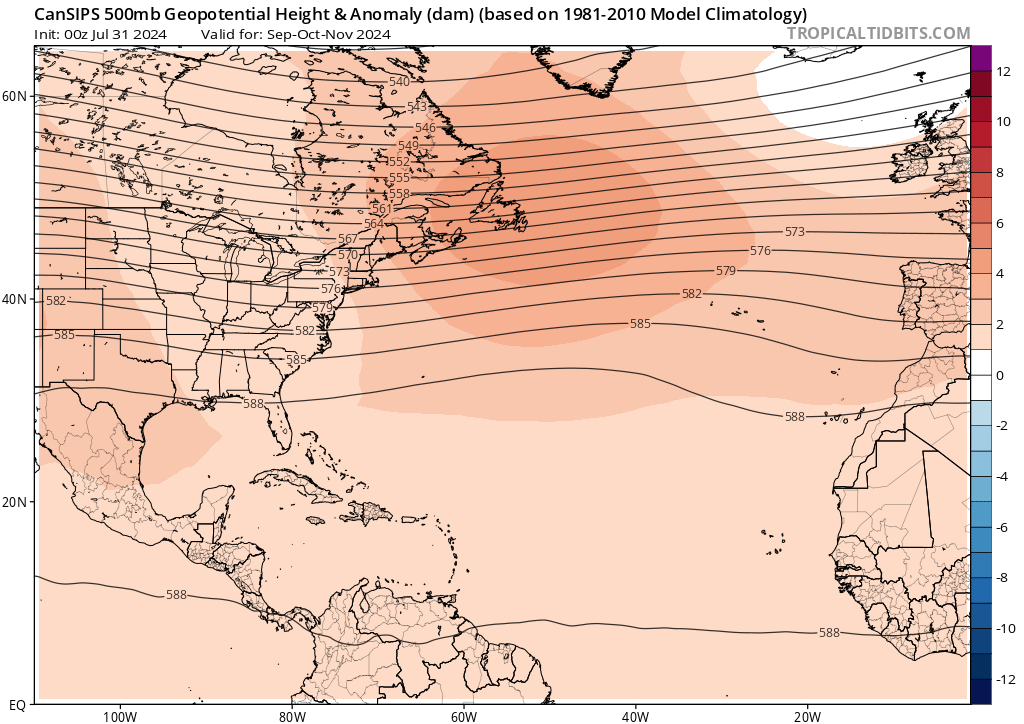
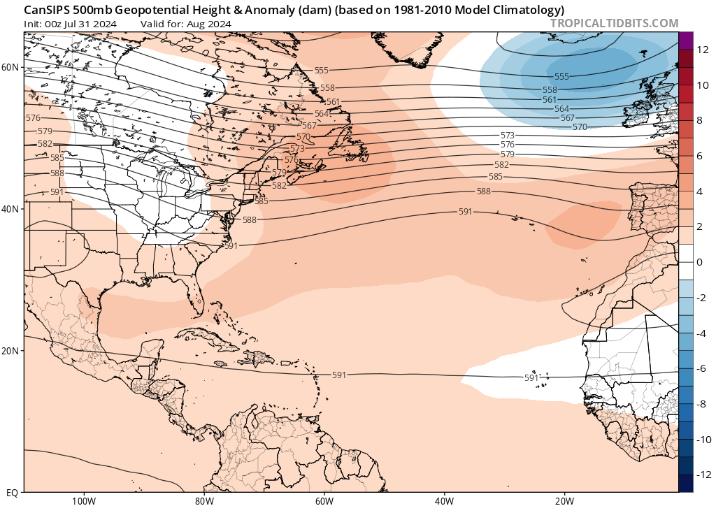
The most recent seasonal forecast calls for well above-average season. We still believe that this forecast will verify, but we are anticipating a brief break after Ernesto that will likely give us normal tropical cyclone activity for the next two weeks.
3 likes   

User avatar
wxman57
Moderator-Pro Met
Moderator-Pro Met
Posts: 22950
Age: 67
Joined: Sat Jun 21, 2003 8:06 pm
Location: Houston, TX (southwest)

Re: Expert Forecasts for the 2024 NATL Hurricane Season: CSU two week forecast up

#286 Postby wxman57 » Tue Aug 20, 2024 2:29 pm

With plenty of dry, sinking air across the deep tropics, it's going to be hard to reach hyperactive numbers. New EC is predicting only an additional 9 named storms with 5 hurricanes. Waves moving off the west coast of Africa can't even hang onto any convection as they cross the tropics. They're moving offshore too far north and sucking in a lot of dry, dusty air. Azores-Bermuda high is weaker than normal. An upper-level trough dominates the U.S. East Coast. Given all that, I'm reducing my numbers to 18/8/4. That's a little above normal, but nowhere near the 23-25 named storms predicted back in June. The environment just isn't very favorable out there. My coworker wanted to go for only 14-15 total named storms. A quieter season is fine with me. I'll enjoy more days off.
2 likes   

MarioProtVI
Category 4
Category 4
Posts: 932
Age: 23
Joined: Sun Sep 29, 2019 7:33 pm
Location: New Jersey

Re: Expert Forecasts for the 2024 NATL Hurricane Season: CSU two week forecast up

#287 Postby MarioProtVI » Tue Aug 20, 2024 2:40 pm

wxman57 wrote:With plenty of dry, sinking air across the deep tropics, it's going to be hard to reach hyperactive numbers. New EC is predicting only an additional 9 named storms with 5 hurricanes. Waves moving off the west coast of Africa can't even hang onto any convection as they cross the tropics. They're moving offshore too far north and sucking in a lot of dry, dusty air. Azores-Bermuda high is weaker than normal. An upper-level trough dominates the U.S. East Coast. Given all that, I'm reducing my numbers to 18/8/4. That's a little above normal, but nowhere near the 23-25 named storms predicted back in June. The environment just isn't very favorable out there. My coworker wanted to go for only 14-15 total named storms. A quieter season is fine with me. I'll enjoy more days off.


Where is this notion the Bermuda high is weaker than normal? I have not seen any evidence to support that, and if anything the latest ensembles show it’s actually stronger with some members being pushed further west. Also, the northern waves is only a temporary thing and the ITCZ is expected to retreat south by month’s end. Additionally it is still very easy to reach hyperactive status, as we are at 55 ACE right now and only need 110 ACE more to do so. This lull will end and the activity will crank up very soon, and the ensembles are showing this. Beryl did not form for nothing and it’s an indicator of things to come. Patience!
5 likes   

User avatar
toad strangler
S2K Supporter
S2K Supporter
Posts: 4543
Joined: Sun Jul 28, 2013 3:09 pm
Location: Earth
Contact:

Re: Expert Forecasts for the 2024 NATL Hurricane Season: CSU two week forecast up

#288 Postby toad strangler » Tue Aug 20, 2024 2:46 pm

MarioProtVI wrote:
wxman57 wrote:With plenty of dry, sinking air across the deep tropics, it's going to be hard to reach hyperactive numbers. New EC is predicting only an additional 9 named storms with 5 hurricanes. Waves moving off the west coast of Africa can't even hang onto any convection as they cross the tropics. They're moving offshore too far north and sucking in a lot of dry, dusty air. Azores-Bermuda high is weaker than normal. An upper-level trough dominates the U.S. East Coast. Given all that, I'm reducing my numbers to 18/8/4. That's a little above normal, but nowhere near the 23-25 named storms predicted back in June. The environment just isn't very favorable out there. My coworker wanted to go for only 14-15 total named storms. A quieter season is fine with me. I'll enjoy more days off.


Where is this notion the Bermuda high is weaker than normal? I have not seen any evidence to support that, and if anything the latest ensembles show it’s actually stronger with some members being pushed further west. Also, the northern waves is only a temporary thing and the ITCZ is expected to retreat south by month’s end. Additionally it is still very easy to reach hyperactive status, as we are at 55 ACE right now and only need 110 ACE more to do so. This lull will end and the activity will crank up very soon, and the ensembles are showing this. Beryl did not form for nothing and it’s an indicator of things to come. Patience!


I think he's harping on storm count. Most know that reaching hyperactive minimum threshold needs the basin to follow just climatological norm going forward. I'm not sold on the Bermuda high placement either. I haven't really read that anywhere else. From the likes of Cowan, CSU, Lowry, etc. But the BH placement isn't going to affect ACE so much in a negative way. If anything, if 57 is correct, ACE could INCREASE with storms staying out in open water for the most part.
Last edited by toad strangler on Tue Aug 20, 2024 2:49 pm, edited 2 times in total.
2 likes   

User avatar
wxman57
Moderator-Pro Met
Moderator-Pro Met
Posts: 22950
Age: 67
Joined: Sat Jun 21, 2003 8:06 pm
Location: Houston, TX (southwest)

Re: Expert Forecasts for the 2024 NATL Hurricane Season: CSU two week forecast up

#289 Postby wxman57 » Tue Aug 20, 2024 2:48 pm

MarioProtVI wrote:
wxman57 wrote:With plenty of dry, sinking air across the deep tropics, it's going to be hard to reach hyperactive numbers. New EC is predicting only an additional 9 named storms with 5 hurricanes. Waves moving off the west coast of Africa can't even hang onto any convection as they cross the tropics. They're moving offshore too far north and sucking in a lot of dry, dusty air. Azores-Bermuda high is weaker than normal. An upper-level trough dominates the U.S. East Coast. Given all that, I'm reducing my numbers to 18/8/4. That's a little above normal, but nowhere near the 23-25 named storms predicted back in June. The environment just isn't very favorable out there. My coworker wanted to go for only 14-15 total named storms. A quieter season is fine with me. I'll enjoy more days off.


Where is this notion the Bermuda high is weaker than normal? I have not seen any evidence to support that, and if anything the latest ensembles show it’s actually stronger with some members being pushed further west. Also, the northern waves is only a temporary thing and the ITCZ is expected to retreat south by month’s end. Additionally it is still very easy to reach hyperactive status, as we are at 55 ACE right now and only need 110 ACE more to do so. This lull will end and the activity will crank up very soon, and the ensembles are showing this. Beryl did not form for nothing and it’s an indicator of things to come. Patience!


The "notion" that the Bermuda High is weaker is because it is centered very close to the Azores at present. Easterly trades south of 20N are much weaker than normal. Low pressure dominates off the East U.S. Coast. Waves are moving off the coast of Africa at much higher latitudes due to the weakened Bermuda High. CanSIPS model is predicting lower than normal pressure across much of the Atlantic from Sept-Nov, with the high centered over the Azores. It's more than a "notion", it's a fact. Now that doesn't mean things can't change, but I'm seeing no signs of a change over the next week or two.

It's only because of Beryl that ACE is above normal. Besides, I'm referring to numbers of storms not ACE.

https://www.tropicaltidbits.com/analysis/models/cansips/2024080100/cansips_mslpaMean_month_atl_2.png
5 likes   

User avatar
toad strangler
S2K Supporter
S2K Supporter
Posts: 4543
Joined: Sun Jul 28, 2013 3:09 pm
Location: Earth
Contact:

Re: Expert Forecasts for the 2024 NATL Hurricane Season: CSU two week forecast up

#290 Postby toad strangler » Tue Aug 20, 2024 2:52 pm

wxman57 wrote:
MarioProtVI wrote:
wxman57 wrote:With plenty of dry, sinking air across the deep tropics, it's going to be hard to reach hyperactive numbers. New EC is predicting only an additional 9 named storms with 5 hurricanes. Waves moving off the west coast of Africa can't even hang onto any convection as they cross the tropics. They're moving offshore too far north and sucking in a lot of dry, dusty air. Azores-Bermuda high is weaker than normal. An upper-level trough dominates the U.S. East Coast. Given all that, I'm reducing my numbers to 18/8/4. That's a little above normal, but nowhere near the 23-25 named storms predicted back in June. The environment just isn't very favorable out there. My coworker wanted to go for only 14-15 total named storms. A quieter season is fine with me. I'll enjoy more days off.


Where is this notion the Bermuda high is weaker than normal? I have not seen any evidence to support that, and if anything the latest ensembles show it’s actually stronger with some members being pushed further west. Also, the northern waves is only a temporary thing and the ITCZ is expected to retreat south by month’s end. Additionally it is still very easy to reach hyperactive status, as we are at 55 ACE right now and only need 110 ACE more to do so. This lull will end and the activity will crank up very soon, and the ensembles are showing this. Beryl did not form for nothing and it’s an indicator of things to come. Patience!


The "notion" that the Bermuda High is weaker is because it is centered very close to the Azores at present. Easterly trades south of 20N are much weaker than normal. Low pressure dominates off the East U.S. Coast. Waves are moving off the coast of Africa at much higher latitudes due to the weakened Bermuda High. CanSIPS model is predicting lower than normal pressure across much of the Atlantic from Sept-Nov, with the high centered over the Azores. It's more than a "notion", it's a fact. Now that doesn't mean things can't change, but I'm seeing no signs of a change over the next week or two.

It's only because of Beryl that ACE is above normal. Besides, I'm referring to numbers of storms not ACE.

https://www.tropicaltidbits.com/analysis/models/cansips/2024070100/cansips_mslpaMean_month_atl_3.png


Actually, without Beryl ACE would still be higher than normal to date. But not by the huge margin like it is now. Can't randomly take a storm away though :D
8 likes   

User avatar
weeniepatrol
Category 5
Category 5
Posts: 1252
Joined: Sat Aug 22, 2020 5:30 pm
Location: WA State

Re: Expert Forecasts for the 2024 NATL Hurricane Season: CSU two week forecast up

#291 Postby weeniepatrol » Tue Aug 20, 2024 3:10 pm

I'm aware different sites have slightly different estimates, but per CSU at https://tropical.atmos.colostate.edu/Re ... thatlantic

Beryl produced 35.1 units of ACE, we are currently at 55.1 units and climo is 18.9. So, even if we subtracted Beryl we still have 20 units which is literally higher than climatology.
3 likes   

User avatar
weeniepatrol
Category 5
Category 5
Posts: 1252
Joined: Sat Aug 22, 2020 5:30 pm
Location: WA State

Re: Expert Forecasts for the 2024 NATL Hurricane Season: CSU two week forecast up

#292 Postby weeniepatrol » Tue Aug 20, 2024 3:14 pm

wxman57 wrote:
MarioProtVI wrote:
wxman57 wrote:With plenty of dry, sinking air across the deep tropics, it's going to be hard to reach hyperactive numbers. New EC is predicting only an additional 9 named storms with 5 hurricanes. Waves moving off the west coast of Africa can't even hang onto any convection as they cross the tropics. They're moving offshore too far north and sucking in a lot of dry, dusty air. Azores-Bermuda high is weaker than normal. An upper-level trough dominates the U.S. East Coast. Given all that, I'm reducing my numbers to 18/8/4. That's a little above normal, but nowhere near the 23-25 named storms predicted back in June. The environment just isn't very favorable out there. My coworker wanted to go for only 14-15 total named storms. A quieter season is fine with me. I'll enjoy more days off.


Where is this notion the Bermuda high is weaker than normal? I have not seen any evidence to support that, and if anything the latest ensembles show it’s actually stronger with some members being pushed further west. Also, the northern waves is only a temporary thing and the ITCZ is expected to retreat south by month’s end. Additionally it is still very easy to reach hyperactive status, as we are at 55 ACE right now and only need 110 ACE more to do so. This lull will end and the activity will crank up very soon, and the ensembles are showing this. Beryl did not form for nothing and it’s an indicator of things to come. Patience!


The "notion" that the Bermuda High is weaker is because it is centered very close to the Azores at present. Easterly trades south of 20N are much weaker than normal. Low pressure dominates off the East U.S. Coast. Waves are moving off the coast of Africa at much higher latitudes due to the weakened Bermuda High. CanSIPS model is predicting lower than normal pressure across much of the Atlantic from Sept-Nov, with the high centered over the Azores. It's more than a "notion", it's a fact. Now that doesn't mean things can't change, but I'm seeing no signs of a change over the next week or two.

It's only because of Beryl that ACE is above normal. Besides, I'm referring to numbers of storms not ACE.

https://www.tropicaltidbits.com/analysis/models/cansips/2024080100/cansips_mslpaMean_month_atl_2.png


Have you seen the westerly anomalies in the MDR? This month has been outrageous.

Image

here's 2010, same scale, for comparison.

Image

Luis or tolakram, can you move my post to the Indicators thread, please? I tried to delete when I noticed this was the wrong thread. My bad.
Last edited by weeniepatrol on Tue Aug 20, 2024 3:18 pm, edited 1 time in total.
1 likes   

User avatar
Teban54
Category 5
Category 5
Posts: 3168
Joined: Sat May 19, 2018 1:19 pm

Re: Expert Forecasts for the 2024 NATL Hurricane Season: CSU two week forecast up

#293 Postby Teban54 » Tue Aug 20, 2024 3:17 pm

wxman57 wrote:CanSIPS model is predicting lower than normal pressure across much of the Atlantic from Sept-Nov, with the high centered over the Azores.

The 7/31 CanSIPS run output that I get from Tropical Tidbits show above-average 500mb geopotential height across the entire Atlantic for Sep-Oct-Nov, with a local maximum over Newfoundland. Is that not the right product to look at?

Image

This 7/31 run also predicted above-average 500mb heights in August:

Image
0 likes   

User avatar
CyclonicFury
Category 5
Category 5
Posts: 2018
Age: 26
Joined: Sun Jul 02, 2017 12:32 pm
Location: NC
Contact:

Re: Expert Forecasts for the 2024 NATL Hurricane Season: CSU two week forecast up

#294 Postby CyclonicFury » Tue Aug 20, 2024 3:22 pm

So far, the Atlantic has only been "unfavorable" due to a very strong and north displaced African Monsoon. With the climatological weakening and southward retreat of the African monsoon trough, this should not be much of an issue come the very end of August through the end of CV season.

I think some perspective is needed as well, we've already seen two hurricanes in August, one of which developed as a TS in the MDR. On average, August sees only 3-4 storms develop; even in 2005 and 2020 only 4 NS formed during August. Historically, strong hurricanes in the MDR during August are rarer than many think: only 6 have formed in the last 45 years! Every year, there always seems to be this misconception that the MDR is supposed to produce strong hurricanes constantly when August arrives when that's not how it works, and when it doesn't happen, the same conversations always come up. Something is off, the MDR is too dry, the MDR is too stable...etc. When you look at the actual data, the MDR has been anomalously favorable aside from strong easterly shear due to the ripping AEJ. We have seen many TCs that affect the western basin form in the MDR, but often don't get going until later. Most of the TCs that actually become strong in the MDR recurve before the Lesser Antilles, or less commonly, recurve near the Lesser Antilles. Storms like Irma and Ike that become strong way out in the MDR and threaten the CONUS are not very common.
8 likes   
NCSU B.S. in Meteorology Class of 2021. Tropical weather blogger at http://www.cyclonicfury.com. My forecasts and thoughts are NOT official, for official forecasts please consult the National Hurricane Center.

User avatar
Teban54
Category 5
Category 5
Posts: 3168
Joined: Sat May 19, 2018 1:19 pm

Re: Expert Forecasts for the 2024 NATL Hurricane Season: CSU two week forecast up

#295 Postby Teban54 » Tue Aug 20, 2024 3:44 pm

Teban54 wrote:
wxman57 wrote:CanSIPS model is predicting lower than normal pressure across much of the Atlantic from Sept-Nov, with the high centered over the Azores.

The 7/31 CanSIPS run output that I get from Tropical Tidbits show above-average 500mb geopotential height across the entire Atlantic for Sep-Oct-Nov, with a local maximum over Newfoundland. Is that not the right product to look at?

https://i.postimg.cc/tgmHWWCp/image.png

This 7/31 run also predicted above-average 500mb heights in August:

https://i.postimg.cc/QtWv7zyJ/image.png

So I admit I'm not very knowledgeable about the various indicators, but since I've seen people discussing the strength of Bermuda highs with 500mb geopotential height plots, I went ahead and generated the plots for 2024.

This doesn't look like August 1-18 has been weaker than average to me...? And the weakness can probably be explained by Ernesto.

Image

For reference, here's the same period in 2010:

Image
0 likes   

User avatar
Teban54
Category 5
Category 5
Posts: 3168
Joined: Sat May 19, 2018 1:19 pm

Re: Expert Forecasts for the 2024 NATL Hurricane Season: CSU two week forecast up

#296 Postby Teban54 » Wed Aug 28, 2024 6:15 pm

NOAA update today on Atlantic Nina:

https://www.climate.gov/news-features/e ... antic-nina

Emphasis mine:
The localized cooling that dominated the Atlantic Niña/Niño region in June-July appears to be weakening.

The Atlantic hurricane season is still expected to be above average.

That musing is based on the fact that a 2023 study found that the presence of Atlantic Niños (the warm phase of the pattern) increases the number of Cape Verde hurricanes. Perhaps an Atlantic Niña would have the opposite influence. But even if an Atlantic Niña were to briefly dampen activity, there remain many other factors pushing the basin toward high levels of activity. And even within an active season, there can be periodic lulls in activity. That’s the difference between climate and weather.


It does take a lot of courage to stick to their guns given recent discussions, and I'm not entirely sure how much the authors of this article specialize in hurricane season forecasts.
3 likes   

User avatar
weeniepatrol
Category 5
Category 5
Posts: 1252
Joined: Sat Aug 22, 2020 5:30 pm
Location: WA State

Re: Expert Forecasts for the 2024 NATL Hurricane Season: CSU two week forecast up

#297 Postby weeniepatrol » Wed Aug 28, 2024 7:12 pm

Teban54 wrote:NOAA update today on Atlantic Nina:

https://www.climate.gov/news-features/e ... antic-nina

Emphasis mine:
The localized cooling that dominated the Atlantic Niña/Niño region in June-July appears to be weakening.

The Atlantic hurricane season is still expected to be above average.

That musing is based on the fact that a 2023 study found that the presence of Atlantic Niños (the warm phase of the pattern) increases the number of Cape Verde hurricanes. Perhaps an Atlantic Niña would have the opposite influence. But even if an Atlantic Niña were to briefly dampen activity, there remain many other factors pushing the basin toward high levels of activity. And even within an active season, there can be periodic lulls in activity. That’s the difference between climate and weather.


It does take a lot of courage to stick to their guns given recent discussions, and I'm not entirely sure how much the authors of this article specialize in hurricane season forecasts.


Finally. Unfortunate that an emergency post was necessary, but, it was.

we are squeezing in a quick extra post because there has been a lot of interest in the event, as well as a bit of…let’s call it over-interpretation…in some corners of the internet (as well as the Climate.gov webmail inbox) that we want to tamp down if possible.


If you are aware of the disinformation space, this has been misquoted and misrepresented repeatedly. Here is an example:

 https://twitter.com/Rothmus/status/1826382394514903045


Last edited by weeniepatrol on Wed Aug 28, 2024 9:51 pm, edited 2 times in total.
8 likes   

User avatar
abajan
S2K Supporter
S2K Supporter
Posts: 4229
Joined: Sun Sep 07, 2003 5:10 am
Location: Barbados

Re: Expert Forecasts for the 2024 NATL Hurricane Season: CSU next two week forecast on September 3

#298 Postby abajan » Tue Sep 03, 2024 3:29 am

Well, that last CSU forecast (for August 20 to September 2) didn't exactly pan out eh. Should be interesting to see what they predict for the next fortnight, within which the statistical peak of the hurricane season falls.
1 likes   

User avatar
cycloneye
Admin
Admin
Posts: 143858
Age: 68
Joined: Thu Oct 10, 2002 10:54 am
Location: San Juan, Puerto Rico

Re: Expert Forecasts for the 2024 NATL Hurricane Season: CSU next two week forecast today

#299 Postby cycloneye » Tue Sep 03, 2024 7:20 am

1 likes   
Visit the Caribbean-Central America Weather Thread where you can find at first post web cams,radars
and observations from Caribbean basin members Click Here

DunedinDave
Tropical Storm
Tropical Storm
Posts: 217
Joined: Fri Aug 25, 2023 10:31 am

Re: Expert Forecasts for the 2024 NATL Hurricane Season: CSU next two week forecast today

#300 Postby DunedinDave » Tue Sep 03, 2024 7:43 am

I expect them to come way down on their predictions. We are at peak week and all is pretty quiet. Just a couple of yellow x’s and that’s it. Many years at this time there are storms popping up all over the place.
0 likes   


Return to “Talkin' Tropics”

Who is online

Users browsing this forum: Stormybajan and 93 guests