MEANINGLESS_NUMBERS wrote:I think 3-4 more days before we get a firm idea of thing thing. That’s when the models showing genesis start to show it.
Thats my play. If I dont see anything consistent by labor day, its a dud in my book
Moderator: S2k Moderators


MEANINGLESS_NUMBERS wrote:I think 3-4 more days before we get a firm idea of thing thing. That’s when the models showing genesis start to show it.
MetroMike wrote:This IS season peak right now and some people on this board are expecting a trackable system and right now the basin should be ideal for development MJO or not.
This is sad to see areas of interest all strung out given the high expectations and the supposed peak right now.
Some areas of the Gulf coast need more rain and tropical systems are sometimes needed to fill basins etc. Does not always mean death and destruction from a T.S. or low end hurricane.


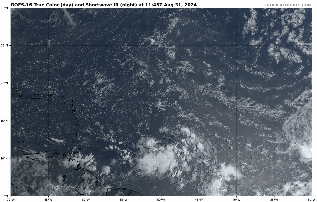
Ubuntwo wrote:The wave has been steadily organizing following sunrise. Convection slid north/east like Teban mentioned earlier. It's a bit elongated, but the mid and low level centers are closer than they've ever been. I believe convective organization was not accurately captured on the 12z GFS - while the 12z Euro is pretty accurate.


TomballEd wrote:I know EPS false alarmed a system earlier this season, but it seems to have caught the storms that have developed earlier than the GEFS. This may be a big nothingburger, but writing it off because the GFS and its ensembles aren't super enthusiastic (although about a third are pretty enthusiastic) when the EPS are enthusiastic may be a mistake. I'm counting 6 of 31 GEFS members with significant lows in the Gulf, and a couple of more with weaker systems at Day 10. Not even the GFS ensembles are signaling Gulf cancel.
chaser1 wrote:Ubuntwo wrote:The wave has been steadily organizing following sunrise. Convection slid north/east like Teban mentioned earlier. It's a bit elongated, but the mid and low level centers are closer than they've ever been. I believe convective organization was not accurately captured on the 12z GFS - while the 12z Euro is pretty accurate.
FWIW, NHC lowered the 8:00am 0/50% to 0/40% at 2:00pm. I'll be the first to say that this does not mean all too much but the point is that this conveys less confidence of near to mid term improvement of conditions. And onward we go

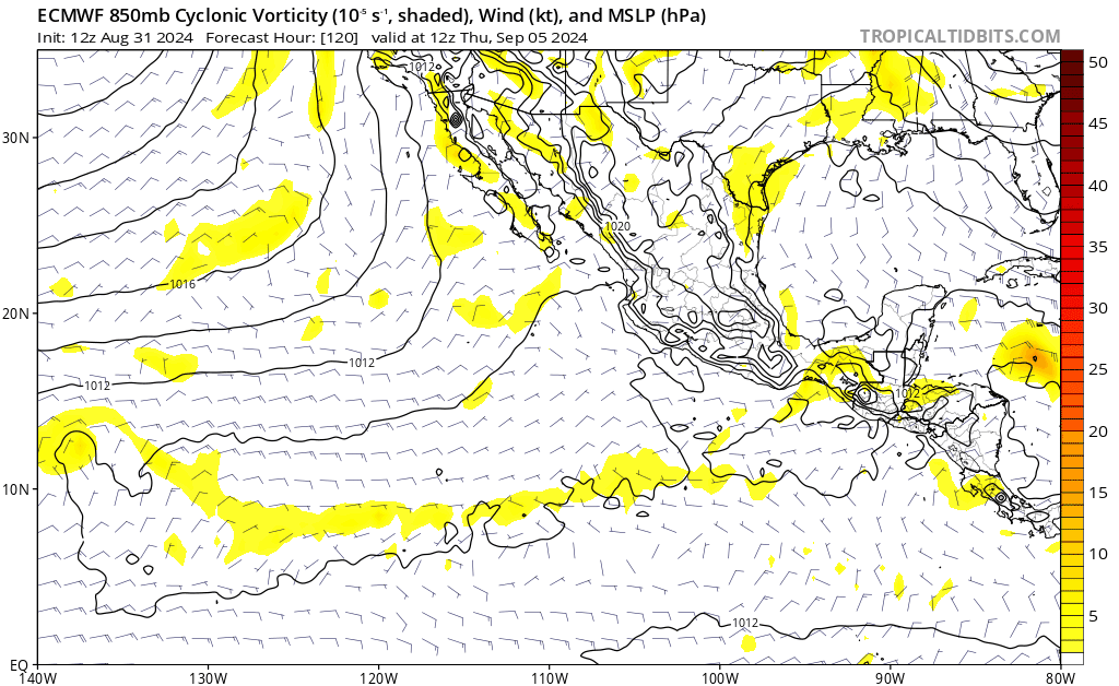
aspen wrote:Huge downtick in the operational 12z models today. Euro throws the wave right into The Shredder before it can ever established a concentrated vort.
Stratton23 wrote:The EPS still has numerous members showing a powerful system affecting the gulf coast, we got a long ways to go with this one folks, Mexico- florida is in play for something, or also just a weak system

aspen wrote:Huge downtick in the operational 12z models today. Euro throws the wave right into The Shredder before it can ever established a concentrated vort.


Users browsing this forum: gib and 207 guests


