Emmett_Brown wrote:18Z GEFS ensemble shows a definite uptick from 12Z, clustering in the NW Car at 162 hours, roughly similar to the 18Z op run
Can you post an image?
Moderator: S2k Moderators


Emmett_Brown wrote:18Z GEFS ensemble shows a definite uptick from 12Z, clustering in the NW Car at 162 hours, roughly similar to the 18Z op run

chaser1 wrote:Steve wrote:wzrgirl1 wrote:Can someone tell me the difference between ensembles and operational models in a sentence or two please. I have been on S2k for 20 years and there is still so much to learn IMO.
Super basic is that Ensembles are x number of runs with slightly different tweaks to account for atmospheric differences.
https://www.weather.gov/about/models
In more simplistic terms, picture a baseball team. The "team" itself would be the "operational model", verses each of the individual players would represent the ensemble members. On any baseball team, some batters might tend to hit farther, or hit more to the right... or left. Some are stronger while others are less so. Each baseball player is unique and each ensemble member as well (with some that apply higher/lower degree of track or strength influence). Throw them all into a pot and what is congealed would ultimately be your operational model outcome.
I apologize if that oversimplies or misses the mark as an analogy.

Stratton23 wrote:TomballEd that may be true, but you have to factor in that the 12z models incorrecty or did not get the waves active convection correct, now the 18z run is closer to what is actually happening , might not be a strong system, but it also will probably be more consolidated than the 12z runs
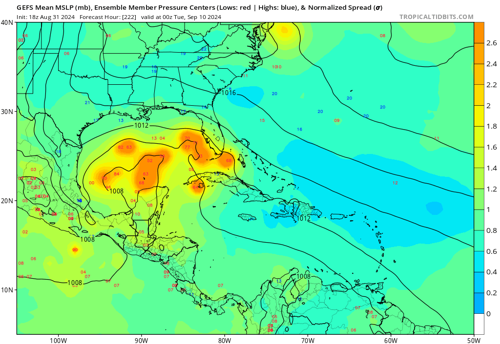
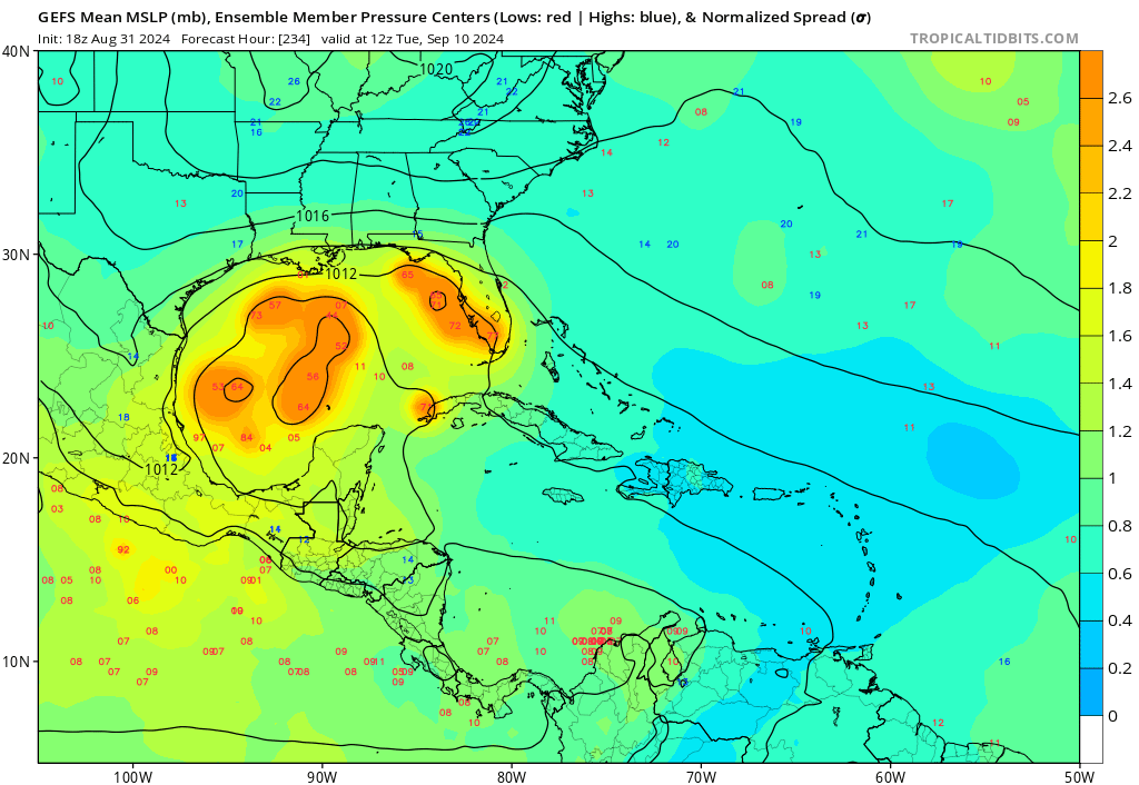
Frank P wrote:A majority of the 18Z GFS ensemble members are west of the operational.
Ivanhater wrote:I bet the 00Z is back to a weak low hitting the Yucatan again
We can watch the system the next couple of days and see if the models have been handling it well or not. If the vorticity becomes more established, the models will latch on
Teban54 wrote:Frank P wrote:A majority of the 18Z GFS ensemble members are west of the operational.
That's a very distinctive change from just about every run prior to this, when GEFS members were usually well east of the operational.


Ivanhater wrote:Eh, operational looks pretty centered amongst the ensembles. The further east ensembles make landfall sooner, then weaken. There were even a couple split off east of Florida. The western solutions look stronger as time goes on as those become dominant https://uploads.tapatalk-cdn.com/20240831/f01367d7bacee9fc38b5807ff5960bbb.jpg
Sent from my motorola razr plus 2023 using Tapatalk


Users browsing this forum: No registered users and 195 guests