One thing I have noticed is that the GFS has the system moving much much slower than the Euro, CMC and ICON models. It practically slows down to a crawl by the time it gets into the Western Caribbean.
Euro, CMC and ICON seem to have it near Belize by September 5th to 6th, Friday. 18z GFS has it near there by September 8th/9th on Sunday/Monday.
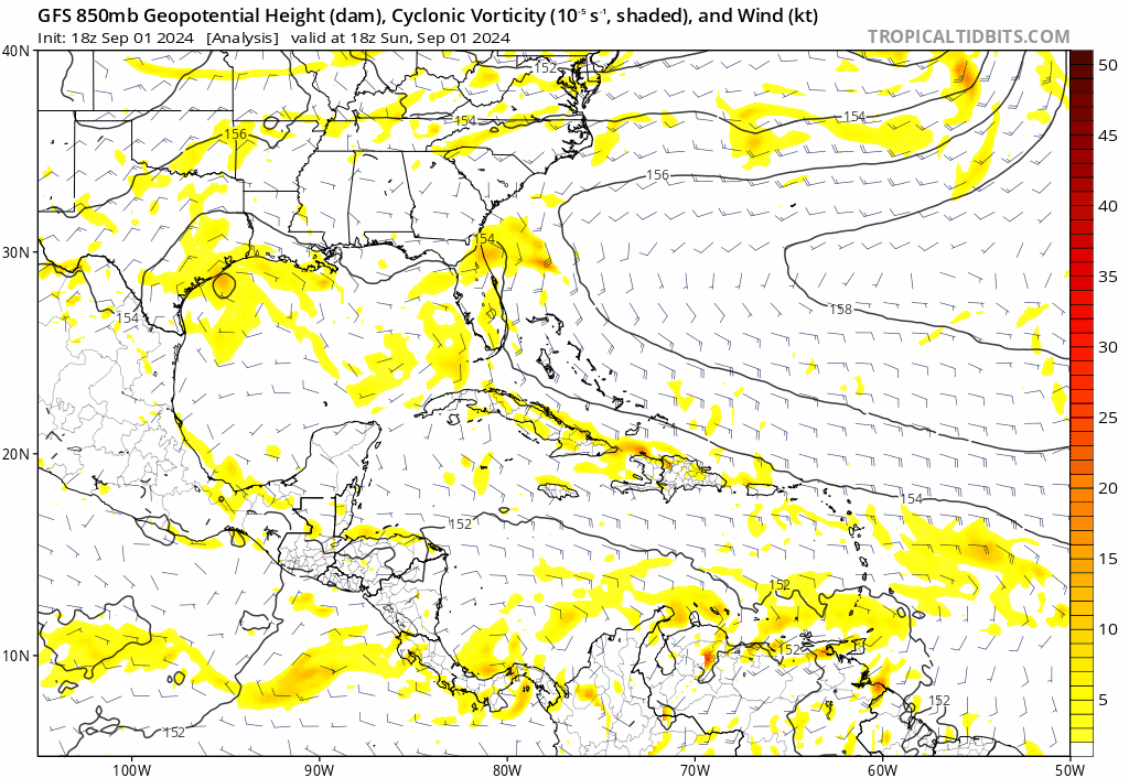
Tropical Wave in Bay of Campeche (Is Invest 91L)
Moderator: S2k Moderators
Forum rules

The posts in this forum are NOT official forecasts and should not be used as such. They are just the opinion of the poster and may or may not be backed by sound meteorological data. They are NOT endorsed by any professional institution or STORM2K. For official information, please refer to products from the National Hurricane Center and National Weather Service.
-
ThunderForce

- Tropical Storm

- Posts: 208
- Age: 26
- Joined: Tue Sep 27, 2022 6:20 pm
- Location: Calhoun County, Florida
Re: Tropical Wave east of Lesser Antilles (10/40)
4 likes
Please refer to the NWS, NHC, SPC or a professional meteorologist for information and decision making during storms.
Re: Tropical Wave east of Lesser Antilles (10/40)
ThunderForce wrote:One thing I have noticed is that the GFS has the system moving much much slower than the Euro, CMC and ICON models. It practically slows down to a crawl by the time it gets into the Western Caribbean.
Euro, CMC and ICON seem to have it near Belize by September 5th to 6th, Friday. 18z GFS has it near there by September 8th/9th on Sunday/Monday.
Considering where the AOI is, that is a long way to go in about 6 days, how fast is it moving?
0 likes
-
Frank P
- S2K Supporter

- Posts: 2779
- Joined: Fri Aug 29, 2003 10:52 am
- Location: Biloxi Beach, Ms
- Contact:
Re: Tropical Wave east of Lesser Antilles (10/40)
18z GFS ensembles are coming back on from life support. I counted about 9 either a ts or hurricane
1 likes
-
ThunderForce
- Tropical Storm
- Posts: 208
- Age: 26
- Joined: Tue Sep 27, 2022 6:20 pm
- Location: Calhoun County, Florida
Re: Tropical Wave east of Lesser Antilles (10/40)
hipshot wrote:ThunderForce wrote:One thing I have noticed is that the GFS has the system moving much much slower than the Euro, CMC and ICON models. It practically slows down to a crawl by the time it gets into the Western Caribbean.
Euro, CMC and ICON seem to have it near Belize by September 5th to 6th, Friday. 18z GFS has it near there by September 8th/9th on Sunday/Monday.
Considering where the AOI is, that is a long way to go in about 6 days, how fast is it moving?
I did a double check and it seems the GFS moves most of the "original" vorticity from this wave into the Nicaragua/Honduras border on about September 5th, but then vorticity roughly to the east/southeast of it seemingly merges with some remnants and slowly starts organizing about a day or two later on September 6th/7th to the east of the Honduras. It then slows to a crawl for about a day or so before making landfall in Belize.
EDIT: Attached a GIF.
0 likes
Please refer to the NWS, NHC, SPC or a professional meteorologist for information and decision making during storms.

Re: Tropical Wave east of Lesser Antilles (10/40)
ThunderForce wrote:hipshot wrote:ThunderForce wrote:One thing I have noticed is that the GFS has the system moving much much slower than the Euro, CMC and ICON models. It practically slows down to a crawl by the time it gets into the Western Caribbean.
Euro, CMC and ICON seem to have it near Belize by September 5th to 6th, Friday. 18z GFS has it near there by September 8th/9th on Sunday/Monday.
Considering where the AOI is, that is a long way to go in about 6 days, how fast is it moving?
I did a double check and it seems the GFS moves most of the "original" vorticity from this wave into the Nicaragua/Honduras border on about September 5th, but then vorticity roughly to the east/southeast of it seemingly merges with some remnants and slowly starts organizing about a day or two later on September 6th/7th to the east of the Honduras. It then slows to a crawl for about a day or so before making landfall in Belize.
https://i.postimg.cc/x1Cccyz3/gfs-z850-vort-watl-fh0-198.gif
EDIT: Attached a GIF.
That "vorticity roughly to the east/southeast" almost exactly aligns with the 500 mb vortmax during these time periods. Thus, the pathway to development is in line with the story from 0z: Low-level vort outruns mid-level and dies, then the mid-level vort works its way down to the surface to form a new LLC. The main difference between 12z/18z and 0z (which still had a NOLA landfall) is track, as 12z/18z take a significantly more southernly track.
The caveat is that other models don't show this. For example, at 6z 9/6, 18z GFS has the mid-level vort south of Jamaica, 12z ECMWF north of Honduras, and 12z CMC inland Yucatan.
1 likes
TC naming lists: retirements and intensity
Most aggressive Advisory #1's in North Atlantic (cr. kevin for starting the list)
Most aggressive Advisory #1's in North Atlantic (cr. kevin for starting the list)
-
Stratton23
- Category 5

- Posts: 3478
- Joined: Fri Jul 21, 2023 10:59 pm
- Location: Katy, Tx
Re: Tropical Wave east of Lesser Antilles (10/40)
00z ICON is just strange, gets a more concentrated vortex near the western caribbean, crosses over into the BOC and even merges with the gulf low that the ICON has, becomes one system in the southern gulf and then kind of just meanders around
1 likes
-
MarioProtVI
- Category 5
- Posts: 1032
- Age: 24
- Joined: Sun Sep 29, 2019 7:33 pm
- Location: New Jersey
Re: Tropical Wave east of Lesser Antilles (10/40)
Stratton23 wrote:00z ICON is just strange, gets a more concentrated vortex near the western caribbean, crosses over into the BOC and even merges with the gulf low that the ICON has, becomes one system in the southern gulf and then kind of just meanders around
Wait till you see the 00z GFS
2 likes
Re: Tropical Wave east of Lesser Antilles (10/40)
I get that nobody is watching now... So what if I present this?
0z GFS continues with the idea of a slow-moving mid-level signature working down to the surface, leading to genesis in WCar. Which, as a reminder, isn't shown on other global models. Nevertheless, this GFS run went even stronger with Belize landfall intensity, now at 987 mb.
The real weenie thing started happening after that. The "main" storm got into BoC this time, and not just a piece of the energy. Then it's stalled just offshore Tamaulipas, Mexico, before blowing up and moving SE. This is all in la-la-land time frames, though.
Obviously very unlikely to happen, but I have to say the GFS is really persistent in the near-term solution. We'll know in 3-4 days. On the other hand, 0z CMC hints at the idea of the wave trying to form in BoC (despite crossing the Yucatan much earlier than GFS), but on this run it's too close to land to properly develop. So a BoC genesis is still very plausible (and even has some support from EPS).
Last edited by Teban54 on Mon Sep 02, 2024 12:34 am, edited 1 time in total.
0 likes
TC naming lists: retirements and intensity
Most aggressive Advisory #1's in North Atlantic (cr. kevin for starting the list)
Most aggressive Advisory #1's in North Atlantic (cr. kevin for starting the list)
-
Stratton23
- Category 5
- Posts: 3478
- Joined: Fri Jul 21, 2023 10:59 pm
- Location: Katy, Tx
Re: Tropical Wave east of Lesser Antilles (10/40)
MarioProVI just saw it, very wonky, but looks like it has more of a weakness to the north instead of like the CMC which just buries it into mexico
0 likes
-
Weathertracker96
- Tropical Storm
- Posts: 150
- Joined: Mon Oct 16, 2023 3:41 pm
Re: Tropical Wave east of Lesser Antilles (10/40)
The Ensembles seem north of the operational GFS.
0 likes
Re: Tropical Wave east of Lesser Antilles (10/40)
2 day down to 0%, 7 day still at 40%. Zone of formation now extended to BoC. I wonder if NHC is discounting the trends of non-GFS operational global models to some extent; either way, they're clearly more bullish than most of us here are.
2. Near the Lesser Antilles and Caribbean Sea:
Disorganized shower and thunderstorm activity continues in
association with a tropical wave located near the Lesser Antilles.
The disturbance is expected to move westward and cross the
eastern Caribbean Sea through Tuesday with little development.
Environmental conditions are forecast to become more conducive for
development while the system moves across the central and western
Caribbean Sea during the middle and latter parts of the week, and a
tropical depression could form during that time. This system could
cause gusty winds and locally heavy rainfall over portions of the
Lesser Antilles today.
* Formation chance through 48 hours...low...near 0 percent.
* Formation chance through 7 days...medium...40 percent.
0 likes
TC naming lists: retirements and intensity
Most aggressive Advisory #1's in North Atlantic (cr. kevin for starting the list)
Most aggressive Advisory #1's in North Atlantic (cr. kevin for starting the list)
-
Stratton23
- Category 5
- Posts: 3478
- Joined: Fri Jul 21, 2023 10:59 pm
- Location: Katy, Tx
Re: Tropical Wave east of Lesser Antilles (10/40)
Teban54 they are probably giving more weight to the ensembles, the eps continues to have support for development in the BOC, but even more for getting pulled northward
0 likes
Re: Tropical Wave east of Lesser Antilles (10/40)
Looks like the area in question is now entering the Caribbean but the shear at the moment is hampering it's development. The way it seems to be trending in the models I could see it becoming a possible tropical cyclone in East Pacific which the GFS in the latest run has it splitting with one in East Pacific and one in the Gulf.

0 likes
-
CFLHurricane

- Category 1

- Posts: 349
- Joined: Thu Mar 27, 2014 5:56 pm
- Location: Floriduh
Re: Tropical Wave east of Lesser Antilles (10/40)
40+ pages on a wave that ultimately goes to the EPac during peak would be the cherry on top of this majestically underperforming hurricane season. ::chefs kiss::
3 likes
I'm not a meteorologist, but I did stay at a motel 8.
-
MEANINGLESS_NUMBERS
- Category 2

- Posts: 503
- Joined: Mon Nov 02, 2020 1:43 pm
Re: Tropical Wave east of Lesser Antilles (10/40)
CFLHurricane wrote:40+ pages on a wave that ultimately goes to the EPac during peak would be the cherry on top of this majestically underperforming hurricane season. ::chefs kiss::
During La Niña as well!
2 likes
Emily '87, Felix '95, Gert '99, Fabian '03, Humberto '19, Paulette '20, Teddy '20, Fiona '22, Lee '23, Ernesto '24, Humberto/Imelda '25
-
Frank P
- S2K Supporter
- Posts: 2779
- Joined: Fri Aug 29, 2003 10:52 am
- Location: Biloxi Beach, Ms
- Contact:
Re: Tropical Wave near the Lesser Antilles (10/40)
It's like the Katrina run but reversed out in the BOC. Crosses MX then the big SE dip in the BOC reminiscence but opposite of the Katrina as it crossed FL then the big SW dip in the SE GOM... and both ended up in SELA and the MS coast.. straight from the Twilight Zone
0 likes
-
Frank P
- S2K Supporter
- Posts: 2779
- Joined: Fri Aug 29, 2003 10:52 am
- Location: Biloxi Beach, Ms
- Contact:
Re: Tropical Wave near the Lesser Antilles (10/40)
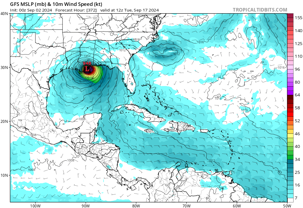
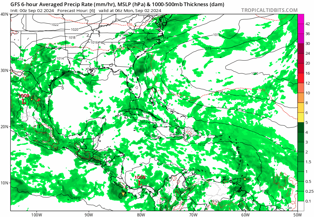
and the 06z GFS run gets buried in Mexico as a Cat 1.

Meanwhile the GFS develops another system off the NW gulf coast of FL then and swings up the east coast brushing Boston and turns NE into the NH and Maine as a hurricane

Meanwhile the GFS develops another system off the NW gulf coast of FL then and swings up the east coast brushing Boston and turns NE into the NH and Maine as a hurricane
Last edited by Frank P on Mon Sep 02, 2024 6:30 am, edited 1 time in total.
0 likes
-
Frank P
- S2K Supporter
- Posts: 2779
- Joined: Fri Aug 29, 2003 10:52 am
- Location: Biloxi Beach, Ms
- Contact:
Re: Tropical Wave near the Lesser Antilles (10/40)
06 GFS run also shows two systems having imitate relations out in the far east Atlantic, mature audiences only. Could see 3 named systems possibly.

3 likes
-
SconnieCane
- Category 5
- Posts: 1013
- Joined: Thu Aug 02, 2018 5:29 pm
- Location: Madison, WI
Re: Tropical Wave near the Lesser Antilles (10/40)
Frank P wrote:and the 06z GFS run gets buried in Mexico as a Cat 1.
https://i.ibb.co/txYTKXH/gfs-mslp-wind-watl-50.png
Meanwhile the GFS develops another system off the NW gulf coast of FL then and swings up the east coast brushing Boston and turns NE into the NH and Maine as a hurricane
https://i.ibb.co/rvW2qnN/gfs-mslp-wind-neus-58.png
That looks like 955mb, which would likely (although pressure/wind relationship isn't constant*, and global model MSLP can never be taken literally) be stronger than Cat. 1.
*Could be high-end Cat. 4 in a tightly wound RI-er like Charley, or high-end Cat. 1/low 2 in a sprawling system with a broad gradient like Ike or Sandy.
0 likes
-
cycloneye

- Admin

- Posts: 149125
- Age: 69
- Joined: Thu Oct 10, 2002 10:54 am
- Location: San Juan, Puerto Rico
Re: Tropical Wave near the Lesser Antilles (0/40)
Near the Lesser Antilles and Caribbean Sea:
A tropical wave is producing disorganized thunderstorms and gusty
winds across portions of the Lesser Antilles, Puerto Rico, and over
the adjacent eastern Caribbean waters. Environmental conditions are
forecast to become more conducive for development when the system
reaches the western Caribbean Sea and southwestern Gulf of Mexico
late this week and over the weekend, and a tropical depression could
form during that time.
* Formation chance through 48 hours...low...near 0 percent.
* Formation chance through 7 days...medium...40 percent.
0 likes
Visit the Caribbean-Central America Weather Thread where you can find at first post web cams,radars
and observations from Caribbean basin members Click Here
and observations from Caribbean basin members Click Here
Who is online
Users browsing this forum: No registered users and 70 guests