Hypercane_Kyle wrote:As the saying goes, it isn't over until the fat lady sings (and this season could certainly pop off a nasty one again before the calendar flips to December) ~ but I'm close to writing this year off.
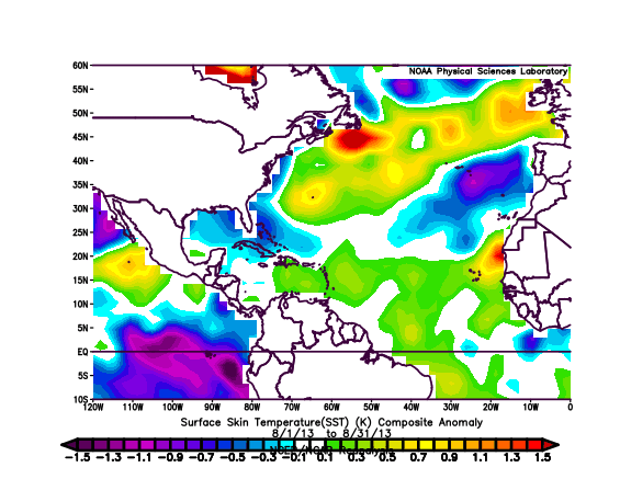
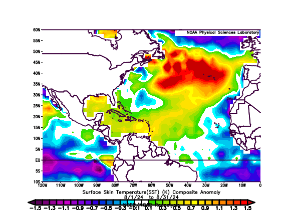
If none of these orange-tagged storms become cyclones, it's the strongest signal possible for a complete season shutdown on par with 2013. It's peak season and there's.. nothing and hasn't been for days. That is weird in El Nino years, but in neutral-ENSO/La Nina years it's especially unusual.
Wild that Beryl could be our most significant storm of the year, and that was in June/July.
There’s a real chance this season could fall below 2013 in NS total, making it the biggest bust relative to seasonal forecasts. I wouldn’t exclude the possibility of zero storms in September.