2024 Indicators: SST's, MSLP, Shear, SAL, Steering, Instability (Day 16+ Climate Models)

This is the general tropical discussion area. Anyone can take their shot at predicting a storms path.

Moderator: S2k Moderators

Forum rules

The posts in this forum are NOT official forecasts and should not be used as such. They are just the opinion of the poster and may or may not be backed by sound meteorological data. They are NOT endorsed by any professional institution or STORM2K. For official information, please refer to products from the National Hurricane Center and National Weather Service.

Help Support Storm2K
Message
Author
WeatherBoy2000
Category 1
Category 1
Posts: 280
Joined: Mon Apr 10, 2023 9:29 am

Re: 2024 Indicators: SST's, MSLP, Shear, SAL, Steering, Instability (Day 16+ Climate Models)

#2381 Postby WeatherBoy2000 » Tue Sep 03, 2024 4:41 pm

WiscoWx02 wrote:
WeatherBoy2000 wrote:
Weathertracker96 wrote:I know it’s September but does anyone realistically see anything else forming for the rest of the season or are we done?
With the models barely showing anything & these months are flying by, could the season be done already?


There will very likely be more storms whether they amount to anything is another question. The season could flip back on at any moment to produce some powerful storms during the next couple months, complete suppression like 2013 is very rare.

A season that comes to mind for me is 2016. 2016 started with a strong el nino but transitioned to cool neutral/weak la nina during the peak, similar to this year. 2016 was also another season that struggled during the peak, September saw no hurricanes develop until Matthew at the very end. 2016's most notable, intense, and highest ace producing storms happened during October-November (Matthew, Nicole, and Otto). It isn't over until it's over.


I would not be surprised if Ernesto was the last storm of the year. I would expect one or two more storms but that’s about it. Maybe one more hurricane but overall the season is basically over at this point imo, that much is clear. We are in unprecedented times of quiet, no reason to believe that’ll change the rest of the month at this rate. Not to mention October is always a major wildcard and usually November is pretty quiet. With how unfavorable the Atlantic is this year…I wouldn’t expect much through the end


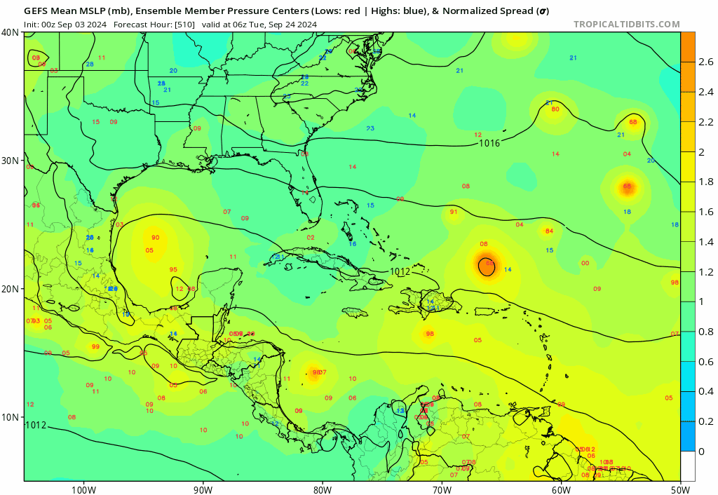
Models do indicate the Atlantic becoming more favorable during the second half of the month.
0 likes   

User avatar
Hammy
Category 5
Category 5
Posts: 5849
Age: 41
Joined: Fri May 25, 2012 5:25 pm
Contact:

Re: 2024 Indicators: SST's, MSLP, Shear, SAL, Steering, Instability (Day 16+ Climate Models)

#2382 Postby Hammy » Tue Sep 03, 2024 4:42 pm

WiscoWx02 wrote:
WeatherBoy2000 wrote:
Weathertracker96 wrote:I know it’s September but does anyone realistically see anything else forming for the rest of the season or are we done?
With the models barely showing anything & these months are flying by, could the season be done already?


There will very likely be more storms whether they amount to anything is another question. The season could flip back on at any moment to produce some powerful storms during the next couple months, complete suppression like 2013 is very rare.

A season that comes to mind for me is 2016. 2016 started with a strong el nino but transitioned to cool neutral/weak la nina during the peak, similar to this year. 2016 was also another season that struggled during the peak, September saw no hurricanes develop until Matthew at the very end. 2016's most notable, intense, and highest ace producing storms happened during October-November (Matthew, Nicole, and Otto). It isn't over until it's over.


I would not be surprised if Ernesto was the last storm of the year. I would expect one or two more storms but that’s about it. Maybe one more hurricane but overall the season is basically over at this point imo, that much is clear. We are in unprecedented times of quiet, no reason to believe that’ll change the rest of the month at this rate. Not to mention October is always a major wildcard and usually November is pretty quiet. With how unfavorable the Atlantic is this year…I wouldn’t expect much through the end


This is not a year to rely on "always" or "usually" in any sense, in any direction. June always features weaker storms (this year it produced a storm that eventually became a Cat 5),
the peak always has activity (this year it doesn't.)

The back half of the season is no more likely to follow normal or usual than the front half did.
4 likes   
The above post is not official and should not be used as such. It is the opinion of the poster and may or may not be backed by sound meteorological data. It is not endorsed by any professional institution or storm2k.org. For official information, please refer to the NHC and NWS products.

User avatar
cheezyWXguy
Category 5
Category 5
Posts: 6091
Joined: Mon Feb 13, 2006 12:29 am
Location: Dallas, TX

Re: 2024 Indicators: SST's, MSLP, Shear, SAL, Steering, Instability (Day 16+ Climate Models)

#2383 Postby cheezyWXguy » Tue Sep 03, 2024 4:50 pm

I know water temps and oceanic heat content are just one piece of the puzzle, but it’s hard to believe this amount of fuel could go untapped the entire season. Even if the rest of the season were to remain generally unfavorable, there will inevitably be windows of favorability and if even a brief one coincides with the passage of a wave or some kind of impetus, a storm is bound to take shape. The high numbers originally forecast look pretty unachievable at this point, but a dormant rest of the season seems equally unachievable imo.
6 likes   

User avatar
Teban54
Category 5
Category 5
Posts: 3168
Joined: Sat May 19, 2018 1:19 pm

Re: 2024 Indicators: SST's, MSLP, Shear, SAL, Steering, Instability (Day 16+ Climate Models)

#2384 Postby Teban54 » Tue Sep 03, 2024 5:16 pm

cheezyWXguy wrote:I know water temps and oceanic heat content are just one piece of the puzzle, but it’s hard to believe this amount of fuel could go untapped the entire season. Even if the rest of the season were to remain generally unfavorable, there will inevitably be windows of favorability and if even a brief one coincides with the passage of a wave or some kind of impetus, a storm is bound to take shape. The high numbers originally forecast look pretty unachievable at this point, but a dormant rest of the season seems equally unachievable imo.

That actually reminded me... We often use 2013 as an example of a complete shutdown in the Atlantic, but in the same year, the WPac also had a relatively slow start of the season (by WPac standards of course). Then quality really picked up in October and November, culminating in one of the most legendary storms ever, Haiyan.

Obviously the situation isn't exactly the same, as WPac is climatologically much more favorable in November than the Atlantic is. But it's definitely a possibility.
0 likes   

User avatar
Hammy
Category 5
Category 5
Posts: 5849
Age: 41
Joined: Fri May 25, 2012 5:25 pm
Contact:

Re: 2024 Indicators: SST's, MSLP, Shear, SAL, Steering, Instability (Day 16+ Climate Models)

#2385 Postby Hammy » Tue Sep 03, 2024 5:47 pm

Teban54 wrote:
cheezyWXguy wrote:I know water temps and oceanic heat content are just one piece of the puzzle, but it’s hard to believe this amount of fuel could go untapped the entire season. Even if the rest of the season were to remain generally unfavorable, there will inevitably be windows of favorability and if even a brief one coincides with the passage of a wave or some kind of impetus, a storm is bound to take shape. The high numbers originally forecast look pretty unachievable at this point, but a dormant rest of the season seems equally unachievable imo.

That actually reminded me... We often use 2013 as an example of a complete shutdown in the Atlantic, but in the same year, the WPac also had a relatively slow start of the season (by WPac standards of course). Then quality really picked up in October and November, culminating in one of the most legendary storms ever, Haiyan.

Obviously the situation isn't exactly the same, as WPac is climatologically much more favorable in November than the Atlantic is. But it's definitely a possibility.


Another thing to think of is 1994--only two short-lived tropical storms (and none of those had formed by now) and then we had two hurricanes (one close to Cat 3) in November. Coincidentally, no named storms were tracked that year between Aug 23 and Sep 8--not to say this year will be as inactive as 1994 from here on, but it's an example of how an abnormally distributed season can easily play out, one hurricane in August and two in November and none in between, but it still had two thirds of them in the back third of the season.
1 likes   
The above post is not official and should not be used as such. It is the opinion of the poster and may or may not be backed by sound meteorological data. It is not endorsed by any professional institution or storm2k.org. For official information, please refer to the NHC and NWS products.

LarryWx
Category 5
Category 5
Posts: 6246
Joined: Sun Sep 07, 2003 2:04 pm
Location: GA

Re: 2024 Indicators: SST's, MSLP, Shear, SAL, Steering, Instability (Day 16+ Climate Models)

#2386 Postby LarryWx » Tue Sep 03, 2024 6:32 pm

Weathertracker96 wrote:I know it’s September but does anyone realistically see anything else forming for the rest of the season or are we done?
With the models barely showing anything & these months are flying by, could the season be done already?


Today’s Euro Weeklies added a new week, Sep 30-Oct 6, and that week is quite active vs climo. In addition the week before is also progged to be active as has been the case on many runs.

So this run suggests that activity will pick up markedly next week though would still be below avg. After a similar subsequent week, activity is suggested to pick up substantially in late Sep and continue into early Oct vs climo:

9/3/24 Euro Weeklies (EW) mean ACE projections as % of climo:
9/2-8: 20% per yest.’s run (meaning ACE of 3)
9/9-15: 60% (meaning ACE of 10)(climo peak week)
9/16-22: 70% (meaning ACE of 11)
9/23-29: 130% (meaning ACE of 17)(vs peak wk climo of 16)
9/30-10/6: 140% (new week)(meaning ACE of 13)


So, today’s EW progs by week are 3-10-11-17-13 meaning two most active weeks are at the end despite climo having dropped off substantially from peak by then. That would get 2024 to ~110 ACE as of Oct 6. So, I wouldn’t put your hurricane supplies up anytime soon. Didn’t @iceresistance suggest something like this might occur?
4 likes   
Personal Forecast Disclaimer:
The posts in this forum are NOT official forecasts and should not be used as such. They are just the opinion of the poster and may or may not be backed by sound meteorological data. They are NOT endorsed by any professional institution or storm2k.org. For official information, please refer to the NHC and NWS products.

User avatar
Spacecoast
Category 2
Category 2
Posts: 758
Joined: Thu Aug 31, 2017 2:03 pm

Re: 2024 Indicators: SST's, MSLP, Shear, SAL, Steering, Instability (Day 16+ Climate Models)

#2387 Postby Spacecoast » Tue Sep 03, 2024 6:56 pm

LarryWx wrote:
Weathertracker96 wrote:I know it’s September but does anyone realistically see anything else forming for the rest of the season or are we done?
With the models barely showing anything & these months are flying by, could the season be done already?


Today’s Euro Weeklies added a new week, Sep 30-Oct 6, and that week is quite active vs climo. In addition the week before is also progged to be active as has been the case on many runs.

So this run suggests that activity will pick up markedly next week though would still be below avg. After a similar subsequent week, activity is suggested to pick up substantially in late Sep and continue into early Oct vs climo:

9/3/24 Euro Weeklies (EW) mean ACE projections as % of climo:
9/2-8: 20% per yest.’s run (meaning ACE of 3)
9/9-15: 60% (meaning ACE of 10)(climo peak week)
9/16-22: 70% (meaning ACE of 11)
9/23-29: 130% (meaning ACE of 17)(vs peak wk climo of 16)
9/30-10/6: 140% (new week)(meaning ACE of 13)


So, today’s EW progs by week are 3-10-11-17-13 meaning two most active weeks are at the end despite climo having dropped off substantially from peak by then. So, I wouldn’t put your hurricane supplies up anytime soon. Didn’t @iceresistance suggest something like this might occur?


Next two weeks ACE of 13 is ~ in line with CSU's forecast. 18z GFS is forecasting a strong phantom, hurricane in central Atlantic, which may easily generate this amount of energy.

Interestingly, weeks 3-4 show an average storm frequency, with the noted above average ACE, inferring stronger than usual systems. Week 3-4 forecast charts show several recurves during this timeframe.
1 likes   

LarryWx
Category 5
Category 5
Posts: 6246
Joined: Sun Sep 07, 2003 2:04 pm
Location: GA

Re: 2024 Indicators: SST's, MSLP, Shear, SAL, Steering, Instability (Day 16+ Climate Models)

#2388 Postby LarryWx » Tue Sep 03, 2024 8:01 pm

The Euro Weeklies’ ACE climo base is 2004-2023 (running 20 year). What I discovered is interesting for 2004-23 vs 1991-2020 climo for ACE for individual weeks:

- 8/26-9/1: decreased ~1/8

- 9/2-9/8: little change (tiny increase)

- 9/9-15: little change/still peak week

- 9/16-9/22: increased ~1/7; now as active as 9/2-8; old climo was 1/10 less active than 9/2-8

- 9/23-29: increased 28%; slightly more active than 8/26-9/1; used to be just over 1/4 less active than 8/26-9/1

- 9/30-10/6: increased 1/4

So, peak day for ACE appears to be ~2 days later. With a drop in late Aug and a rise last half of Sept through early Oct, the season is significantly more backloaded ACEwise 2004-23 vs 1991-2020. Total seasonal ACE is 131 vs 122.
3 likes   
Personal Forecast Disclaimer:
The posts in this forum are NOT official forecasts and should not be used as such. They are just the opinion of the poster and may or may not be backed by sound meteorological data. They are NOT endorsed by any professional institution or storm2k.org. For official information, please refer to the NHC and NWS products.

User avatar
SFLcane
S2K Supporter
S2K Supporter
Posts: 10162
Age: 47
Joined: Sat Jun 05, 2010 1:44 pm
Location: Lake Worth Florida

Re: 2024 Indicators: SST's, MSLP, Shear, SAL, Steering, Instability (Day 16+ Climate Models)

#2389 Postby SFLcane » Tue Sep 03, 2024 9:36 pm

Extreme long range GEFS so “use with caution” but a heavy back loaded season is certainly possible. I expect the atl to eventually move into a more favorable state.

Image
3 likes   

LarryWx
Category 5
Category 5
Posts: 6246
Joined: Sun Sep 07, 2003 2:04 pm
Location: GA

Re: 2024 Indicators: SST's, MSLP, Shear, SAL, Steering, Instability (Day 16+ Climate Models)

#2390 Postby LarryWx » Tue Sep 03, 2024 10:05 pm

SFLcane wrote:Extreme long range GEFS so “use with caution” but a heavy back loaded season is certainly possible. I expect the atl to eventually move into a more favorable state.

https://i.postimg.cc/W3ZpyyPM/IMG-1564.gif


Yep Adrian, fwiw since it is a very long term GEFS prog and thus could end up way off: higher than normal mean SLP and H5 late Sep/early Oct in NE US along with a progged uptick in activity to well above normal is saying to the US SE coast to watch for the bears. So, get enough shut-eye these next couple of weeks because you may need it for later.
0 likes   
Personal Forecast Disclaimer:
The posts in this forum are NOT official forecasts and should not be used as such. They are just the opinion of the poster and may or may not be backed by sound meteorological data. They are NOT endorsed by any professional institution or storm2k.org. For official information, please refer to the NHC and NWS products.

User avatar
chaser1
S2K Supporter
S2K Supporter
Posts: 5407
Age: 64
Joined: Sat Oct 15, 2005 5:59 pm
Location: Longwood, Fl

Re: 2024 Indicators: SST's, MSLP, Shear, SAL, Steering, Instability (Day 16+ Climate Models)

#2391 Postby chaser1 » Tue Sep 03, 2024 10:42 pm

This feels to me like some out of the twilight zone moment. CSU's anticipated 2 week forcast update came out but toward the end of it, there was what I found to be a very interesting "addendum". "This lack of activity will be discussed in detail in a note on our website by the end of today (3 September)". So naturally I came to the S2K Expert Forecast thread but there was no reference to this. I would have thought others would have been just as curious to read this as well, but no one has even pondered why this "note" has yet to come out on their web site (I checked there too). No reference to it here either :double:
0 likes   
Andy D

(For official information, please refer to the NHC and NWS products.)

supercane
S2K Supporter
S2K Supporter
Posts: 2858
Joined: Wed Sep 16, 2009 8:27 pm

Re: 2024 Indicators: SST's, MSLP, Shear, SAL, Steering, Instability (Day 16+ Climate Models)

#2392 Postby supercane » Tue Sep 03, 2024 11:53 pm

chaser1 wrote:This feels to me like some out of the twilight zone moment. CSU's anticipated 2 week forcast update came out but toward the end of it, there was what I found to be a very interesting "addendum". "This lack of activity will be discussed in detail in a note on our website by the end of today (3 September)". So naturally I came to the S2K Expert Forecast thread but there was no reference to this. I would have thought others would have been just as curious to read this as well, but no one has even pondered why this "note" has yet to come out on their web site (I checked there too). No reference to it here either :double:


It's finally up.
https://twitter.com/philklotzbach/status/1831185547861114940
Link at https://tropical.colostate.edu/Forecast/2024_0903_seasondiscussion.pdf
Copied from the executive summary/abstract:
1
DISCUSSION OF 2024 ATLANTIC HURRICANE SEASON TO DATE AND FORECAST THOUGHTS ON THE REST OF THE SEASON
The 2024 Atlantic hurricane season got off to an extremely fast start, with Hurricane Beryl becoming the earliest Category 5 hurricane in the Atlantic on record. Hurricanes Debby and Ernesto followed in early and mid-August, respectively, leading to a well above-average season through the middle part of August. However, since Ernesto dissipated on 20 August, the Atlantic has had no named storm activity. As we near the climatological peak of the Atlantic hurricane season, we discuss the 2024 season in detail, including several possible reasons for the recent dearth in Atlantic hurricane activity. These reasons include: 1) a northward-shifted monsoon trough resulting in African easterly waves emerging at too far north of a latitude, 2) extremely warm upper-level temperatures resulting in stabilization of the atmosphere, 3) too much easterly shear in the eastern Atlantic, and more recently 4) unfavorable subseasonal variability associated with the Madden-Julian oscillation. We believe that it is likely a combination of these factors (and perhaps others) that have led to this recent quiet period. We still do anticipate an above-normal season overall, however, given that large-scale conditions appear to become more favorable around the middle of September. We note that we are not issuing a new seasonal forecast with this discussion.
1 likes   

User avatar
chaser1
S2K Supporter
S2K Supporter
Posts: 5407
Age: 64
Joined: Sat Oct 15, 2005 5:59 pm
Location: Longwood, Fl

Re: 2024 Indicators: SST's, MSLP, Shear, SAL, Steering, Instability (Day 16+ Climate Models)

#2393 Postby chaser1 » Wed Sep 04, 2024 1:44 am

supercane wrote:
chaser1 wrote:This feels to me like some out of the twilight zone moment. CSU's anticipated 2 week forcast update came out but toward the end of it, there was what I found to be a very interesting "addendum". "This lack of activity will be discussed in detail in a note on our website by the end of today (3 September)". So naturally I came to the S2K Expert Forecast thread but there was no reference to this. I would have thought others would have been just as curious to read this as well, but no one has even pondered why this "note" has yet to come out on their web site (I checked there too). No reference to it here either :double:


It's finally up.
https://twitter.com/philklotzbach/status/1831185547861114940
Link at https://tropical.colostate.edu/Forecast/2024_0903_seasondiscussion.pdf
Copied from the executive summary/abstract:
1
DISCUSSION OF 2024 ATLANTIC HURRICANE SEASON TO DATE AND FORECAST THOUGHTS ON THE REST OF THE SEASON
The 2024 Atlantic hurricane season got off to an extremely fast start, with Hurricane Beryl becoming the earliest Category 5 hurricane in the Atlantic on record. Hurricanes Debby and Ernesto followed in early and mid-August, respectively, leading to a well above-average season through the middle part of August. However, since Ernesto dissipated on 20 August, the Atlantic has had no named storm activity. As we near the climatological peak of the Atlantic hurricane season, we discuss the 2024 season in detail, including several possible reasons for the recent dearth in Atlantic hurricane activity. These reasons include: 1) a northward-shifted monsoon trough resulting in African easterly waves emerging at too far north of a latitude, 2) extremely warm upper-level temperatures resulting in stabilization of the atmosphere, 3) too much easterly shear in the eastern Atlantic, and more recently 4) unfavorable subseasonal variability associated with the Madden-Julian oscillation. We believe that it is likely a combination of these factors (and perhaps others) that have led to this recent quiet period. We still do anticipate an above-normal season overall, however, given that large-scale conditions appear to become more favorable around the middle of September. We note that we are not issuing a new seasonal forecast with this discussion.


Thank you for the heads-up! Will enjoy the read in the morning (well, the part of the morning that includes daylight :wink: )
0 likes   
Andy D

(For official information, please refer to the NHC and NWS products.)

jlauderdal
S2K Supporter
S2K Supporter
Posts: 7177
Joined: Wed May 19, 2004 5:46 am
Location: NE Fort Lauderdale
Contact:

Re: 2024 Indicators: SST's, MSLP, Shear, SAL, Steering, Instability (Day 16+ Climate Models)

#2394 Postby jlauderdal » Wed Sep 04, 2024 4:40 am

chaser1 wrote:
supercane wrote:
chaser1 wrote:This feels to me like some out of the twilight zone moment. CSU's anticipated 2 week forcast update came out but toward the end of it, there was what I found to be a very interesting "addendum". "This lack of activity will be discussed in detail in a note on our website by the end of today (3 September)". So naturally I came to the S2K Expert Forecast thread but there was no reference to this. I would have thought others would have been just as curious to read this as well, but no one has even pondered why this "note" has yet to come out on their web site (I checked there too). No reference to it here either :double:


It's finally up.
https://twitter.com/philklotzbach/status/1831185547861114940
Link at https://tropical.colostate.edu/Forecast/2024_0903_seasondiscussion.pdf
Copied from the executive summary/abstract:
1
DISCUSSION OF 2024 ATLANTIC HURRICANE SEASON TO DATE AND FORECAST THOUGHTS ON THE REST OF THE SEASON
The 2024 Atlantic hurricane season got off to an extremely fast start, with Hurricane Beryl becoming the earliest Category 5 hurricane in the Atlantic on record. Hurricanes Debby and Ernesto followed in early and mid-August, respectively, leading to a well above-average season through the middle part of August. However, since Ernesto dissipated on 20 August, the Atlantic has had no named storm activity. As we near the climatological peak of the Atlantic hurricane season, we discuss the 2024 season in detail, including several possible reasons for the recent dearth in Atlantic hurricane activity. These reasons include: 1) a northward-shifted monsoon trough resulting in African easterly waves emerging at too far north of a latitude, 2) extremely warm upper-level temperatures resulting in stabilization of the atmosphere, 3) too much easterly shear in the eastern Atlantic, and more recently 4) unfavorable subseasonal variability associated with the Madden-Julian oscillation. We believe that it is likely a combination of these factors (and perhaps others) that have led to this recent quiet period. We still do anticipate an above-normal season overall, however, given that large-scale conditions appear to become more favorable around the middle of September. We note that we are not issuing a new seasonal forecast with this discussion.


Thank you for the heads-up! Will enjoy the read in the morning (well, the part of the morning that includes daylight :wink: )

They are doing everything but raising the white flag, they are throwing out the same ideas we have already been hearing for a few weeks now, but honestly, they are educated guesses at best. It will take far more analysis than anything that can be done during the season and we may never see complete answer. This season will affect yearly forecasts for the foreseeable future, expect something very conservative next year regardless of what their analysis leads them to put out. It's embarrassing to the research community, and those looking for funding will have some serious explaining to do for the next round. See something, say something for the rest of the season, keep looking at models but until you see something actually developing, there isnt anything regardless of model agreement.
4 likes   

User avatar
Hurricane2022
Category 5
Category 5
Posts: 1496
Joined: Tue Aug 23, 2022 11:38 pm
Location: Araçatuba, Brazil

Re: 2024 Indicators: SST's, MSLP, Shear, SAL, Steering, Instability (Day 16+ Climate Models)

#2395 Postby Hurricane2022 » Wed Sep 04, 2024 5:38 am

it´s 2013 all over again!!! (valid for WPAC only)
0 likes   
Sorry for the bad English sometimes...!
For reliable and detailed information for any meteorological phenomenon, please consult the National Hurricane Center, Joint Typhoon Warning Center , or your local Meteo Center.

--------

Una cvm Christo, pro Christo, et in Christo. Sit nomen Domini benedictvm.

tolakram
Admin
Admin
Posts: 19990
Age: 61
Joined: Sun Aug 27, 2006 8:23 pm
Location: Florence, KY (name is Mark)

Re: 2024 Indicators: SST's, MSLP, Shear, SAL, Steering, Instability (Day 16+ Climate Models)

#2396 Postby tolakram » Wed Sep 04, 2024 7:18 am

jlauderdal wrote:
chaser1 wrote:


Thank you for the heads-up! Will enjoy the read in the morning (well, the part of the morning that includes daylight :wink: )

They are doing everything but raising the white flag, they are throwing out the same ideas we have already been hearing for a few weeks now, but honestly, they are educated guesses at best. It will take far more analysis than anything that can be done during the season and we may never see complete answer. This season will affect yearly forecasts for the foreseeable future, expect something very conservative next year regardless of what their analysis leads them to put out. It's embarrassing to the research community, and those looking for funding will have some serious explaining to do for the next round. See something, say something for the rest of the season, keep looking at models but until you see something actually developing, there isnt anything regardless of model agreement.


Who does better though? Maybe they all take their money and go home, but just about every expert predicted an active season. I'm not disagreeing with you, just wondering out loud.
1 likes   
M a r k
- - - - -
Join us in chat: Storm2K Chatroom Invite. Android and IOS apps also available.

The posts in this forum are NOT official forecasts and should not be used as such. Posts are NOT endorsed by any professional institution or STORM2K.org. For official information and forecasts, please refer to NHC and NWS products.

jlauderdal
S2K Supporter
S2K Supporter
Posts: 7177
Joined: Wed May 19, 2004 5:46 am
Location: NE Fort Lauderdale
Contact:

Re: 2024 Indicators: SST's, MSLP, Shear, SAL, Steering, Instability (Day 16+ Climate Models)

#2397 Postby jlauderdal » Wed Sep 04, 2024 8:19 am

tolakram wrote:
jlauderdal wrote:
chaser1 wrote:
Thank you for the heads-up! Will enjoy the read in the morning (well, the part of the morning that includes daylight :wink: )

They are doing everything but raising the white flag, they are throwing out the same ideas we have already been hearing for a few weeks now, but honestly, they are educated guesses at best. It will take far more analysis than anything that can be done during the season and we may never see complete answer. This season will affect yearly forecasts for the foreseeable future, expect something very conservative next year regardless of what their analysis leads them to put out. It's embarrassing to the research community, and those looking for funding will have some serious explaining to do for the next round. See something, say something for the rest of the season, keep looking at models but until you see something actually developing, there isnt anything regardless of model agreement.


Who does better though? Maybe they all take their money and go home, but just about every expert predicted an active season. I'm not disagreeing with you, just wondering out loud.


They are looking at the same data, discussing and some with each other and putting out a number. or in NOAA's case, an accuweather type of range :roll: I bet if we put a panel of 5 people together from this group as voted in by the membership, the seasonal number would have an error rate over 5 years within 20% of NOAA, if we are going to do ranges lets do it :D . Its not a rip job on any one organization but they are the ones at the top of the hurricane food chain so they get the incoming fire, its tough at the top. Lets not forget its September 4th, plenty of time for some very dangerous landfalling hurricanes. It looks rather quiet but dont forget how fast Beryl arrived on the field so as bad as the shorter developing hurricanes, it can be worng in not developing them when it should. I predict inside of30 days we are talking about a United States major hurricane threat, where is my Labor Day betting partner, lol.
0 likes   

al78
Professional-Met
Professional-Met
Posts: 326
Joined: Thu Nov 01, 2018 12:20 pm

Re: 2024 Indicators: SST's, MSLP, Shear, SAL, Steering, Instability (Day 16+ Climate Models)

#2398 Postby al78 » Wed Sep 04, 2024 8:59 am

jlauderdal wrote:
chaser1 wrote:


Thank you for the heads-up! Will enjoy the read in the morning (well, the part of the morning that includes daylight :wink: )

They are doing everything but raising the white flag, they are throwing out the same ideas we have already been hearing for a few weeks now, but honestly, they are educated guesses at best. It will take far more analysis than anything that can be done during the season and we may never see complete answer. This season will affect yearly forecasts for the foreseeable future, expect something very conservative next year regardless of what their analysis leads them to put out. It's embarrassing to the research community, and those looking for funding will have some serious explaining to do for the next round. See something, say something for the rest of the season, keep looking at models but until you see something actually developing, there isnt anything regardless of model agreement.


If that attitude is widespread I find it very disappointing and rather lazy thinking. If anything, a major forecast bust should increase the incentive for further research to reduce the chance of it happening again. In the UK in October 1987 our Met Office failed to predict an extremely damaging billion pound loss windstorm and they were heavily vilified for it. That forecast bust, however, led to further research on cyclogenesis and extreme winds and the phenomena known as sting jets was discovered, and now forecasters know what to look for in a developing windstorm to identify the formation of a sting jet and the likelihood of extreme near-surface gusts.

https://theconversation.com/sting-jet-t ... inds-85620

Ultimately meteorology is not an exact science and expecting superb predictions all the time is unrealistic. Forecasts are probabilistic by nature, the deterministic forecast can be viewed as the most-likely outcome, but inherent uncertainty means the actual outcome may be better or worse than predicted, the probability decreasing the further away from the deterministic forecast you go. With the 2024 hurricane season forecasts, even though all agencies were predicting a hyper-active season, there was never a zero probability of an above-average but not hyper-active, or even a near average season, it is just these outcomes were much less likely given the known teleconnections prior to peak season. If I see the same Nino state and tropical Atlantic SSTs next year and we have a hurricane in the MDR in June/July I will almost certainly make the same prediction as I did this year, and I will make the same statement in the forecast document that unpredictable intra-seasonal factors may result in a less active season.
10 likes   

User avatar
toad strangler
S2K Supporter
S2K Supporter
Posts: 4543
Joined: Sun Jul 28, 2013 3:09 pm
Location: Earth
Contact:

Re: 2024 Indicators: SST's, MSLP, Shear, SAL, Steering, Instability (Day 16+ Climate Models)

#2399 Postby toad strangler » Wed Sep 04, 2024 9:20 am

It sure is the narrative since just before Ernesto left the playing field to look at longer range for activity as nothing has transpired since .... here is the longer range content form the latest Michael Lowry update today..
THIS IS A MIX of pre 16 day and post 16 day so wasn't sure where to put it. PLEASE MOVE IF NEED BE!

Deep Atlantic perks up for late next week
The Hurricane Center has tagged two disturbances today out in the wide open Atlantic. Although we could see some slow development with either system into next week, neither will be headed toward any land areas and computer models show little in the way of robust development.

That said, our primary global models do indicate the possibility of the deep Atlantic perking up by the latter part of next week into next weekend (the weekend of September 14th). They don’t agree yet on where development could occur, but the general trend shows a noticeable reduction in wind shear and a drop off in the dry conditions plaguing the eastern Atlantic.
Image

This is also broadly consistent with the return of the rising branch of the Madden-Julian Oscillation or MJO which could bring more favorable conditions back into the Atlantic writ-large for the end of the month.
Image
Image

We’ll have more to say on this change of pace soon.
4 likes   

User avatar
SFLcane
S2K Supporter
S2K Supporter
Posts: 10162
Age: 47
Joined: Sat Jun 05, 2010 1:44 pm
Location: Lake Worth Florida

Re: 2024 Indicators: SST's, MSLP, Shear, SAL, Steering, Instability (Day 16+ Climate Models)

#2400 Postby SFLcane » Wed Sep 04, 2024 9:41 am

al78 wrote:
jlauderdal wrote:
chaser1 wrote:
Thank you for the heads-up! Will enjoy the read in the morning (well, the part of the morning that includes daylight :wink: )

They are doing everything but raising the white flag, they are throwing out the same ideas we have already been hearing for a few weeks now, but honestly, they are educated guesses at best. It will take far more analysis than anything that can be done during the season and we may never see complete answer. This season will affect yearly forecasts for the foreseeable future, expect something very conservative next year regardless of what their analysis leads them to put out. It's embarrassing to the research community, and those looking for funding will have some serious explaining to do for the next round. See something, say something for the rest of the season, keep looking at models but until you see something actually developing, there isnt anything regardless of model agreement.


If that attitude is widespread I find it very disappointing and rather lazy thinking. If anything, a major forecast bust should increase the incentive for further research to reduce the chance of it happening again. In the UK in October 1987 our Met Office failed to predict an extremely damaging billion pound loss windstorm and they were heavily vilified for it. That forecast bust, however, led to further research on cyclogenesis and extreme winds and the phenomena known as sting jets was discovered, and now forecasters know what to look for in a developing windstorm to identify the formation of a sting jet and the likelihood of extreme near-surface gusts.

https://theconversation.com/sting-jet-t ... inds-85620

Ultimately meteorology is not an exact science and expecting superb predictions all the time is unrealistic. Forecasts are probabilistic by nature, the deterministic forecast can be viewed as the most-likely outcome, but inherent uncertainty means the actual outcome may be better or worse than predicted, the probability decreasing the further away from the deterministic forecast you go. With the 2024 hurricane season forecasts, even though all agencies were predicting a hyper-active season, there was never a zero probability of an above-average but not hyper-active, or even a near average season, it is just these outcomes were much less likely given the known teleconnections prior to peak season. If I see the same Nino state and tropical Atlantic SSTs next year and we have a hurricane in the MDR in June/July I will almost certainly make the same prediction as I did this year, and I will make the same statement in the forecast document that unpredictable intra-seasonal factors may result in a less active season.


So what is your take on a heavy backloaded season? I mean there is still almost 3 months left in this season. If you asked me a backloaded season would be of concern as development shifts closer to were most of us live soon.
1 likes   


Return to “Talkin' Tropics”

Who is online

Users browsing this forum: No registered users and 181 guests