Tropical Wave in Bay of Campeche (Is Invest 91L)
Moderator: S2k Moderators
Forum rules

The posts in this forum are NOT official forecasts and should not be used as such. They are just the opinion of the poster and may or may not be backed by sound meteorological data. They are NOT endorsed by any professional institution or STORM2K. For official information, please refer to products from the National Hurricane Center and National Weather Service.
-
MEANINGLESS_NUMBERS
- Category 2

- Posts: 503
- Joined: Mon Nov 02, 2020 1:43 pm
Re: Tropical Wave in Western Caribbean (0/30)
1000 posts for a lemon, and whole basin looks like a lemon tree. What a year.
6 likes
Emily '87, Felix '95, Gert '99, Fabian '03, Humberto '19, Paulette '20, Teddy '20, Fiona '22, Lee '23, Ernesto '24, Humberto/Imelda '25

Re: Tropical Wave in Western Caribbean (0/30)
A GEFS/EPS ensemble average for today would support a drop to 20%.
0 likes
Kendall -> SLO -> PBC
Memorable Storms: Katrina (for its Florida landfall...) Wilma Matthew Irma
Memorable Storms: Katrina (for its Florida landfall...) Wilma Matthew Irma
-
Stratton23
- Category 5

- Posts: 3517
- Joined: Fri Jul 21, 2023 10:59 pm
- Location: Katy, Tx
Re: Tropical Wave in Western Caribbean (0/30)
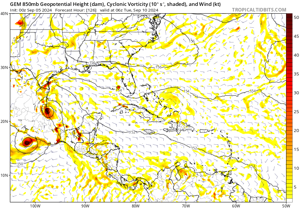
CMC TS into mexico, but most of the moisture ends up getting funneled right into texas , GFS maybe slowly caving to the ICON somewhat, had more of a stronger surface low before fizzling out in the southern gulf
0 likes

Re: Tropical Wave in Western Caribbean (0/30)
Have there ever been concurrent storms on both sides of Central America that are so close to each other?
0 likes
TC naming lists: retirements and intensity
Most aggressive Advisory #1's in North Atlantic (cr. kevin for starting the list)
Most aggressive Advisory #1's in North Atlantic (cr. kevin for starting the list)
Re: Tropical Wave in Western Caribbean (0/30)
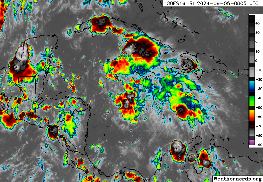
For once, convection didn't poof overnight and actually looks much better. But too late now.
0 likes
TC naming lists: retirements and intensity
Most aggressive Advisory #1's in North Atlantic (cr. kevin for starting the list)
Most aggressive Advisory #1's in North Atlantic (cr. kevin for starting the list)
-
Stratton23
- Category 5
- Posts: 3517
- Joined: Fri Jul 21, 2023 10:59 pm
- Location: Katy, Tx
Re: Tropical Wave in Western Caribbean (0/30)
For the western caribbean yeah, but it will still be worth watching in the BOC, the models that do develop, dont do so until its in the BOC
0 likes
-
Stratton23
- Category 5
- Posts: 3517
- Joined: Fri Jul 21, 2023 10:59 pm
- Location: Katy, Tx
Re: Tropical Wave in Western Caribbean (0/30)
00z Euro gets close to development again, the wave gets entangled with the broad weak gulf low that the euro tries to develop now, sends a lot of rain towards the texas coast, regardless if it develops, the wave and low could work in tandem to send some really heavy rain toward the western gulf states
0 likes

Re: Tropical Wave in Western Caribbean (0/30)
Teban54 wrote:For once, convection didn't poof overnight and actually looks much better. But too late now.
https://i.postimg.cc/hGLkRjz3/83498829.gif
If the models get a closed low in the western Caribbean it will be interesting to see where they track it.
Might spend too much time over the peninsula and open back up as a wave for example.
0 likes

Re: Tropical Wave in Western Caribbean (0/30)
MEANINGLESS_NUMBERS wrote:1000 posts for a lemon, and whole basin looks like a lemon tree. What a year.
The lemon tree is even more fruitful this morning.
7 likes
-
Stratton23
- Category 5
- Posts: 3517
- Joined: Fri Jul 21, 2023 10:59 pm
- Location: Katy, Tx
Re: Tropical Wave in Western Caribbean (0/30)
GFS may slowly be playing catch up to the ICON, but the CMC shows a complex interaction with our gulf low, it exhibits enough of a tug on our caribbean wave that it brings its a good deal further north, this run is closer to the texas border, previous runs were central mexico, its possible if the gulf low develops, it could definitely change the steering pattern, worth watching
0 likes
-
Stratton23
- Category 5
- Posts: 3517
- Joined: Fri Jul 21, 2023 10:59 pm
- Location: Katy, Tx
Re: Tropical Wave in Western Caribbean (0/30)
12z UKMET caves to the ICON, showing a very similar scenario, system moving NNW towards north mexico or south texas at the end of its 144 hour run fwiw
0 likes
-
cycloneye

- Admin

- Posts: 149261
- Age: 69
- Joined: Thu Oct 10, 2002 10:54 am
- Location: San Juan, Puerto Rico
Re: Tropical Wave in Western Caribbean (0/20)
Now down to 20%.
Northwestern Caribbean Sea and Southwestern Gulf of Mexico:
Shower and thunderstorm activity remains disorganized in
association with a westward-moving tropical wave located over the
western Caribbean Sea. Development is not expected before the
system reaches Belize and the Yucatan Peninsula by early Friday.
Some gradual development is possible late in the weekend into early
next week after the system emerges over the southwestern Gulf of
Mexico.
* Formation chance through 48 hours...low...near 0 percent.
* Formation chance through 7 days...low...20 percent.
2 likes
Visit the Caribbean-Central America Weather Thread where you can find at first post web cams,radars
and observations from Caribbean basin members Click Here
and observations from Caribbean basin members Click Here
-
Frank P
- S2K Supporter

- Posts: 2779
- Joined: Fri Aug 29, 2003 10:52 am
- Location: Biloxi Beach, Ms
- Contact:
Re: Tropical Wave in Western Caribbean (0/20)
maybe, just maybe the lemon crops are all rotten this year.
3 likes

Re: Tropical Wave in Western Caribbean (0/20)
This has to be the longest thread for an AOI that never developed, right?
3 likes
Irene '11 Sandy '12 Hermine '16 5/15/2018 Derecho Fay '20 Isaias '20 Elsa '21 Henri '21 Ida '21
I am only a meteorology enthusiast who knows a decent amount about tropical cyclones. Look to the professional mets, the NHC, or your local weather office for the best information.
I am only a meteorology enthusiast who knows a decent amount about tropical cyclones. Look to the professional mets, the NHC, or your local weather office for the best information.
-
Frank P
- S2K Supporter
- Posts: 2779
- Joined: Fri Aug 29, 2003 10:52 am
- Location: Biloxi Beach, Ms
- Contact:
Re: Tropical Wave in Western Caribbean (0/20)
Well, if it can carry most of this convection over the Yucatan and get into the BOC and not the EPAC, and it combines with the ICON if it moves south, then yeah, it may have a chance... lots of it's with this old system... lost a lot of hours tracking and waiting for this system to develop that I will never get back a good ROI on, cheers.

0 likes
-
Edwards Limestone

- S2K Supporter
- Posts: 504
- Age: 36
- Joined: Tue Dec 28, 2021 11:05 am
- Location: Smithson Valley, TX
Re: Tropical Wave in Western Caribbean (0/30)
TomballEd wrote:One 'forecaster' doesn't care what the models say, or the satellite, or CIMMS remote data or NHC PhDs forecast. Its going to be a hurricane and its heading to Texas because he lives there.
Maybe, like the ICON, he'll be right for once.
Being a permabear about every wave isn’t as intelligent as you’d like to think.
0 likes
The above post is NOT an official forecast and should not be used as such. It is just the opinion of the poster and may or may not be backed by sound meteorological data. It is NOT endorsed by any professional institution including Storm2k. For official information, please refer to NWS products.
Re: Tropical Wave in Western Caribbean (0/20)
Probably would have developed if only it had slowed down more.
0 likes
TC naming lists: retirements and intensity
Most aggressive Advisory #1's in North Atlantic (cr. kevin for starting the list)
Most aggressive Advisory #1's in North Atlantic (cr. kevin for starting the list)
-
TomballEd
- Category 5
- Posts: 1260
- Age: 62
- Joined: Wed Aug 16, 2023 4:52 pm
- Location: Spring/Klein area, not Tomball
Re: Tropical Wave in Western Caribbean (0/30)
Edwards Limestone wrote:TomballEd wrote:One 'forecaster' doesn't care what the models say, or the satellite, or CIMMS remote data or NHC PhDs forecast. Its going to be a hurricane and its heading to Texas because he lives there.
Maybe, like the ICON, he'll be right for once.
Being a permabear about every wave isn’t as intelligent as you’d like to think.
I'm far from a permabear. I was quite enthusiastic when Beryl was only being sensed by the Euro ensembles. I get that weenies hate it when I mention satellite presentation, data from CIMSS, what I can discern from MIMIC TPW, and obviously model and say the ICON hurricane for their backyard probably isn't happening. Saying a PhD at NHC was wrong for not raising odds is not a good look. ICON had some good runs, where it was closer than the GFS and Euro, speaking of Beryl, but if it is go to model to say a system will develop when the GFS and Euro and their ensembles are downplaying it, that isn't a good sign.
1 likes
-
TomballEd
- Category 5
- Posts: 1260
- Age: 62
- Joined: Wed Aug 16, 2023 4:52 pm
- Location: Spring/Klein area, not Tomball
Re: Disturbed weather in Central Atlantic (0/20)
TomballEd wrote:GFS family seems less enthusiastic about the AOI today. The Euro and Canadian ensembles still like it. 12Z trends will be interesting. But I'd trust multiple models, including the Euro, against the GFS. And the GEFS haven't lost it completely.
https://i.giphy.com/media/v1.Y2lkPTc5MGI3NjExcHV0dHpsZXp3MGVlNHl4dDJpYzBneDBxYTA2ODJsbHR5bTFpMmZrbCZlcD12MV9pbnRlcm5hbF9naWZfYnlfaWQmY3Q9Zw/mMNGDcy1iovP8gdzIy/giphy.gif
Back when I was being a permabear, not. When the wave looked decent on satellite, and it had multi-model support. Reading the handwriting on the wall isn't the same as trolling the people that just know everything will develop. I was on the train for this when it looked like it might develop. I got off that train when it became more and more unlikely that it would.
0 likes
Re: Tropical Wave in Western Caribbean (0/30)
Edwards Limestone wrote:TomballEd wrote:One 'forecaster' doesn't care what the models say, or the satellite, or CIMMS remote data or NHC PhDs forecast. Its going to be a hurricane and its heading to Texas because he lives there.
Maybe, like the ICON, he'll be right for once.
Being a permabear about every wave isn’t as intelligent as you’d like to think.
Ed isn’t a permabear imho based on years of reading his posts elsewhere. My impression fwiw is that he’s overall fairly even-keeled as opposed to being biased either bull or bear.
A good example of a permabear was the poster “frank” in S FL (not the current poster Frank P.) who went through Andrew and let his feelings bias many of his posts to the bearish side.
1 likes
Personal Forecast Disclaimer:
The posts in this forum are NOT official forecasts and should not be used as such. They are just the opinion of the poster and may or may not be backed by sound meteorological data. They are NOT endorsed by any professional institution or storm2k.org. For official information, please refer to the NHC and NWS products.
The posts in this forum are NOT official forecasts and should not be used as such. They are just the opinion of the poster and may or may not be backed by sound meteorological data. They are NOT endorsed by any professional institution or storm2k.org. For official information, please refer to the NHC and NWS products.
Who is online
Users browsing this forum: No registered users and 86 guests