Tropical Wave in Bay of Campeche (Is Invest 91L)

This is the general tropical discussion area. Anyone can take their shot at predicting a storms path.

Moderator: S2k Moderators

Forum rules

The posts in this forum are NOT official forecasts and should not be used as such. They are just the opinion of the poster and may or may not be backed by sound meteorological data. They are NOT endorsed by any professional institution or STORM2K. For official information, please refer to products from the National Hurricane Center and National Weather Service.

Help Support Storm2K
Message
Author
User avatar
Ubuntwo
Category 5
Category 5
Posts: 1401
Age: 31
Joined: Thu Oct 05, 2017 10:41 pm

Re: Tropical Wave in SW GOM (30/50)

#1061 Postby Ubuntwo » Fri Sep 06, 2024 11:36 pm

TomballEd wrote:GFS showing 40 knots or more shear across this in the NW Gulf, and dry air being pushed into the system by the shear. No matter how warm the Gulf is, it'll be facing hostile conditions and probably won't become a hurricane. Not sure it isn't subtropical. Decent shot as using the F storm name in a year where NS are tightly rationed.

https://i.giphy.com/media/v1.Y2lkPTc5MGI3NjExdDVqODRqMm40cWQ0NWw3NWtneHptemV3cHRrYWd4MDNkMXQ1MHQ1ciZlcD12MV9pbnRlcm5hbF9naWZfYnlfaWQmY3Q9Zw/APyIldHhAEzla8rw3t/giphy.gif

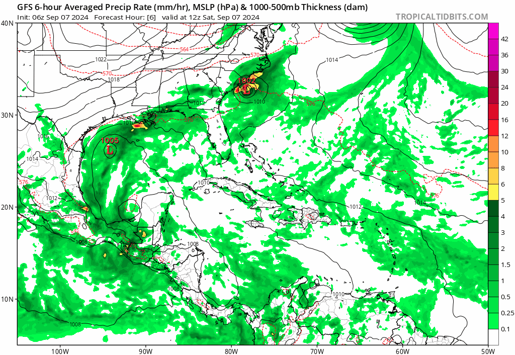
The operational GFS (taken literally) does show a fully tropical system. It's a symmetric warm core and the pressure gradient is very tight. However, some of the systems on the ensembles look kind of subtropical with very broad gradients and loose RMWs - though they are still technically tropical storms.
2 likes   
Kendall -> SLO -> PBC

Memorable Storms: Katrina (for its Florida landfall...) Wilma Matthew Irma

User avatar
tropicwatch
Category 5
Category 5
Posts: 3364
Age: 61
Joined: Sat Jun 02, 2007 10:01 am
Location: Panama City Florida
Contact:

Re: Tropical Wave in SW GOM (40/60)

#1062 Postby tropicwatch » Sat Sep 07, 2024 5:45 am

000
ABNT20 KNHC 070522
TWOAT

Tropical Weather Outlook
NWS National Hurricane Center Miami FL
200 AM EDT Sat Sep 7 2024

For the North Atlantic...Caribbean Sea and the Gulf of Mexico:

Southwestern Gulf of Mexico:
A tropical wave over the Yucatan Peninsula of Mexico is producing
disorganized showers and thunderstorms over Guatemala, southeastern
Mexico, and the adjacent waters of the southwestern Gulf of Mexico.
The wave is expected to move over the Bay of Campeche later today,
and an area of low pressure is forecast to develop while interacting
with a frontal boundary. Environmental conditions are forecast to be
conducive for development, and a tropical depression could form
during the early or middle part of next week while the system moves
slowly northwestward over the southwestern Gulf of Mexico.
* Formation chance through 48 hours...medium...40 percent.
* Formation chance through 7 days...medium...60 percent.

$$
Forecaster Reinhart
1 likes   
Tropicwatch


Agnes 72', Eloise 75, Elena 85', Kate 85', Charley 86', Florence 88', Beryl 94', Dean 95', Erin 95', Opal 95', Earl 98', Georges 98', Ivan 2004', Arlene 2005', Dennis 2005', Ida 2009' Debby 2012' Irma 2017' Michael 2018'

Frank P
S2K Supporter
S2K Supporter
Posts: 2772
Joined: Fri Aug 29, 2003 10:52 am
Location: Biloxi Beach, Ms
Contact:

Re: Tropical Wave in SW GOM (40/60)

#1063 Postby Frank P » Sat Sep 07, 2024 5:52 am

Looks like the convection survived the night and soon we'll she can do during daylight. Probably needs to start some northly motion as well so it doesn't run into Mexico. Will be fun to see how all sthis cenario plays out today and first 60% AOI I've seen in a while... cheers
Image
2 likes   

User avatar
tropicwatch
Category 5
Category 5
Posts: 3364
Age: 61
Joined: Sat Jun 02, 2007 10:01 am
Location: Panama City Florida
Contact:

Re: Tropical Wave in SW GOM (40/60)

#1064 Postby tropicwatch » Sat Sep 07, 2024 6:04 am

Decent looking system but it sure looks like it is going to run into Mexico.
0 likes   
Tropicwatch


Agnes 72', Eloise 75, Elena 85', Kate 85', Charley 86', Florence 88', Beryl 94', Dean 95', Erin 95', Opal 95', Earl 98', Georges 98', Ivan 2004', Arlene 2005', Dennis 2005', Ida 2009' Debby 2012' Irma 2017' Michael 2018'

Frank P
S2K Supporter
S2K Supporter
Posts: 2772
Joined: Fri Aug 29, 2003 10:52 am
Location: Biloxi Beach, Ms
Contact:

Re: Tropical Wave in SW GOM (40/60)

#1065 Postby Frank P » Sat Sep 07, 2024 6:37 am

06z GFS ensemble model run, looks like a tad shift east with some of the members from previous runs.
Image
0 likes   

User avatar
cycloneye
Admin
Admin
Posts: 143863
Age: 68
Joined: Thu Oct 10, 2002 10:54 am
Location: San Juan, Puerto Rico

Re: Tropical Wave in Bay of Campeche (40/60)

#1066 Postby cycloneye » Sat Sep 07, 2024 6:58 am

Southwestern Gulf of Mexico:
A tropical wave over the Bay of Campeche is producing disorganized
showers and thunderstorms. An area of low pressure is forecast to
develop while the wave interacts with a frontal boundary during
the next couple of days. Environmental conditions are forecast to
be conducive for development, and a tropical depression could form
during the early or middle part of next week while the system moves
slowly northwestward to northward over the southwestern Gulf of
Mexico.
* Formation chance through 48 hours...medium...40 percent.
* Formation chance through 7 days...medium...60 percent.
0 likes   
Visit the Caribbean-Central America Weather Thread where you can find at first post web cams,radars
and observations from Caribbean basin members Click Here

Frank P
S2K Supporter
S2K Supporter
Posts: 2772
Joined: Fri Aug 29, 2003 10:52 am
Location: Biloxi Beach, Ms
Contact:

Re: Tropical Wave in Bay of Campeche (40/60)

#1067 Postby Frank P » Sat Sep 07, 2024 7:17 am

0z UKMET has what looks like a TS for SELA and MS coast, rainfall would be the main concern however.
Image
Image
Last edited by Frank P on Sat Sep 07, 2024 7:49 am, edited 1 time in total.
1 likes   

User avatar
tropicwatch
Category 5
Category 5
Posts: 3364
Age: 61
Joined: Sat Jun 02, 2007 10:01 am
Location: Panama City Florida
Contact:

Re: Tropical Wave in Bay of Campeche (40/60)

#1068 Postby tropicwatch » Sat Sep 07, 2024 7:22 am

Should get an invest tag pretty soon I would think.
0 likes   
Tropicwatch


Agnes 72', Eloise 75, Elena 85', Kate 85', Charley 86', Florence 88', Beryl 94', Dean 95', Erin 95', Opal 95', Earl 98', Georges 98', Ivan 2004', Arlene 2005', Dennis 2005', Ida 2009' Debby 2012' Irma 2017' Michael 2018'

User avatar
gatorcane
S2K Supporter
S2K Supporter
Posts: 23689
Age: 47
Joined: Sun Mar 13, 2005 3:54 pm
Location: Boca Raton, FL

Re: Tropical Wave in Bay of Campeche (40/60)

#1069 Postby gatorcane » Sat Sep 07, 2024 7:28 am

Agreed, looks like we will more than likely see a depression and quite possibly a tropical storm (Francine) from this. Latest 06Z GFS shows a strong tropical storm:

Image
0 likes   

Frank P
S2K Supporter
S2K Supporter
Posts: 2772
Joined: Fri Aug 29, 2003 10:52 am
Location: Biloxi Beach, Ms
Contact:

Re: Tropical Wave in Bay of Campeche (40/60)

#1070 Postby Frank P » Sat Sep 07, 2024 7:37 am

Looking at a Mexican radar here is where the broad center IMO appears to be as it enters the BOC. I couldn't make a gif so if someone can, go for it. Vis sat images should be coming up soon.
Image
1 likes   

User avatar
Hypercane_Kyle
Category 5
Category 5
Posts: 3344
Joined: Sat Mar 07, 2015 7:58 pm
Location: Cape Canaveral, FL

Re: Tropical Wave in Bay of Campeche (40/60)

#1071 Postby Hypercane_Kyle » Sat Sep 07, 2024 7:41 am

This system's genesis (if it happens) would be a pretty big win for the EC-AIFS model (the AI-based Euro), which called for genesis as far back as Tuesday.
1 likes   
My posts are my own personal opinion, defer to the National Hurricane Center (NHC) and other NOAA products for decision making during hurricane season.

User avatar
wxman57
Moderator-Pro Met
Moderator-Pro Met
Posts: 22950
Age: 67
Joined: Sat Jun 21, 2003 8:06 pm
Location: Houston, TX (southwest)

Re: Tropical Wave in Bay of Campeche (40/60)

#1072 Postby wxman57 » Sat Sep 07, 2024 7:45 am

Will have to wait for the NHC to designate this system an invest before we get any tropical models. My forecast has a 50kt TS moving inland near the TX/LA border on Wednesday.
5 likes   

3090
Category 2
Category 2
Posts: 548
Age: 65
Joined: Fri Aug 19, 2011 4:01 pm

Re: Tropical Wave in Bay of Campeche (40/60)

#1073 Postby 3090 » Sat Sep 07, 2024 8:13 am

wxman57 wrote:Will have to wait for the NHC to designate this system an invest before we get any tropical models. My forecast has a 50kt TS moving inland near the TX/LA border on Wednesday.

Before a LLC has even been remotely formed?
0 likes   

Frank P
S2K Supporter
S2K Supporter
Posts: 2772
Joined: Fri Aug 29, 2003 10:52 am
Location: Biloxi Beach, Ms
Contact:

Re: Tropical Wave in Bay of Campeche (40/60)

#1074 Postby Frank P » Sat Sep 07, 2024 8:14 am

First vis sat image indicates it continues to fire convection on its western flank..
Image
1 likes   

User avatar
HurricaneBrain
S2K Supporter
S2K Supporter
Posts: 520
Joined: Thu Jun 30, 2011 2:07 pm

Re: Tropical Wave in Bay of Campeche (40/60)

#1075 Postby HurricaneBrain » Sat Sep 07, 2024 8:24 am

We have invest 91L.
AL, 91, 2024090612, , BEST, 0, 188N, 881W, 15, 1007, DB, 0, , 0, 0, 0, 0, 1008, 100, 30, 0, 0, L, 0, , 0, 0, GENESIS014, , 0, , 0, 0, 0, 0, genesis-num, 014,
AL, 91, 2024090618, , BEST, 0, 190N, 890W, 15, 1007, DB, 0, , 0, 0, 0, 0, 1008, 100, 30, 0, 0, L, 0, , 0, 0, GENESIS014, , 0, , 0, 0, 0, 0, genesis-num, 014,
AL, 91, 2024090700, , BEST, 0, 191N, 900W, 15, 1006, DB, 0, , 0, 0, 0, 0, 1007, 100, 30, 0, 0, L, 0, , 0, 0, GENESIS014, , 0, , 0, 0, 0, 0, genesis-num, 014,
AL, 91, 2024090706, , BEST, 0, 191N, 913W, 15, 1006, DB, 0, , 0, 0, 0, 0, 1007, 100, 30, 0, 0, L, 0, , 0, 0, GENESIS014, , 0, , 0, 0, 0, 0, genesis-num, 014,
AL, 91, 2024090712, , BEST, 0, 188N, 927W, 20, 1005, DB, 34, NEQ, 0, 0, 0, 0, 1007, 130, 40, 0, 0, L, 0, , 0, 0, INVEST, S, 0, , 0, 0, 0, 0, genesis-num, 014, SPAWNINVEST, al752024 to al912024,
2 likes   

User avatar
cycloneye
Admin
Admin
Posts: 143863
Age: 68
Joined: Thu Oct 10, 2002 10:54 am
Location: San Juan, Puerto Rico

Re: Tropical Wave in Bay of Campeche (40/60) (Is Invest 91L)

#1076 Postby cycloneye » Sat Sep 07, 2024 8:29 am

This has been the most longest thread of a pre invest area in S2K but it ends now.

Go to the 91L discussion thread.
14 likes   
Visit the Caribbean-Central America Weather Thread where you can find at first post web cams,radars
and observations from Caribbean basin members Click Here


Return to “Talkin' Tropics”

Who is online

Users browsing this forum: No registered users and 87 guests