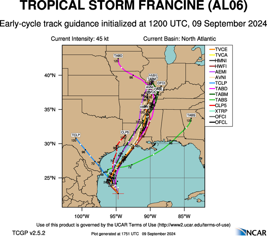
Steve wrote:GFS 960s SCLA. This puts St. Mary, Terrebonne, and Assumption Parishes in the range where you pretty much have to prepare whether it verifies or not. It’s gonna be somewhat close.
I agree, they are in a position now where prepping for a hurricane is their only option. Then you can hope for the best. Are you back in LA? This looks to be another gulf storm strengthening on approach to landfall so a late wobble here or there can make a significant impact for the LA coast.