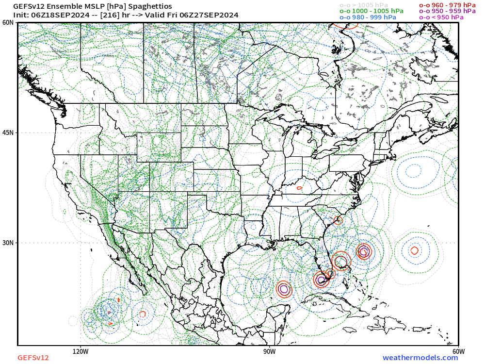
mantis83 wrote:models seem to be trending towards a weaker system, if one forms, which is good news....
Which models are you referring to, if I may ask?
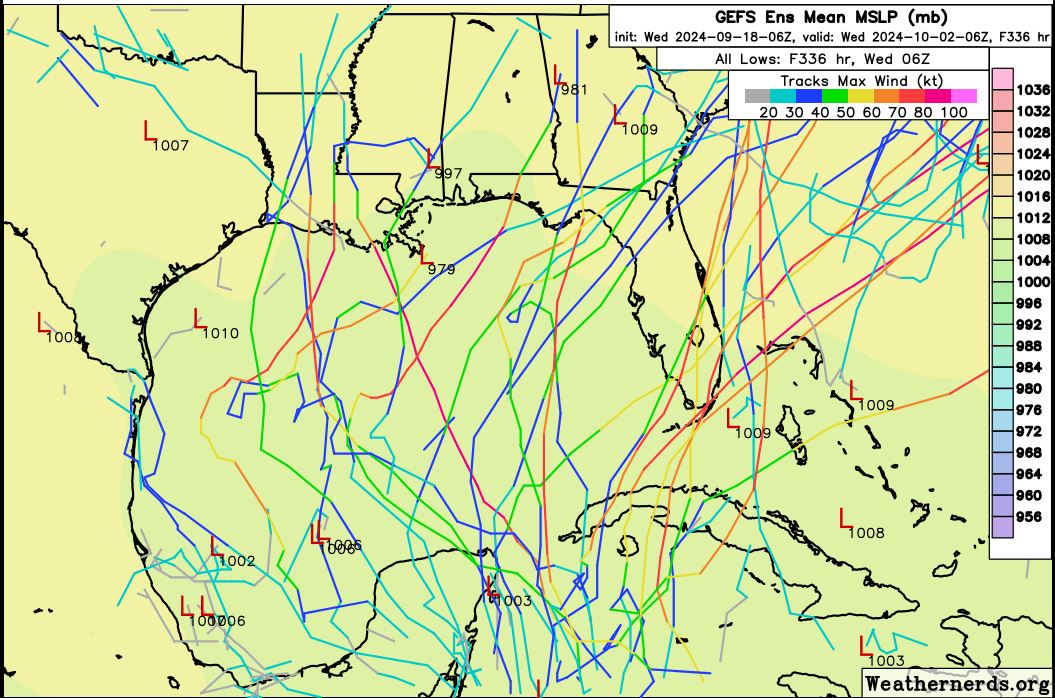
Usually intensity is one of the last things to refer to models for, especially before a system develops. Intensity will likely fluctuate in between runs, and if models were to really be taken at face value regarding this, then we should've never seen storms like Beryl or Otis blow up. I think the bottom line is that there is still solid consensus that something will try to form in the WCAR by next week and head somewhere northward. We can look at intensity closer once we really get something going.