StPeteMike wrote:A more seasonal poster/met might help me here. Will the 12z runs incorporate where the NHC has placed the X or is it a non factor?
Sometimes. Hurricane models are more based on initial conditions where a center is. But not always. Sometimes we get random initializations where a given model can be north east south or west of where a center is. Those can be frustrating if you’re waiting on them to run and they end up being useless (happens with globals as well). They won’t run hurricane models until there is an invest.
06z ICON is 985mb and strengthening what I think is 200 miles south of Pascagoula.
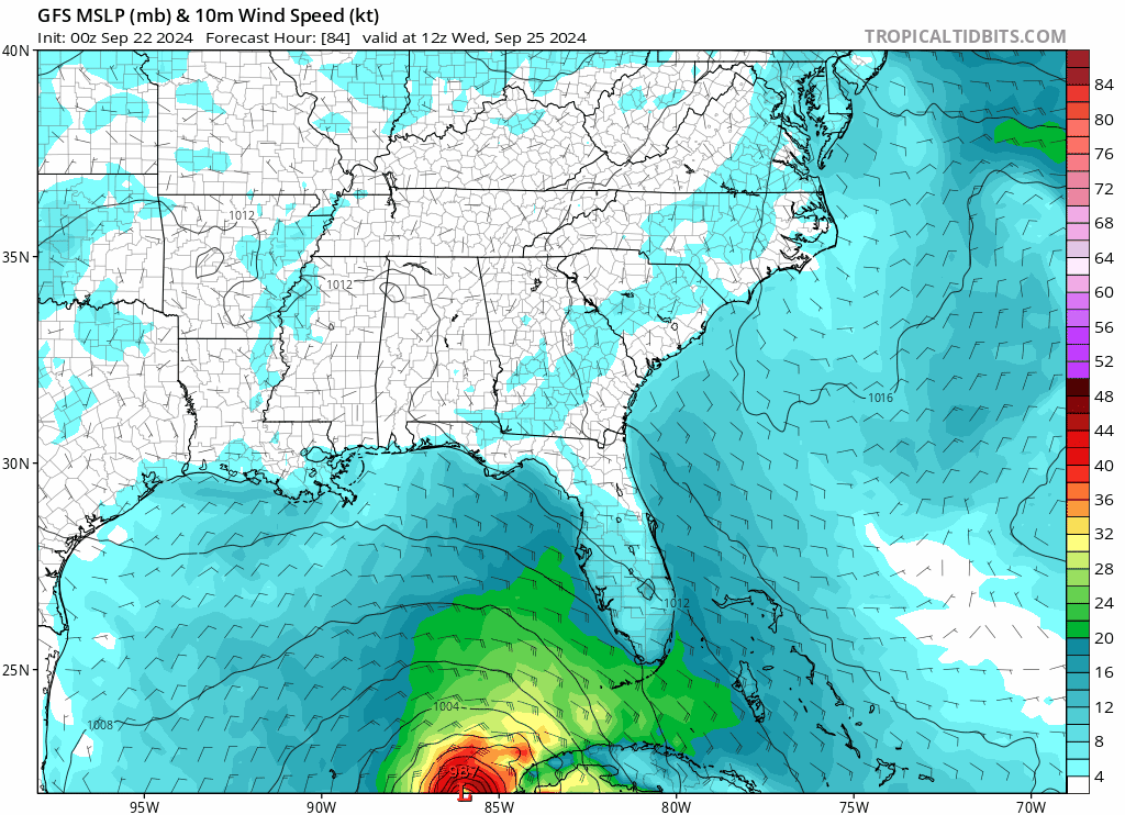
https://www.tropicaltidbits.com/analysi ... 206&fh=120Cut off low is a little farther east in eastern Oklahoma from the 00z run. In this scenario it can only get so far east before it gets caught. It ends at 120 and appears to want to hook a little toward the NE. But as you can see from 500mb, it’s eventually going to correct north or NNW. Looks like landfall would be somewhere between Baldwin County, AL and Okaloosa Co, Fl if the run went farther out than 120. We will see in 2 hours what the 12z does. /IF/ the trough cuts off a low in the plains, this is much more realistic than what the GFS had been hinting at mid and late week with a back door trough from the NE picking it up. The east part of the NC Gulf from Gulfport over to 30A would be on high alert if it’s telegraphing a solution with a narrower Gulf Shores to Destin landfall more likely and possibly strengthening since the hurricane would be in an upward motion quadrant (entrance to the jet) relative to the cut off low.
Here’s 500mb
https://www.tropicaltidbits.com/analysi ... 206&fh=120


