https://ftp.nhc.noaa.gov/atcf/btk/bep942024.dat
EPAC: JOHN - Remnants - Discussion
Moderator: S2k Moderators
EPAC: JOHN - Remnants - Discussion
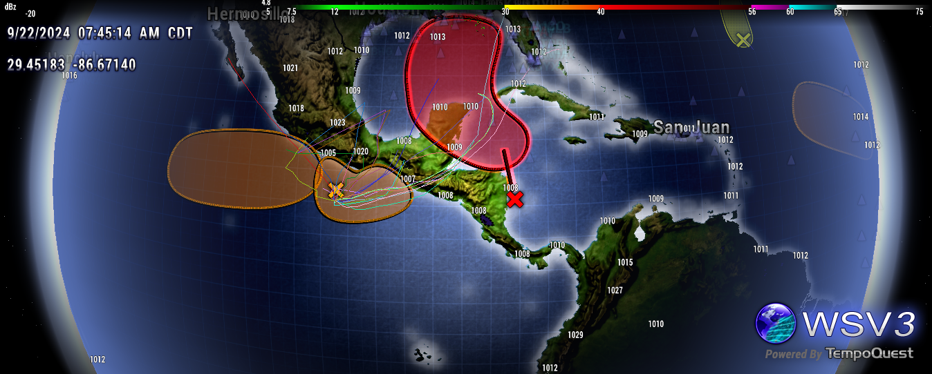
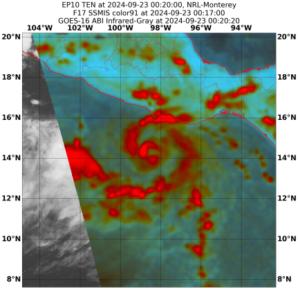
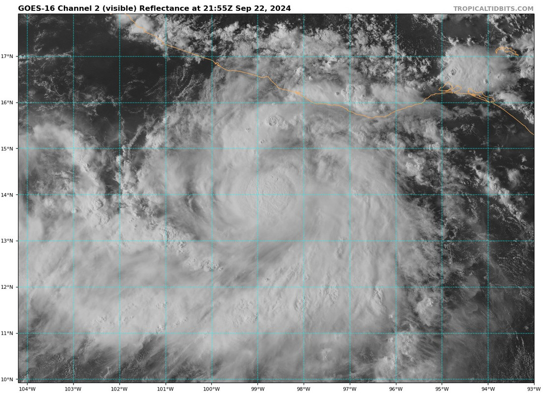
EP, 94, 2024092200, , BEST, 0, 127N, 990W, 25, 1008, DB, 34, NEQ, 0, 0, 0, 0, 1010, 200, 60, 0, 0, E, 0, , 0, 0, INVEST, S, 0, , 0, 0, 0, 0, genesis-num, 025, SPAWNINVEST, ep772024 to ep942024,
https://ftp.nhc.noaa.gov/atcf/btk/bep942024.dat
0 likes
- cycloneye
- Admin
- Posts: 143865
- Age: 68
- Joined: Thu Oct 10, 2002 10:54 am
- Location: San Juan, Puerto Rico
Re: EPAC: INVEST 94E - Discussion

1 likes
Visit the Caribbean-Central America Weather Thread where you can find at first post web cams,radars
and observations from Caribbean basin members Click Here
- cycloneye
- Admin
- Posts: 143865
- Age: 68
- Joined: Thu Oct 10, 2002 10:54 am
- Location: San Juan, Puerto Rico
Re: EPAC: INVEST 94E - Discussion
Offshore of Southern Mexico (EP94):
Showers and thunderstorms associated with an area of low pressure
located less than 200 miles south of the coast of southern Mexico
have become better organized since yesterday. Environmental
conditions appear conducive for additional development of this
system, and a tropical depression could form during the next couple
of days while the system drifts slowly northeastward toward the
coast of southern Mexico.
* Formation chance through 48 hours...medium...50 percent.
* Formation chance through 7 days...medium...60 percent.
0 likes
Visit the Caribbean-Central America Weather Thread where you can find at first post web cams,radars
and observations from Caribbean basin members Click Here
Re: EPAC: INVEST 94E - Discussion
Looking a lot like a TD/TS already. ASCAT this morning had a closed circulation with 33 knot winds. I'd expect a special outlook later.
0 likes
- Kingarabian
- S2K Supporter
- Posts: 15827
- Joined: Sat Aug 08, 2009 3:06 am
- Location: Honolulu, Hawaii
Re: EPAC: INVEST 94E - Discussion
Steering is not gonna give it much time over water. Basically needs to form within the next 12 hrs.
0 likes
RIP Kobe Bryant
- tropicwatch
- Category 5
- Posts: 3364
- Age: 61
- Joined: Sat Jun 02, 2007 10:01 am
- Location: Panama City Florida
- Contact:
Re: EPAC: INVEST 94E - Discussion
Forecast models are kind of different for a pacific system.


0 likes
Tropicwatch
Agnes 72', Eloise 75, Elena 85', Kate 85', Charley 86', Florence 88', Beryl 94', Dean 95', Erin 95', Opal 95', Earl 98', Georges 98', Ivan 2004', Arlene 2005', Dennis 2005', Ida 2009' Debby 2012' Irma 2017' Michael 2018'
-
- Tropical Storm
- Posts: 195
- Joined: Mon Mar 15, 2021 10:05 am
Re: EPAC: INVEST 94E - Discussion
Kingarabian wrote:Steering is not gonna give it much time over water. Basically needs to form within the next 12 hrs.
Don't really see that. The 00z EPS doesn't have it approach the shore for quite a while, and we saw this occur with Max last year. This may linger around for 3 days before landfall. Some members even make it a hurricane, and if current organization is anything to go by, I would agree.
0 likes
Re: EPAC: INVEST 94E - Discussion
Kingarabian wrote:Steering is not gonna give it much time over water. Basically needs to form within the next 12 hrs.
It just did...
0 likes
- cycloneye
- Admin
- Posts: 143865
- Age: 68
- Joined: Thu Oct 10, 2002 10:54 am
- Location: San Juan, Puerto Rico
Re: EPAC: TEN-E - Tropical Depression - Discussion
Tropical Depression Ten-E Advisory Number 1
NWS National Hurricane Center Miami FL EP102024
300 PM CST Sun Sep 22 2024
...NEW TROPICAL DEPRESSION FORMS IN THE EASTERN PACIFIC...
...TROPICAL STORM WATCH ISSUED FOR PORTIONS OF THE SOUTHERN COAST OF
MEXICO...
SUMMARY OF 300 PM CST...2100 UTC...INFORMATION
----------------------------------------------
LOCATION...13.8N 98.7W
ABOUT 175 MI...280 KM S OF PUNTA MALDONADO MEXICO
MAXIMUM SUSTAINED WINDS...35 MPH...55 KM/H
PRESENT MOVEMENT...STATIONARY
MINIMUM CENTRAL PRESSURE...1005 MB...29.68 INCHES
WATCHES AND WARNINGS
--------------------
CHANGES WITH THIS ADVISORY:
The government of Mexico has issued a Tropical Storm Watch for
the southern coast of Mexico from Punta Maldonado to Salina Cruz.
SUMMARY OF WATCHES AND WARNINGS IN EFFECT:
A Tropical Storm Watch is in effect for...
* Punta Maldonado to Salina Cruz
For storm information specific to your area, please monitor
products issued by your national meteorological service.
DISCUSSION AND OUTLOOK
----------------------
At 300 PM CST (2100 UTC), the center of Tropical Depression Ten-E
was located near latitude 13.8 North, longitude 98.7 West. The
depression is nearly stationary, but a slow northeastward motion is
expected to begin later tonight and Monday. A northeastward to
east-northeastward motion is anticipated on Tuesday and Wednesday.
On the forecast track, the center of the system is forecast to move
near the southern coast of Mexico during the next couple of days.
Satellite wind data indicate that maximum sustained winds are near
35 mph (55 km/h) with higher gusts. Strengthening is forecast during
the next few days while the center of the system remains over water.
The estimated minimum central pressure is 1005 mb (29.68 inches).
HAZARDS AFFECTING LAND
----------------------
Key Messages for the depression can be found in the Tropical
Cyclone Discussion under AWIPS header MIATCDEP5 and WMO header
WTPZ45 KNHC and on the web at hurricanes.gov/text/MIATCDEP5.shtml
RAINFALL: Through Thursday, the depression is expected to produce 6
to 12 inches of rain with isolated totals around 15 inches across
the coastal areas of Chiapas. In areas along and near the Oaxaca
coast, between 10 and 20 inches of rain can be expected through
Thursday, with localized higher amounts near 30 inches.
WIND: Tropical storm conditions are possible within portions of the
watch area beginning on Tuesday.
NEXT ADVISORY
-------------
Next intermediate advisory at 600 PM CST.
Next complete advisory at 900 PM CST.
$$
Tropical Depression Ten-E Discussion Number 1
NWS National Hurricane Center Miami FL EP102024
300 PM CST Sun Sep 22 2024
Convection has gradually become better organized today in
association with an area of low pressure that the NHC has been
monitoring off the coast of southern Mexico. A recent scatterometer
pass shows the circulation is closed, with a well-defined center and
peak winds of about 30 kt over the southern semicircle. Therefore, a
new tropical depression has formed in the eastern Pacific basin.
The depression is nearly stationary, but a slow northeastward drift
is expected to begin later tonight. The track forecast is
challenging, as there is a large spread in the guidance regarding
the potential path of the system. Much of the track guidance shows
the system moving generally east-northeastward as it becomes
captured within the broader circulation of a developing Central
American Gyre. However, a couple of global models (ECMWF and UKMET)
instead show a northward drift over the next couple of days. The NHC
track forecast favors the first scenario, and generally lies between
the simple and corrected consensus aids. However, this track
forecast is of low confidence given the large spread in the models,
and adjustments will likely be required with future issuances.
The moist, unstable environment and very warm waters should be
conducive for some strengthening of the system during the next
couple of days. The NHC intensity forecast lies between the IVCN and
HCCA aids, but it should be noted that there are some models
indicating the system could reach hurricane strength. While this is
not explicitly forecast, it certainly cannot be ruled out given the
environmental and oceanic conditions, and interests along the coast
of southern Mexico should monitor the latest forecast updates. The
peak intensity of the system will be highly dependent on how long
the cyclone remains over water before reaching the coast, which is
quite uncertain given the track challenges described above.
Based on this forecast, the government of Mexico has issued a
Tropical Storm Watch for the southern coast of Mexico from Punta
Maldonado to Salina Cruz.
KEY MESSAGES:
1. Slow-moving Tropical Depression Ten-E will bring very heavy
rainfall to coastal portions of southern and southwestern Mexico
through the upcoming week. This heavy rainfall will bring a risk of
significant flash flooding and mudslides to the Mexican States of
Chiapas and Oaxaca, particularly in areas near the coast.
2. The depression is forecast to become a tropical storm while
moving near the coast of southern Mexico on Monday or Tuesday. A
Tropical Storm Watch has been issued for a portion of the coastline,
where tropical storm conditions could begin on Tuesday.
3. The system could strengthen more than forecast if it remains
over water. Interests along the coast of southern Mexico should
monitor the latest forecast updates, as a Hurricane Watch could be
required for a portion of the coastline later tonight or on Monday.
FORECAST POSITIONS AND MAX WINDS
INIT 22/2100Z 13.8N 98.7W 30 KT 35 MPH
12H 23/0600Z 14.0N 98.6W 35 KT 40 MPH
24H 23/1800Z 14.4N 98.2W 45 KT 50 MPH
36H 24/0600Z 14.8N 97.5W 50 KT 60 MPH
48H 24/1800Z 15.0N 96.6W 55 KT 65 MPH
60H 25/0600Z 15.3N 95.6W 55 KT 65 MPH
72H 25/1800Z 16.1N 94.1W 55 KT 65 MPH
96H 26/1800Z 17.1N 92.9W 20 KT 25 MPH...INLAND
120H 27/1800Z...DISSIPATED
$$

0 likes
Visit the Caribbean-Central America Weather Thread where you can find at first post web cams,radars
and observations from Caribbean basin members Click Here
Re: EPAC: TEN-E - Tropical Depression - Discussion
Looking at the cone....does this system have the potential to emerge eventually into the BOC?...
0 likes
- cycloneye
- Admin
- Posts: 143865
- Age: 68
- Joined: Thu Oct 10, 2002 10:54 am
- Location: San Juan, Puerto Rico
Re: EPAC: TEN-E - Tropical Depression - Discussion
0 likes
Visit the Caribbean-Central America Weather Thread where you can find at first post web cams,radars
and observations from Caribbean basin members Click Here
- StPeteMike
- Category 2
- Posts: 622
- Joined: Thu Jun 07, 2018 11:26 pm
Re: EPAC: TEN-E - Tropical Depression - Discussion
Small core, would allow strengthening to pretty quickly.
0 likes
The above post is not official and should not be used as such. It is the opinion of the poster and may or may not be backed by sound meteorological data. It is not endorsed by any professional institution or storm2k.org. For official information, please refer to the NHC and NWS products.
- cycloneye
- Admin
- Posts: 143865
- Age: 68
- Joined: Thu Oct 10, 2002 10:54 am
- Location: San Juan, Puerto Rico
Re: EPAC: TEN-E - Tropical Depression - Discussion
Tropical Depression Ten-E Discussion Number 2
NWS National Hurricane Center Miami FL EP102024
900 PM CST Sun Sep 22 2024
Satellite images show that the depression is gradually becoming
better organized, with some convective banding features developing
around the circulation and a small area of very cold cloud tops
over the estimated center. Upper-level outflow is fairly well
defined over the southern semicircle of the system. Subjective
Dvorak classifications from both TAFB and SAB indicate a T-number of
2.0, so the advisory intensity is held at 30 kt for now.
Center fixes indicate little movement since earlier today, so the
initial motion estimate is nearly stationary. As noted earlier,
the track forecast for this tropical cyclone is quite problematic,
with a large spread in the guidance models. The regional hurricane
models are generally east of the global guidance, with the ECMWF on
the western side of the model tracks. The most recent run of the
GFS takes the cyclone inland in a couple of days but later
develops one or two new centers offshore. Since the dominant
steering mechanism seems to be the Central American Gyre, the
official track forecast shows a mainly east-northeastward motion
during the forecast period, along the southern periphery of the
Gyre. This track moves the center close to the southern coast of
Mexico for several days before making landfall, and lies between
the simple and corrected dynamical model consensus predictions.
During most of the forecast period, the system should remain over
very warm waters with low vertical wind shear and in a moist low-
to mid-level air mass. Therefore strengthening is likely, and the
official intensity forecast is similar to the statistical-dynamical
LGEM guidance. One major source of uncertainty in the forecast is
how much the system interacts with land during the next few days.
Given the favorable environment, it is possible that the system
could become a hurricane before landfall. Interests along the coast
of southern Mexico should closely monitor the latest forecast
updates for this system. A Hurricane Watch could be required for a
portion of the coast now covered by a Tropical Storm Watch.
KEY MESSAGES:
1. Slow-moving Tropical Depression Ten-E will bring very heavy
rainfall to coastal portions of southwest Mexico through the
upcoming week. This heavy rainfall will likely cause significant
and possibly catastrophic, life-threatening flash flooding and
mudslides to the Mexican States of Chiapas, Oaxaca, and southeast
Guerrero, particularly in areas near the coast.
2. The depression is forecast to become a tropical storm later
tonight or on Monday. A Tropical Storm Watch is in effect for a
portion of the coastline of southern Mexico, where tropical storm
conditions could begin on Tuesday.
3. The system could strengthen more than forecast depending on how
long it remains over water. Interests along the coast of southern
Mexico should monitor the latest forecast updates, as a Hurricane
Watch could be required for a portion of the coastline later tonight
or on Monday.
FORECAST POSITIONS AND MAX WINDS
INIT 23/0300Z 13.9N 98.6W 30 KT 35 MPH
12H 23/1200Z 14.3N 98.3W 35 KT 40 MPH
24H 24/0000Z 14.6N 97.9W 45 KT 50 MPH
36H 24/1200Z 15.0N 97.1W 50 KT 60 MPH
48H 25/0000Z 15.2N 96.3W 55 KT 65 MPH
60H 25/1200Z 15.6N 95.2W 55 KT 65 MPH
72H 26/0000Z 16.3N 94.1W 45 KT 50 MPH...INLAND
96H 27/0000Z...DISSIPATED
$$
0 likes
Visit the Caribbean-Central America Weather Thread where you can find at first post web cams,radars
and observations from Caribbean basin members Click Here
-
- Category 5
- Posts: 8903
- Age: 39
- Joined: Thu Jul 06, 2017 1:51 am
Re: EPAC: TEN-E - Tropical Depression - Discussion
I am laughing!!!!
I'd estimate based on microwave that this is probably 50-55 knts.


I'd estimate based on microwave that this is probably 50-55 knts.
3 likes
- lilbump3000
- Category 4
- Posts: 966
- Age: 37
- Joined: Sat Sep 20, 2003 10:09 am
- Location: New Orleans, Louisiana
- Contact:
Re: EPAC: TEN-E - Tropical Depression - Discussion
Sciencerocks wrote:I am laughing!!!!![]()
![]()
![]()
![]()
I'd estimate based on microwave that this is probably 50-55 knts.
Right? This is weird. No way this is just a depression


3 likes
Andrew (1992), Irene (1999), Frances (2004), Katrina (2005), Wilma (2005), Fay (2008), Irma (2017), Eta (2020), Ian (2022)
- ElectricStorm
- Category 5
- Posts: 5017
- Age: 24
- Joined: Tue Aug 13, 2019 11:23 pm
- Location: Skiatook, OK / Norman, OK
Re: EPAC: TEN-E - Tropical Depression - Discussion
Yeah I mentioned in the 97L thread I think this could be an overperformer and it appears well on its way to do so. Could be a significant hurricane threat for Mexico and I think they need to consider putting up hurricane watches soon.
1 likes
I am in no way a professional. Take what I say with a grain of salt as I could be totally wrong. Please refer to the NHC, NWS, or SPC for official information.
Boomer Sooner!
Boomer Sooner!
- Kingarabian
- S2K Supporter
- Posts: 15827
- Joined: Sat Aug 08, 2009 3:06 am
- Location: Honolulu, Hawaii
Re: EPAC: TEN-E - Tropical Depression - Discussion
Sciencerocks wrote:I am laughing!!!!![]()
![]()
![]()
![]()
I'd estimate based on microwave that this is probably 50-55 knts.
How was this deemed a TD?

6 likes
RIP Kobe Bryant
- REDHurricane
- Category 1
- Posts: 394
- Age: 27
- Joined: Sun Jul 03, 2022 2:36 pm
- Location: Northeast Pacific Ocean
Re: EPAC: TEN-E - Tropical Depression - Discussion
Kingarabian wrote:Sciencerocks wrote:I am laughing!!!!![]()
![]()
![]()
![]()
I'd estimate based on microwave that this is probably 50-55 knts.
How was this deemed a TD?
https://i.postimg.cc/76W70LLJ/Untitled.jpg
No explanation except for incompetence at this point...
1 likes
Who is online
Users browsing this forum: No registered users and 3 guests