

ConvergenceZone wrote:TomballEd wrote:Over the on the models thread- after a muted 18Z following a nuclear 12Z series of runs, the high res hurricane models are swinging back to significant hurricane mode.
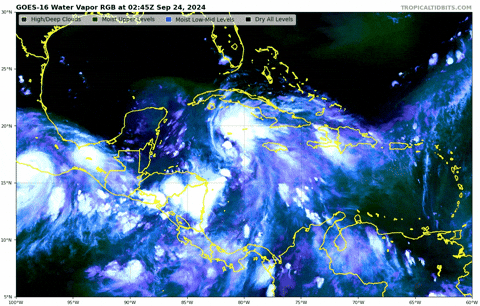
Upper low near the Yucatan that has been shearing PTC9 is backing W, shear should be dropping as modeled.
https://i.giphy.com/media/v1.Y2lkPTc5MGI3NjExNGM1MnVwcXYzMG9zeDF5c2NiZ3ZseHNxZWozY2RiazNoZHhzN2thNCZlcD12MV9pbnRlcm5hbF9naWZfYnlfaWQmY3Q9Zw/UPNCSoz2xGkhDaLBmv/giphy.gif
I think it's only the over excited H Models(can never remember the letters) that are showing anything real significant. All the others are the same or weaker, but please correct me if I'm wrong.
All of the hurricane models are H models.


