


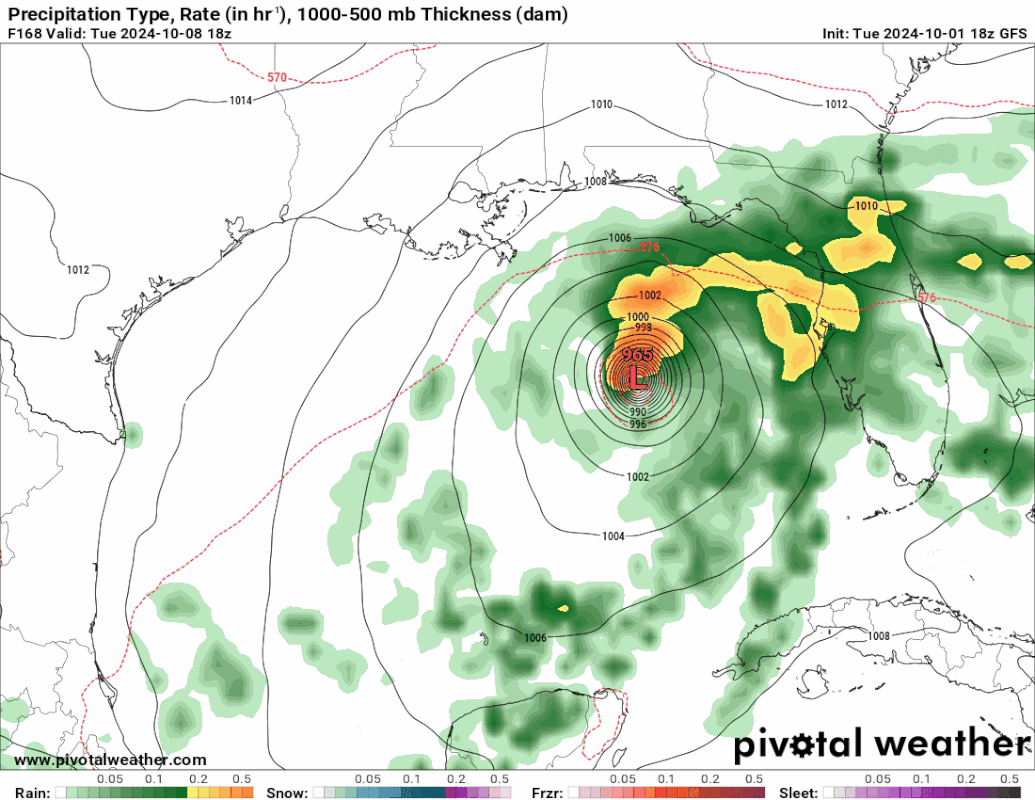
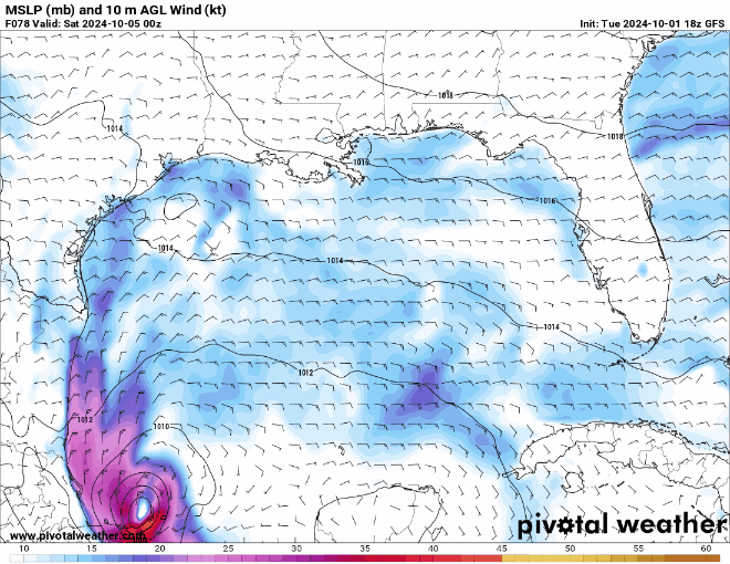
Northwestern Caribbean Sea and Gulf of Mexico:
A broad trough of low pressure is producing a large area of
disorganized showers and thunderstorms from the southwestern
Caribbean Sea into the southern Gulf of Mexico. Environmental
conditions could support some gradual development of this system,
and a tropical depression could form towards the end of the week or
over the weekend as the broader disturbance moves fully into the
Gulf of Mexico. Interests along the U.S. Gulf Coast should continue
to monitor the progress of this system.
* Formation chance through 48 hours...low...near 0 percent.
* Formation chance through 7 days...medium...40 percent.


