Possible development in the Gulf of Mexico (Is Invest 92L)
Moderator: S2k Moderators
Forum rules

The posts in this forum are NOT official forecasts and should not be used as such. They are just the opinion of the poster and may or may not be backed by sound meteorological data. They are NOT endorsed by any professional institution or STORM2K. For official information, please refer to products from the National Hurricane Center and National Weather Service.
-
WeatherBoy2000
- Category 1

- Posts: 463
- Joined: Mon Apr 10, 2023 9:29 am
Re: Possible development in the Gulf of Mexico (0/40)
Looking increasingly likely that at least a TS will come out of this.
2 likes
-
CourierPR

- Category 5

- Posts: 1336
- Age: 72
- Joined: Tue Aug 31, 2004 7:53 pm
- Location: Pompano Beach, Florida
Re: Possible development in the Gulf of Mexico (0/40)
According to Met. Joe Bastardi we may well see a cat. 1.5.
0 likes
-
SFLcane

- S2K Supporter

- Posts: 10281
- Age: 48
- Joined: Sat Jun 05, 2010 1:44 pm
- Location: Lake Worth Florida
Re: Possible development in the Gulf of Mexico (0/40)
Dont think this is still 40% just based along on the 12z suite. Moreso 50-60% id say
1 likes
-
Hypercane_Kyle

- Category 5
- Posts: 3465
- Joined: Sat Mar 07, 2015 7:58 pm
- Location: Cape Canaveral, FL
Re: Possible development in the Gulf of Mexico (0/40)
CourierPR wrote:According to Met. Joe Bastardi we may well see a cat. 1.5.
He always goes to the highest bar; I'm thinking moderate TS. Upper-level conditions will be very hostile, and the system might even take on subtropical characteristics at first. Waters will be plenty warm though.
1 likes
My posts are my own personal opinion, defer to the National Hurricane Center (NHC) and other NOAA products for decision making during hurricane season.
Re: Possible development in the Gulf of Mexico (0/40)
skillz305 wrote:Where is wxman57 when we need him? He was bearish on this a couple days ago. Need his updated insight. In his expert opinion of course. Central Florida here.
I think Xman57 is taking a few days off...he mentioned it in earlier posts I believe....he also shared his analysis of this system....you can read his earlier posts....I think his conclusions remain tha same today...as they have a few days ago....it looks like more rain for Florida......
0 likes
Re: Possible development in the Gulf of Mexico (0/40)
From the 12 pm NWS Miami forecast discussion...."Details: The mid-level ridge over the eastern US will erode on Sunday in
response to a potent shortwave trough shifting eastward, with this
shortwave acting to carve out a weakness over the Eastern CONUS which will
likely persist through much of the upcoming work-week.
Concurrently, a low-lvl disturbance will begin to organize in the
southern GOM, with a surface low potentially forming by early
next week in the vicinity of the Bay of Campeche or just north of
the Yucatan Peninsula. Given the aforementioned mid-lvl weakness,
the low`s track would generally be to the E-NE with the current
"consensus" favoring the low to be near the southern/central
Florida Peninsula in the Tuesday-Thursday time frame. However,
this setup/evolution is complicated by several factors, namely:
the aforementioned primary surface low will be only one part of a larger
cyclonic gyre which may also include a northern circulation, the
interaction of the low with a cold front which will shift into the southern
US/northern GOM early next week, and the positioning of an UL jet streak
over the southern US which depending on the low`s placement and
organization could either impart additional shear (limiting organization)
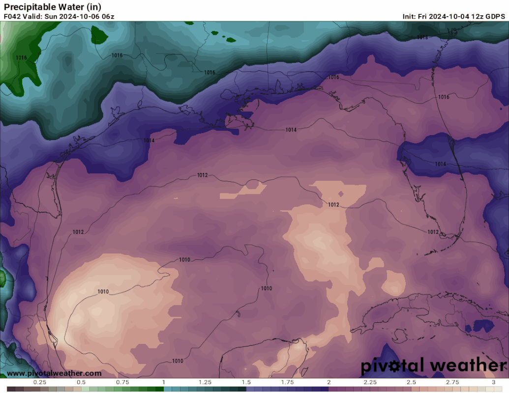
or enhance upper-lvl divergence (aiding organization)."end quote.......whatever form this system takes....unfortunately is looking likely that our friends in Florida may possibly be getting more rain....the satellite imagery of the gulf looks much more active today...than in the past few days....
response to a potent shortwave trough shifting eastward, with this
shortwave acting to carve out a weakness over the Eastern CONUS which will
likely persist through much of the upcoming work-week.
Concurrently, a low-lvl disturbance will begin to organize in the
southern GOM, with a surface low potentially forming by early
next week in the vicinity of the Bay of Campeche or just north of
the Yucatan Peninsula. Given the aforementioned mid-lvl weakness,
the low`s track would generally be to the E-NE with the current
"consensus" favoring the low to be near the southern/central
Florida Peninsula in the Tuesday-Thursday time frame. However,
this setup/evolution is complicated by several factors, namely:
the aforementioned primary surface low will be only one part of a larger
cyclonic gyre which may also include a northern circulation, the
interaction of the low with a cold front which will shift into the southern
US/northern GOM early next week, and the positioning of an UL jet streak
over the southern US which depending on the low`s placement and
organization could either impart additional shear (limiting organization)
or enhance upper-lvl divergence (aiding organization)."end quote.......whatever form this system takes....unfortunately is looking likely that our friends in Florida may possibly be getting more rain....the satellite imagery of the gulf looks much more active today...than in the past few days....
Last edited by underthwx on Fri Oct 04, 2024 11:54 am, edited 1 time in total.
0 likes

-
SFLcane
- S2K Supporter
- Posts: 10281
- Age: 48
- Joined: Sat Jun 05, 2010 1:44 pm
- Location: Lake Worth Florida
Re: Possible development in the Gulf of Mexico (0/40)
All 12z guidance trended stronger GFS,CMC and ICON bring this into the 980's likely hurricane intensity whether its tropical or sub tropical the impacts are the same to the average person.
3 likes
Re: Possible development in the Gulf of Mexico (0/40)
SFLcane wrote:All 12z guidance trended stronger GFS,CMC and ICON bring this into the 980's likely hurricane intensity whether its tropical or sub tropical the impacts are the same to the average person.
UKMet also came in stronger
1 likes
-
Weathertracker96
- Tropical Storm

- Posts: 150
- Joined: Mon Oct 16, 2023 3:41 pm
Re: Possible development in the Gulf of Mexico (0/40)
Cat5James wrote:SFLcane wrote:All 12z guidance trended stronger GFS,CMC and ICON bring this into the 980's likely hurricane intensity whether its tropical or sub tropical the impacts are the same to the average person.
UKMet also came in stronger
What Path does the UKMet show?
Also, I wonder if anyone has heard from LarryWx?
I know he usually posted about the UKMet
0 likes

Re: Possible development in the Gulf of Mexico (0/40)
Cat5James wrote:SFLcane wrote:All 12z guidance trended stronger GFS,CMC and ICON bring this into the 980's likely hurricane intensity whether its tropical or sub tropical the impacts are the same to the average person.
UKMet also came in stronger
If this is subtropical it will cover a larger area even if it hits alittle north of Tampa ,South Florida will still feel the affects of this storm.
0 likes


Re: Possible development in the Gulf of Mexico (0/40)
Do any current model runs show this thing crossing Florida and then turning north toward the mid-Atlantic? Or do they show it heading OTS? I'm assuming the latter.
0 likes
-
toad strangler

- S2K Supporter
- Posts: 4546
- Joined: Sun Jul 28, 2013 3:09 pm
- Location: Earth
- Contact:
Re: Possible development in the Gulf of Mexico (0/40)
12z UKMET goes into Fort Myers heading ENE. Although not very strong. Probably a TS or Sub Stropical Storm.
1 likes
My Weather Station
https://www.wunderground.com/dashboard/pws/KFLPORTS603
https://www.wunderground.com/dashboard/pws/KFLPORTS603
-
cycloneye

- Admin

- Posts: 149695
- Age: 69
- Joined: Thu Oct 10, 2002 10:54 am
- Location: San Juan, Puerto Rico
Re: Possible development in the Gulf of Mexico (10/50)
2 PM TWO up to 10/50:
Gulf of Mexico:
A trough of low pressure over the western Gulf of Mexico is
producing widespread shower and thunderstorm activity. A broad area
of low pressure is expected to develop from this system over the
southwestern or south-central Gulf of Mexico during the next day or
two, and additional subsequent development is possible while the low
moves slowly eastward or northeastward. A tropical or subtropical
depression or storm could form during the early to middle part of
next week if the low remains separate from a frontal boundary that
is forecast to extend across the Gulf of Mexico next week.
Regardless of tropical or subtropical development, locally heavy
rains could occur over portions of Mexico during the next few days
and over portions of the Florida Peninsula late this weekend into
next week.
* Formation chance through 48 hours...low...10 percent.
* Formation chance through 7 days...medium...50 percent.
1 likes
Visit the Caribbean-Central America Weather Thread where you can find at first post web cams,radars
and observations from Caribbean basin members Click Here
and observations from Caribbean basin members Click Here

Re: Possible development in the Gulf of Mexico (10/50)
2024 loves reviving its AOIs. Pre-Francine and pre-Gordon both went from orange AOIs to lemon, only to come back to orange and eventually develop. Let's see if this one follows suit.
0 likes
TC naming lists: retirements and intensity
Most aggressive Advisory #1's in North Atlantic (cr. kevin for starting the list)
Most aggressive Advisory #1's in North Atlantic (cr. kevin for starting the list)
Re: Possible development in the Gulf of Mexico (10/50)
cycloneye wrote:2 PM TWO up to 10/50:Gulf of Mexico:
A trough of low pressure over the western Gulf of Mexico is
producing widespread shower and thunderstorm activity. A broad area
of low pressure is expected to develop from this system over the
southwestern or south-central Gulf of Mexico during the next day or
two, and additional subsequent development is possible while the low
moves slowly eastward or northeastward. A tropical or subtropical
depression or storm could form during the early to middle part of
next week if the low remains separate from a frontal boundary that
is forecast to extend across the Gulf of Mexico next week.
Regardless of tropical or subtropical development, locally heavy
rains could occur over portions of Mexico during the next few days
and over portions of the Florida Peninsula late this weekend into
next week.
* Formation chance through 48 hours...low...10 percent.
* Formation chance through 7 days...medium...50 percent.
Not surprised to see it bumped up to 50%....should be in even higher chances by the overnight hours?.....
0 likes
-
chris_fit

- Category 5
- Posts: 3261
- Age: 43
- Joined: Wed Sep 10, 2003 11:58 pm
- Location: Tampa Bay Area, FL
Re: Possible development in the Gulf of Mexico (10/50)
12Z EURO much stronger than 00z through 72 hours...

0 likes

-
jlauderdal
- S2K Supporter
- Posts: 7240
- Joined: Wed May 19, 2004 5:46 am
- Location: NE Fort Lauderdale
- Contact:
Re: Possible development in the Gulf of Mexico (10/50)
There is plenty of runway if it can find a pocket and tropical systems are good at that, we are looking at a scenario where hurricane preps might be done in flooding conditions, when was the last time we saw that? Typically we get subsidence around something worth putting shutters up for so this could get interesting.
1 likes
Who is online
Users browsing this forum: Kingarabian, Ulf and 175 guests