
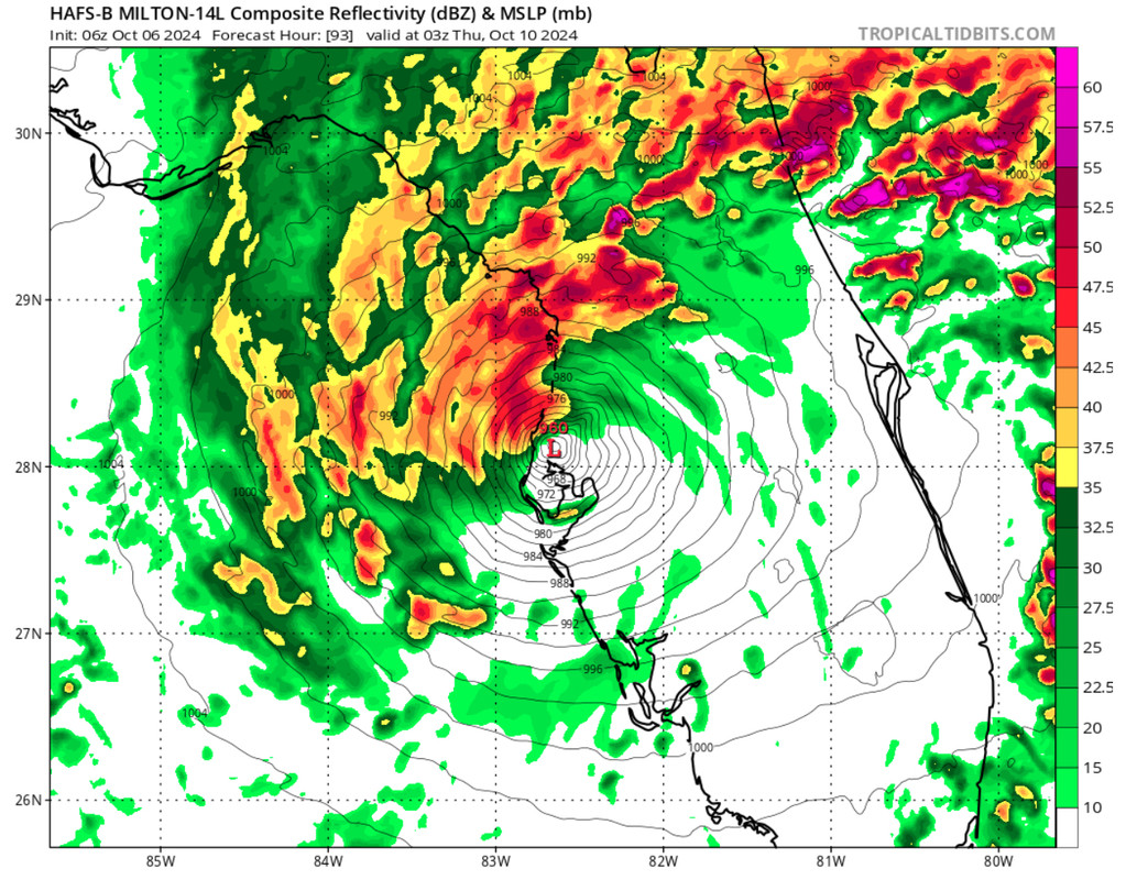
NDG wrote:I would not be throwing out the GFS out the window, just about nailed it current position of 22.5 N, pressure off by just a few mb which is not abnormal when handling a small storm like Milton. It shows steadily strengthening during the next 24 hrs, dropping down to the lower 970s mb by tomorrow morning, which will probably be down to at least the 960s mb by tomorrow morning.
GFS has the best track record within 72-84 hrs in the GOM during the past two hurricanes.
https://i.imgur.com/luorKkt.gif
It is a bit small, but once it fills in the SE side it will be close to stretching across the BOC


