
jlauderdal wrote:SFLcane wrote:wxman57 wrote:Storms moving up against a jet stream always track right of the forecast (Francine, Helene, Charley, etc). Consensus (green) and corrected consensus (gray) are now well south of NHC's track (maroon). Look for a gradual NHC track shift south of TPA. They may not do it this morning, but it's coming. Meanwhile, for those of you in Tampa, the SLOSH map below indicates what kind of surge you would see with NHC's current track. Over 18ft into NE Tampa Bay. You definitely want it going in to the south.
https://wxman57.com/images/12ZConsensus.JPG
https://wxman57.com/images/12ZConsensus.JPG
https://wxman57.com/images/SLOSHCat3.JPG
https://wxman57.com/images/SLOSHCat3.JPG
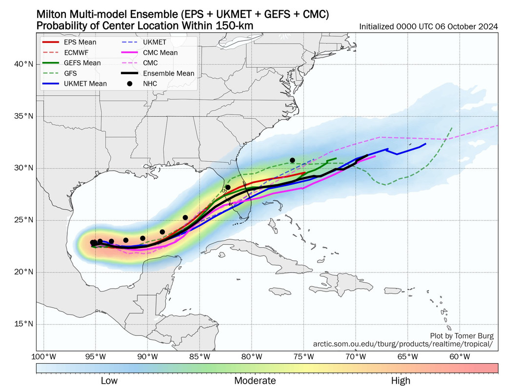
NHC is north of almost all the ensembles.
https://i.postimg.cc/3xMVMWn3/IMG-9571.jpg
The ICON track as of now looks good, intensity and track make sense.
Do yall anticipate nudges in the forecast track to occur throughout the day today?.....considering the fact that Milton's structure will expand...resulting in a more widespread event for much of the Florida Peninsula.....even Miami is displaying tropical storm conditions are possible later this week....forecasters across the state must find it frustrating not to be able to committ to a forecast for their area of responsibility...due to track fluctuations....tough to forecast...


