
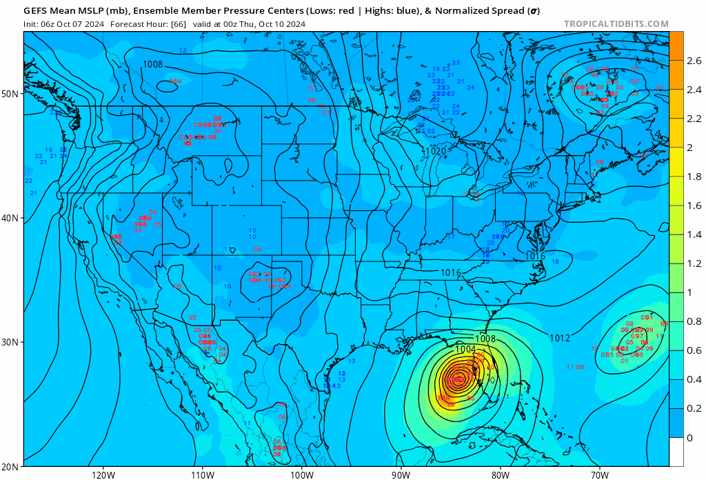
TampaWxLurker wrote:HAFS-B has 893mb 12z Wed, up to 963mb 06z Thur, just off the coast of southern Pinellas.
Is this S of 00z and 18z runs?
Moderator: S2k Moderators
TampaWxLurker wrote:HAFS-B has 893mb 12z Wed, up to 963mb 06z Thur, just off the coast of southern Pinellas.
TampaWxLurker wrote:HAFS-B has 893mb 12z Wed, up to 963mb 06z Thur, just off the coast of southern Pinellas.

fllawyer wrote:TampaWxLurker wrote:HAFS-B has 893mb 12z Wed, up to 963mb 06z Thur, just off the coast of southern Pinellas.
Is this S of 00z and 18z runs?


 Hurricanes: Andrew 1992 - Irene 1999 - Frances 2004 - Jeanne 2004 - Katrina 2005 - Wilma 2005 - Matthew 2016 - Irma 2017 - Ian 2022 - Nicole 2022 - Milton 2024

skillz305 wrote:The direct cut east is kinda worrisome for the treasure coast here
Users browsing this forum: No registered users and 13 guests


