ATL: MILTON - Post-Tropical - Discussion
Moderator: S2k Moderators
-
Tailgater33
- Tropical Depression

- Posts: 94
- Joined: Thu Jun 02, 2022 9:15 am
Re: ATL: MILTON - Hurricane - Discussion: 150 mph / 929 mbs
I’m not reading back 20 pages to see someone posted this already but Milton seems to drop farther south while deepening, also it’s probably in the coolest waters in the GOM then it’ll hit the loop current region. Come on shear, don’t let us down.
6 likes

Re: ATL: MILTON - Hurricane - Discussion: 150 mph / 929 mbs
Since we're wobble watching anyways: the south component seems to have disappeared in the last 20 minutes of floater imagery, now pretty much due east.
4 likes
-
SFLcane

- S2K Supporter

- Posts: 10281
- Age: 48
- Joined: Sat Jun 05, 2010 1:44 pm
- Location: Lake Worth Florida
Re: ATL: MILTON - Hurricane - Discussion: 150 mph / 929 mbs
Wxman always says these storms from this angle more times then not find a way to come south of Tampa. Have to keep watching down to Fort myers
5 likes

Re: ATL: MILTON - Hurricane - Discussion: 150 mph / 929 mbs
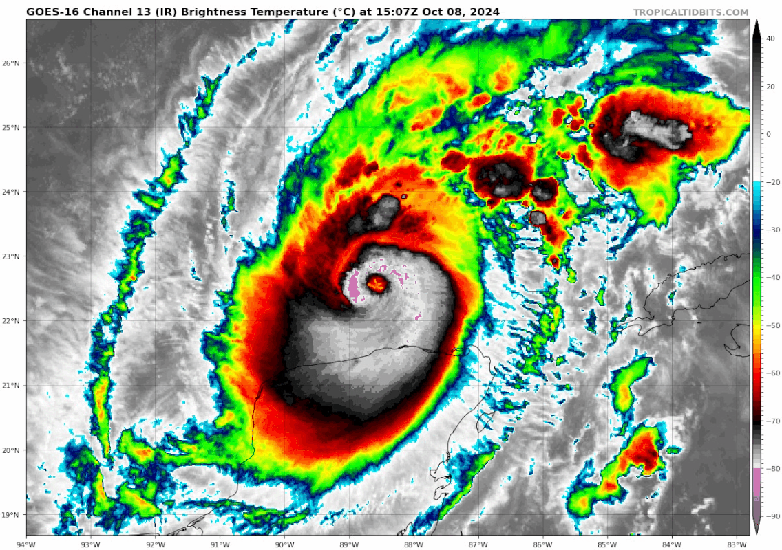
Eyedrop
850mb is back to saturation.
No sign of a forthcoming EWRC
https://www.tropicaltidbits.com/recon/r ... 8-1530.png
850mb is back to saturation.
No sign of a forthcoming EWRC
https://www.tropicaltidbits.com/recon/r ... 8-1530.png
3 likes

Re: ATL: MILTON - Hurricane - Discussion: 150 mph / 929 mbs
tolakram wrote:chaser1 wrote:Perhaps a partial cyclonic turn or track adjustment?
As I posted in the models thread, this southward movement, or wobble, was forecast as it starts to strengthen again.
I probably would have read that had I been keeping up with posts from the models thread.Thanks for repeating that here nonetheless.
0 likes
Andy D
(For official information, please refer to the NHC and NWS products.)
(For official information, please refer to the NHC and NWS products.)
-
Flwxguy86

- Tropical Depression
- Posts: 51
- Age: 39
- Joined: Sun Sep 15, 2024 11:06 am
- Location: Oldsmar,FL
Re: ATL: MILTON - Hurricane - Discussion: 150 mph / 929 mbs
tulum07 wrote:By overachieving, Milton has caused complacency. Now people are saying it is "only" a C3. Maybe Milton will come back and bite them in the butt.
I agree, I hope maybe it loses a bit of it's bite because I'll be riding it out in the middle of Pinellas county in Clearwater, If they track stays as it is now, I will go through the Northern eyewall of Milton, Which is exciting but kinda nerve wracking too. I am not worried about the place I will be staying just not looking forward to the damage and possible days or weeks without power. Although I am not sure my primary residence in Oldsmar will see any storm surge or not but I am not going to stay here and find out that hard way. I've been through one other cat 3 in my lifetime and that was Fran in 1996 I believe was the year but that was a long time ago and all I can really remember about that experience was how loud it was, sounded like someone was hammering the side of the house constantly.
1 likes

Re: ATL: MILTON - Hurricane - Discussion: 150 mph / 929 mbs
sicktght311 wrote:underthwx wrote:sicktght311 wrote:People need to continue to put this stuff into perspective. So many people on here and in the media are all celebrating "oh its going to weaken before landfall", which is all well and good, if this was a category 1 or 2 now and then weakening to TS. This is one of the strongest TCs on record, and even moderate weakening before landfall will still have devastating consequences. If this was a Category 3 from start to finish, people would and still should be sounding the alarms. Dont count yourselves safe just because a historic category 5 *might* weaken slightly. It might not even weaken that much at all
Also, people need to stop watching pressures and wind speeds of each Hurricane Hunter run and start sounding all clears. Watch the pressure, watch the wind, but also pay attention to IR. He's wrapping up and deepening around the eye again as we speak, so theres no chance hes done putting on his show yet
I haven't detected an atmosphere of all clear....either here...or with the NHC....as for the media....I dont watch....my information that I pay attention to...is fact based....and yes...Milton is a dangerous cyclone to say the least....and as a result....residents are heeding warnings and leaving the areas that are most vulnerable to Milton's fury.....please accept my comment as respectful to you....peace....
Its a reminder to some folks here who are quick to comment "its weakening", as well as people in the media, to look at things from a larger perspective, and consider that it can play with people's lives. People are impressionable, dumb, and short sighted. Everyone tries to balance risk vs optimism, but its always just a reminder that the only optimistic way to mitigate risk is to avoid it. If its dangerous now, treat it as if it will be just as dangerous in 48 hours
While I agree everyone should still treat it like the threat it is, the forecasted weakening on models like HAFS-B is significant (like +40mb) and that should be communicated to avoid sensationalism. Yes, it’s one of the most powerful hurricanes ever, but we know with a pretty high degree of confidence that it won’t make landfall at that intensity. It’s in the public interest to (cautiously) let that be known.
Last edited by technikal on Tue Oct 08, 2024 11:23 am, edited 1 time in total.
4 likes

Re: ATL: MILTON - Hurricane - Discussion: 150 mph / 929 mbs
Tailgater33 wrote:I’m not reading back 20 pages to see someone posted this already but Milton seems to drop farther south while deepening, also it’s probably in the coolest waters in the GOM then it’ll hit the loop current region. Come on shear, don’t let us down.
What is the latest SHIPs and shear forecast? Earlier this morning it seemed to be less than expected around landfall than we had thought yesterday
0 likes
Just like Jon Snow..."I know nothing" except what I know, and most of what I know is gathered by the fine people of the NHC
-
tolakram
- Admin

- Posts: 20173
- Age: 62
- Joined: Sun Aug 27, 2006 8:23 pm
- Location: Florence, KY (name is Mark)
Re: ATL: MILTON - Hurricane - Discussion: 150 mph / 929 mbs
Tailgater33 wrote:I’m not reading back 20 pages to see someone posted this already but Milton seems to drop farther south while deepening, also it’s probably in the coolest waters in the GOM then it’ll hit the loop current region. Come on shear, don’t let us down.
Where are people coming up with this cool water idea? Before the Asheville site went down this area reported some of the warmest.

Last edited by tolakram on Tue Oct 08, 2024 11:35 am, edited 1 time in total.
Reason: spelled Asheville wrong
Reason: spelled Asheville wrong
4 likes
M a r k
- - - - -
Join us in chat: Storm2K Chatroom Invite. Android and IOS apps also available.
The posts in this forum are NOT official forecasts and should not be used as such. Posts are NOT endorsed by any professional institution or STORM2K.org. For official information and forecasts, please refer to NHC and NWS products.
-
Blown Away

- S2K Supporter
- Posts: 10253
- Joined: Wed May 26, 2004 6:17 am
Re: ATL: MILTON - Hurricane - Discussion: 150 mph / 929 mbs
kevin wrote:Since we're wobble watching anyways: the south component seems to have disappeared in the last 20 minutes of floater imagery, now pretty much due east.
Looks still slight S of E...
3 likes
Hurricane Eye Experience: David 79, Irene 99, Frances 04, Jeanne 04, Wilma 05… Hurricane Brush Experience: Andrew 92, Erin 95, Floyd 99, Matthew 16, Irma 17, Ian 22, Nicole 22…
-
bythetrack
- Tropical Wave

- Posts: 9
- Age: 67
- Joined: Thu Sep 12, 2019 7:27 am
- Location: exact center of Florida
- Contact:
Re: ATL: MILTON - Hurricane - Discussion: 150 mph / 929 mbs
Hey all, sitting in Sebring . Guess all the orchids are going inside for a couple of days. We have around 40, 200 year old oak trees on our property. Clean up is always fun . Been through 135 mph here a couple of years ago so we know the drill. I lived on the coast for years and after the 2004 season moved inland. Right now Im glad I did. Everyone stay safe and pay attention. This too shall pass, Roger
5 likes
From Andrew on in the south west , central and nature coast of Fla.
-
tolakram
- Admin
- Posts: 20173
- Age: 62
- Joined: Sun Aug 27, 2006 8:23 pm
- Location: Florence, KY (name is Mark)
Re: ATL: MILTON - Hurricane - Discussion: 150 mph / 929 mbs
technikal wrote:sicktght311 wrote:underthwx wrote:I haven't detected an atmosphere of all clear....either here...or with the NHC....as for the media....I dont watch....my information that I pay attention to...is fact based....and yes...Milton is a dangerous cyclone to say the least....and as a result....residents are heeding warnings and leaving the areas that are most vulnerable to Milton's fury.....please accept my comment as respectful to you....peace....
Its a reminder to some folks here who are quick to comment "its weakening", as well as people in the media, to look at things from a larger perspective, and consider that it can play with people's lives. People are impressionable, dumb, and short sighted. Everyone tries to balance risk vs optimism, but its always just a reminder that the only optimistic way to mitigate risk is to avoid it. If its dangerous now, treat it as if it will be just as dangerous in 48 hours
While I agree everyone should still treat it like the threat it is, the forecasted weakening on models like HAFS-B is significant (like +40mb) and that should be communicated to avoid sensationalism. Yes, it’s one of the most powerful hurricanes ever, but we know with a pretty high degree of confidence that it won’t make landfall at that intensity. It’s in the public interest to (cautiously) let that be known.
I disagree, unless we can agree on what weakening means. Less surge, less wind, less overall impact? The mission statement of the NHC is: To save lives, mitigate property loss, and improve economic efficiency by issuing the best watches, warnings, forecasts and analyses of hazardous tropical weather, and by increasing understanding of these hazards through global outreach.
How does mentioning the barometric pressure or wind speed of a storm is weakening while the most dangerous part of the storm, the surge, is not fit into that statement. Katrina was weakening. The NHC doesn't report on the whims of every model.
13 likes
M a r k
- - - - -
Join us in chat: Storm2K Chatroom Invite. Android and IOS apps also available.
The posts in this forum are NOT official forecasts and should not be used as such. Posts are NOT endorsed by any professional institution or STORM2K.org. For official information and forecasts, please refer to NHC and NWS products.
- - - - -
Join us in chat: Storm2K Chatroom Invite. Android and IOS apps also available.
The posts in this forum are NOT official forecasts and should not be used as such. Posts are NOT endorsed by any professional institution or STORM2K.org. For official information and forecasts, please refer to NHC and NWS products.
-
TomballEd
- Category 5

- Posts: 1246
- Age: 62
- Joined: Wed Aug 16, 2023 4:52 pm
- Location: Spring/Klein area, not Tomball
Re: ATL: MILTON - Hurricane - Discussion: 150 mph / 929 mbs
Flwxguy86 wrote:tulum07 wrote:By overachieving, Milton has caused complacency. Now people are saying it is "only" a C3. Maybe Milton will come back and bite them in the butt.
I agree, I hope maybe it loses a bit of it's bite because I'll be riding it out in the middle of Pinellas county in Clearwater, If they track stays as it is now, I will go through the Northern eyewall of Milton, Which is exciting but kinda nerve wracking too. I am not worried about the place I will be staying just not looking forward to the damage and possible days or weeks without power. Although I am not sure my primary residence in Oldsmar will see any storm surge or not but I am not going to stay here and find out that hard way. I've been through one other cat 3 in my lifetime and that was Fran in 1996 I believe was the year but that was a long time ago and all I can really remember about that experience was how loud it was, sounded like someone was hammering the side of the house constantly.
Katrina was only a 3 at landfall. A high end Cat 4 a day from landfall will bring a big surge even if it has weakened. See also Ike, just a Cat 2, and big surge.
2 likes
-
AutoPenalti
- Category 5
- Posts: 4091
- Age: 29
- Joined: Mon Aug 17, 2015 4:16 pm
- Location: Ft. Lauderdale, Florida
Re: ATL: MILTON - Hurricane - Discussion: 150 mph / 929 mbs
Wobble watching this early will get your eyes strained. Trochoidal wobbles are normal in TC's this intense. Extrapolating it just has this heading due East as forecast.
7 likes
The posts in this forum are NOT official forecasts and should not be used as such. They are just the opinion of the poster and may or may not be backed by sound meteorological data. They are NOT endorsed by any professional institution or STORM2K. For official information, please refer to products from the NHC and NWS.
Model Runs Cheat Sheet:
GFS (5:30 AM/PM, 11:30 AM/PM)
HWRF, GFDL, UKMET, NAVGEM (6:30-8:00 AM/PM, 12:30-2:00 AM/PM)
ECMWF (1:45 AM/PM)
TCVN is a weighted averaged
-
SFLcane
- S2K Supporter
- Posts: 10281
- Age: 48
- Joined: Sat Jun 05, 2010 1:44 pm
- Location: Lake Worth Florida
Re: ATL: MILTON - Hurricane - Discussion: 150 mph / 929 mbs
AutoPenalti wrote:Wobble watching this early will get your eyes strained. Trochoidal wobbles are normal in TC's this intense. Extrapolating it just has this heading due East as forecast.
Yup reminds me of wilma though the motion looks more ENE to me. Can't stress it enough how tricky it is to pin point a landfall in west fl coming at an angle like this.
Last edited by SFLcane on Tue Oct 08, 2024 11:35 am, edited 1 time in total.
2 likes
Re: ATL: MILTON - Hurricane - Discussion: 150 mph / 929 mbs
Here on out, I am estimating roughly 50% of its track will be over the Loop Current.
2 likes
-
tolakram
- Admin
- Posts: 20173
- Age: 62
- Joined: Sun Aug 27, 2006 8:23 pm
- Location: Florence, KY (name is Mark)
Re: ATL: MILTON - Hurricane - Discussion: 150 mph / 929 mbs
saved loop

6 likes
M a r k
- - - - -
Join us in chat: Storm2K Chatroom Invite. Android and IOS apps also available.
The posts in this forum are NOT official forecasts and should not be used as such. Posts are NOT endorsed by any professional institution or STORM2K.org. For official information and forecasts, please refer to NHC and NWS products.
- - - - -
Join us in chat: Storm2K Chatroom Invite. Android and IOS apps also available.
The posts in this forum are NOT official forecasts and should not be used as such. Posts are NOT endorsed by any professional institution or STORM2K.org. For official information and forecasts, please refer to NHC and NWS products.
-
Flwxguy86
- Tropical Depression
- Posts: 51
- Age: 39
- Joined: Sun Sep 15, 2024 11:06 am
- Location: Oldsmar,FL
Re: ATL: MILTON - Hurricane - Discussion: 150 mph / 929 mbs
Since a lot of people are talking about wobbles, Some of you might be aware of it but if you aren't, The Local news here WFLA has a 24/7 Live wobble tracker, and it has had some pretty crazy wobbles to the south and north which could definitely effect the track down the line but if you are interested in tracking the wobbles that's an interesting and informative way to watch.
https://www.wfla.com/weather/tracking-the-tropics/live-wobble-tracker-changes-in-hurricane-miltons-path-could-have-huge-impacts/
https://www.wfla.com/weather/tracking-the-tropics/live-wobble-tracker-changes-in-hurricane-miltons-path-could-have-huge-impacts/
Last edited by Flwxguy86 on Tue Oct 08, 2024 11:38 am, edited 2 times in total.
5 likes
Re: ATL: MILTON - Hurricane - Discussion: 150 mph / 929 mbs
tolakram wrote:saved loop
https://i.imgur.com/bwRi4Ev.gif
Great image!.....look at how the convection fires up around the center.....amazing look at Milton....
1 likes
Who is online
Users browsing this forum: No registered users and 45 guests