ATL: INVEST 98L - Discussion

Moderator: S2k Moderators

Message
Author
User avatar
AJC3
Admin
Admin
Posts: 3998
Age: 61
Joined: Tue Aug 31, 2004 7:04 pm
Location: West Melbourne, Florida
Contact:

ATL: INVEST 98L - Discussion

#1 Postby AJC3 » Sat Nov 09, 2024 2:35 pm

AL, 98, 2024110818, , BEST, 0, 235N, 689W, 25, 1011, DB, 0, , 0, 0, 0, 0, 1013, 180, 30, 0, 0, L, 0, , 0, 0, GENESIS038, , 0, , 0, 0, 0, 0, genesis-num, 038,
AL, 98, 2024110900, , BEST, 0, 237N, 695W, 25, 1011, DB, 0, , 0, 0, 0, 0, 1013, 180, 30, 0, 0, L, 0, , 0, 0, GENESIS038, , 0, , 0, 0, 0, 0, genesis-num, 038,
AL, 98, 2024110906, , BEST, 0, 240N, 700W, 25, 1011, DB, 0, , 0, 0, 0, 0, 1013, 180, 30, 0, 0, L, 0, , 0, 0, GENESIS038, , 0, , 0, 0, 0, 0, genesis-num, 038,
AL, 98, 2024110912, , BEST, 0, 243N, 705W, 25, 1011, DB, 0, , 0, 0, 0, 0, 1013, 180, 30, 0, 0, L, 0, , 0, 0, GENESIS038, , 0, , 0, 0, 0, 0, genesis-num, 038,
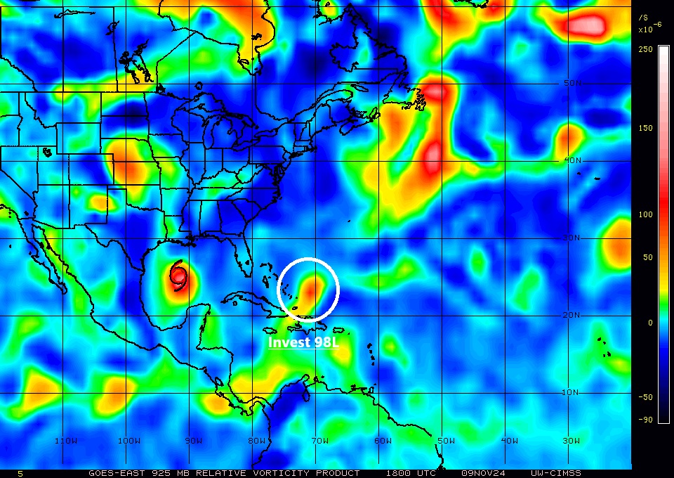
AL, 98, 2024110918, , BEST, 0, 247N, 710W, 25, 1011, DB, 34, NEQ, 0, 0, 0, 0, 1013, 180, 30, 0, 0, L, 0, , 0, 0, INVEST, S, 0, , 0, 0, 0, 0, genesis-num, 038, SPAWNINVEST, al722024 to al982024,
1 likes   

User avatar
WalterWhite
Category 1
Category 1
Posts: 342
Joined: Fri Mar 17, 2023 5:53 pm

Re: ATL: INVEST 98L - Discussion

#2 Postby WalterWhite » Sat Nov 09, 2024 2:42 pm

We were all going to write off this disturbance, but then 2024 said "not so fast".
1 likes   

User avatar
tropicwatch
Category 5
Category 5
Posts: 3364
Age: 61
Joined: Sat Jun 02, 2007 10:01 am
Location: Panama City Florida
Contact:

Re: ATL: INVEST 98L - Discussion

#3 Postby tropicwatch » Sat Nov 09, 2024 2:52 pm

98L 925mb vorticity:

Image
0 likes   
Tropicwatch


Agnes 72', Eloise 75, Elena 85', Kate 85', Charley 86', Florence 88', Beryl 94', Dean 95', Erin 95', Opal 95', Earl 98', Georges 98', Ivan 2004', Arlene 2005', Dennis 2005', Ida 2009' Debby 2012' Irma 2017' Michael 2018'

User avatar
sunnyday
Category 5
Category 5
Posts: 1590
Joined: Thu Sep 04, 2003 8:16 pm

Re: ATL: INVEST 98L - Discussion

#4 Postby sunnyday » Sat Nov 09, 2024 4:00 pm

Where is it going?
0 likes   

User avatar
HurricaneBelle
S2K Supporter
S2K Supporter
Posts: 1169
Joined: Sun Aug 27, 2006 6:12 pm
Location: Clearwater, FL

Re: ATL: INVEST 98L - Discussion

#5 Postby HurricaneBelle » Sat Nov 09, 2024 4:03 pm

sunnyday wrote:Where is it going?


headed to Florida as a wave but GFS and Euro shunts it off to the NE
1 likes   

User avatar
sunnyday
Category 5
Category 5
Posts: 1590
Joined: Thu Sep 04, 2003 8:16 pm

Re: ATL: INVEST 98L - Discussion

#6 Postby sunnyday » Sat Nov 09, 2024 4:06 pm

Thank you .
0 likes   

User avatar
MetroMike
Category 4
Category 4
Posts: 941
Joined: Sun Aug 29, 2004 8:13 pm
Location: Tampa Bay
Contact:

Re: ATL: INVEST 98L - Discussion

#7 Postby MetroMike » Sat Nov 09, 2024 4:22 pm

How on Earth is this an invest? The yellow hatched area only 10%? Fill me in.
0 likes   

User avatar
Jr0d
S2K Supporter
S2K Supporter
Posts: 1394
Joined: Tue Aug 27, 2019 10:52 am
Location: Cayo Hueso

Re: ATL: INVEST 98L - Discussion

#8 Postby Jr0d » Sat Nov 09, 2024 5:40 pm

MetroMike wrote:How on Earth is this an invest? The yellow hatched area only 10%? Fill me in.


My guess is so they can run the hurricane models on it. The global models struggled with Oscar in part because how small it was...I suppose they do not want another surprise like that as this approaches the Bahamas and Florida early in the week.
3 likes   

User avatar
cycloneye
Admin
Admin
Posts: 143858
Age: 68
Joined: Thu Oct 10, 2002 10:54 am
Location: San Juan, Puerto Rico

Re: ATL: INVEST 98L - Discussion

#9 Postby cycloneye » Sat Nov 09, 2024 6:31 pm

Tropical Weather Outlook
NWS National Hurricane Center Miami FL
700 PM EST Sat Nov 9 2024

For the North Atlantic...Caribbean Sea and the Gulf of Mexico:

Active Systems:
The National Hurricane Center is issuing advisories on Tropical
Storm Rafael, located over the central Gulf of Mexico.

1. Near the Bahamas:
A concentrated area of showers and thunderstorms a couple of hundred
miles east of the central Bahamas is associated with a trough of low
pressure. Some gradual development of this system is possible
during the next day or so before it moves into unfavorable
environmental conditions on Sunday. Regardless of development,
locally heavy rains and gusty winds are possible as it moves
generally westward across the Bahamas through Sunday.
* Formation chance through 48 hours...low...10 percent.
* Formation chance through 7 days...low...10 percent.
0 likes   
Visit the Caribbean-Central America Weather Thread where you can find at first post web cams,radars
and observations from Caribbean basin members Click Here

User avatar
Nimbus
Category 5
Category 5
Posts: 5274
Joined: Mon Jul 19, 2004 10:54 am

Re: ATL: INVEST 98L - Discussion

#10 Postby Nimbus » Sat Nov 09, 2024 6:36 pm

MetroMike wrote:How on Earth is this an invest? The yellow hatched area only 10%? Fill me in.


12Z Euro shows a weak circulation approaching Miami in 48 hours.
We get those rare depressions that come through the windward and leeward islands just as they start to reach tropical storm strength so better to have the invest for Florida in case there is a tornado or something. Appears to be a weak dry surface circulation already.
3 likes   

User avatar
AJC3
Admin
Admin
Posts: 3998
Age: 61
Joined: Tue Aug 31, 2004 7:04 pm
Location: West Melbourne, Florida
Contact:

Re: ATL: INVEST 98L - Discussion

#11 Postby AJC3 » Sun Nov 10, 2024 5:20 am

Tropical Weather Outlook
NWS National Hurricane Center Miami FL
100 AM EST Sun Nov 10 2024

Near the Bahamas:
Disorganized showers and thunderstorms continue near a trough of
low pressure located a couple of hundred miles east of the central
Bahamas. Some slight development of this system is possible before
it moves into unfavorable environmental conditions late today.
Regardless of development, locally heavy rains and gusty winds are
possible as it moves generally westward across the Bahamas through
tonight.
* Formation chance through 48 hours...low...10 percent.
* Formation chance through 7 days...low...10 percent.


Tropical Weather Discussion
NWS National Hurricane Center Miami FL
0605 UTC Sun Nov 10 2024

...ATLANTIC OCEAN...

A cold front curves westward from the north-central Atlantic
across 31N56W to near Daytona Beach Florida, then continues
northwestward as a stationary front across northern Florida.
Patchy showers are seen near and up to 40 nm south of this
boundary. A 1011 mb low pressure north of the Turks and Caicos
Islands are generating scattered moderate convection from 23N to
26N between 66W and 72W
.

Fresh to strong NW to NE winds and seas at 8 to 12 ft in large
northerly swells are evident north of 24N between 50W and the
Florida-Georgia coast.
Farther east, moderate to fresh with
locally strong S to SW winds and 6 to 8 ft seas are noted north of
24N between 40W and 50W.

For the forecast west of 55W, strong NE winds and rough seas
near the aforementioned 1011 mb low will persist through Sunday.

A strong cold front will continue to progress southward through
the central and western Atlantic this weekend, reaching 23N by Sun
morning and 19N by Mon before stalling through Tue.


Early morning IR satellite imagery shows the convection decreasing in coverage as the trough moves west toward the central Bahamas, and into a more stable thermodynamic enviroment as it gets overtaken by the post-frontal air mass to its north:
Image

Scatterometer imagery shows it has deamplified (become flatter) since Saturday morning:
Image

Whatever small chance this had to spinup yesterday has ended. However, as has been mentioned in the TWOs, this will produce some heavy showers and some gusty squalls as it pushes from the Bahamas across southern and central FL over the next few days.
0 likes   

User avatar
cycloneye
Admin
Admin
Posts: 143858
Age: 68
Joined: Thu Oct 10, 2002 10:54 am
Location: San Juan, Puerto Rico

Re: ATL: INVEST 98L - Discussion

#12 Postby cycloneye » Sun Nov 10, 2024 6:27 am

Tropical Weather Outlook
NWS National Hurricane Center Miami FL
700 AM EST Sun Nov 10 2024

For the North Atlantic...Caribbean Sea and the Gulf of Mexico:

Active Systems:
The National Hurricane Center is issuing advisories on Tropical
Storm Rafael, located over the central Gulf of Mexico.

1. Near the Bahamas (AL98):
Disorganized showers and thunderstorms have decreased in areal
coverage since yesterday near a trough of low pressure located less
than a couple of hundred miles east of the central Bahamas.
Development is becoming less likely as the system is forecast to
reach more unfavorable environmental conditions later today.
Regardless of development, locally heavy rains and gusty winds are
possible as the system moves generally westward across the Bahamas
through tonight.
* Formation chance through 48 hours...low...10 percent.
* Formation chance through 7 days...low...10 percent.


Forecaster Hagen
0 likes   
Visit the Caribbean-Central America Weather Thread where you can find at first post web cams,radars
and observations from Caribbean basin members Click Here

User avatar
cycloneye
Admin
Admin
Posts: 143858
Age: 68
Joined: Thu Oct 10, 2002 10:54 am
Location: San Juan, Puerto Rico

Re: ATL: INVEST 98L - Discussion

#13 Postby cycloneye » Sun Nov 10, 2024 12:48 pm

Bye.

Near the Bahamas (AL98):
Shower activity has diminished near a trough of low pressure located
near the central Bahamas. This system is located within an
unfavorable environment, and development is not expected. However,
locally gusty winds are still possible as the system moves generally
westward across the Bahamas through tonight.
* Formation chance through 48 hours...low...near 0 percent.
* Formation chance through 7 days...low...near 0 percent.
2 likes   
Visit the Caribbean-Central America Weather Thread where you can find at first post web cams,radars
and observations from Caribbean basin members Click Here


Return to “2024”

Who is online

Users browsing this forum: No registered users and 6 guests