I don’t know what to do!
Texas Winter 2024-2025
Moderator: S2k Moderators
Forum rules
 The posts in this forum are NOT official forecast and should not be used as such. They are just the opinion of the poster and may or may not be backed by sound meteorological data. They are NOT endorsed by any professional institution or STORM2K.

The posts in this forum are NOT official forecast and should not be used as such. They are just the opinion of the poster and may or may not be backed by sound meteorological data. They are NOT endorsed by any professional institution or STORM2K.
-
AubreyStorm

- Category 1

- Posts: 337
- Age: 45
- Joined: Fri Jun 16, 2017 6:21 pm
- Location: Texas, USA
Re: Texas Winter 2024-2025
Hmmmm maybe I will cancel my flight for this Friday arriving at Dallas Love Field or wait until if cancelled.
I don’t know what to do!
I don’t know what to do!
0 likes
The posts are NOT an official forecast. Please REFER to the NHC and NWS for official forecasts and products.

Re: Texas Winter 2024-2025
Here is a cool website to find out about weather events in your city. I have it pulled up to the snowiest winter season in Tyler, which was 14.4 inches in February 2021. It was freaking cold, too.
https://www.extremeweatherwatch.com/cities/tyler/snowiest-winter-season
Do your own search and see what you can find or what memories it will elicit.
https://www.extremeweatherwatch.com/cities/tyler/snowiest-winter-season
Do your own search and see what you can find or what memories it will elicit.
2 likes
-
Fifty Rock
- Tropical Storm

- Posts: 149
- Joined: Mon Sep 11, 2023 10:08 am
- Location: Albany, Texas
Re: Texas Winter 2024-2025
AubreyStorm wrote:Hmmmm maybe I will cancel my flight for this Friday arriving at Dallas Love Field or wait until if cancelled.
I don’t know what to do!
Just know if you do cancel, nothing will happen and if you don’t, it will be a 12’ surprise!
4 likes
Re: Texas Winter 2024-2025
Fifty Rock wrote:Storm 2K needs a rehab page with the ability to prescribe Xanax and pass out Kleenex tissue’s
Don't forget the rehydration so you can reliably replenish and shed those croc tears several times for all to see!
2 likes
-
Lagreeneyes03
- Category 2

- Posts: 608
- Joined: Mon Dec 09, 2013 10:53 am
- Location: Luxurious Lake Grapevine
Re: Texas Winter 2024-2025
CaptinCrunch wrote:Even with all the pretty models and possibilities, I said from the start the best we may see is 3-5” which according to NWS FTW is right there with their forecast. Now those higher totals will be north of 820, so in the immediate DFW metro area 2-4” range is acceptable.
I'm fine with that. It will still look nice, make for some good pictures, shut down the city for a couple of days and practice for what's to come haha
3 likes
I'm a Princess, not a forecaster.
-
mmmmsnouts
- Tropical Storm
- Posts: 213
- Joined: Tue Sep 05, 2023 10:04 pm
- Location: Arlington, TX
Re: Texas Winter 2024-2025
2-4" of snow is plenty for the kids to go out and play in. I didn't want all those fantasy land totals, I have a roof and tree branches to worry about.
4 likes
-
Fifty Rock
- Tropical Storm
- Posts: 149
- Joined: Mon Sep 11, 2023 10:08 am
- Location: Albany, Texas
Re: Texas Winter 2024-2025
BradKingK wrote:Fifty Rock wrote:Storm 2K needs a rehab page with the ability to prescribe Xanax and pass out Kleenex tissue’s
Don't forget the rehydration so you can reliably replenish and shed those croc tears several times for all to see!
Maybe Gatorade can make a new drink from all the snow up North and add a pinch of alcohol to it. That and a Xanax and it’s
“WHAT SNOW”
1 likes
-
Lagreeneyes03
- Category 2
- Posts: 608
- Joined: Mon Dec 09, 2013 10:53 am
- Location: Luxurious Lake Grapevine
Re: Texas Winter 2024-2025
I feel like current temperatures, including yesterday, have been trending down than the original forecast. I think today originally it was supposed to be mid-ish 40's and now the forecast is 38. This has to have some effect on the upcoming system, models still too warm. I also notice the Low seems to be in Mexico. Could lack of data have caused the model swing?
4 likes
I'm a Princess, not a forecaster.
-
Ralph's Weather
- S2K Supporter

- Posts: 3371
- Age: 38
- Joined: Fri Dec 13, 2013 11:55 am
- Location: Lindale, TX
- Contact:
Re: Texas Winter 2024-2025
Most of the model sites only plot snow or freezing rain. Have to interpret sleet in between. I believe so will see hefty sleet totals out of this. 1" QPF with a profile fluctuating near 0C could result in multi inch sleet.
Sleet sticks to roads much more efficiently than freezing rain or snow. Once you get a layer of sleet anything after will stick to that layer. This is why the I-20 corridor of E TX could experience major impacts from this event.
Sleet sticks to roads much more efficiently than freezing rain or snow. Once you get a layer of sleet anything after will stick to that layer. This is why the I-20 corridor of E TX could experience major impacts from this event.
3 likes
Follow on Facebook at Ralph's Weather.
-
Lagreeneyes03
- Category 2
- Posts: 608
- Joined: Mon Dec 09, 2013 10:53 am
- Location: Luxurious Lake Grapevine
Re: Texas Winter 2024-2025
Ralph's Weather wrote:Most of the model sites only plot snow or freezing rain. Have to interpret sleet in between. I believe so will see hefty sleet totals out of this. 1" QPF with a profile fluctuating near 0C could result in multi inch sleet.
Sleet sticks to roads much more efficiently than freezing rain or snow. Once you get a layer of sleet anything after will stick to that layer. This is why the I-20 corridor of E TX could experience major impacts from this event.
Should I dare say................THUNDERSLEET?

4 likes
I'm a Princess, not a forecaster.
Re: Texas Winter 2024-2025
Take it with a tiny grain of salt, but the long-range RAP is significantly colder than the other models, enough for all snow for most of North Texas.
7 likes
-
Ralph's Weather
- S2K Supporter
- Posts: 3371
- Age: 38
- Joined: Fri Dec 13, 2013 11:55 am
- Location: Lindale, TX
- Contact:
Re: Texas Winter 2024-2025
Lagreeneyes03 wrote:Ralph's Weather wrote:Most of the model sites only plot snow or freezing rain. Have to interpret sleet in between. I believe so will see hefty sleet totals out of this. 1" QPF with a profile fluctuating near 0C could result in multi inch sleet.
Sleet sticks to roads much more efficiently than freezing rain or snow. Once you get a layer of sleet anything after will stick to that layer. This is why the I-20 corridor of E TX could experience major impacts from this event.
Should I dare say................THUNDERSLEET?
Honestly that is on the table. Shades of March 2013 when I had 2" of sleet in a short period of time with a lot of lightning. Place I was living in was a metal building so it was a loud and impressive evening.
2 likes
Follow on Facebook at Ralph's Weather.
Re: Texas Winter 2024-2025
snownado wrote:Take it with a tiny grain of salt, but the long-range RAP is significantly colder than the other models, enough for all snow for most of North Texas.
Is the RAP a reliable model at this range?
1 likes
-
txtwister78

- Category 5

- Posts: 2146
- Joined: Wed Jan 30, 2019 12:56 pm
- Location: San Antonio
Re: Texas Winter 2024-2025
Different topic but definitely something trending out west across Los Angeles region, but a massive wildfire has broken out threatening communities. Looks bad based on some initial pictures and proximity to cities. 60 to 70mph wind gust out there right now.
Last edited by txtwister78 on Tue Jan 07, 2025 2:28 pm, edited 2 times in total.
0 likes
Re: Texas Winter 2024-2025
gpsnowman wrote:snownado wrote:Take it with a tiny grain of salt, but the long-range RAP is significantly colder than the other models, enough for all snow for most of North Texas.
Is the RAP a reliable model at this range?
RAP is what replaced the RUC model and is similar to the HRRR (just somewhat lower resolution and goes further out).
1 likes
-
KeriCarter

- S2K Supporter
- Posts: 43
- Joined: Wed Feb 02, 2011 10:56 am
- Location: Palestine/Texarkana
- Contact:
Re: Texas Winter 2024-2025
Whatever verifies, I am enjoying the models, analysis, and forecast discussion posts this winter. Thanks guys! 
9 likes
-
Ralph's Weather
- S2K Supporter
- Posts: 3371
- Age: 38
- Joined: Fri Dec 13, 2013 11:55 am
- Location: Lindale, TX
- Contact:
Re: Texas Winter 2024-2025
Ralph's Weather wrote:Lagreeneyes03 wrote:Ralph's Weather wrote:Most of the model sites only plot snow or freezing rain. Have to interpret sleet in between. I believe so will see hefty sleet totals out of this. 1" QPF with a profile fluctuating near 0C could result in multi inch sleet.
Sleet sticks to roads much more efficiently than freezing rain or snow. Once you get a layer of sleet anything after will stick to that layer. This is why the I-20 corridor of E TX could experience major impacts from this event.
Should I dare say................THUNDERSLEET?
Honestly that is on the table. Shades of March 2013 when I had 2" of sleet in a short period of time with a lot of lightning. Place I was living in was a metal building so it was a loud and impressive evening.
Euro gives me almost 2" QPF and 850mb maxes at 2C briefly during the event. Pivotal interprets that as almost all rain but that would in reality be a heavy sleet event. Profile is saturated all the way up to 200mb.
Just get that a tad colder and the snow could be incredible.
2 likes
Follow on Facebook at Ralph's Weather.
-
Iceresistance

- Category 5
- Posts: 9570
- Age: 22
- Joined: Sat Oct 10, 2020 9:45 am
- Location: Tecumseh, OK/Norman, OK
Re: Texas Winter 2024-2025
What just happened to the 12z NAM? It's the reverse NAMed! Even I get nada! 
1 likes
Bill 2015 & Beta 2020
Winter 2020-2021
All observations are in Tecumseh, OK unless otherwise noted.
Winter posts are focused mainly for Oklahoma & Texas.
Take any of my forecasts with a grain of salt, refer to the NWS, SPC, and NHC for official information
Never say Never with weather! Because ANYTHING is possible!
Winter 2020-2021
All observations are in Tecumseh, OK unless otherwise noted.
Winter posts are focused mainly for Oklahoma & Texas.
Take any of my forecasts with a grain of salt, refer to the NWS, SPC, and NHC for official information
Never say Never with weather! Because ANYTHING is possible!
-
Iceresistance
- Category 5
- Posts: 9570
- Age: 22
- Joined: Sat Oct 10, 2020 9:45 am
- Location: Tecumseh, OK/Norman, OK
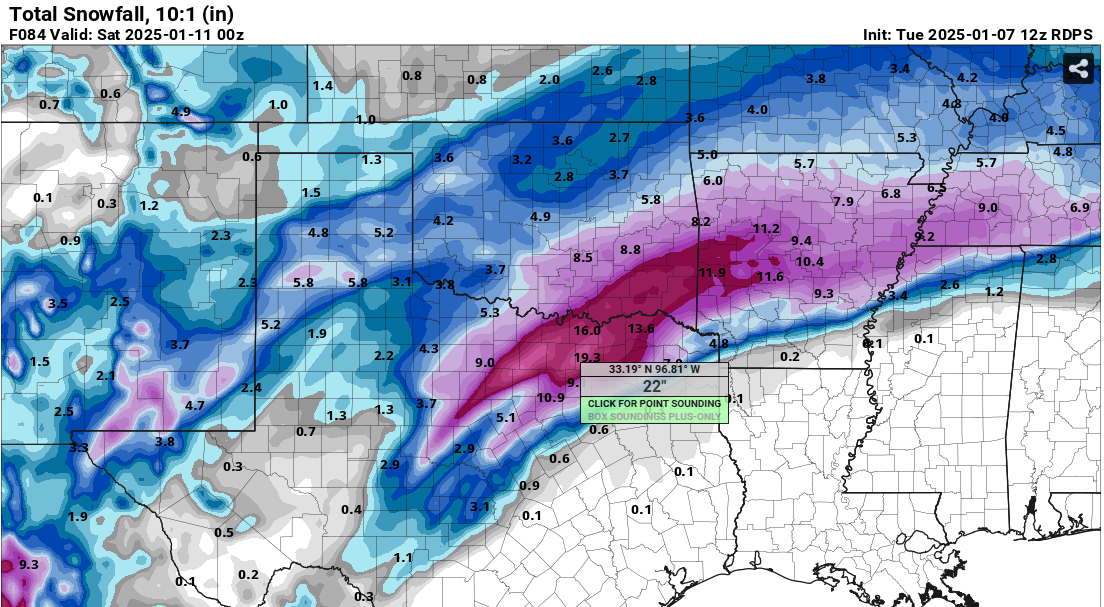
Re: Texas Winter 2024-2025

4 likes
Bill 2015 & Beta 2020
Winter 2020-2021
All observations are in Tecumseh, OK unless otherwise noted.
Winter posts are focused mainly for Oklahoma & Texas.
Take any of my forecasts with a grain of salt, refer to the NWS, SPC, and NHC for official information
Never say Never with weather! Because ANYTHING is possible!
Winter 2020-2021
All observations are in Tecumseh, OK unless otherwise noted.
Winter posts are focused mainly for Oklahoma & Texas.
Take any of my forecasts with a grain of salt, refer to the NWS, SPC, and NHC for official information
Never say Never with weather! Because ANYTHING is possible!
Who is online
Users browsing this forum: Stratton23 and 45 guests