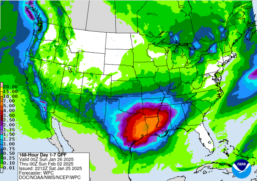
Stratton23 wrote:Im not buying the models or the operational models showing a very strong se ridge ( models have shown that alot this winter and it hasnt verified + weak la ninas do not favor overly strong se ridges) shoving the trough back out even off the west coast, thats makes no sense with a building ridge in alaska, what we will see is a trough set up shop over the west/ central us with the arctic air plowing straight into the se ridge, we are going to get cold regardless of what the op models show, which is why ensemble guidance is the way to go , even if the MJO goes into a warmer phase its just very temporary as it quickly progresses toward the colder phases
The only part of this where I would disagree slightly is regarding the PNA signal. We really haven't had a bullish negative PNA forecasted (SE ridge to deal with) for most of the winter. It's actually been more positive to recently neutral in the lead up to the cold we just came out of and so this is a different pattern headed into February no question than what January brought. It's still a pattern that can deliver to your point, but this may be more of a gradual step-down process where you see big warmth out ahead (unlike January) and then shots of cold beating that down a bit before you get one big blast of arctic air to finish it where the ridge is eventually overwhelmed and cold dominates.
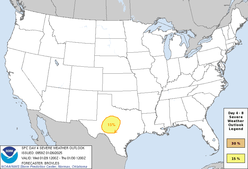
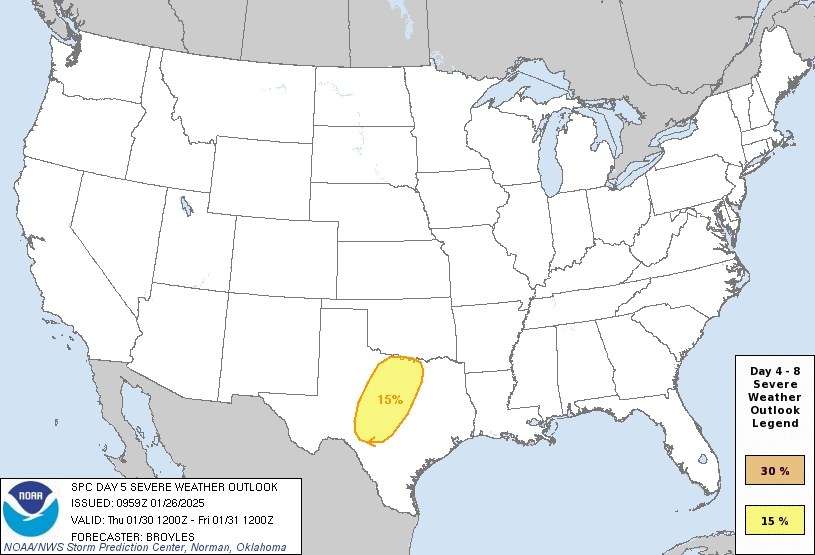
The key to that is you need a prolonged EPO/blocking signal over Alaska and right now even the ensembles (GEFS/GEPS) are sort of back and forth on that probably due to the weakening MJO signal. I would expect models to muddy that up a bit before coming into greater consensus.
But we have time to watch as warmth is coming for a period of time. The question remains for how long?
 The posts in this forum are NOT official forecast and should not be used as such. They are just the opinion of the poster and may or may not be backed by sound meteorological data. They are NOT endorsed by any professional institution or