rwfromkansas wrote:Down to 27 so getting into danger zone.
Just may not be wet enough.
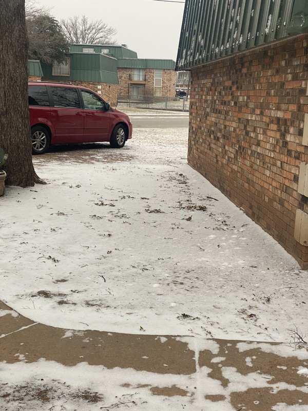
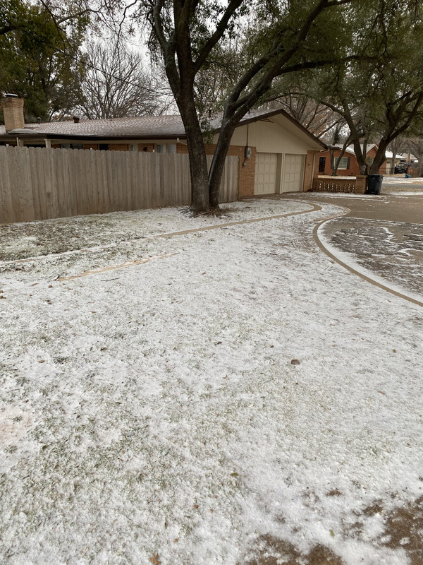
Yep, moist enough to cause some issues…25F and moderate frz drizzle in Fort Worth
Moderator: S2k Moderators
 The posts in this forum are NOT official forecast and should not be used as such. They are just the opinion of the poster and may or may not be backed by sound meteorological data. They are NOT endorsed by any professional institution or STORM2K.

rwfromkansas wrote:Down to 27 so getting into danger zone.
Just may not be wet enough.


Cpv17 wrote:wxman22 wrote:Still getting moderate snow here! The wonderful thing is that the snow will stick around for a few days.
https://i.postimg.cc/N0Q3r4kn/IMG-0983.jpg
https://i.postimg.cc/yYqqh9h7/IMG-0985.jpg
Does the cold up there feel different from the cold down here?
wxman22 wrote:Cpv17 wrote:wxman22 wrote:Still getting moderate snow here! The wonderful thing is that the snow will stick around for a few days.
https://i.postimg.cc/N0Q3r4kn/IMG-0983.jpg
https://i.postimg.cc/yYqqh9h7/IMG-0985.jpg
Does the cold up there feel different from the cold down here?
The wind I feel makes the biggest difference up here, it's so windy here all the time during the winter and spring. The wind really adds a extra punch to the cold. For those that may not know, I'm from Houston. So this being my first winter here has been a big difference from what I'm used to. To say the least.
Cpv17 wrote:wxman22 wrote:Cpv17 wrote:
Does the cold up there feel different from the cold down here?
The wind I feel makes the biggest difference up here, it's so windy here all the time during the winter and spring. The wind really adds a extra punch to the cold. For those that may not know, I'm from Houston. So this being my first winter here has been a big difference from what I'm used to. To say the least.
Interesting. I’ve always heard from several people that the cold down here feels much worse than the cold up north.


Brent wrote:It's ok but yeah I don't think we're making warning criteria. The insane cold is far more the story
https://i.ibb.co/FbGBxc9r/IMG-20250218-184348028-HDR.jpg
HockeyTx82 wrote:Down to 22F here at the home weather station.
Ntxw wrote:That wind has been uncomfortable. 30-40mph gusts really nips at you.
Quixotic wrote:HockeyTx82 wrote:Down to 22F here at the home weather station.
What do you use? Want a Davis vue but I have a small backyard. So, all that precision going to waste on imprecise wind makes me hesitate. It’s about 26 here in NW Frisco. Had frozen drizzle hitting my face earlier.


Brent wrote:Ntxw wrote:Extreme cold watch for Houston, for the wind chills.URGENT - WEATHER MESSAGE
National Weather Service Houston/Galveston TX
237 AM CST Tue Feb 18 2025
TXZ178-179-199-212-213-227-236-335-182100-
/O.NEW.KHGX.EC.A.0002.250220T0800Z-250220T1600Z/
San Jacinto-Polk-Montgomery-Waller-Inland Harris-Fort Bend-Inland
Matagorda-Coastal Jackson-
Including the cities of Brookshire, Shepherd, Houston, Missouri
City, Prairie View, Rosenberg, First Colony, Bay City, Mission
Bend, Livingston, Waller, Sugar Land, The Woodlands, Coldspring,
Hempstead, Conroe, Pecan Grove, and Corrigan
237 AM CST Tue Feb 18 2025
...EXTREME COLD WATCH IN EFFECT FROM LATE WEDNESDAY NIGHT THROUGH
THURSDAY MORNING...
* WHAT...Dangerously cold wind chills as low as 16 possible.
* WHERE...Coastal Jackson, Fort Bend, Inland Harris, Inland
Matagorda, Montgomery, Polk, San Jacinto, and Waller Counties.
* WHEN...From late Wednesday night through Thursday morning.
* IMPACTS...Hypothermia will occur if unprotected people are exposed
to these temperatures for prolonged stretches. An extended period
of freezing temperatures could cause ruptured water pipes if
exposed and unprotected.
PRECAUTIONARY/PREPAREDNESS ACTIONS...
Dress in layers including a hat, face mask, and gloves if you go
outside.
To prevent exposed water pipes from freezing; wrap or drain or allow
them to drip slowly.
Make frequent checks on older family, friends, and neighbors. Ensure
portable heaters are used correctly. Do not use generators or grills
inside.
Monitor the latest forecasts and warnings for updates.
Just another cold snap eh?

UPDATE...
Issued at 613 PM CST Tue Feb 18 2025
Key Messages:
- Parts of the I-35 corridor north of San Marcos could experience
some spotty icing on elevated surfaces between 9 PM and 3 AM.
- Arrival of gusty winds could approach Wind Advisory criteria in the
late evening hours.
This may sound alarmist, but we can't speak for all of the area not
forming any ice from the late afternoon showers. Strong wind gusts
are hitting 30 knots already into the San Marcos area, but cooling to
the freezing level is offset well to the north over Northern Burnet
and Llano Counties as of 6 PM. A look at afternoon rains reveals
quite a few areas that received over 1/10 inch with a locally
impressive total of 0.27 noted at Bee Cave. These amounts are
sufficient to create mud puddles on some of the poorer quality roads
and intersections, potentially leading to a low end black ice
threat where evening traffic splashes into them. Major freeways are
expected to remain safe, and it was noted that I-35 was pretreated as
far south as New Braunfels.
The updated forecast reflects a bit more wind, mainly to fill in some
of the gridded data pockets where our populate schemes show
unrealistic lower winds in protected valleys.

Users browsing this forum: No registered users and 249 guests


