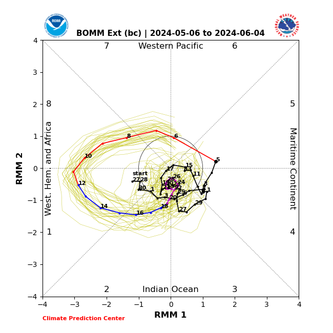
LarryWx wrote:The last two runs of the Euro Weeklies for the week 5/26-6/1 have backed way down on the chance for W Caribbean/gyre originating activity later threatening FL/SE US.
Hi my friend. Moved your post to this model runs thread from the indicators one. By the way, you are in orange now. Thank you for supporting S2K.