Tropical Weather Outlook
NWS National Hurricane Center Miami FL
500 AM PDT Thu Jun 26 2025
For the eastern and central North Pacific east of 180 longitude:
Offshore of Central America and Southern Mexico (EP95):
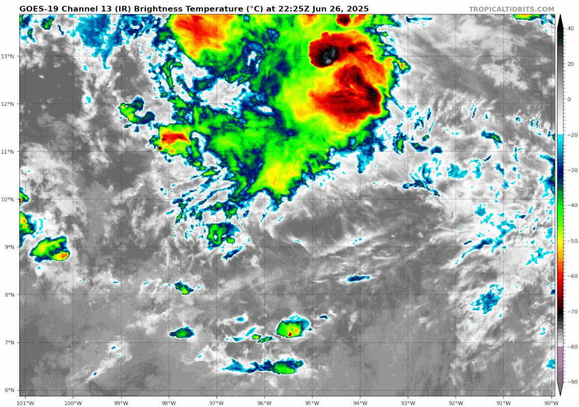
Showers and thunderstorms associated with a broad area of low
pressure located a few hundred miles southwest of the coast of
Guatemala remain limited and disorganized. Environmental conditions
are expected to become more conducive for development during the
next few days, and a tropical depression is likely to form by late
this weekend while the system moves slowly west-northwestward, off
the coast of southern Mexico.
* Formation chance through 48 hours...medium...40 percent.
* Formation chance through 7 days...high...80 percent.
$$
Forecaster Jelsema/Pasch
NWS National Hurricane Center Miami FL
500 AM PDT Thu Jun 26 2025
For the eastern and central North Pacific east of 180 longitude:
Offshore of Central America and Southern Mexico (EP95):
Showers and thunderstorms associated with a broad area of low
pressure located a few hundred miles southwest of the coast of
Guatemala remain limited and disorganized. Environmental conditions
are expected to become more conducive for development during the
next few days, and a tropical depression is likely to form by late
this weekend while the system moves slowly west-northwestward, off
the coast of southern Mexico.
* Formation chance through 48 hours...medium...40 percent.
* Formation chance through 7 days...high...80 percent.
$$
Forecaster Jelsema/Pasch