ATL: INVEST 93L - Models
Moderator: S2k Moderators
-
Stratton23
- Category 5

- Posts: 3525
- Joined: Fri Jul 21, 2023 10:59 pm
- Location: Katy, Tx
Re: ATL: INVEST 93L - Models
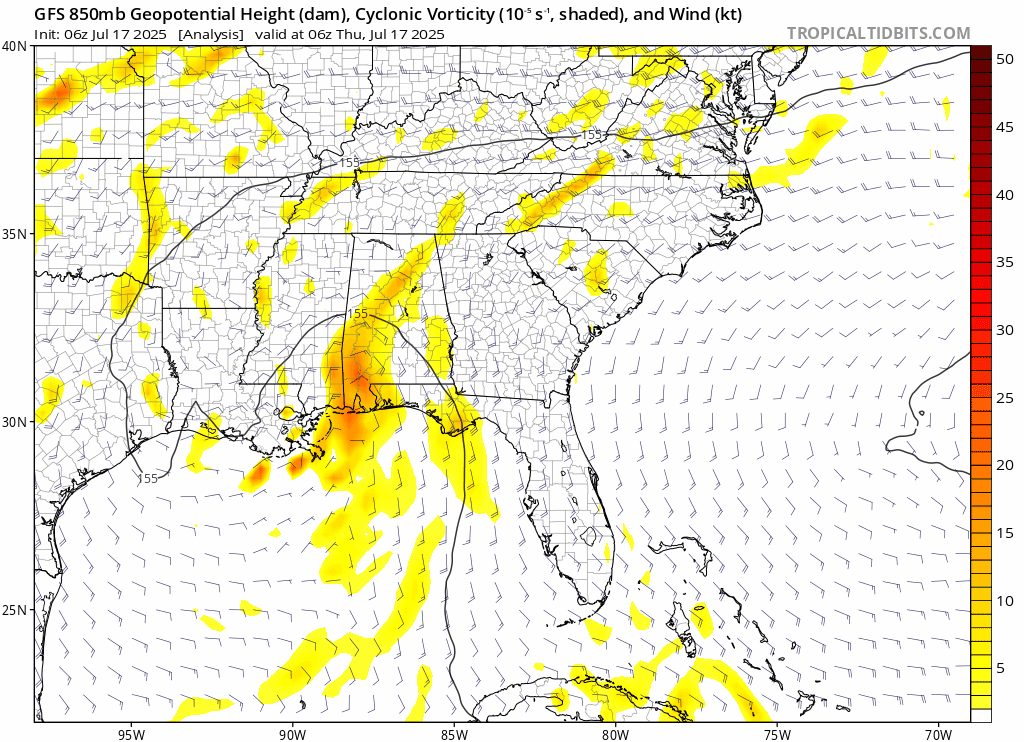
Icon/ GFS/ Euro all shifted west more, close enough to texas to bring some rain bands into se texas
0 likes
-
cycloneye

- Admin

- Posts: 149276
- Age: 69
- Joined: Thu Oct 10, 2002 10:54 am
- Location: San Juan, Puerto Rico
Re: ATL: INVEST 93L - Models
0 likes
Visit the Caribbean-Central America Weather Thread where you can find at first post web cams,radars
and observations from Caribbean basin members Click Here
and observations from Caribbean basin members Click Here

Re: ATL: INVEST 93L - Models
Latest UKMET (6Z): 1009 mb
0Z was 1013
18Z was 1004
12Z was 1010
6Z Euro a little weaker than 0Z, which was slightly weaker than the most bullish so far 18Z
6Z ICON weakest in a couple of days with only down to 1011 mb
6Z GFS, like prior GFS runs, has very little
0Z was 1013
18Z was 1004
12Z was 1010
6Z Euro a little weaker than 0Z, which was slightly weaker than the most bullish so far 18Z
6Z ICON weakest in a couple of days with only down to 1011 mb
6Z GFS, like prior GFS runs, has very little
1 likes
Personal Forecast Disclaimer:
The posts in this forum are NOT official forecasts and should not be used as such. They are just the opinion of the poster and may or may not be backed by sound meteorological data. They are NOT endorsed by any professional institution or storm2k.org. For official information, please refer to the NHC and NWS products.
The posts in this forum are NOT official forecasts and should not be used as such. They are just the opinion of the poster and may or may not be backed by sound meteorological data. They are NOT endorsed by any professional institution or storm2k.org. For official information, please refer to the NHC and NWS products.
-
cycloneye
- Admin
- Posts: 149276
- Age: 69
- Joined: Thu Oct 10, 2002 10:54 am
- Location: San Juan, Puerto Rico
Re: ATL: INVEST 93L - Models
GFS would have a big win if 93L does not develop.
2 likes
Visit the Caribbean-Central America Weather Thread where you can find at first post web cams,radars
and observations from Caribbean basin members Click Here
and observations from Caribbean basin members Click Here
Re: ATL: INVEST 93L - Models
12Z ICON is coming in even a little weaker than the 6Z and possibly slightly further north. It has essentially no LLC of significance.
0 likes
Personal Forecast Disclaimer:
The posts in this forum are NOT official forecasts and should not be used as such. They are just the opinion of the poster and may or may not be backed by sound meteorological data. They are NOT endorsed by any professional institution or storm2k.org. For official information, please refer to the NHC and NWS products.
The posts in this forum are NOT official forecasts and should not be used as such. They are just the opinion of the poster and may or may not be backed by sound meteorological data. They are NOT endorsed by any professional institution or storm2k.org. For official information, please refer to the NHC and NWS products.
Re: ATL: INVEST 93L - Models
12Z globals are not showing much of anything LLCwise.
0 likes
Personal Forecast Disclaimer:
The posts in this forum are NOT official forecasts and should not be used as such. They are just the opinion of the poster and may or may not be backed by sound meteorological data. They are NOT endorsed by any professional institution or storm2k.org. For official information, please refer to the NHC and NWS products.
The posts in this forum are NOT official forecasts and should not be used as such. They are just the opinion of the poster and may or may not be backed by sound meteorological data. They are NOT endorsed by any professional institution or storm2k.org. For official information, please refer to the NHC and NWS products.
-
Stratton23
- Category 5
- Posts: 3525
- Joined: Fri Jul 21, 2023 10:59 pm
- Location: Katy, Tx
Re: ATL: INVEST 93L - Models
What in thinking is going to happen is that LLC is going to die, and we see a new center form further south under the MLC, convection has been very consistent ( although weak) near the MLC, i still think their is a decent chance this is going to be dexter in the next 48 hours despite models not being enthusiastic, interesting to note that most model guidance takes the MLC into the upper texas coast and brings some healthy rain chances to se texas, eastern texas and of course louisiana
2 likes
-
Ivanhater

- Storm2k Moderator

- Posts: 11221
- Age: 39
- Joined: Fri Jul 01, 2005 8:25 am
- Location: Pensacola
ATL: INVEST 93L - Discussion
New model guidance has it riding the northern Gulf coast. Less likely to develop with that track but still heavy rain

Sent from my motorola razr plus 2023 using Tapatalk
Sent from my motorola razr plus 2023 using Tapatalk
1 likes
Michael
-
Stratton23
- Category 5
- Posts: 3525
- Joined: Fri Jul 21, 2023 10:59 pm
- Location: Katy, Tx
Re: ATL: INVEST 93L - Models
GFS/ CMC loop the remnants of potential “ dexter” back around into the gulf again in the 10 day range, absolutely crazy
0 likes

Re: ATL: INVEST 93L - Models
Stratton23 wrote:GFS/ CMC loop the remnants of potential “ dexter” back around into the gulf again in the 10 day range, absolutely crazy
ECMWF also has it looping around a few times for the next couple of weeks making a lot of rain for south east US.


0 likes
Re: ATL: INVEST 93L - Models
12z gfs and canadian have it looping up for a repeat next week (mon-fri, very similar areas), It'll be the neverending low if that happens. 12z euro at least keeps it more inland.
0 likes
-
Stratton23
- Category 5
- Posts: 3525
- Joined: Fri Jul 21, 2023 10:59 pm
- Location: Katy, Tx
Re: ATL: INVEST 93L - Models
Look at the models, im kind of feeling an Ivan like scenario ( not necessarily a strong system or developing ) but seeing that big loop back out over the gulf again in about a week
0 likes
-
cycloneye
- Admin
- Posts: 149276
- Age: 69
- Joined: Thu Oct 10, 2002 10:54 am
- Location: San Juan, Puerto Rico
Re: ATL: INVEST 93L - Models
0 likes
Visit the Caribbean-Central America Weather Thread where you can find at first post web cams,radars
and observations from Caribbean basin members Click Here
and observations from Caribbean basin members Click Here
-
Stratton23
- Category 5
- Posts: 3525
- Joined: Fri Jul 21, 2023 10:59 pm
- Location: Katy, Tx
Re: ATL: INVEST 93L - Models
00z GFS tries to again develop 93L when it re enters the gulf just off the texas coast line at day 7-8 , lots of tropical rains incoming, CMC rides the lousiana coast bringing heavy rains to central, sw lousiana and se texas, could be a very wet next 10 days and could be watching 93L for quite some time
0 likes
Re: ATL: INVEST 93L - Models
6z GFS shows something interesting happening when the "ghost of 93L" reenters the Atlantic, it splits off and forms something heading into around New Bern, NC. Not sure if this should go here or the general model thread, but it's probably more than not related to 93L. Also Texas at the same time too, why not? At least it's still relatively weak on these models. 93L (or its ghost) is just going to linger on.
3 likes
Re: ATL: INVEST 93L - Models
I consider 93L to be a big fail for the ICON.
1 likes
Personal Forecast Disclaimer:
The posts in this forum are NOT official forecasts and should not be used as such. They are just the opinion of the poster and may or may not be backed by sound meteorological data. They are NOT endorsed by any professional institution or storm2k.org. For official information, please refer to the NHC and NWS products.
The posts in this forum are NOT official forecasts and should not be used as such. They are just the opinion of the poster and may or may not be backed by sound meteorological data. They are NOT endorsed by any professional institution or storm2k.org. For official information, please refer to the NHC and NWS products.

Re: ATL: INVEST 93L - Discussion
Ivanhater wrote:GFS loops this around 3 times
Let’s go. Some rain but little damage.
1 likes
Who is online
Users browsing this forum: No registered users and 85 guests