2025 Global Model Runs Discussion (Out thru day 16)

This is the general tropical discussion area. Anyone can take their shot at predicting a storms path.

Moderator: S2k Moderators

Forum rules

The posts in this forum are NOT official forecasts and should not be used as such. They are just the opinion of the poster and may or may not be backed by sound meteorological data. They are NOT endorsed by any professional institution or STORM2K. For official information, please refer to products from the National Hurricane Center and National Weather Service.

Help Support Storm2K
Message
Author
TomballEd
Category 2
Category 2
Posts: 744
Age: 61
Joined: Wed Aug 16, 2023 4:52 pm
Location: Spring/Klein area, not Tomball

Re: 2025 Global Model Runs Discussion (Out thru day 16)

#401 Postby TomballEd » Thu Jul 24, 2025 12:14 pm

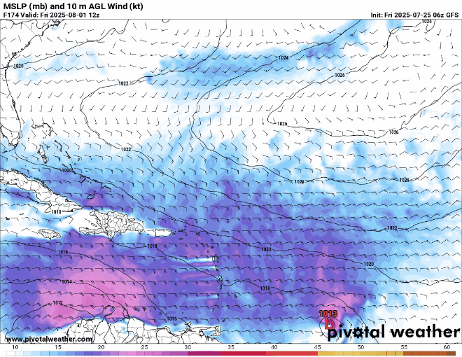
jaguars_22 wrote:Texas could be a tropical magnet according to the GFS. We have the "lemon" in the gulf currently, round 5 of another disturbance enters the gulf next week, then a wave coming in from the carribean...


Breaks from the heat because clouds and rain but I don't see a closed low in the Basin other than the MDR wave the Euro ensembles like. I think the MJO jumps back in the hole before becoming favorable for the Atlantic. I'm not sold on the 10 day entering the Caribbean disturbance developing but it does have ECEN support and some GFS ensemble support. That could be lemonized late weekend or early next week. It fizzled coming off Africa

Oustide shot at a lemon before that in the MDR, it grabs the eye on visible satellite.

Image
2 likes   

User avatar
cycloneye
Admin
Admin
Posts: 145595
Age: 68
Joined: Thu Oct 10, 2002 10:54 am
Location: San Juan, Puerto Rico

Re: 2025 Global Model Runs Discussion (Out thru day 16)

#402 Postby cycloneye » Thu Jul 24, 2025 1:16 pm

12z Euro has strong wave that is still inside Africa and almost has a TD.

Image
2 likes   
Visit the Caribbean-Central America Weather Thread where you can find at first post web cams,radars
and observations from Caribbean basin members Click Here

User avatar
cycloneye
Admin
Admin
Posts: 145595
Age: 68
Joined: Thu Oct 10, 2002 10:54 am
Location: San Juan, Puerto Rico

Re: 2025 Global Model Runs Discussion (Out thru day 16)

#403 Postby cycloneye » Thu Jul 24, 2025 1:35 pm

Euro AIFS develops wave after it passes Puerto Rico. Wave emerges from West Africa in 3 days.

Image
3 likes   
Visit the Caribbean-Central America Weather Thread where you can find at first post web cams,radars
and observations from Caribbean basin members Click Here

WeatherBoy2000
Category 1
Category 1
Posts: 357
Joined: Mon Apr 10, 2023 9:29 am

Re: 2025 Global Model Runs Discussion (Out thru day 16)

#404 Postby WeatherBoy2000 » Thu Jul 24, 2025 3:04 pm

cycloneye wrote:Euro AIFS develops wave after it passes Puerto Rico. Wave emerges from West Africa in 3 days.

https://i.imgur.com/JudmVTn.gif


 https://x.com/SCweather_wx/status/1948471277888700831

3 likes   

Stratton23
Category 5
Category 5
Posts: 2544
Joined: Fri Jul 21, 2023 10:59 pm
Location: Katy, Tx

Re: 2025 Global Model Runs Discussion (Out thru day 16)

#405 Postby Stratton23 » Thu Jul 24, 2025 5:26 pm

18z GFS has a TS at day 7 headed toward the cuba/ key west gap, strong ridging building to the north
1 likes   

User avatar
Category5Kaiju
Category 5
Category 5
Posts: 4105
Joined: Thu Dec 24, 2020 12:45 pm
Location: Seattle

Re: 2025 Global Model Runs Discussion (Out thru day 16)

#406 Postby Category5Kaiju » Thu Jul 24, 2025 6:07 pm

12z ECMWF ensembles have exploded in activity with regards to a strong AEW that originates in the MDR at the tail end of this month going into early August, with a few rather strong members.

The 18z GFS operational also shows this system, albeit weaker but does intensify en route to the Gulf while moving close to the Greater Antilles (Georges-like track).

Things can change of course, but given the sudden multi-model excitement with this system, I'm going to bet that this may end up as our first real tropical-born threat this season.
1 likes   
Unless explicitly stated, all info in my posts is based on my own opinions and observations. Tropical storms and hurricanes can be extremely dangerous. Do not think you can beat Mother Nature. Refer to an accredited weather research agency or meteorologist if you need to make serious decisions regarding an approaching storm.

BobHarlem
Category 5
Category 5
Posts: 2131
Joined: Thu Oct 20, 2005 6:11 pm

Re: 2025 Global Model Runs Discussion (Out thru day 16)

#407 Postby BobHarlem » Thu Jul 24, 2025 6:42 pm

First classic happy hour GFS run of the season that's not a complete West Caribbean phantom.
Image

Other things to call out, another wave behind that and something southwest of Bermuda right at the end of the run (heading west)
Last edited by BobHarlem on Thu Jul 24, 2025 6:44 pm, edited 1 time in total.
2 likes   

User avatar
Hurricane2022
Category 5
Category 5
Posts: 1574
Joined: Tue Aug 23, 2022 11:38 pm
Location: Araçatuba, Brazil

Re: 2025 Global Model Runs Discussion (Out thru day 16)

#408 Postby Hurricane2022 » Thu Jul 24, 2025 6:42 pm

Category5Kaiju wrote:12z ECMWF ensembles have exploded in activity with regards to a strong AEW that originates in the MDR at the tail end of this month going into early August, with a few rather strong members.

The 18z GFS operational also shows this system, albeit weaker but does intensify en route to the Gulf while moving close to the Greater Antilles (Georges-like track).

Things can change of course, but given the sudden multi-model excitement with this system, I'm going to bet that this may end up as our first real tropical-born threat this season.

 https://x.com/FloridaTropics1/status/1948492199726846274

0 likes   
Sorry for the bad English sometimes...!
For reliable and detailed information for any meteorological phenomenon, please consult the National Hurricane Center, Joint Typhoon Warning Center , or your local Meteo Center.

--------

Una cvm Christo, pro Christo, et in Christo. Sit nomen Domini benedictvm.

User avatar
DorkyMcDorkface
Category 3
Category 3
Posts: 898
Age: 27
Joined: Mon Sep 30, 2019 1:32 pm
Location: Mid-Atlantic

Re: 2025 Global Model Runs Discussion (Out thru day 16)

#409 Postby DorkyMcDorkface » Thu Jul 24, 2025 7:25 pm

Good ol' Happy hour (checks notes)...AIFS?
Image
6 likes   
Please note the thougths expressed by this account are solely those of the user and are from a hobbyist perspective. For more comprehensive analysis, consult an actual professional meteorologist or meteorology agency.


Floyd 1999 | Isabel 2003 | Hanna 2008 | Irene 2011 | Sandy 2012 | Isaias 2020

User avatar
Category5Kaiju
Category 5
Category 5
Posts: 4105
Joined: Thu Dec 24, 2020 12:45 pm
Location: Seattle

Re: 2025 Global Model Runs Discussion (Out thru day 16)

#410 Postby Category5Kaiju » Thu Jul 24, 2025 7:34 pm

DorkyMcDorkface wrote:Good ol' Happy hour (checks notes)...AIFS?
https://i.imgur.com/6c5eGXA.gif


This storm really wants to get the D name, doesn't it? :lol:

(crime drama fans will know what I'm talking about here)
0 likes   
Unless explicitly stated, all info in my posts is based on my own opinions and observations. Tropical storms and hurricanes can be extremely dangerous. Do not think you can beat Mother Nature. Refer to an accredited weather research agency or meteorologist if you need to make serious decisions regarding an approaching storm.

User avatar
Hurricane2022
Category 5
Category 5
Posts: 1574
Joined: Tue Aug 23, 2022 11:38 pm
Location: Araçatuba, Brazil

Re: 2025 Global Model Runs Discussion (Out thru day 16)

#411 Postby Hurricane2022 » Thu Jul 24, 2025 7:37 pm

DorkyMcDorkface wrote:Good ol' Happy hour (checks notes)...AIFS?
https://i.imgur.com/6c5eGXA.gif

Mr. Andrew, this isn't time to rise from the dead, ok?
1 likes   
Sorry for the bad English sometimes...!
For reliable and detailed information for any meteorological phenomenon, please consult the National Hurricane Center, Joint Typhoon Warning Center , or your local Meteo Center.

--------

Una cvm Christo, pro Christo, et in Christo. Sit nomen Domini benedictvm.

BobHarlem
Category 5
Category 5
Posts: 2131
Joined: Thu Oct 20, 2005 6:11 pm

Re: 2025 Global Model Runs Discussion (Out thru day 16)

#412 Postby BobHarlem » Thu Jul 24, 2025 7:54 pm

Another shot of the Euro AI (Who is a Dexter tv show fan apparently)

Image
4 likes   

User avatar
StormWeather
Tropical Storm
Tropical Storm
Posts: 183
Joined: Wed Jun 05, 2024 2:34 pm

Re: 2025 Global Model Runs Discussion (Out thru day 16)

#413 Postby StormWeather » Thu Jul 24, 2025 8:27 pm

DorkyMcDorkface wrote:Good ol' Happy hour (checks notes)...AIFS?
https://i.imgur.com/6c5eGXA.gif

This raises my eyebrows a bit. Usually the GFS is the first one to go gangbusters in the long range. To see another model do so first (And the AI model of all models, the one that doesn’t have super low pressures too often on modeled storms) is a bit concerning for me.
4 likes   
Just your average cyclone tracker

Cyclones experienced;

Debby 24’

Fancy1002
Tropical Storm
Tropical Storm
Posts: 140
Joined: Sun Dec 25, 2022 3:47 pm

Re: 2025 Global Model Runs Discussion (Out thru day 16)

#414 Postby Fancy1002 » Thu Jul 24, 2025 10:28 pm

DorkyMcDorkface wrote:Good ol' Happy hour (checks notes)...AIFS?
https://i.imgur.com/6c5eGXA.gif

Kinda like a weakened Andrew
0 likes   

TomballEd
Category 2
Category 2
Posts: 744
Age: 61
Joined: Wed Aug 16, 2023 4:52 pm
Location: Spring/Klein area, not Tomball

Re: 2025 Global Model Runs Discussion (Out thru day 16)

#415 Postby TomballEd » Thu Jul 24, 2025 11:06 pm

Tracking back 18Z vort, not the same wave Euro ensembles like. GFS future Gulf wave arrives in the Antilles in less than 4 days. That is my not much Euro ensemble support swirly mid Atlantic wave around 40W (Edit- posted with loop about noon CDT July 24 above, looked closer to 35 than 40 then). The NOLA fantasy range cane in not the one further E.

I thought that wave came off yesterday but that wave is hard to spot on satellite. But the Euro wave mentioned prior based on ensembles arrives 5 days later in the Lesser Antilles. All the 18Z GFS ensembles TCs in the Gulf about the same time look to have developed from the same troughiness trying and so far failing to spin up a TC, ie 93L, son of 93L, etc. 18Z GFS ensembles not too enthusiastic on the Gulf stuff in 11 days.

I could be off on the Euro wave by a day or so using my counting back from seeing something show up on models as the clear vorticity but 4 days, 20 degrees, fits my mid-Atlantic swirly from the earlier post very well.
0 likes   

TomballEd
Category 2
Category 2
Posts: 744
Age: 61
Joined: Wed Aug 16, 2023 4:52 pm
Location: Spring/Klein area, not Tomball

Re: 2025 Global Model Runs Discussion (Out thru day 16)

#416 Postby TomballEd » Fri Jul 25, 2025 12:25 am

GFS sees the Euro wave that arrives in about 8 or 9 days. May have a TD or low end TS approaching the Lesser Antilles. The system weakens but can be tracked all the way across the Caribbean and into the extreme SW Gulf. Almost there on multiple models. I suspect growing GFS ensemble support. It could evaporate like all threats do that are 8 or 9 days out. But when different models see similar things I pay attention.

Image
3 likes   

BobHarlem
Category 5
Category 5
Posts: 2131
Joined: Thu Oct 20, 2005 6:11 pm

Re: 2025 Global Model Runs Discussion (Out thru day 16)

#417 Postby BobHarlem » Fri Jul 25, 2025 5:30 am

0z Euro ensembles are still very active. The AI backed off the miami scenario.
Image

GFS ensembles much less active
Image

the Canadian is not doing much either, and Icon takes the energy across the islands without really developing it.

6z GFS is rolling in, currently south of Puerto Rico by the August 3rd. (not much different than 0z (out to 225 hours at least) then after dives into the Hispaniola shredder.

Image
2 likes   

jaguars_22
Category 2
Category 2
Posts: 597
Joined: Tue Jun 20, 2017 2:26 pm
Location: Victoria TX

Re: 2025 Global Model Runs Discussion (Out thru day 16)

#418 Postby jaguars_22 » Fri Jul 25, 2025 9:35 am

Can i ask what's going on around the Yucatan? That area looks better than the lemon in the gulf... Which way is this area moving?
1 likes   

BobHarlem
Category 5
Category 5
Posts: 2131
Joined: Thu Oct 20, 2005 6:11 pm

Re: 2025 Global Model Runs Discussion (Out thru day 16)

#419 Postby BobHarlem » Fri Jul 25, 2025 10:02 am

jaguars_22 wrote:Can i ask what's going on around the Yucatan? That area looks better than the lemon in the gulf... Which way is this area moving?


Just an area of convection.

Easiest ways to tell if something has even the slightest chance of tropical development is to look at the vorticity (spin) charts

https://tropic.ssec.wisc.edu/real-time/ ... oom=&time=
Above link, the 850mb is the best one (usually) for checking for low level spin

https://tropic.ssec.wisc.edu/real-time/ ... oom=&time=
500mb for mid level stuff (If the low and mid levels are aligned on a tropical system you know it's organized) Also the more circular and deeper reds indicate better organization. Non tropical stuff shows up in the higher latitudes on these charts.

200mb for upper level stuff/steering currents.

the 850/500/200 numbers is typical "neutral" pressure at the altitude. Ie true neutral ground level surface/sea level would technically be 1000mb. So lower the "mb" value, higher the altitude. You get close to zero you are in outer space. When the NHC reports storm pressures, it's relative to sea level. Weather pushes it up and down (high/low)

In this case the area off the Yucatan has none of that. And unless something pops up there, there is no chance for anything tropical to form. Look at MDR for more stuff. In the case of the lemon area, 850 is pretty obvious, 500mb is split off from it enough, and it's running out of time, so it's not likely to develop at all.
Last edited by BobHarlem on Fri Jul 25, 2025 12:20 pm, edited 2 times in total.
2 likes   

USTropics
Professional-Met
Professional-Met
Posts: 2659
Joined: Sun Aug 12, 2007 3:45 am
Location: Florida State University

Re: 2025 Global Model Runs Discussion (Out thru day 16)

#420 Postby USTropics » Fri Jul 25, 2025 10:48 am

BobHarlem wrote:
jaguars_22 wrote:Can i ask what's going on around the Yucatan? That area looks better than the lemon in the gulf... Which way is this area moving?


Just an area of convection.

Easiest ways to tell if something has even the slightest chance of tropical development is to look at the vorticity (spin) charts

https://tropic.ssec.wisc.edu/real-time/ ... oom=&time=
Above link, the 850mb is the best one (usually) for checking for low level spin

https://tropic.ssec.wisc.edu/real-time/ ... oom=&time=
500mb for mid level stuff (If the low and mid levels are aligned on a tropical system you know it's organized) Also the more circular and deeper reds indicate better organization. Non tropical stuff shows up in the higher latitudes on these charts.

200mb for upper level stuff/steering currents.

the 850/500/200 numbers is typical "neutral" pressure at the altitude. Ie true neutral ground level surface/sea level would technically be 1000mb.

In this case the area off the Yucatan has none of that. And unless something pops up there, there is no chance for anything tropical to form. Look at MDR for more stuff. In the case of the lemon area, 850 is pretty obvious, 500mb is split off from it enough, and it's running out of time, so it's not likely to develop at all.


Pretty much spot on analysis. There is 'some' stuff going on here, but all the action at the mid-low levels is hundreds of miles north of this area. We originally had an ULL move westward that has since degraded and become rain filled. We now have 3 features to note that I've roughly highlighted below with WV imagery. We have a trough axis over the central GOM (in teal), we have high pressure off the western coast of Cuba (red) and we have a tropical wave moving into the area (green). I've included dashed arrows to show the general flow from these features:
Image

Essentially we have a lot of air piling up over the Yucatan, which is giving us the convection. However, the environment cannot support any type of structure at the mid or lower levels here (so just some impressive convection).
1 likes   


Return to “Talkin' Tropics”

Who is online

Users browsing this forum: Cpv17, riapal, zzzh and 74 guests